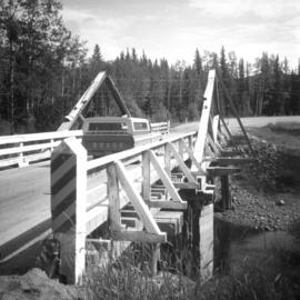
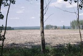
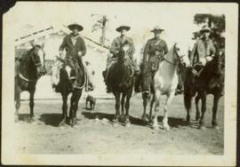
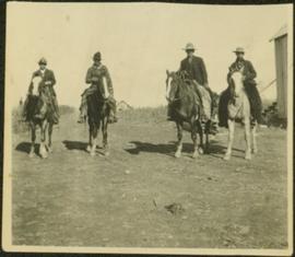
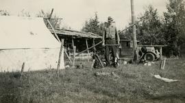
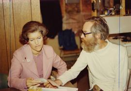
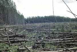
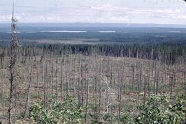
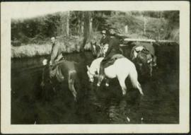
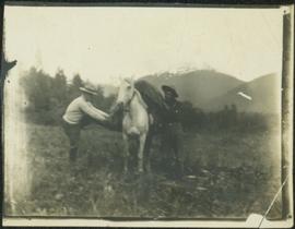
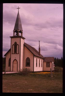
Vanderhoof, BC

Taxonomy

Code

Scope note(s)

Source note(s)

Display note(s)

Hierarchical terms

Vanderhoof, BC

Equivalent terms

Vanderhoof, BC

Associated terms

Vanderhoof, BC

30 Archival description results for Vanderhoof, BC

30 results directly related Exclude narrower terms

Audrey L'Heureux Northern BC History Collection

  • 2000.23
  • Collection
  • ca. 1960-ca. 1970

Collection consists of textual reserach notes created by L'heureux related to the history and geography of Northern BC, BC,

L'Heureux, Audrey

Bridge between Vanderhoof and Burns Lake

Photograph taken on Highway 16, between Vanderhoof and Burns Lake. This road and bridge was to be passed by a new section of the highway. To the date the photograph was taken, all traffic between Prince George and Prince Rupert had used the bridge.

Clare Willis fonds

  • 2001.13
  • Fonds
  • c. 1950 - c. 1990

Fonds consists of 2 boxes textual materials and newsclippings related to Willis family history and Vanderhoof history, as well as aerial photographs of northern BC and Alberta.

Gordon Wyness and Jack Lee at Bobtail campsite near Vanderhoof

Photograph depicts (from left to right) Gordon Wyness and Jack Lee at a camp scene "at Bobtail" (possibly Bobtail Lake) near Vanderhoof. As noted in the album caption, the crew had "just returned from Vanderhoof". The telegraph cabin roof and their 1930 Buick Series 40 car is visible at right.

Jack Lee rafting on Bobtail Lake

Photograph depicts Jack Lee rafting with a sail on Bobtail Lake, as he was going over to other side of the lake to locate traverse posts (without success, according to the annotation on the photograph verso).

Job 336 - W.D. McIntosh Land Surveying Ltd. - Fawcett Farm Subdivision and Consolidation - Vanderhoof

File consists of records created and accumulated by Gary Runka over the course of his consultancy work for W.D. McIntosh Land Surveying Ltd. for the "Fawcett Farm Subdivision and Consolidation" project in Vanderhoof. This file was numbered as G.G. Runka Land Sense Ltd. client file #336; that client number may be seen referenced elsewhere in the G. Gary Runka fonds. The Land Sense Ltd. client files generally include records such as correspondence, contracts, invoices, project reports, publications, ephemera, memoranda, maps or map excerpts, legal documents, meeting materials, clippings, and handwritten notes.

Includes the following map:

  • W.D. McIntosh B.C. Land Surveyor, "Plan of Proposed Subdivision of the SE 1/4, SW 1/4 of Section 33, and the N 1/2 of Section 32, all in Township 3, Range 4, Coast District", 1988.

Job 566 - W.D. McIntosh Land Surveying Ltd. - Proposed Log Home Construction Use - Vanderhoof

File consists of records created and accumulated by Gary Runka over the course of his consultancy work for W.D. McIntosh Land Surveying Ltd. for the "Proposed Log Home Construction Use" project in Vanderhoof. This file was numbered as G.G. Runka Land Sense Ltd. client file #566; that client number may be seen referenced elsewhere in the G. Gary Runka fonds. The Land Sense Ltd. client files generally include records such as correspondence, contracts, invoices, project reports, publications, ephemera, memoranda, maps or map excerpts, legal documents, meeting materials, clippings, and handwritten notes.

Job 597 - W.D. McIntosh Land Surveying Ltd. - Consultations on Proposed Log Home Building Operation Land Use - Vanderhoof

File consists of records created and accumulated by Gary Runka over the course of his consultancy work for W.D. McIntosh Land Surveying Ltd. for the "Consultations on Proposed Log Home Building Operation Land Use" project in Vanderhoof. This file was numbered as G.G. Runka Land Sense Ltd. client file #597; that client number may be seen referenced elsewhere in the G. Gary Runka fonds. The Land Sense Ltd. client files generally include records such as correspondence, contracts, invoices, project reports, publications, ephemera, memoranda, maps or map excerpts, legal documents, meeting materials, clippings, and handwritten notes.

Micks Family Collection

  • 2006.29
  • Fonds

Collection consists of 19 photographic reproductions of black and white photographs documenting the Micks Family life on their Vanderhoof ranch. Also included is a transcript of Doris Ferland (nee Micks) describing her family's move from Nebraska to Vanderhoof in 1913

Trail Maps and Recreation Guides

File consists of trail maps and recreation guides from various places in British Columbia, especially Northern British Columbia. Maps include:

  • British Columbia Road Map and Parks Guide
  • Northwood Pulp and Timber Limited Forest Operations Recreation Map
  • Provincial Parks of Northern British Columbia
  • Visitor's Guide: Mackenzie Woodlands
  • Visitors Guide: Mackenzie Woodlands
  • Mackenzie Forest District Recreation Map
  • Dawson Creek Forest District Recreation Map
  • Morice Forest District Recreation Map
  • Fort St. James Forest District Recreation Map
  • Lakes Forest District Recreation Map
  • Cariboo Forest Region Recreation Map
  • Lakes District Visitors Map
  • Prince George Forest District Recreation Map
  • Vanderhoof Forest District Recreation Map
  • Fort St. John Forest District Recreation Map
  • Cariboo Forest Region Recreation Map (East)
  • Robson Valley Forest District Recreation Map
  • Fort Nelson Forest District Recreation Map
  • Forest Service Recreation Sites: Valemount - Blue River
  • Forest Service Recreation Sites: McBride - Goat River
  • Forest Service Recreation Sites: Prince George West
  • Forest Service Recreation Sites: Moberly - Sukunka
  • Forest Service Recreation Sites: Nation - Takla
  • Forest Service Recreation Sites: Murrat - Kiskatinaw
  • Recreation Road Map for the Prince George Forest Area (1987-1988)
  • Recreation Road Map for the Prince George Forest Area (1997)
  • The Bobtail Forest Service Road Tour
  • Forest Recreation Map: Northwood Pulp and Timber Limited
  • Forest Operations Recreation Map: Northwood pulp and timber limited
  • Forest Service: Recreation Sites Williston/Mackenzie
  • Forest Service Recreation Sites Prince George West
  • The Official Prince George Tourist Street Map
  • Ecological Reserves in British Columbia (July 1990)
  • Prince George Forest District map (April 1990) with annotations regarding trials.

Two Men with Horse

Photograph depicts two men believed to be North-West Mounted Police officers standing on either side of white packhorse. Forest and mountains in background. Photograph may have been taken in Vanderhoof, B.C.

Vanderhoof

Image depicts a barn with large, Harvestore Systems. It is possibly located on one of the many farms near Vanderhoof, B.C.