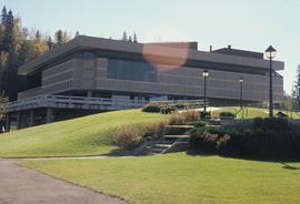
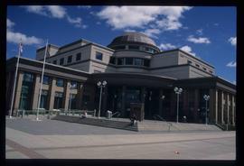
Image depicts the Prince George Public Library (Bob Harkins Branch). Map coordinates 53°54'44.6"N 122°45'01.7"W
Prince George, BC
2402 Archival description results for Prince George, BC
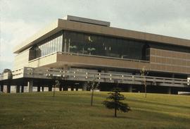
Image depicts the Prince George Public Library (Bob Harkins Branch). Map coordinates 53°54'43.1"N 122°44'56.4"W
File consists of promotional pamphlets and brochures advertising the City of Prince George. Includes:
- Prince George Downtown Business Improvement Association, "Your Guide to Downtown Prince George 2020/21"
- City of Prince George, "Trail Guide", [ca. 2020]
- Tourism PG, "Falls Guide: Waterfall Destinations", [ca. 2022]
- Tourism PG, "Recreation Sites Guide: Prince George Area", [ca. 2022]
- Prince George Citizen, "Taste of Prince George 2023" restaurant guide
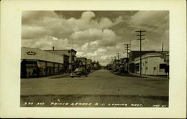
Postcard image depicts streetview looking west along 3rd Ave in Prince George, B.C. Storefronts and period automobiles are visible. Handwritten annotation on photographic negative, now visible along bottom of print image reads: "3rd Ave, Prince George B.C. Looking West. HND 41".
Videotape contains footage of: 26-Jul-05 - Scenery - Prince George overview from Gunn Park / 26-Jul-05 - Scenery - Prince George river, cutbanks, Connaught hill, from Gunn Park
File contains slides depicting maps for land use in Prince George.
Consists of miscellaneous issues of early Prince George newspapers, newspaper purchase agreements, and transfer of ownership documentation. Includes the following newspaper issues:
Fort George Herald (South Fort George) 31-Dec-1910
Fort George Herald (South Fort George) 9-Dec-1911
Fort George Herald (South Fort George) 7-Aug-1914
Fort George Herald (South Fort George) 2-Jan-1915
Fort George Herald (South Fort George) 16-Jan-1915
Fort George Herald (South Fort George) 8-Jan-1916
Fort George Tribune (Central Fort George) 6-Nov-1909
Fort George Tribune (Central Fort George) 23-Sep-1911
Fort George Tribune (Central Fort George) 16-Mar-1912
Fort George Tribune (Central Fort George) 28-Sep-1912
Fort George Tribune (Central Fort George) 16-Nov-1912
Fort George Tribune (Central Fort George) 23-Nov-1912
Fort George Tribune (Central Fort George) 12-Jul-1913
Fort George Tribune (Central Fort George) 2-Aug-1913
Fort George Tribune (Central Fort George) 9-Aug-1913
Fort George Tribune (Central Fort George) 13-Sep-1913
Fort George Tribune (Central Fort George) 4-Oct-1913
Fort George Tribune (Central Fort George) 28-Mar-1914
Fort George Tribune (Central Fort George) 18-Apr-1914
Fort George Tribune (Central Fort George) 20-Jun-1914
Fort George Tribune (Central Fort George) 27-Jun-1914
Fort George Tribune (Central Fort George) 25-Jul-1914
Fort George Tribune (Central Fort George) 7-Nov-1914
Fort George Tribune (Central Fort George) 14-Nov-1914
Fort George Tribune (Central Fort George) 21-Nov-1914
Fort George Tribune (Central Fort George) 28-Nov-1914
Fort George Tribune (Central Fort George) 16-Jan-1915
Fort George Tribune (Central Fort George) 23-Jan-1915
Fort George Tribune (Central Fort George) 30-Jan-1915
Fort George Tribune (Central Fort George) 15-May-1915
Fort George Tribune (Central Fort George) 22-May-1915
Prince George Post 16-Jan-1915
Prince George Post 23-Jan-1915
Prince George Post 19-May-1915
Prince George Daily News (flyer from) 18-Oct-1913
Prince George Daily News 1-Jun-1915
Prince George Daily News 2-Jun-1915
Prince George Daily News 3-Jun-1915
Prince George Daily News 4-Jun-1915
Prince George Daily News 5-Jun-1915
Prince George Daily News 7-Jun-1915
Prince George Daily News 8-Jun-1915
Prince George Daily News 9-Jun-1915
Prince George Daily News 10-Jun-1915
Prince George Daily News 11-Jun-1915
Prince George Daily News 12-Jun-1915
Prince George Daily News 14-Jun-1915
Prince George Daily News 15-Jun-1915
Prince George Daily News 16-Jun-1915
Prince George Daily News 17-Jun-1915
Prince George Daily News 18-Jun-1915
Prince George Daily News 19-Jun-1915
Prince George Daily News 21-Jun-1915
Prince George Daily News 22-Jun-1915
Prince George Daily News 23-Jun-1915
Prince George Daily News 24-Jun-1915
Prince George Daily News 25-Jun-1915
Prince George Daily News 26-Jun-1915
Prince George Daily News 28-Jun-1915
Prince George Daily News 29-Jun-1915
Prince George Daily News 30-Jun-1915
Prince George Daily News 22-Sep-1915
Prince George Daily News 14-Dec-1915
Prince George Daily News 22-Dec-1915
Prince George Daily News 31-Dec-1915
Prince George Daily News 8-Jan-1916
Prince George Star 21-Apr-1916
Prince George Star 25-Apr-1916
Prince George Star 28-Apr-1916
Prince George Star 2-May-1916
Prince George Star 5-May-1916
Prince George Star 9-May-1916
Prince George Star 12-May-1916
Prince George Star 16-May-1916
Prince George Star 19-May-1916
Prince George Star 23-May-1916
Prince George Star 26-May-1916
Prince George Star 2-Jun-1916
Prince George Star 9-Jun-1916
Prince George Star 13-Jun-1916
Prince George Star 20-Jun-1916
Prince George Star 23-Jun-1916
Prince George Star 27-Jun-1916
Prince George Star 4-Jul-1916
Prince George Star 3-Nov-1916
Prince George Star 21-Nov-1916
Prince George Star 28-Nov-1916
Prince George Star 29-Dec-1916
Prince George Star 2-Jan-1917
Prince George Star 5-Jan-1917
Prince George Star 9-Jan-1917
Prince George Star 10-Jan-1917
Prince George Star 12-Jan-1917
Prince George Star 16-Jan-1917
Prince George Star 26-Jan-1917
Prince George Star 2-Feb-1917
Prince George Star 6-Feb-1917
Prince George Star 2-Mar-1917
Prince George Star 30-Mar-1917
Prince George Star 13-Apr-1917
Prince George Star 15-May-1917
Prince George Leader 4-Mar-1921
Prince George Leader 15-Apr-1921
Prince George Leader 15-Mar-1923
Prince George Citizen 9-Mar-1916
Prince George Citizen 8-Apr-1916
Prince George Citizen 12-Apr-1916
Prince George Citizen 1-Sep-1916
Prince George Citizen 5-Sep-1916
Prince George Citizen 14-Sep-1916
Prince George Citizen 16-Sep-1916
Prince George Citizen 29-Sep-1916
Prince George Citizen 13-Apr-1917
Prince George Citizen 13-Sep-1918
Prince George Citizen 20-Dec-1918
Prince George Citizen 7-Jan-1919
Prince George Citizen 10-Jan-1919
Prince George Citizen 10-Dec-1919
Prince George Citizen 31-Dec-1919
Prince George Citizen 14-Jan-1920
Prince George Citizen 29-Oct-1920
Prince George Citizen 9-Nov-1920
Prince George Citizen 15-May-1920
Prince George Citizen 22-May-1924
Prince George Citizen 5-Jun-1924
Prince George Citizen 5-Jun-1924
Prince George Citizen 12-Jun-1924
Prince George Citizen 19-Jun-1924
Prince George Citizen 26-Jun-1924
Prince George Citizen 3-Jul-1924
Prince George Citizen 10-Jul-1924
Prince George Citizen 17-Jul-1924
Prince George Citizen 18-Sep-1924
Prince George Citizen 22-Jan-1925
Prince George Citizen 16-Apr-1925
Prince George Citizen 14-May-1925
Prince George Citizen 25-Jun-1925
Prince George Citizen 9-Jul-1925
Prince George Citizen 16-Jul-1925
Prince George Citizen 30-Jul-1925
Prince George Citizen 3-Sep-1925
Prince George Citizen 18-Sep-1925
Prince George Citizen 16-Dec-1926
Prince George Citizen 14-Nov-1929
Prince George Citizen 26-Jun-1930
Prince George Citizen 10-Jul-1930
Prince George Citizen 17-Jul-1930
Prince George Citizen 24-Jul-1930
Prince George Citizen 24-Nov-1937
Prince George Citizen 14-Jun-1945
Prince George Citizen 20-Sep-1945
Prince George Citizen 26-Aug-1948
Prince George Citizen 17-Feb-1949
Prince George Citizen 3-Mar-1949
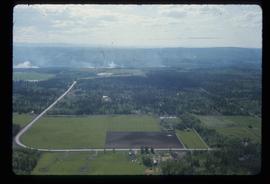
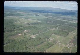
Image depicts Prince George near the Airport Road.
Subseries consists of material collected and created by Kent Sedgwick for research relating to museums and historical societies within Prince George. Includes material regarding the Fraser Fort-George Regional Museum, the Exploration Place Museum, the Prince George Railway and Forestry Museum, the Fraser-Nechako Historical Society, the Prince George Oral History Group, and the Prince George Genealogical Society. Also includes publications such as newspapers and calendars created by the museums and societies and various materials regarding activities conducted by the institutions.
Collection consists of oral histories gathered as part of Dr. Mike Evan's oral history project with the Prince George Metis Elders Society. Includes consent forms, transcripts, and the recorded oral histories on their original cassette tapes.
Evans, Michael JohnVideotape contains footage of: 23-Feb-01 - Residency Program continued - Riome-York, Sasha / 26-Feb-01 - Tabor Lake limnology class - students
CD-Rom is a "media CD" containing promotional videos, brochures, and photographs of Prince George. The CD was created for distribution at the 2006 Winter Games at Torino. UNBC was part of a Northern BC delegation that went to the 2006 Olympics in anticipation of the 2010 Winter Olympics in Vancouver. Rob van Adrichem was the Media Relations representative for the Northern BC delegation.
Subseries includes research material created and collected by Kent Sedgwick relating to land survey, development, and settlement in Prince George and British Columbia. Land surveys were conducted in British Columbia by surveyors George Dawson, the North Coast Land Company, Alfred R.C. Selwyn, and the Geological Survey of Canada during the late 19th and early 20th centuries. James C. Anderson and engineer J. Gill conducted topographical surveys for the Grand Trunk Pacific Railway on Fort George and the Indian Reserve. Surveyors and land plot companies developed the land for sale to promote settlement in the area. Also includes materials regarding the continued development of the City of Prince George throughout the 20th century. The files primarily consist of newspaper clippings, research notes, and photocopied documents.
File contains an original "Prince George Land and Resource Management Plan" published by the Government of British Columbia.
Videotape contains footage of: 15-Jan-06 - Scenery - Prince George in winter from Gunn Park
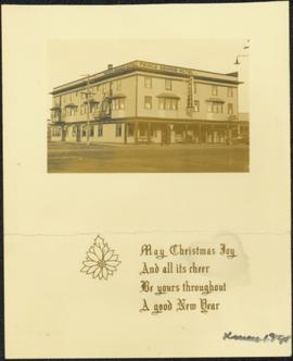
Photograph features the hotel on George Street, Prince George BC. Handwritten annotation on verso of photograph reads: "Xmas [1948?]", on recto: "From Mr. & Mrs. Fask Douglas." Poem on verso reads: "May Christmas Joy And all its cheer Be yours throughout A good New Year".
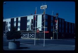
Image depicts the Prince George Hotel.
Collection contains photographs depicting community life in Prince George, B.C. Images depict holiday events, sports teams, government buildings, businesses (hotels, banks, retail, newspaper office), riverboats, railroad construction, fishing, a cemetery, street scenes, aerials, and landscapes. Also includes photos taken outside of the Prince George vicinity including Prairie Creek, Thomas Creek and Barkerville, B.C.
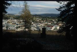
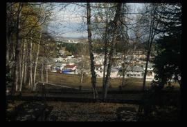
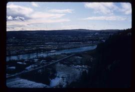
Image depicts a Prince George residential area from the viewpoint of the Ginter Property.
Image depicts a Prince George residential area from the viewpoint of the Ginter Property.
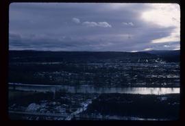
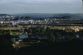
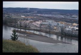
Image depicts a view of Prince George from the cutbanks on the Nechako river.
Image depicts a view of Prince George from the cutbanks.
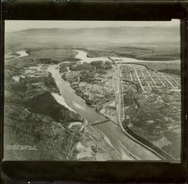
Item is a photograph of Prince George taken from the air, looking east with the Cameron Street Bridge in the foreground.
Image depicts Prince George from the view of Peden Hill.
Image depicts the Courthouse in Prince George, B.C.
Subseries consists of material collected and created by Kent Sedgwick for research relating to community life in Prince George. The files primarily consist of notes and newspaper clippings discussing life in Prince George during the 20th century. Subseries contains material on public services and infrastructure including fire protection, electricity, water towers, policing and jails, and medicine; the history of businesses including Northern Hardware; public events; and recreational activities including hockey, baseball, curling, skiing, tennis, soccer, lacrosse, boxing, horse racing, golfing, and art.
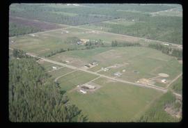
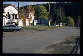
Image depicts a clearing in Prince George, B.C., possibly in the Pineview area.
Image depicts a clearing in Prince George, B.C.
Item is a special issue of the Prince George Citizen featuring UNBC entitled "UNBC: Putting a Face to the Place".
File consists of Prince George Citizen Newspaper 9-Jan-1990, 10-Jan-1990
This fold out brochure, published by the Prince George Board of Trade, provides an overview of the industries present in Prince George by the BC Centennial; as well as a brief presentation of local recreational opportunities and a mileage listing.
This very large drawing shows CN leases and private property buildings on Island Cache in detail.
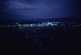
Lockwood Survey Corporation Ltd.Image depicts Prince George at night from the cutbanks.
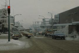
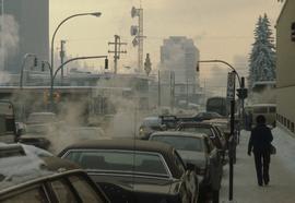
Image depicts 3rd Ave at Brunswick Street in -35 degree weather. Map coordinates 53°55'03.0"N 122°44'51.7"W
Image depicts Brunswick Street at 3rd Ave in -35 degree weather. Map coordinates 53°55'03.0"N 122°44'51.7"W
Subseries consists of material collected and created by Kent Sedgwick for research regarding various areas within Prince George. These files include material on neighbourhoods and notable areas within the city, as well as the Regional District of Fraser-Fort George. Notable areas include the Fort George Canyon, downtown Prince George, and Cottonwood Island. The files primarily contain notes and newspaper clippings relating to the development and history of these areas.
Subseries consists of material collected and created by Kent Sedgwick for research regarding schools in Prince George and area, as well as materials relating to Kent Sedgwick's involvement with the Prince George Retired Teacher's Association. Files primarily consist of notes regarding the location and history of various schools in and surrounding Prince George and photographs depicting historic school buildings. The research on schools aided the development of a history of schools for the Prince George Retired Teachers' Association.
File consists of flyers and leaflets relating to protests and activism in Prince George. Includes:
- "Grasslands Not Gas Lands" leaflet regarding action against Westcoast Olefins extraction plant in Pineview, 2021
- "'Centralized Strategy' Decision Student Led Protest" flyer regarding resistance against the City of Prince George's decision to centralize Prince George homeless populations into the Moccasin Flats encampment, 2023
File consists of music programs, brochures, and news clippings from performances in Prince George and Vanderhoof. Some of the concerts were organized by the Prince George and District Drama and Music Association, the Prince George Concert Association, the Prince George Concert Group, the Prince George Cantata Singers, Alaska Music Trail, Overture Concert Association, and the Nechako Community Arts Council.
Image depicts an uncertain street in Prince George, B.C.
Image depicts a sawmill in Prince George, B.C.
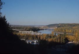
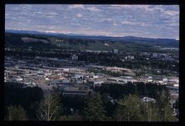
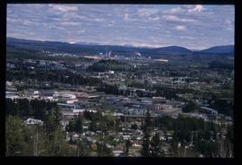
Image depicts Prince George, with the picture looking North-Northeast from University Way.
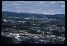
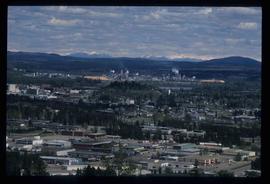
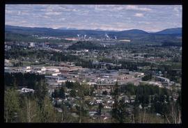
Image depicts Prince George from University Way, with the P.G.I. Pulp Mill in the distance.
Image depicts Prince George from University Way, with the P.G.I. Pulp Mill in the distance.
Image depicts Prince George from University Way, with the P.G.I. Pulp Mill in the distance.
Image depicts Prince George from University Way, with the P.G.I pulp mill in the distance.
Consists of 1 brochure entitled "Prince George : Centre City of British Columbia Canada : An Invitation to Tourists," made possible by the Prince George & District Board of Trade. Printed by Spee-Dee Printers Ltd. The Tourist Centre, 101 George Street, is provided as a contact for further information
