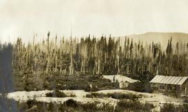
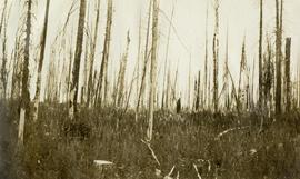
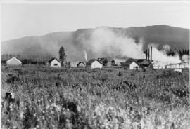
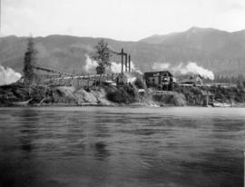
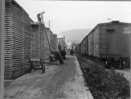
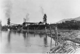
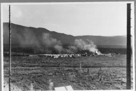
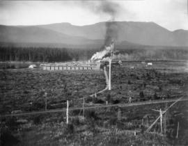
Original photographic print included in "Northern Interior Forest Experiment Station: Report of Preliminary Investigations" by Percy Barr.
Penny, BC
62 Archival description results for Penny, BC
Original photographic print included in "Northern Interior Forest Experiment Station: Report of Preliminary Investigations" by Percy Barr.
Photograph depicts Red Mountain Lumber Company mill owned by Roy Spurr in Penny, BC in 1929. Scattered all around the mill are the remnants of the previous coniferous forest that was destroyed in the Penny Fire that occurred 2 years earlier.
Photograph depicts Red Mountain Lumber Company mill owned by Roy Spurr in Penny, BC in 1929. Scattered all around the mill are the remnants of the previous coniferous forest that was destroyed in the Penny Fire that occurred 2 years earlier.
Photograph depicts Red Mountain Lumber Company mill owned by Roy Spurr in Penny, BC in 1929. Scattered all around the mill are the remnants of the previous coniferous forest that was destroyed in the Penny Fire that occurred 2 years earlier.
Photograph depicts Red Mountain Lumber Company mill owned by Roy Spurr in Penny, BC in 1929. Scattered all around the mill are the remnants of the previous coniferous forest that was destroyed in the Penny Fire that occurred 2 years earlier.
Photograph depicts Red Mountain Lumber Company mill owned by Roy Spurr in Penny, BC in 1929. Scattered all around the mill are the remnants of the previous coniferous forest that was destroyed in the Penny Fire that occurred 2 years earlier.
Photograph depicts Red Mountain Lumber Company mill owned by Roy Spurr in Penny, BC in 1929. Scattered all around the mill are the remnants of the previous coniferous forest that was destroyed in the Penny Fire that occurred 2 years earlier.
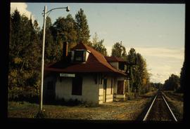
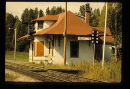
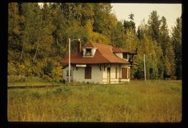
Image depicts the CN Station in Penny B.C.
Image depicts the CN Station in Penny B.C. A woman, possibly Sue Sedgwick, is sitting against the outside wall.
Image depicts the CN Station in Penny B.C.
Subseries consists of material collected by Kent Sedgwick for research regarding the communities along the East Line of the Grand Trunk Pacific Railway in Central British Columbia, particularly between Prince George and McBride. These communities and locations include, among others, Shelley, Willow River, Sinclair Mills, Longworth, Dunster, Tete Jaune, Valemount, Mount Robson, and the Yellowhead Pass. Research on these communities was conducted during Kent Sedgwick's involvement in the UNBC-led Upper Fraser Historical Geography Project. The files primarily consist of research notes, audio and transcripts of oral interviews, and photographs of the East Line communities.
File contains slides depicting places along the east line of the BC Railway.
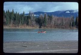
Image depicts a red boat on a river, possibly the Fraser, near Penny, B.C.
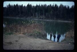
Image depicts four unidentified individuals standing on the bank of a river, possibly the Fraser, somewhere in or near Penny, B.C.
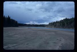
Image depicts a river, possibly the Fraser, near Penny, B.C.
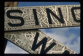
Image depicts a railway crossing sign with peeling and cracked paint somewhere in or near Penny, B.C.
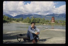
Image depicts Kent Sedgwick sitting on the bank of a river. An old beehive burner is visible in the background. Located somewhere in or near Penny, B.C.
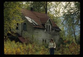
Image depicts Sue Sedgwick standing in front of an old, run-down house somewhere in or near Penny, B.C.
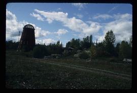
Image depicts a beehive burner somewhere in or near Penny, B.C.
The Upper Fraser Historical Geography Project was conducted by UNBC faculty and a team of researchers between 1999 and 2002. The lead researchers were Aileen Espritiu, Gail Fondahl, Greg Halseth, Debra Straussfogel, and Tracy Summerville. The project resulted in the creation of 93 oral history records and their transcripts. Participants included regional forest industry executives, politicians (including former MLA Ray Williston, local mayors and Fraser Fort George Regional District representatives), forest industry workers, and former and contemporary Upper Fraser community residents. The oral histories document the rise, consolidation and demise of the forestry-based settlements along the Upper Fraser River between 1915 and 2000.
File consists of an audio recording of an interview with Earl Lousier and Harry Gairns. Includes two original recorded audio cassettes.
File consists of a transcript of an oral history interview with Earl Lousier and Harry Gairns.
File consists of a transcript of an oral history interview with Jack Boudreau. Also includes photocopies of Jack Boudreau's personal records, such as the Diary of Ada (Adelia) Sykes.
File consists of an audio recording of an interview with Jack Boudreau. Includes one original recorded audio cassette and one copy.
File consists of an audio recording of an interview with Barb Harkins. Includes one original recorded audio cassette and one copy.
File consists of a transcript of an oral history interview with Barb Harkins. Also includes photocopies of Barb Harkins' personal records, such as photographs.
File consists of a transcript of an oral history interview with Bob Harkins/
File consists of an audio recording of an interview with Bob Harkins. Includes two original recorded audio cassettes and one copy.
File consists of a transcript of an oral history interview with Lea Gobbi and Kate Anderson.
File consists of an audio recording of an interview with Lea Gobbi and Kate Anderson. Includes two original recorded audio cassettes and two copies.
File consists of a transcript of an oral history interview with Cy Bechtel.
File consists of an audio recording of an interview with Cy Bechtel. Includes one original recorded audio cassette and two copies.
File consists of an audio recording of an interview with Milly Saville. Includes one original recorded audio cassette and two copies.
File consists of a transcript of an oral history interview with Milly Saville.
File consists of a transcript of an oral history interview with Myra and Glen Hooker.
File consists of a transcript of an oral history interview with Jim and Dianne Humphreys.
File consists of an audio recording of an interview with Myra and Glen Hooker. Includes one original recorded audio cassette and one copy.
File consists of an audio recording of an interview with Jim and Dianne Humphreys. Includes one original recorded audio cassette and one copy.
File consists of a transcript of an oral history interview with Sandra Trolian.
File consists of an audio recording of an interview with Sandra Trolian. Includes one original recorded audio cassette and two copies.
File consists of an audio recording of an interview with Jean May. Includes one original recorded audio cassette and one copy.
File consists of an audio recording of an interview with Crissie Ward and Laureen Stewart. Includes two original recorded audio cassettes and two copies.
File consists of a transcript of an oral history interview with Jean May.
File consists of a transcript of an oral history interview with Crissie Ward and Laureen Stewart.
File consists of a transcript of an oral history interview with John Humphreys.
File consists of an audio recording of an interview with John Humphreys. Includes one original recorded audio cassette and one copy.
File consists of a transcript of an oral history interview with Anna Mellos.
File consists of an audio recording of an interview with Anna Mellos. Includes one original recorded audio cassette and one copy.
File consists of a transcript of an oral history interview with Victor Litnosky.
