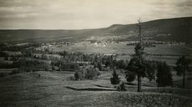
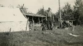
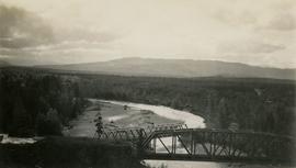
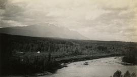
Land, Settlement and Immigration

Elements area

Taxonomy

Code

Scope note(s)

  • Claiming, settling, and moving to a new land
  • Land titles, distribution, grants, etc.
  • Community and regional settlement patterns
  • Land settlement companies
  • Land surveys and surveyors
  • Real estate companies and activities
  • Organizations involved in sponsoring and supporting immigrants

Source note(s)

  • MemoryBC Subject Groups

Display note(s)

    Hierarchical terms

    Land, Settlement and Immigration

      Equivalent terms

      Land, Settlement and Immigration

        Associated terms

        Land, Settlement and Immigration

          1372 Archival description results for Land, Settlement and Immigration

          1996.8.2.11 · File · [1956?]
          Part of Chander Suri fonds

          File consists of a brief developed by the Lower Mainland Regional Planning Board of B.C. examining the problems with expanding urban sprawl in Greater Vancouver, outlining the findings of the research, and offering future suggestions.

          Buckhorn Elementary School
          2012.13.2.16.41 · File · [between 2001 and 2005]
          Part of J. Kent Sedgwick fonds

          File consists of notes relating to Buckhorn Elementary School. Also includes photographs depicting the old Buckhorn School building and the Prince George Snowmobile club building from the exterior (between 2001 and 2005).

          Photographs
          2020.4.8 · Series · 1956-2013
          Part of G. Gary Runka fonds

          Gary Runka was a hobbyist photographer and documented his work and personal life through photography as he travelled across every region of British Columbia. His photographs document the evolution of British Columbia communities and regions over a 30 year period. Gary Runka's core interest was land and changing land uses. Many of his photographs tell a story of urban edge and/or natural resource compatibility/conflict. There are also a substantial number of photographs related to soils, including soil profiles, soil erosion and land (topography, drainage etc.) capability for agriculture. The collection also includes specific client-related photos, tied to Land Sense Ltd. client file job numbers.

          The collection also documents personal travels and hiking trips throughout British Columbia and backpacking in some historic areas, such as the West Coast Trail and Cape Scott. These photographs also represent land evolution over time, including extent of alpine glaciation or biodiversity/plant species inhabiting the area.

          Print Photographs
          2020.4.8.2 · Subseries · 1956-1990
          Part of G. Gary Runka fonds

          Series consists of print photographs created or collected by Gary Runka over the course of his personal and professional life. Includes school portraits, sporting event photographs, and work-related group portraits. Also includes aerial photographs of the West Coast Trail.

          2012.13.2.19 · Subseries · 1955-2011
          Part of J. Kent Sedgwick fonds

          Subseries contains material collected and created by Kent Sedgwick for research on various areas in British Columbia and Alberta. Includes written notes by Kent Sedgwick, pamphlets, and newspaper clippings relating to towns and settlements. These areas include Quesnel, Likely, the Yukon Telegraph Trail, Barkerville, Wells, the Cariboo region, Fort Alexandria, Soda Creek, the Chilcotin region, Jasper, the Rocky Mountains, Mackenzie, Tumbler Ridge, the Peace River region, Fort St. James, the Omineca region, Kitimat, Lethbridge, the Bulkley Valley, and Fort Mcleod. These files cover a variety of topics including Chinese people in British Columbia, land settlement, tourism, and historic information on the regions.

          Personal Records
          2020.4.1 · Series · 1953-2014
          Part of G. Gary Runka fonds

          Series consists of records relating to G. Gary Runka's personal life, including academic records, personal resume, and posthumous materials. Also includes Runka's personal correspondence during his time with the Agricultural Land Commission and memorabilia from his curling activities.

          G. Gary Runka fonds
          2020.4 · Fonds · 1945-2013

          This fonds illustrates the life and work of G. Gary Runka and his contributions to the province of British Columbia. Gary Runka was the first General Manager of British Columbia's Agricultural Land Commission and helped establish the provincial Agricultural Land Reserve. After transitioning from a government career to private consulting, Runka provided comprehensive professional services through his land consultancy business, G.G. Runka Land Sense Ltd., offering land capability and environmental assessments, integrated resource management, land and water use conflict resolution, and interdisciplinary land use planning. Described by colleagues as one of BC's most highly respected agrologists and influential land use planners, Runka had a 52-year career working on (or against) an incredible number of landmark projects in British Columbia, such as the Site C Project. Gary Runka’s partner in life and vocation, Joan M. Sawicki, worked with Gary on many of these projects—as well as her own; her contributions are also represented throughout the records of this fonds.

          Gary Runka's deep connection to the land is evident from his earliest papers on aerial photo interpretation, his work with the Canada Land Inventory, through his speeches and his work establishing the BC Agricultural Land Reserve and in his subsequent consulting career through G.G. Runka Land Sense Ltd. Gary Runka's influence and legacy was recognized in the tributes paid after his death, including the post-humus award as the Real Estate Foundation's "Land Champion" for 2014.

          The G. Gary Runka fonds has been divided into the following nine series:
          1) Personal Records
          2) Speeches & Publications
          3) Professional Records
          4) Agricultural Land Commission
          5) Land Sense Ltd.
          6) Client Files
          7) Maps
          8) Photographs
          9) Digital Records

          Runka, G. Gary
          Speeches and Publications
          2020.4.2 · Series · 1945-2009
          Part of G. Gary Runka fonds

          Series consists of works written or collected by G. Gary Runka.

          The 2020.4.2.1 Speeches sub-series includes manuscripts of speeches written by G. Gary Runka.

          The 2020.4.2.2 G. Gary Runka Writing sub-series includes publications, manuscripts, and drafts of worked written, co-written, or edited by G. Gary Runka over the course of his career.

          The 2020.4.2.3 Collected Works sub-series includes works collected by G. Gary Runka. Runka collected a comprehensive resource library of publications, reports, and rare grey literature that reflected the depth and breadth of natural resource issues in British Columbia. Material from this resource library was intrinsically tied to Runka's work; selected unique items from the resource library are contained within this sub-series to contextualize the scope of land management issues.

          Collected Works
          2020.4.2.3 · Subseries · 1945-2009
          Part of G. Gary Runka fonds

          Subseries includes works collected by G. Gary Runka. Runka collected a comprehensive resource library of publications, reports, and rare grey literature that reflected the depth and breadth of natural resource issues in British Columbia. Material from this resource library was intrinsically tied to Runka's work; selected unique items from the resource library are contained within this sub-series to contextualize the scope of land management issues.

          2012.13.2.02 · Subseries · 1941-2011
          Part of J. Kent Sedgwick fonds

          Subseries includes research material created and collected by Kent Sedgwick relating to land survey, development, and settlement in Prince George and British Columbia. Land surveys were conducted in British Columbia by surveyors George Dawson, the North Coast Land Company, Alfred R.C. Selwyn, and the Geological Survey of Canada during the late 19th and early 20th centuries. James C. Anderson and engineer J. Gill conducted topographical surveys for the Grand Trunk Pacific Railway on Fort George and the Indian Reserve. Surveyors and land plot companies developed the land for sale to promote settlement in the area. Also includes materials regarding the continued development of the City of Prince George throughout the 20th century. The files primarily consist of newspaper clippings, research notes, and photocopied documents.

          "Land Settlement: A Report"
          2012.13.2.02.64 · File · 1941
          Part of J. Kent Sedgwick fonds

          File consists of a bound typescript book titled "Land Settlement (A report by a C.S.T.A Committee)" produced by the Canadian Society of Technical Agriculturists in 1941.

          Research Subject Files
          2012.13.2 · Series · 1937-2011
          Part of J. Kent Sedgwick fonds

          Kent Sedgwick’s research subject files contain original research notes, interviews and oral histories, news clippings, and collected primary and secondary sources. The series also includes both original and reproduction photographs, audio recordings, and maps. The subject files primarily relate to the history, urban planning, and historical geography of the Central Interior of British Columbia, especially Prince George area and the East Line communities over the course of the 20th century. They also include extensive notes on geographic features, landscapes, interpretative trails, architectural history, industrial history, history of Western exploration and land survey, and the First Nations history of the region.

          Lone Butte, BC
          2020.05.22 · Item · Oct. 1936
          Part of Gordon Wyness Album

          Photograph depicts a view of Lone Butte, BC. The butte formation of the same name (Lone Butte) is visible in the background; a ranch or residence is visible in the foreground. Wyness notes that Lone Butte was the "last one [they] tied in". "Tying in" is a land surveying technique. Since the photograph is dated October 1936 and Wyness described the survey trip as lasting June 5 - October 8, 1936, that implies that Lone Butte was the last location they surveyed on this trip.

          2020.05.05 · Item · October 1936
          Part of Gordon Wyness Album

          Photograph depicts Mount Begbie, noted by Wyness to be the highest point on the Cariboo Highway at mile 85. Mount Begbie is located at approximately 51°28'33''N, 121°22'00''W, on the east side of Cariboo Hwy, between 70 Mile House and 100 Mile House, in the Lillooet Land District. Wyness annotated this photograph with the statement that they "tied this one in"; 'tying in' is a land survey term, implying that the crew may have also been surveying in this area.

          2020.05.07 · Item · October 1936
          Part of Gordon Wyness Album

          Photograph depicts Mount Begbie, noted by Wyness to be the highest point on the Cariboo Highway at mile 85. Mount Begbie is located at approximately 51°28'33''N, 121°22'00''W, on the east side of Cariboo Hwy, between 70 Mile House and 100 Mile House, in the Lillooet Land District. Also visible in this photograph is the Cariboo Highway road.

          2020.05.08 · Item · October 1936
          Part of Gordon Wyness Album

          Photograph depicts a view of the Fraser River from what Wyness calls "Fraser Mountain". There are a number of places named "Mount Fraser" in British Columbia, but the exact location of where this photograph was taken is unclear.

          2020.05.06 · Item · October 1936
          Part of Gordon Wyness Album

          Photograph depicts Mount Begbie, noted by Wyness to be the highest point on the Cariboo Highway at mile 85. Mount Begbie is located at approximately 51°28'33''N, 121°22'00''W, on the east side of Cariboo Hwy, between 70 Mile House and 100 Mile House, in the Lillooet Land District. Also visible in this photograph is the Cariboo Highway road.

          2020.05.15 · Item · [Sept. or Oct. 1936]
          Part of Gordon Wyness Album

          Photograph depicts (from left to right) Gordon Wyness and Jack Lee at a camp scene "at Bobtail" (possibly Bobtail Lake) near Vanderhoof. As noted in the album caption, the crew had "just returned from Vanderhoof". The telegraph cabin roof and their 1930 Buick Series 40 car is visible at right.

          2020.05.17 · Item · [Sept. or Oct. 1936]
          Part of Gordon Wyness Album

          Photograph depicts Jack Lee rafting with a sail on Bobtail Lake, as he was going over to other side of the lake to locate traverse posts (without success, according to the annotation on the photograph verso).

          2020.05.25 · Item · [Sept. or Oct. 1936]
          Part of Gordon Wyness Album

          Photograph depicts a view of the city of Prince George looking west from the east hill. The confluence of the Fraser River and Nechako River is visible to the right. The Grand Trunk Pacific Railway bridge is visible at centre. The current location of where this photograph may have been taken is likely somewhere near where Highway 16 rises on the hill past the correctional centre (jail).

          Bridges at Telkwa River
          2020.05.19 · Item · [Sept. or Oct. 1936]
          Part of Gordon Wyness Album

          Photograph depicts two bridges crossing the Telkwa River. Wyness notes (on photograph verso) that this is where their survey crew traversed the river; he also noted erosion in the area.

          Campsite at Sheraton
          2020.05.29 · Item · [Sept. or Oct. 1936]
          Part of Gordon Wyness Album

          Photograph depicts (from left to right) Gordon Wyness and Jack Lee at their campsite at Sheraton. This location may reference the small community east of Burns Lake on the Canadian National Railway line. Wyness notes that "Sherton" [Sheraton?] Mountain is visible in the background of the photograph; the current name of that geographical feature could not be determined. The survey crew's car and tent are also visible in the image.

          2020.05.11 · Item · [Sept. or Oct. 1936]
          Part of Gordon Wyness Album

          Photograph depicts (from left to right) Gordon Wyness and Jack Lee in front of the Fort St. James sign, which reads "First white settlement in British Columbia. Established by the North West Company in 1806 by Simon Fraser and John Stuart and taken over by the Hudson's Bay Company in 1821. - General Merchandise Visitors Welcome".

          2020.05.14 · Item · [Sept. or Oct. 1936]
          Part of Gordon Wyness Album

          Photograph depicts (from left to right) Jack Lee, Philip Monckton, Jessie McInnes, and Archie McInnes at Pioneer Ranch.

          In 1903, brothers Neil and Archie McInnes pre-empted a section of land two miles east of Cote Flat, each taking half. Archie McInnes' land later became known as Pioneer Ranch (later known as the Barnett Ranch); Neil McInnes' land became Meadowbrook Ranch. Archie McInnes married Jessie Aitken in October 1905. Pioneer Ranch became known as a stop-over for travellers en route from Hazelton to the Ootsa Lake area via the Telegraph Trail. Archie and Jessie McInnes had three daughters: Vera (m. Ivan Frank), Ivy (m. Eric Strimbold), and Neva (m. John Ivan Nickolichuk).

          François Lake Ferry
          2020.05.51 · Item · Sept. 1936
          Part of Gordon Wyness Album

          Photograph depicts the Francois Lake Ferry. Gordon Wyness stands next to the survey crew's Buick car in the middle of the boat. Jack Lee leans on the railing at the back of the boat.

          2020.05.10 · Item · Sept. 1936
          Part of Gordon Wyness Album

          Photograph depicts (from left to right) Gordon Wyness, Philip Monckton, and Lavender Monckton by their 1930 Buick Series 40 car in the Williams Lake area. In this image, the car may be broken down; Wyness noted that they "were forced to spend the nite in a school house due to condenser burning out in the car". Wyness also noted that they had "just finished tying in Fraser Mtn", suggesting that they had just completed survey work in the Fraser Mountain area.

          2020.05.13 · Item · [Sept. or Oct. 1936]
          Part of Gordon Wyness Album

          Photograph depicts (from left to right) Jack Lee, Gordon Wyness, Jessie McInnes, and Archie McInnes at Pioneer Ranch.

          In 1903, brothers Neil and Archie McInnes pre-empted a section of land two miles east of Cote Flat, each taking half. Archie McInnes' land later became known as Pioneer Ranch (later known as the Barnett Ranch); Neil McInnes' land became Meadowbrook Ranch. Archie McInnes married Jessie Aitken in October 1905. Pioneer Ranch became known as a stop-over for travellers en route from Hazelton to the Ootsa Lake area via the Telegraph Trail. Archie and Jessie McInnes had three daughters: Vera (m. Ivan Frank), Ivy (m. Eric Strimbold), and Neva (m. John Ivan Nickolichuk).