File contains two maps of the Columbia River system.
Series consists of cartographic materials including maps and blueprints of the Aleza Lake Research Forest. The maps reflect permanent sample plots and other study areas. The blueprints outline details for the development of a Ranger Station.
Series consists of maps collected by Kent Sedgwick covering historical and contemporary British Columbia. The maps include originals and photocopies that depict Fort George; Indian Reserve No.1; Anahim Lake, Bella Colla, Quesnel; Salmon Valley; the Cariboo district; the Peace River Country; Prince Rupert; Terrace; Bowron River; Giscome; Prince George; and Isle Pierre. The maps include tourism and recreation maps, pre-emptor maps, and resource maps created by the Province of British Columbia.
File contains three maps of the Project area.
The item is a reproduction of a map originally printed in 1926. The original was lost in the Fort George museum fire. The map depicts topography and lot areas of Prince George. Map also highlights the area of industrial development on DL 417. Annotations state, "Blue Print copy in Eng. Records original burned in museum fire 1926."
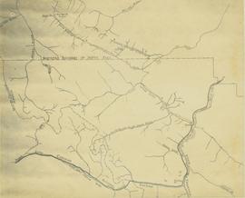
Map depicts the rivers, railways, and select lakes and towns located at Jasper Park between the northern boundary of the park and the townsite of Jasper. Part of the border between Alberta and British Columbia is visible on the west of the map.
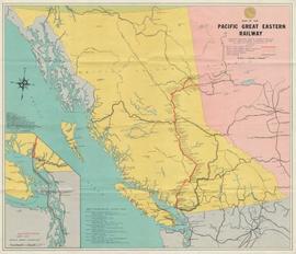
Map depicts the routes of the Pacific Great Eastern Railway, showing stations, railway connection, and the PGE Microwave Communication System.
Wyld, James. "Map of the Colony of New Caledonia and the British & American Territory West of the Rocky Mountains including Vancouvers Island and the Gold Fields" by James Wyld, Geographer to the Queen & the Prince Consort, Charing Cross East & 2 Royal Exchange, London, July 16, 1858.
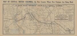
Item is a photocopy of a map depicting the central section of British Columbia showing the area served by the Grand Trunk Pacific Railway published by the Poole Brothers in Chicago.
The item is a map depicting the Prince Rupert townsite. Map is published by McRae Bros. Ltd. and Collart & Reynolds Real Estate.
Map reflects reserve boundary, roads, trails, 20 feet contour intervals, air photo centre, declination, swamps, and mile post at the Aleza Lake Forest Reserve.
Item is an original 1879 map depicting northern British Columbia and the Peace River Country, created by G.M. Dawson and published in Geological Survey of Canada Report B 1879-80.
Map depicts rail lines in the BC lower mainland, including BC Hydro Railway, Burlington Northern Railway, the Canadian Pacific Railway, the Canadian National Railway, and the Pacific Great Eastern Railway.
Item is a map that distinguishes the regions covered by Tree Farm Licence No. 1 granted to Columbia Cellulose and Three Farm Licence No. 40 granted to Skeena Kraft. Major locations indicated in this map include: Prince Rupert, Terrace, Hazelton, Smithers, Kitimat, Skeena River, and Nass River. Railway routes are also shown.
Item is a photocopied map of the Aleza Lake area annotated to show transects.
Item is a reproduced map of Aleza Lake annotated to show a 1994 RFP study area.
Series contains working and management plans, a policy handbook, drafts, correspondence, proposals, recommendations, revenue records, photographs, handwritten notes, maps, and planning projects.
Item is a map annotated in colour by the City of Prince George Planning Department depicting major residential development proposals from June 1975 to August 1977 in the City of Prince George. This map was drawn for the City of Prince George interim Community Plan.
Map depicts the whole of Canada and notes: gas pipelines, gas gathering lines, proposed gas pipelines, oil pipelines, oil gathering lines, proposed oil pipelines, gas fields, oil fields, refining centres, extraction plants, and oil sands. There is a smaller subsequent map of Alberta highlighting these features in greater detail.
File contains various correspondence regarding 1964 annual cuts for sawmills in the area, memoranda consisting of various administrative issues such as the 1973 amalgamation of Purden Lake and Aleza Lake, and the sale of lumber previously infested by spruce beetles. File also contains 1972 applications to purchase Crown timber and road use, as well as 1966 logging permits.
Collection consists of records related to the Alcan/Kemano project on the Nechako River circa 1980-2000 from the Nechako Neyenk'ut Society, the Rivers Defense Coalition, and the Smelter Study Group.
Burgener, LouiseArea covered: Howe Sound to Maple Ridge/Langley / Coquitlam Lake to international boundary.
Shows: lost streams & shores; existing streams & shores; existing freshwater bodies of water; roads; municipalities.
Verso: Stewarding our local streams; Stream stories; text; illustrations.
Contemporary stream information from TRIM program.
These historically important aerial photographs depict Williston Lake soon after its creation in 1968 with the building of the W.A.C. Bennett Dam on the Peace River. Also depicted are the rivers and tributaries that empty into the Williston Reservoir, such as the Finlay River, the Ospika River, and the Omineca River.
These remote-sensing aerial photographs were taken by Lockwood Survey Corporation Ltd. under contract for the B.C. Forest Service. Some photographs are annotated to show logging activity; clearcuts, slash piles, log booms, and tree debris on the water are also visible in some of the images. No detailed location information or index accompanies the photographs.
Lockwood Survey Corporation Ltd.Map depicts producing mines and prospects in British Columbia and parts of Alberta.
Map depicts locations of all mining properties in British Columbia. Includes index with names of owners of properties.
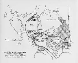
Item is a map showing the watersheds of Diana Lake, Rainbow Lake and Prudhomme Lake.
Subseries consists of materials collected by Kent Sedgwick for research relating to Lheidli T'enneh First Nations. The Lheidli T'enneh are a sub-group of the Dakelh people whose traditional territory includes the city of Prince George, British Columbia. These files primarily consist of material regarding the original Lheidli T'enneh reserve and cemetery, the reserve relocation, and the desecration of the cemetery.
File consists of a land capability map for the Prince George special sales area, part of the ARDA Canada Land Inventory. Includes a letter from R.J. McCormack, Chief of the Canada Land Inventory.
Map depicts the Kitlope range, Kimsquit Watershed, and area around Kitlope Lake. Includes Indigenous place names, grease trails, Indigenous village sites, and wildlife information.
The map depicts the town of Kitimat and on the other side of the map there is an advertisement for Northland Shipping.
Map depicts the city of Kelowna and area. Annotated by Davies to emphasize rail lines.
Map depicts area around Kelowna, with annotated Kettle Valley Railway Carmi subdivision line, Hydraulic Lake, and McCulloch.
File consists of records created and accumulated by Gary Runka over the course of his consultancy work for BC Ministry of Lands, Parks and Housing for the "Moberly DPA" project in Fort St. John. This file was numbered as G.G. Runka Land Sense Ltd. client file #079; that client number may be seen referenced elsewhere in the G. Gary Runka fonds. The Land Sense Ltd. client files generally include records such as correspondence, contracts, invoices, project reports, publications, ephemera, memoranda, maps or map excerpts, legal documents, meeting materials, clippings, and handwritten notes.
Maps include:
- "Moberly River" NTS map annotated with Soils & Landforms;
- "Moberly Crown Land Plan Area - Land Capability for Agriculture Interpretation" by G. G. Runka Land Sense Ltd., 1982;
- "Hudson Hope" 1964 NTS map annotated with Soils & Landforms;
- "Moberly Crown Land Plan Area", n.d. - 2 copies;
- "Climate Capability for Agriculture 94A-SW", 1970.
File consists of records created and accumulated by Gary Runka over the course of his consultancy work for B.C. Women's Institutes for the "Site C - Environmental Impact Statement Technical Review" project in Site C. This file was numbered as G.G. Runka Land Sense Ltd. client file #671; that client number may be seen referenced elsewhere in the G. Gary Runka fonds. The Land Sense Ltd. client files generally include records such as correspondence, contracts, invoices, project reports, publications, ephemera, memoranda, maps or map excerpts, legal documents, meeting materials, clippings, and handwritten notes. Also includes an oversize bound map book by BC Hydro entitled "Preliminary Impact Lines and Preferred Highway 29 Realignments Maps" for the Site C project, published April 2012.
File consists of records created and accumulated by Gary Runka over the course of his consultancy work for Canoe Creek Indian Band for the "Overview of Issues and Concerns Related to Transmission Line Corridor Component" project in Dog Creek. This file was numbered as G.G. Runka Land Sense Ltd. client file #650; that client number may be seen referenced elsewhere in the G. Gary Runka fonds. The Land Sense Ltd. client files generally include records such as correspondence, contracts, invoices, project reports, publications, ephemera, memoranda, maps or map excerpts, legal documents, meeting materials, clippings, and handwritten notes. File also includes 2 accompanying DVDs.
Maps include:
- Reproduction of NTS map Bambrick Creek 92-O/11 Edition 2 showing photocopied overlay depicting planned transmission line corridor
- Reproduction of NTS map Mount Alex 92-O/10 Edition 3 showing photocopied overlay depicting planned transmission line corridor
- Reproduction of NTS map Gustafsen Lake 92-P/12 Edition 2 showing photocopied overlay depicting planned transmission line corridor
- Reproduction of NTS map Dog Creek 92-O/9 Edition 3 showing photocopied overlay depicting planned transmission line corridor
- Reproduction of NTS map Mount Tatlow 92-O/5 Edition 2 showing photocopied overlay depicting planned transmission line corridor
- Reproduction of NTS map Elkin Creek 92-O/12 Edition 2 showing photocopied overlay depicting planned transmission line corridor
- Jacques Whitford - AXYS Ltd. for Taseko Mines Ltd. Prosperity Project, "Taseko Transmission Corridor Orthophotography Series 1" draft map, August 2008 (revision #2).
- Jacques Whitford - AXYS Ltd. for Taseko Mines Ltd. Prosperity Project, "Taseko Transmission Corridor Orthophotography Series 2" draft map, August 2008 (revision #2).
- Jacques Whitford - AXYS Ltd. for Taseko Mines Ltd. Prosperity Project, "Taseko Transmission Corridor Orthophotography Series 3" draft map, August 2008 (revision #2).
- Stswecem'c Xgat'tem Natural Resources Department, untitled map showing reserves and transmission corridor, scale 1:26,779, May 2009.
- Stswecem'c Xgat'tem Natural Resources Department, untitled map showing reserves and transmission corridor and transmission line, scale 1:35,705, May 2009.
- Stswecem'c Xgat'tem Natural Resources Department, untitled map showing reserves and transmission corridor, scale 1:63,476, May 2009.
File consists of records created and accumulated by Gary Runka over the course of his consultancy work for Environment Canada, Lands Directorate for the "Okanagan Fruitlands: The Location, Nature, Amount and Rate of Land Use Change (Report to Accompany Land Use Change Maps)" project in Penticton South. This file was numbered as G.G. Runka Land Sense Ltd. client file #065; that client number may be seen referenced elsewhere in the G. Gary Runka fonds. The Land Sense Ltd. client files generally include records such as correspondence, contracts, invoices, project reports, publications, ephemera, memoranda, maps or map excerpts, legal documents, meeting materials, clippings, and handwritten notes.
Includes map:
- "Okanagan Fruitlands Study - Land Converted to Built-up Uses 1958-1981; Agricultural Land Reserves and Built-Up Uses in 1981; Land Use in 1981", [1982?]
File consists of records created and accumulated by Gary Runka over the course of his consultancy work for BC Ministry of Sustainable Resource Management for the "Facilitation and Mediation of Central Coast Land and Resource Management Plan" project in Central Coast. This file was numbered as G.G. Runka Land Sense Ltd. client file #578; that client number may be seen referenced elsewhere in the G. Gary Runka fonds. The Land Sense Ltd. client files generally include records such as correspondence, contracts, invoices, project reports, publications, ephemera, memoranda, maps or map excerpts, legal documents, meeting materials, clippings, and handwritten notes.
Maps include:
- BC Ministry of Sustainable Resource Management Decision Support Services for Treaty Negotiations Office, "Central Coast LRMP", Nov. 2003.
- Nature Conservancy Canada, "Bella Coola Valley CIT Input and Analysis", Dec. 2005.
File consists of records created and accumulated by Gary Runka over the course of his consultancy work for BC Hydro for the "Capability Analysis and Land Use Concept Plan - West Arrow Park" project in West Arrow Park. This file was numbered as G.G. Runka Land Sense Ltd. client file #057; that client number may be seen referenced elsewhere in the G. Gary Runka fonds. The Land Sense Ltd. client files generally include records such as correspondence, contracts, invoices, project reports, publications, ephemera, memoranda, maps or map excerpts, legal documents, meeting materials, clippings, and handwritten notes. File also includes 12 accompanying aerial photographs.
Includes the following reports:
- Sigma Resource Consultants for British Columbia Hydro and Power Authority Land Division, "Assessment of Land Capability - Wigwam, Demars, West Arrow Park, Whatshan, Needles - Arrow Reservoir Region - Final Report", July 1975
- Sigma Resource Consultants for British Columbia Hydro and Power Authority Properties Division, "Arrow Reservoir Region Perspective on Resources and Settlement", 1979
- Sigma Resource Consultants for British Columbia Hydro and Power Authority Land Division, "Arrow Reservoir Region Regional Resource Study", October 1975
- G. G. Runka Land Sense Ltd. for B.C. Hydro Reservoir Land Management, "Explanatory Notes - West Arrow Park Land Disposal (Central Section) - Agriculture Unit Concept Plan", January 1985.
Maps include:
- "Composite Plan of Central Section (Between Mosquito Creek and Dixon Creek) of West Arrow Park", 22 Oct. 1984 - 2 copies, one annotated with overlay;
- "Columbia River Arrow Lakes Region: Edgewood to Nakusp", 2 Nov. 1964 - 6 different sheets showing differing mosaic units ;
- "Columbia River Development Arrow Lakes Relocation Programme: Middle Narrow - BC Hydro Needles x Nakusp 138 Kv Transmission Line Route Plan", n.d. - 2 copies;
- "BC Hydro Land Mosaic Columbia River Developments Arrow Project", March 1965 - 4 different sheets with annotations ;
- "Composite Sketch Plan of North Section (Glendevon Area) of West Arrow Park Area", n.d. ;
- "Part of Whatshan to Saddle Mountain Forest Service Road in the Arrow park-Glendevon Area";
- "BC Ministry of Forests Forest Cover Series 82-K-4-d";
- "West Arrow Park oversize printed aerial photograph map", ca. 1970.
File consists of records created and accumulated by Gary Runka over the course of his consultancy work for Nadleh Whut'en Indian Band for the "Forage Land Value Assessment for Lejac Residential School Property" project in Fraser Lake. This file was numbered as G.G. Runka Land Sense Ltd. client file #429; that client number may be seen referenced elsewhere in the G. Gary Runka fonds. The Land Sense Ltd. client files generally include records such as correspondence, contracts, invoices, project reports, publications, ephemera, memoranda, maps or map excerpts, legal documents, meeting materials, clippings, and handwritten notes. File also includes 3 accompanying aerial photographs.
Maps include:
- M.E.C., "Preliminary Plan of Lejac School Site, Seaspunkut I.R. No. 4", July 1973.
- Energy, Mines and Resources Canada Surveys and Mapping Branch, "Survey Overlay Photomap of Seaspunkut I.R. No. 4, Range 5, Coast District, British Columbia", scale 5000, NTS map sheet 93K/2, Nov. 1992.
File consists of records created and accumulated by Gary Runka over the course of his consultancy work for Spallumcheen Indian Band, Pape & Salter for the "Review of Impact and Future Use of Hydro Right of Way Land by Spallumcheen Indian Band" project in Spallumcheen. This file was numbered as G.G. Runka Land Sense Ltd. client file #376; that client number may be seen referenced elsewhere in the G. Gary Runka fonds. The Land Sense Ltd. client files generally include records such as correspondence, contracts, invoices, project reports, publications, ephemera, memoranda, maps or map excerpts, legal documents, meeting materials, clippings, and handwritten notes. File also includes 32 accompanying aerial photographs.
Includes the following:
- Land Use and Impact BC Hydro Right-of-Way Enderby Indian Reserve #2. Prepared by G.G. Runka Land Sense Ltd. for Spallumcheen Indian Band Negotiating Team. 1995.
Maps include:
- Terra Engineering Ltd. for Spallumcheen Indian Band, "Enderby Gravel Pit, Depth to Bedrock", sheet 2 of 3, Jan. 1995.
- Terra Engineering Ltd. for Spallumcheen Indian Band, "Enderby Gravel Pit, Bedrock Surface", sheet 3 of 3, Jan. 1995.
- Energy, Mines and Resources Canada Surveys and Mapping Branch, "General Purpose Photomap Survey Overlay Photomap of Enderby I.R. No. 2, Kamloops Division of Yale District, British Columbia", sheet 1 of 1, scale 1:10000, NTS map sheet 82L/11, Aug. 1992. (2 copies)
- Energy, Mines and Resources Canada Surveys and Mapping Branch, "Survey Overlay Photomap of Enderby I.R. No. 2, Kamloops Division of Yale District, British Columbia", sheet 1 of 3, scale 1:5000, NTS map sheet 82L, Sept. 1993. (2 copies)
- Energy, Mines and Resources Canada Surveys and Mapping Branch, "Survey Overlay Photomap of Enderby I.R. No. 2, Kamloops Division of Yale District, British Columbia", sheet 2 of 3, scale 1:5000, NTS map sheet 82L, Sept. 1993. (2 copies)
- Energy, Mines and Resources Canada Surveys and Mapping Branch, "Survey Overlay Photomap of Enderby I.R. No. 2, Kamloops Division of Yale District, British Columbia", sheet 3 of 3, scale 1:5000, NTS map sheet 82L, Sept. 1993. (2 copies)
- Energy, Mines and Resources Canada Surveys and Mapping Branch, "Photomap of Enderby I.R. No. 2, Kamloops Division of Yale District, British Columbia", sheet 3 of 3, scale 1:5000, NTS map sheet 82L, n.d.
- G.G. Runka Land Sense Ltd., overlay for "Survey Overlay Photomap of Enderby I.R. No. 2", sheet 1 of 3, July 1995.
- G.G. Runka Land Sense Ltd., print reproduction of overlay for "Survey Overlay Photomap of Enderby I.R. No. 2", sheet 1 of 3, July 1995.
- G.G. Runka Land Sense Ltd., overlay for "Survey Overlay Photomap of Enderby I.R. No. 2", sheet 2 of 3, July 1995.
- G.G. Runka Land Sense Ltd., print reproduction of overlay for "Survey Overlay Photomap of Enderby I.R. No. 2", sheet 2 of 3, July 1995.
- G.G. Runka Land Sense Ltd., overlay for "Survey Overlay Photomap of Enderby I.R. No. 2", sheet 3 of 3, July 1995.
- G.G. Runka Land Sense Ltd., print reproduction of overlay for "Survey Overlay Photomap of Enderby I.R. No. 2", sheet 3 of 3, July 1995.
- Energy, Mines and Resources Canada Surveys and Mapping Branch, "Survey Overlay Enderby I.R. No. 2, Kamloops Division of Yale District, British Columbia", sheet 1 of 3, scale 1:5000, NTS map sheet 82L, [1995?] - annotated
- Energy, Mines and Resources Canada Surveys and Mapping Branch, "Survey Overlay Enderby I.R. No. 2, Township 18, Ranges 8 and 9, W. 6 M., District of Kamloops, British Columbia", sheet # of 3, scale 1:5000, NTS map sheet 82L, n.d. - annotated
- Energy, Mines and Resources Canada Surveys and Mapping Branch, "Reference Plan of Enderby I.R. No. 2, Kamloops Division of Yale District, British Columbia", scale 1:10,000, NTS map sheet 82L/11E, revised to August 1992. (3 copies)
- Reproduction of BC Hydro and Power Authority, "Plan and Field Notes of Survey of Transmission Line Right of Way through a part of Enderby Indian Reserve No. 2 TP. 18 Rge. 8 and 9 W. 6M., Kamloops Division Yale District, Province of British Columbia", 1976
- Reproduction of BC Hydro drawing No. 300-T07-X15 showing transmission line through Enderby Indian Reserve No. 2", n.d.
- Reproduction of BC Hydro drawing showing transmission line through Enderby Indian Reserve No. 2", n.d.
- Reproduction of BC Hydro Structure Location Plan 300-T07-X16 drawn on top of "Field Notes of Survey of Transmission Line Right of Way through Part of Enderby Indian Reserve No. 2 TP. 18, R. 8 and 9, W 6th Mer., Kamloops Division, Yale District, Province of British Columbia", 1976. (4 copies)
- Reproduction of BC Hydro Structure Location Plan 300-T07-X17 drawn on top of "Plan and Field Notes of Survey of Transmission Line Right of Way through Part of Enderby Indian Reserve No. 2 TP. 18, R. 8 and 9, W 6th Mer., Kamloops Division, Yale District, Province of British Columbia", 1976. (5 copies)
- Reproduction of "Plan and Field Notes of Survey of Transmission Line Right of Way through Part of Enderby Indian Reserve No. 2 TP. 18, R. 8 and 9, W 6th Mer., Kamloops Division, Yale District, Province of British Columbia", Jan. 1976.
- BC Ministry of Crown Lands, "82L.055 Digital", n.d.
File consists of records created and accumulated by Gary Runka over the course of his consultancy work for BC Commission on Resources and Environment (CORE) for the "Mediation of Regional Land Use Plan - East Kootenay Table" project in East Kootenay. This file was numbered as G.G. Runka Land Sense Ltd. client file #360; that client number may be seen referenced elsewhere in the G. Gary Runka fonds. The Land Sense Ltd. client files generally include records such as correspondence, contracts, invoices, project reports, publications, ephemera, memoranda, maps or map excerpts, legal documents, meeting materials, clippings, and handwritten notes. File also includes an accompanying 3.5 inch floppy disk and audio recordings of meetings.
Includes the following:
- West Kootenay-Boundary and East Kootenay Land Use Plans. Explanation of the Methodology Used to Complete the Impact Analysis. Commission on Resources and Environment. 1995.
- East Kootenay Land Use Plan and Summary Report. Commission on Resources and Environment. Victoria, BC. October 1994 and March 1995.
- Conserving Working Landscapes: A Framework for Conservation on Private Land. East Kootenay Conservation Program. Undated.
Maps include:
- Timberland Consultants Ltd., "Kootenay-Boundary C.O.R.E. Table - Southwestern Kootenays - Negotiation Units - CORE Table Scenario 1", 1994
- Timberland Consultants Ltd., "Kootenay-Boundary C.O.R.E. Table - Southeastern Kootenays - Negotiation Units - Alternative 2", 1994 - annotated and hand col.
- Timberland Consultants Ltd., "Kootenay-Boundary C.O.R.E. Table - Northern Kootenays - Negotiation Units - Alternative 2", 1994 - annotated and hand col.
- Timberland Consultants Ltd., "Kootenay-Boundary C.O.R.E. Table - Southwestern Kootenays - Negotiation Units - Government Services Team", 1994
- Nelson Region GIS Center, "Kootenay-Boundary C.O.R.E. Table - Northern Kootenays - Land Use Designations - East Table", 1994
- Nelson Region GIS Center, "Kootenay-Boundary C.O.R.E. Table - Southeastern Kootenays - Land Use Designations - East Table", 1994
File consists of records created and accumulated by Gary Runka over the course of his consultancy work for W.D. McIntosh Land Surveying Ltd. for the "Fawcett Farm Subdivision and Consolidation" project in Vanderhoof. This file was numbered as G.G. Runka Land Sense Ltd. client file #336; that client number may be seen referenced elsewhere in the G. Gary Runka fonds. The Land Sense Ltd. client files generally include records such as correspondence, contracts, invoices, project reports, publications, ephemera, memoranda, maps or map excerpts, legal documents, meeting materials, clippings, and handwritten notes.
Includes the following map:
- W.D. McIntosh B.C. Land Surveyor, "Plan of Proposed Subdivision of the SE 1/4, SW 1/4 of Section 33, and the N 1/2 of Section 32, all in Township 3, Range 4, Coast District", 1988.
File consists of records created and accumulated by Gary Runka over the course of his consultancy work for North Okanagan Regional District for the "Coldstream Ranch Land Use Concept Plan" project in Coldstream. This file was numbered as G.G. Runka Land Sense Ltd. client file #325; that client number may be seen referenced elsewhere in the G. Gary Runka fonds. The Land Sense Ltd. client files generally include records such as correspondence, contracts, invoices, project reports, publications, ephemera, memoranda, maps or map excerpts, legal documents, meeting materials, clippings, and handwritten notes.
Maps include:
- Photocopy of BC Land Commission, "Agricultural Land Reserve Plan for the Regional District of North Okanagan - District of Coldstream", 1974.
- Photocopy of Coldstream topographical map
- Photocopied segment of District of Coldstream map
- Regional District of North Okanagan, District of Coldstream, "Official Community Plan", Sheet 1 of 2, 1987. (2 copies)
- Regional District of North Okanagan, District of Coldstream, "Official Community Plan", Sheet 2 of 2, 1987. (2 copies)
- Regional District of North Okanagan, District of Coldstream, "Official Community Plan", Sheet 2 of 2, 1987 - annotated and hand col. to show Coldstream Ranch
- BC Ministry of Crown Lands, "Kalamalka Lake Provincial Park", July 1989
- Regional District of North Okanagan, "Coldstream", May 1992.
- Regional District of North Okanagan, "Coldstream Ranch Land Use Concept Plan", July 1992.


