


Title and statement of responsibility area
Title proper
General material designation
Textual record
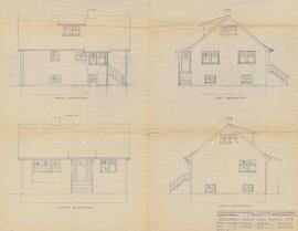
Architectural drawing
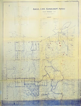
Cartographic material
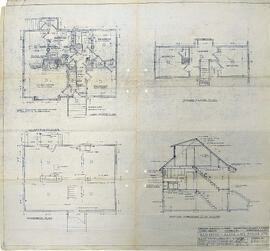
Technical drawing
Parallel title
Other title information
Title statements of responsibility
Title notes
- Source of title proper: Title of ORCS Schedule 17800 Secondary 80 (Maps)
Level of description
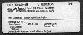
Reference code
Edition area
Edition statement
Edition statement of responsibility
Class of material specific details area
Statement of scale (cartographic)
Statement of projection (cartographic)
Statement of coordinates (cartographic)
Statement of scale (architectural)
Issuing jurisdiction and denomination (philatelic)
Dates of creation area
Date(s)
-
1949-1998 (Creation)
Physical description area
Physical description
- 1 cm of textual records
- 22 maps
- 2 architectural drawings
- 1 technical drawing
Publisher's series area
Title proper of publisher's series
Parallel titles of publisher's series
Other title information of publisher's series
Statement of responsibility relating to publisher's series
Numbering within publisher's series
Note on publisher's series
Archival description area
Name of creator
Custodial history
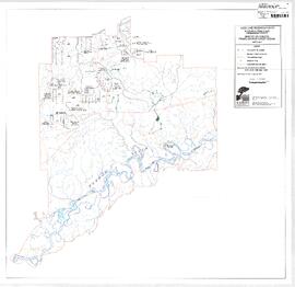
Scope and content
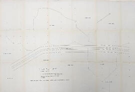
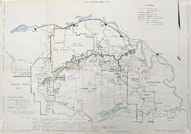
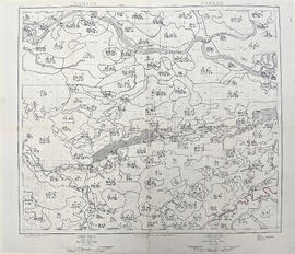
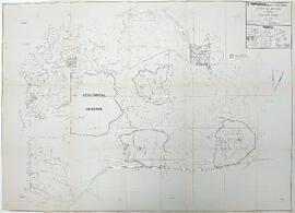
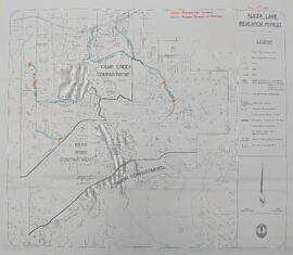
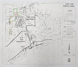
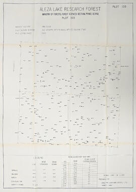
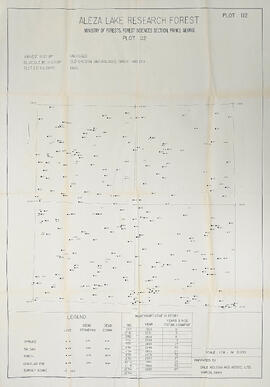
Series consists of cartographic materials including maps and blueprints of the Aleza Lake Research Forest. The maps reflect permanent sample plots and other study areas. The blueprints outline details for the development of a Ranger Station.
Notes area
Physical condition
Immediate source of acquisition
Arrangement
Records arranged with the Ministry of Forests and Range Records Classification System.
Language of material
English
Script of material
Location of originals
Availability of other formats
Restrictions on access
No restrictions.
Terms governing use, reproduction, and publication
Personal or academic use of materials is welcomed under the standard fair use and educational use clauses of Canadian Copyright Law. Commercial use is, however, forbidden without the express permission of the copyright holder. For information on obtaining written permission from the copyright holder, please contact the Northern B.C. Archives and Special Collections.
Finding aids
Uploaded finding aid
Associated materials
Part of the Aleza Lake Research Forest fonds