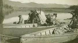
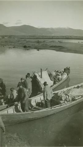
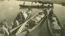
Photograph depicts the supply laden canoes of the Bedaux expedition at Pete Toy's bar, taken during the Bedeaux Canadian Sub-Arctic Expedition in the summer of 1934. This photograph was originally attributed to a location on the Peace River; however, this is likely incorrect. If this photograph does depict Pete Toy's bar, the location of the photograph is actually the Finlay River. Annotated on the back of this print is the code "I-57382" which denotes the same photograph in the collection of the BC Archives.
Finlay River, BC
15 Archival description results for Finlay River, BC
Emil Bronlund was in 1927 hired by Consolidated Mining and Smelting Ltd. (later known as Cominco) to take on the company's mining exploration in northern British Columbia, a position he held for almost 25 years. Bronlund had a Leica camera and took photographs during his exploratory trips.
This album of Bronlund's photographic negatives from 1930 to 1932 includes photographs of the following trips:
- Trip to Osilinka River and Omineca River, July 1930
- Copper Mountain on Duck Creek, July 1930
- Wedge Creek, Sept. 1930
- Finlay River, Finlay Forks, Parsnip River, and Crooked River, Oct. 1930
- Prince George, Aug. 1930
- Gola, Norway, Apr. 1931
- Emil Bronlund and Frank Swannell survey crews at Thutade Lake, June 1931 and Sept. 1931
- Cairn mining claim exploration for Consolidated Mining and Smelting Ltd., June-July 1931
- Brothers Lake, Bronlund Peak, and Fredricksen Lake, July 1932
- Sustut Lake, Sept.-Oct 1931
- McLeod River trip, Mar.-Apr. 1932
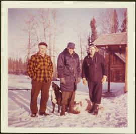
Item is a photograph of Finlay Forks trader Roy McGregor, pilot Ian Watt and British resource development designer Percy Gray in March 1957 after the first leg of Grey’s flight over the Rocky Mountain Trench.
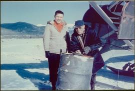
Item is a photograph of Percy Gray and pilot Ian Watt gassing up their plane at Finlay Forks before continuing their survey of the Rocky Mountain Trench in March 1957.
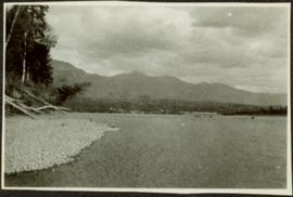
Photograph depicts river and shore in foreground, hills on opposite shore in background. Handwritten annotation on recto of photograph: "Finlay Forks."
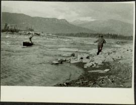
Photograph depicts a man standing in a small canoe, facing a second man walking along the shore. Hills on opposite shore in background. Handwritten annotation on recto of photograph: "Finlay Rapids. Peace River."
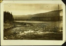
Handwritten caption below this photo reads: "Finlay River Rapids. - 1930."
A small peninsula extends into river in left midground, rapids in foreground, trees and hills on opposite shore in background.
These historically important aerial photographs depict Williston Lake soon after its creation in 1968 with the building of the W.A.C. Bennett Dam on the Peace River. Also depicted are the rivers and tributaries that empty into the Williston Reservoir, such as the Finlay River, the Ospika River, and the Omineca River.
These remote-sensing aerial photographs were taken by Lockwood Survey Corporation Ltd. under contract for the B.C. Forest Service. Some photographs are annotated to show logging activity; clearcuts, slash piles, log booms, and tree debris on the water are also visible in some of the images. No detailed location information or index accompanies the photographs.
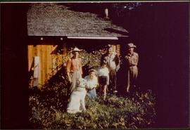
Lockwood Survey Corporation Ltd.Item is a photograph of the McGregor family on land that was subsequently flooded to create the reservoir for the W.A.C. Bennett Dam.
Photograph depicts the supply laden canoes of the Bedaux expedition at Pete Toy's bar, taken during the Bedeaux Canadian Sub-Arctic Expedition in the summer of 1934. This photograph was originally attributed to a location on the Peace River; however, this is likely incorrect. If this photograph does depict Pete Toy's bar, the location of the photograph is actually the Finlay River. Annotated on the back of this print is the code "B-04443" which denotes the same photograph in the collection of the BC Archives.
Photograph depicts men standing on shore near what appears to be a long pier extending into the river. Trees on left, opposite shore in background. Handwritten annotation on recto of photograph: "Pete Joy's Bar Finlay River."
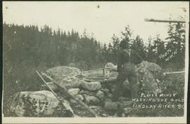
Photograph depicts an unidentified man mining in rocky area, trees and hills in background. Handwritten annotations on verso of photograph: "PLACER MINER WSHING FOR GOLD FINDLAY RIVER BC", "PHOTO WWW".
Photograph depicts the supply laden canoes of the Bedaux expedition at Pete Toy's bar, taken during the Bedeaux Canadian Sub-Arctic Expedition in the summer of 1934. Original annotation on photograph recto: "River boats on the Peace River". However, this annotation is likely incorrect; if this photograph does depict Pete Toy's bar, the location of the photograph is actually the Finlay River. There may be an error in the original annotation. Also annotated on the back of this print is the code "B-04444" which denotes the same photograph in the collection of the BC Archives.
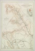
Topographic map depicting regions, communities, unexplored areas, bodies of water, transport routes, and glaciers.
Topographic map depicting regions, communities, unexplored areas, bodies of water, transport routes, and glaciers.
