File consists of an original typed manuscript entitled "A Man's Country" by Norah Doherty. Also includes a photocopy of the manuscript as well as a transcription of selected excerpts created by Gillian Homer as part of a Living Landscapes project.
Red Rock, BC
23 Archival description results for Red Rock, BC
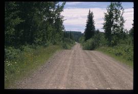
Image depicts Bellos Road, most likely in Red Rock, B.C.
Image depicts Bellos Road, most likely in Red Rock, B.C.
File consists of materials resulting from the interview with Krystyna Simpson, conducted as part of the Living Landscapes Red Rock Project. Includes audio cassettes containing the oral history, a transcript of the interview, and a consent form.
File consists of materials resulting from the interview with Mary and Bill Payne, conducted as part of the Living Landscapes Red Rock Project. Includes audio cassettes containing the oral history, a transcript of the interview, and a consent form.
The Mabel Rutherford Photograph Collection consists of 8 photographs depicting images of Red Rock and region: family, road and rail construction, landscape, farming equipment.
Rutherford, MabelFonds consists of an unpublished manuscript entitled "A Man's Country" written by Norah Banbery Doherty, accompanied by photographs and related photocopied articles and correspondence written or received by Doherty.
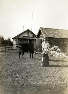
Doherty, Norah Lilian BanberyAnnotation on photograph verso: "Auntie Lily at Red Rock? 1934". "Auntie Lily" represents Norah Banbery Doherty, whose middle initial was "L". Photograph depicts Norah Banbery Doherty petting a dog while standing beside a black cow. Cabin, shed, and fence are in background.
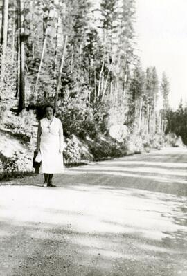
Annotation on photograph verso: "Auntie Lily - Red Rock, 1938". "Auntie Lily" represents Norah Banbery Doherty, whose middle initial was "L". Photograph depicts Norah Banbery Doherty walking along a dirt road.
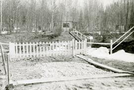
Annotation on photograph verso: "Auntie Lily's Home - Red Rock". "Auntie Lily" represents Norah Banbery Doherty, whose middle initial was "L". Photograph depicts a fenced yard with plank walkways, steps, a house and an outbuilding in the background. The fence has a nameplate reading "Glenora".
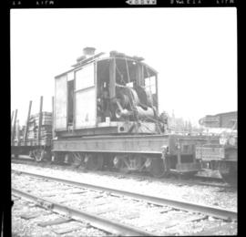
Photograph taken at Red Rock which is 18 miles south of Prince George. Image depicts a steam crane marked #4 and owned by United Rentals Ltd., Nanaimo, forming part of a pile driving work train.
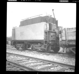
Photograph taken at Red Rock which is 18 miles south of Prince George. Image displays part of a pile driving work train owned by United Rentals Ltd. of Nanaimo. A tender and a steam crane #4 for pile driving are also visible.
File consists of photographs depicting the lives of Norah Banbery Doherty and her husband, Irwin Doherty. Some of the photographs have annotations on verso written by Doherty's niece.
Subseries contains material collected and created by Kent Sedgwick for research regarding various areas surrounding Prince George. Includes materials on the Crooked River area; Summit Lake; Ferguson Lake; Chief Lake; Salmon Valley; Mud River; Beaverly; Buckwater; Chilako River; Indian Reserve no. 4; Blackburn; Pineview; Stone Creek; Red Rock; Woodpecker; and Hixon. The files primarily consist of research notes and photographs depicting the communities.
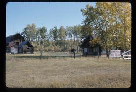
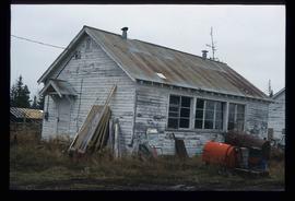
Image depicts a building in Red Rock.
Image depicts a building in Red Rock.
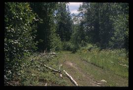
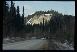
Image depicts a road, forest, and hill rise in an uncertain location possibly near Red Rock, B.C.
Collection consists of 17 oral histories, and transcripts generated for the Living Landscapes Red Rock Community History Project and copies of photographs. Recordings by Lorita Doudiet; Doris Holzworth; Torben Lindstrom; John Marcoll; Kate Marcoll; Eric Patterson; Bill and Mary Payne; Tom Payne; John Ryser; Mabel Rutherford; Margaret Shatzko; Krystyna Simpson and Marge Slater.
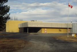
Northern BC Archives & Special CollectionsImage depicts the Red Rock School.
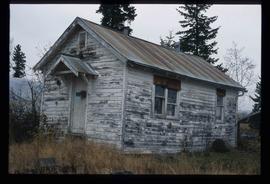
Image depicts a the teacherage building in Red Rock.
File contains slides depicting images of places in or around Red Rock, Hixon, and Woodpecker, B.C.
File contains slides depicting places in or around Red Rock, Hixon, and Woodpecker, B.C.
