Series consists of one file containing two newspaper clippings, one from the BC Saturday Sunset dated September 14, 1912 and another from The Globe dated Saturday March 23, 1907
Prince Rupert, BC
621 Archival description results for Prince Rupert, BC
A collection of postcard photographs of Port Essington BC, Port Simpson BC, Atlin, Quesnel, McBride, Hagwilget Village, Giscome, Likely, Kitwanga, Smithers, Prince Rupert BC, Prince (Fort) George BC Images depict street scenes, water scenes, community events, businesses, buildings, and aerials of the towns. Collection also depicts a number of Northern BC paddle wheelers.
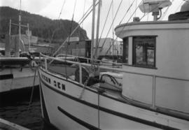
Photograph depicts the "Ocean Gem" fishing boat at the Prince Rupert marina. The Prince Rupert Fisherman's Co-operative Assocation Building is visible in the background.
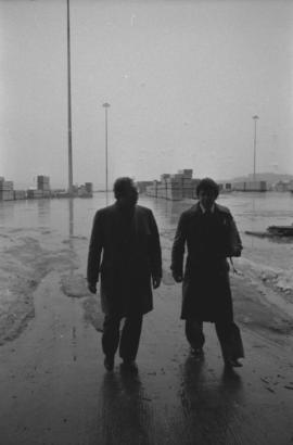
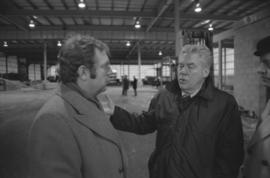
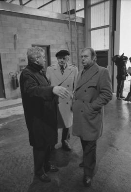
Photograph depicts Otto Lang, Minister of Transport, and an unknown man walking on the Fairview Cargo Terminal in Prince Rupert.
Photograph depicts Otto Lang, Minister of Transport, being videotaped with two unknown men during his visit to the Fairview Cargo Terminal in Prince Rupert.
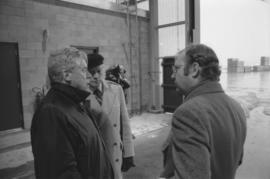
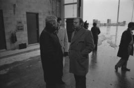
Photograph depicts Otto Lang, Minister of Transport, speaking with two unknown men during his visit to the Fairview Cargo Terminal in Prince Rupert.
Photograph depicts Otto Lang, Minister of Transport, speaking with two unknown men during his visit to the Fairview Cargo Terminal in Prince Rupert.
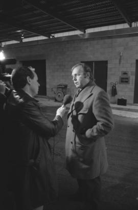
Photograph depicts Otto Lang, Minister of Transport, being videotaped while talking to a reporter with a microphone during his visit to Prince Rupert Fairview Cargo Terminal.
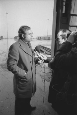
Photograph depicts Otto Lang, Minister of Transport, talking to a reporter with a microphone during his visit to Prince Rupert Fairview Cargo Terminal.
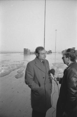
Photograph depicts Otto Lang, Minister of Transport, talking with a reporter outdoors during his visit to Prince Rupert Fairview Cargo Terminal.
Photograph depicts Otto Lang, Minister of Transport, with two unknown men during his visit to the Fairview Cargo Terminal in Prince Rupert.
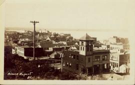
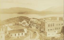
Overhead view of many commercial buildings in Prince Rupert, BC. Printed annotation reads: "Prince Rupert, BC."
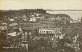
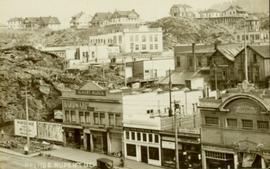
Wide angle photograph of many buildings scattered in a clear cut area. Foreground shows several businesses, including "Kelly Carruther's Supply" and "Prince Rupert Hardware and Supply Co." Some remaining forest is visible in the background. Annotation on recto reads: "Prince Rupert, BC 1659."
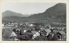
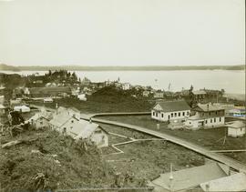
Overhead view of a residential area in Prince Rupert, BC. Printed annotation on recto reads: "Prince Rupert, BC Photo by J.W."
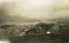
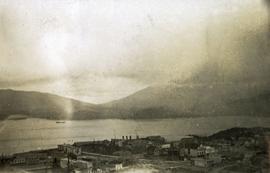
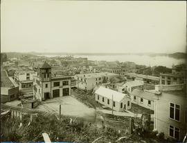
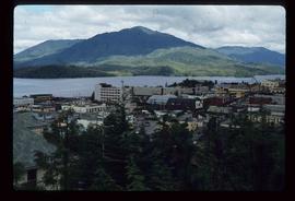
Photograph depicts a view looking down on the buildings of the city of Prince Rupert BC and beyond to the harbor and mountains in the distance.
Photograph depicts a view looking down on the buildings of the city of Prince Rupert BC and beyond to the harbor and mountains in the distance.
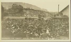
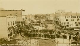
Slightly overhead shot of a large crowd gathered by general store and railroad. Annotation on recto reads: "Overseas contingent leaving Prince Rupert BC Feb 26th 1915. McRae Bros."
Part of a set of 41 original black & white photographs [1908-1933-?]) of the Grand Trunk Pacific Railway line in BC depicting surveying crews, town sites (Prince Rupert and its port, Hazelton and Fort George), and First Nations Peoples.
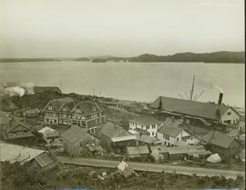
Elevated street view of Fulton Street in Prince Rupert, BC. City Hall is in the left foreground. Hills and water are visible in the background. Printed annotation on recto reads: "Prince Rupert. B.C."
Postcard overview of several identifiable storefronts built amongst the rocky outcrops of Prince Rupert. Printed annotation on recto reads: "Prince Rupert BC."
Part of a set of 41 original black & white photographs [1908-1933-?]) of the Grand Trunk Pacific Railway line in BC depicting surveying crews, town sites (Prince Rupert and its port, Hazelton and Fort George), and First Nations Peoples.
Part of a set of 41 original black & white photographs [1908-1933-?]) of the Grand Trunk Pacific Railway line in BC depicting surveying crews, town sites (Prince Rupert and its port, Hazelton and Fort George), and First Nations Peoples.
Photograph of several floats parading down Second Avenue in Prince Rupert. A large crowd is gathered. Annotation on recto reads: "Photo by MacRae Bros Prince Rupert BC Prince Rupert B."
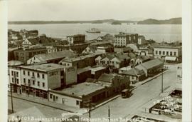
Overhead view of a block of business and harbour buildings in Prince Rupert BC. The "Savoy Hotel" is visible in the foreground. Printed annotation on recto reads: "Part of Business Section & Harbour. Prince Rupert B.C. F. Button Photo Pr. Rupert No. 494."
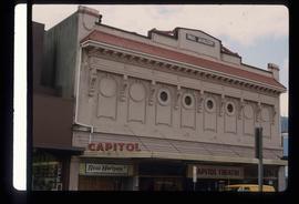
Image depicts an old theatre owned by Paul Aivazoff in Prince Rupert, B.C. It opened in 1935 and was closed in 1981; it has since been renovated for retail use.
Series consists of nine photographs of Prince Rupert scenery, buildings, residents and surrounding area. Includes image of totem and dugout canoe.
Series consists of images pertaining the Collison family, North Coastal First Nations communities, means of transportation along North Coastal British Columbia, and various church structures and religious events.
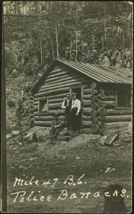
Photograph depicts three men wearing semi-formal attire at doorway to log building, miscellaneous supplies leaning against base of building. Dirt road in foreground, forest trees on hillside in background. Handwritten annotation on verso of photograph reads: "Mile 47 B.C. Police Barracks.", on recto of photograph: "Summit of Yellowhead pass and east boundary of British Columbia Mile 0. 699 miles to Prince Rupert. Tete Jaune Mile 52. Mile 47 east of Tete Jaune in the Park.", "1911".
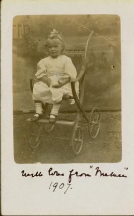
Photograph of a young girl believed to be Katy Collison seated for a formal portrait on a wheeled chair. Handwritten annotation in pen on recto reads: "With love from 'Mama'[?] 1907." Handwritten address on verso reads: "Miss West[?] Metlakatla British Columbia N.W. America." Two half penny stamps affixed on verso and partially obscured by two postmarks which read: "Folkstone 1.15 PM SP 19 07."
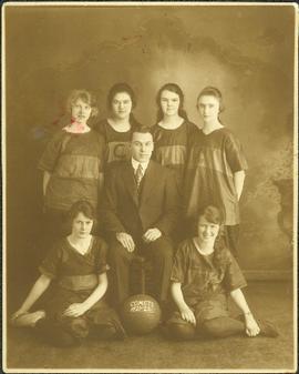
Violet stands second from left among group of six girls wearing uniforms, posed in front of backdrop. Two sit on floor, and four stand behind their coach, who is seated in a chair and wearing a suit. A basketball sits between his feet, painted with "COMETS 1921-1922". Violet's shirt has a letter "C" on its front. This photograph was taken in Prince Rupert where Violet attended high school while living with her relatives Sarah and Herbert Glassey.
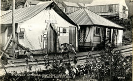
Photograph of post office and neighbouring building. Both buildings are composed of wood and tent materials. Annotation on recto reads: "Post Office & Customs House, Prince Rupert, BC."
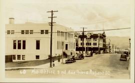
Street view of Third Avenue in Prince Rupert. Printed annotation on recto reads: "60 Post office 3rd Ave Prince Rupert BC."
File contains postcards portraying life in Prince Rupert, B.C. Images depict harbour scenes, street scenes (Third Avenue, Sixth Street, Central Street, and Mainstreet), airplanes, large ships, fisheries, city aerials, parades, military, a dog sled mail team, and a frozen fishing boat.
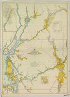
Colour-coded map depicting surveyed lands respectively open and closed to preemption. Depicts land recording divisions, land district boundaries, government reserves, communities, bodies of water, and transport routes. Includes topographical inset.
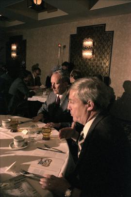
Photograph depicts Premier Peter Lougheed and an unidentified man sitting at a table and talking at the Crest Hotel in Prince Rupert during Campagnolo's Skeena Riding tour. An unidentified group of people sit a table behind them.
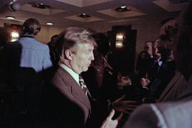
Photograph depicts Premier Peter Lougheed talking with unidentified men at the Crest Hotel in Prince Rupert during Campagnolo's Skeena Riding tour. Campagnolo stands behind Lougheed. Several unidentified people talk behind them.
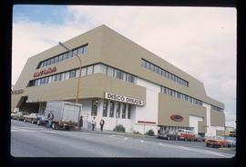
Image depicts the Pride O' the North shopping mall in Prince Rupert, B.C.
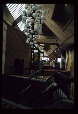
Image depicts the interior of the Pride O' the North shopping mall in Prince Rupert, B.C.
The Prince George Railway & Forestry Museum Society Collection consists primarily of textual, photographic, and cartographic records related to the regional developments of the railway industry in Northern BC. A predominant portion of the collection is made up of material from the Canadian National Railway; other railways represented include the Pacific Great Eastern Railway, the British Columbia Railway (BC Rail), the Grand Trunk Pacific Railway, the Grand Trunk Railway, the Intercolonial Railway, and the Okanagan Express. Significant geographical areas covered include Prince George, the Peace River Region, Terrace, Bulkley Valley, Hazelton and Prince Rupert.
The forestry industry is represented in the collection with operational and financial records from Fyfe Lake Sawmill Ltd., which operated southwest of Prince George in the 1950s.
The collection has been organized into series according to creator, each of which also has been arranged to subseries, file and item level, where applicable. This collection consists of eight series, as follows:
1) Canadian National Railway
2) Grand Trunk Railway
3) Pacific Great Eastern Railway
4) British Columbia Railway (BC Rail)
5) Canadian Pacific Railway (CPR)
6) Intercolonial Railway
7) Fyfe Lake Sawmill ltd.
8) PGRFM
9) Photographs
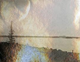
File contains slides depicting places in and around Prince Rupert, B.C.
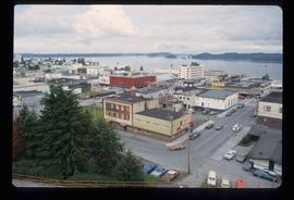
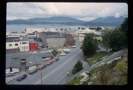
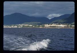
Image depicts a view of Prince Rupert, B.C.
Image depicts a view of Prince Rupert, B.C.
Image depicts a view of Prince Rupert, B.C.
Photograph depicts silhouette of Prince Rupert BC buildings and the view looking beyond to the water.
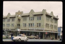
Image depicts the Bank of Nova Scotia located on "Besner Block" in Prince Rupert, B.C.
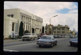
Image depicts the City Hall of Prince Rupert, B.C.
Image depicts a view of the downtown core of Prince Rupert, B.C.
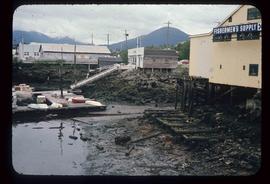
Image depicts numerous buildings and a small dock somewhere in Prince Rupert, B.C. One of the buildings is labelled "Fishermen's Supply."
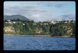
Image depicts numerous houses on the cliff-sides in Prince Rupert, B.C.
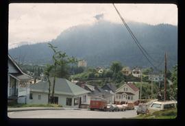
Image depicts numerous houses in Prince Rupert, B.C.
