File contains the deed of property to UNBC downtown BMO building.
Prince George, BC
2402 Archival description results for Prince George, BC
Videotape contains footage of: 13-Dec-99 - Sportsplex Announcement - Jago, Charles; McMann, Dale; Masich, Tom; Carter, Terry / 20-Dec-99 - Goat River Aerial Footage / 6-Jan-00 - NRM400 Class on Goat River - Dewhurst, Steve
Videotape contains footage of: 3-Dec-98 - Biology class / 4-Dec-98 - Small-scale Forestry Workshop - Williamson, Garth Edgar / 10-Jan-99 - New Exchange with Swedish university of Agricultural Sciences - Lindgren, Staffan / 15-Jan-99 - Koerner Lecture Series - first presentation - Koerner, Roy / 16-Jan-99 - Web project with Borealis - Beeler, Stan; McDonald, Deneka; Drysdale, Lisa
Videotape contains footage of: 4-Dec-96 - Toys for Tots - Paskus, Elliot; McLean, Charlotte / 5-Dec-96 - Reel World Film Festival - Livingstone, David / 10-Dec-96 - Russian Exchange students - Mineev, Vladimir; Chliamine, Andrei / 10-Dec-96 - Co-op Education - Petryszak, Nick; Verticchio, Lu; Leman, David / 10-Dec-96 - Women's Timberwolves Basketball - Dueck, Terri; Paskalidis, Selena; Hausot, Heather
Videotape contains footage of: 11-Dec-96 - Co-op job placements - Peterson, Ken; Rempel, Darlene / 11-Dec-96 - Men's Timberwolves Basketball - Robinson, Zane; Pooni, Jesse / 14-Dec-96 - Stand-ups and Headlines - Rob
Videotape contains footage of: 17-Dec-96 - Daycare Christmas Concert / 11-Jan-97 - Sports Psychology Project - Haney, Colleen; Buckmaster, Jayme; Clarke, Jon; Johannesen, Larry / 16-Jan-97 - UNBC Student Goes to Peru - Taner, Shona
Videotape contains footage of: 6-Dec-95 - Montreal Massacre Memorial - Jago, Charles; Poff, Deborah
Videotape contains footage of: 8-Dec-95 - -40 degrees in Prince George / 15-Dec-95 - Stand-ups - Rob / 16-Dec-95 - Headlines - Rob
Videotape contains footage of: 19-Dec-95 - Student Bagpiper - Embree, Andrew / 19-Dec-95 - Reel World Film Festival at UNBC - Boyd-Noel, Sarah; Livingstone, David
Videotape contains footage of: 16-Dec-94 - December 6th Memorial - Kelm, Mary Ellen / 16-Dec-94 - Enrolment Numbers - Conway, Chris / 16-Dec-94 - Circumpolar Universities Cooperation Conference - Trimble, Sheena / 17-Dec-94 - Circumpolar Universities Cooperation Conference - Nord, Doug / 17-Dec-94 - Conference Centre Construction / 17-Dec-94 - How High School Students View UNBC - Willms, Mike / 19-Dec-94 - News Headlines - Rob
Videotape contains footage of: 21-Dec-94 - Circumpolar Universities Cooperation Conference - Weller, Geoffrey
Videotape contains footage of: 2-Dec-93 - Centennial High School Visit - Webb, Terry / 3-Dec-93 - News Conference Announcing the Transition from the IGC to the Board and Senate - Miller, Dan / 4-Dec-93 - Last Interim Governing Council Meeting / 4-Dec-93 - The Demise of the IGC - Kerr, Dale / 21-Dec-93 - The Transition to a Board and Senate - Sander, Horst
Photograph depicts David Phillips at "Words, Loves" conference.
Videotape contains footage of: 21-Jan-03 - David Baxter presentation on the North's economic impact - Baxter, David / 8-Feb-03 - UNBC Day / 8-Feb-03 - hockey on outdoor ice rink
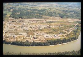
Image depicts a the Danson Industrial Park in Prince George, B.C.
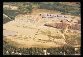
Image depicts a sawmill in the Danson Industrial Park in Prince George, B.C.
File consists of an edition of the publication "Cutting Up the North" that was used to research for "Virtual Clearcut".
Image depicts an area of cut trees at Island Cache.
Recording consists of CTV News footage on "UNBC students graduate in Gitksan language".
File consists of photographs of the CSAM Awards Ceremony on 23 Jan. 2004.
File consists of photographs of the CSAM Awards Ceremony on 23 Jan. 2004.
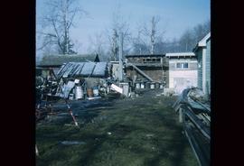
Image depicts a backyard filled with various items piled against a shed in Island Cache.
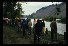
Image depicts a large crowd of people on a section of the Heritage Trail on Cottonwood Island in Prince George, B.C.
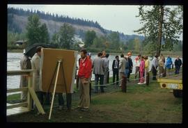
Image depicts a crowd of people on a section of the Heritage Trail on Cottonwood Island in Prince George, B.C.
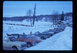
Photograph depicts a photographer and other men standing over a crowd at Northern BC Winter Games event in Prince George.
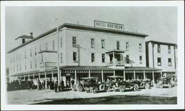
Photograph depicts hotel on corner of street, crowd and cars in foreground.
Handwritten annotation on verso “Albert Johnson’s 'Northern Hotel' South Fort George 1914".
Photograph depicts four men pulling a long canoe across a clearing on a wheeled trailer.
Image depicts a long line of people cross country skiing somewhere on Tabor Mountain in Prince George, B.C.
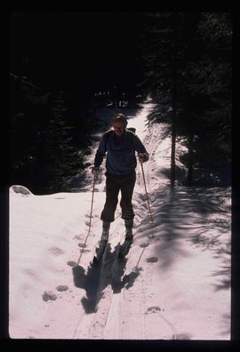
Image depicts an unidentified man cross country skiing somewhere on Tabor Mountain in Prince George, B.C.
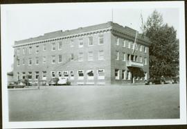
Photograph depicts large three story building, road and parked cars in foreground.
Annotation on verso: “Court House and Prov. Govt. offices at Pr. George. Once used to be 'Alexandra Hotel' now site occupied by Kresge’s. Alexander Hotel. Opened Sept 25, 1915."
Photograph depicts man and woman speculated to be Pat (Bridget Moran's son) and Tracy holding food and beverage on deck in backyard. Unidentified individuals semi-visible on far left and right. Trees and building visible in background. Photo taken on the day Bridget Moran received an Honourary Law Degree from the University of Northern British Columbia in Prince George, B.C.
Videotape contains footage of: 7-Sep-01 - Cougars Exhibition vs Kamloops, continued / 8-Sep-01 - Fencing / 8-Sep-01 - Backyard BBQ with Maestro and spirit of the West
Image depicts a the Cottonwood Island Nature Park sign and map in Prince George, B.C.
Image depicts a the Cottonwood Island Nature Park sign and map in Prince George, B.C.
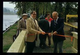
Image depicts Elmer Mercier, a former mayor of Prince George, B.C., cutting the ribbon to open Cottonwood Park's Heritage Trail.
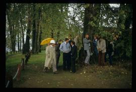
Image depicts a crowd of people in Cottonwood Park in Prince George, B.C.
File consists of records created and collected by Kent Sedgwick regarding the removal of Island Cache residents after the 1972 flood and suggestions for creation of park on Cottonwood Island. The majority of the file consists of reproduced City of Prince George records. Includes memoranda to and from the mayor, city manager, and aldermen; meeting minutes of the Flood Committee; city reports on Cottonwood Island and the flooding situation; a listing of Cottonwood Island properties offered for sale to the municipality; a report entitled "Cottonwood Island - A report on desirable land use" (Nov. 1970); a "Proposal for Cottonwood Island as a Park Reserve" (1973); a document from the Cottonwood Island Study Committee; correspondence from Mary Fallis; and a City of Prince George memorandum regarding a Public Hearing.
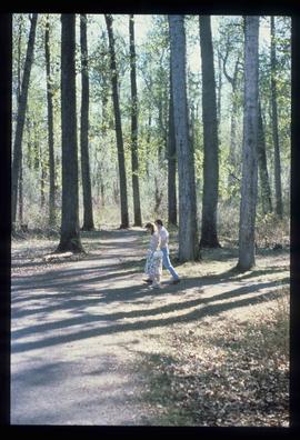
Image depicts a couple walking through a nature trail in Cottonwood Island Park. Map coordinates 53°55'23.6"N 122°43'53.8"W
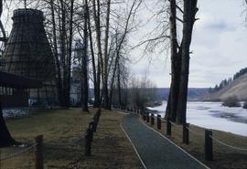
Image depicts a nature trail in Cottonwood Island Park by a beehive burner. Map coordinates 53°55'23.6"N 122°43'53.8"W
File consists of maps and plans depicting the Cottonwood Island area in Prince George. Includes:
- "Plan of Subdivision pursuant to the replotting provisions of the Municipal Act of Parcel A of Plan 25046, of District Lots 343, 662, 1511, 4736, and 7813, Cariboo District" by McWilliam, Whyte, Goble & Associates B.C. Land Surveyors for the City of Prince George, 26 July 1979 (reproduction on 2 sheets)
- "Cottonwood Island" original draft map with annotations by Kent Sedgwick; the map may have been created by Sedgwick during his time as Senior City Planner with the City of Prince George [197-?]
- "Prince George B.C., Fraser Subdivision, Mile 146.05" plan for Canadian National Railways by Lockwood Survey Corporation Ltd., 1967. This very large technical drawing shows CN leases and private property buildings on Island Cache in detail.
- McWilliam-Whyte-Goble & Associates, B.C. Land Surveyors, "Plan Showing Sections in Proposed Lakeland Mill Site", July 1978 (original reproduction).
- Carroll, Hatch & Associates, "Lakeland Mills (1973) Ltd., Prince George, B.C., Stud Mill Studies, Site Plan", 31 July 1978 (original reproduction).
File consists of records created and collected by Kent Sedgwick regarding Cottonwood Island in connection with his employment with the City of Prince George Planning Department. Includes briefs, proposals, memoranda, correspondence, newspaper clippings, questionnaires, legal correspondence, meeting minutes, and photocopied excerpts from maps/plans. Also includes two polaroid photo prints depicting garbage in Cottonwood Island Park circa 1979. Highlights include:
- Prince George Kiwanis Club, "Brief to City Council, City of Prince George, re: Nechako Riverfront Park", 12 Mar. 1973.
- New Caledonia Institute of Environmental Studies, "Proposal for Cottonwood Island as a Park Reserve", Summer 1973.
- "Cottonwood Island Study", [before 1975] (photocopy).
- Mary Fallis, "Letter to the Editor of The Citizen", 5 Mar. 1976 (photocopy).
- City of Prince George Planning Department, "Ownership, Legal and Assessment Data - Private and School District Properties within the Proposed Replot Area [Island Cache]", 11 Oct. 1978.
- "Assessed Values for City and Crown Lands within the Proposed Replot Area North of First Ave" (handwritten table), 16 Oct. 1978.
File consists of proposals and documents by Kent Sedgwick regarding Cottonwood Island. Includes: "Proposal for Cottonwood Island as a Park Reserve" and "Some Comments on the Cottonwood Island Park Designation of the Official Community Plan".
File consists of records created and collected by Kent Sedgwick regarding Cottonwood Island. Includes: "Welcome to Cottonwood Island Nature Park" brochure [197-?]; "A Brief History of Cottonwood Island Park" by Kent Sedgwick (2001); "History of Cottonwood Island Park and Side Channel Restoration" (2001?); a Regional District of Fraser-Fort George "Notice of Public Hearing" (1973); an outline for "Cottonwood Island Brief" (1973); an original copy of the "Cottonwood Island Study" by the Regional District of Fraser-Fort George (1975); annotated hand-drawn small maps of Cottonwood Island; photocopied aerial photographs; and photocopied newspaper clippings about Cottonwood Island and Island Cache. Also includes 15 colour photographic prints and accompanying negatives taken of Cottonwood Island by Bob Nelson.
Image depicts Cottonwood Island.
Image depicts Cottonwood Island.
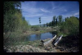
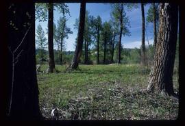
File contains slides depicting Cottonwood Island in Prince George, B.C. These photographs were taken by Kent Sedgwick when he was an instructor in Geography at the College of New Caledonia. The images were taken in support of a proposal by the New Caledonia Institute of Environmental Studies to create a municipal park at Cottonwood Island.
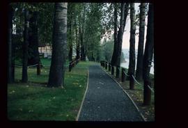
Image depicts a section of the Heritage Trail on Cottonwood Island in Prince George, B.C.
File consists of three business letters and one telegram sent by W.F. Smith in 1914 from Smithers, Prince George, and Fort George.
