Videotape contains footage of: 22-Mar-94 - Off-campus housing in the City of Prince George - Bloodoff, Peter / 22-Mar-94 - Faculty of Health and Human Sciences - Fish, David / 23-Mar-94 - Off-campus housing from a spokesman for the City's Affordable Housing Committee - Jorgensen, Ivan / 24-Mar-94 - UNBC On and Off-Campus Housing - Brazzoni, Randall / 24-Mar-94 - High-Tech at UNBC - Chiu, Michael / 24-Mar-94 - Stand-ups - Rob
Prince George, BC
2269 Archival description results for Prince George, BC
Videotape contains footage of: 24-Mar-94 - Stand-ups - Rob / 24-Mar-94 - BC Tel's Involvement with Installing UNBC's High-Tech Fibre-Optic Network - Christiaens, Rick / 25-Mar-94 - The Social Work Program - Herringer, Barbara / 25-Mar-94 - Library Acquires Book # 50,000 - Appavoo, Pat / 29-Mar-94 - South Africa Forum
Videotape contains footage of: 27-Mar-94 - The Nursing Program - Hardy, Leslie / 28-Mar-94 - U of A Students Planning to Attend UNBC - Turner, Jennifer; Moss, Duncan / 28-Mar-94 - Prince George Public Information Session - Lyotier, Nicole / 28-Mar-94 - News Headlines - Rob / 29-Mar-94 - The Psychology Program - Prkachin, Ken / 29-Mar-94 - News Briefing on the Queen's Visit - Boone, Lois; Weller, Geoffrey
Videotape contains footage of: 21-Mar-93 - News Headlines - Rob / 23-Mar-93 - International Studies and International Exchanges - Nord, Douglas
Series consists of maps, plans, and drawings collected by faculty in the UNBC School of Planning and Sustainability. The majority of these maps reflect the planning history of the City of Prince George and include large format, hand-drawn plans created by the City Planning Department from the 1970s and 1980s. Maps from City of Prince George Official Community Plans are also included.
File consists of photocopied maps of Island Cache (Cottonwood Island) and Prince George.
File consists of maps of the Squamish Forest District, Prince George, the Prince George Forest District, and Russia.
This promotional map of the city of Prince George describes the city as "the hub of our northwest empire". Includes a printed map drawn by Hammond that shows significant locations in Prince George, including the Prince George Citizen office, civic arena, bus depot, civic centre, city hall, city hospital, CNR station, fire hall, government building, post office, provincial library, and the junior-senior high school. Includes numerous handwritten annotations of other locations including the women's provincial jail, old army buildings, power house, armories, bowling alley, Connaught Hill, and "The Cache".
Image depicts a man holding up a board which appears to have maps of the Cottonwood Park on it.
Image depicts a snow sculpture of a man with a shovel, possibly during the Winter City Conference, in Prince George, B.C. Taken at the Prince George Civic Center. Map coordinates 53°54'45.6"N 122°44'59.6"W
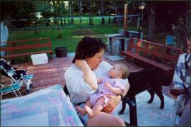
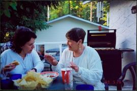
Photograph depicts Dave seated in lawn chair on deck in backyard. Chairs and tables set with food and beverages are also visible on deck. Accompanying note from Maureen Faulkner: "Dave looks on... He wished he'd been able to attend the ceremony. Next time?" Photo taken on the day Moran received an Honourary Law Degree from the University of Northern British Columbia in Prince George, B.C.
Unidentified man can be seen walking on railroad tracks on far right. Utility poles, field, small building and background hills are visible in image.
Photograph depicts lane in front of tent buildings flooded with water, and a man standing near doorway to first building. It is believed that this photograph may depict the Island Cache in flood, at Prince George, BC.
Cane floats in flooded area of camp, tent buildings and forest trees in background. It is believed that this photograph may depict the Island Cache in flood, at Prince George, BC.
Photograph depicts a man bathing himself while standing in a small metal tub. Photograph description in album notes this as "His 'Semi Annual'" [bath]. On the left is a log structure, presumably a cache building. A large clearing surrounds the building and bathing man. There is a forest and bluff in the background. Possibly located near Giscome Portage.
Item is a map annotated in colour by the City of Prince George Planning Department depicting major residential development proposals from June 1975 to August 1977 in the City of Prince George. This map was drawn for the City of Prince George interim Community Plan.
Photograph taken in front of the 'main line' that led to a pulp mill and river crossing. To the left was a lesser used connector to the CN main line. Behind the camera was a 4-track interchange yard. Beyond that, the CN line to Alberta could be found.
Videotape contains footage of: 8-Nov-03 - Maclean's ranking of UNBC - shot for Global, incl. campus shots - Hasham, Moezine; Palmer, Andrea (wedding), Bond, Shirley / 15-Nov-03 - Research on Moose collisions with vehicles in urban areas - McMahon, Julie; Almond, Richard; Rea, Roy; Hoekstra, Dorianna
The Mabel Rutherford Photograph Collection consists of 8 photographs depicting images of Red Rock and region: family, road and rail construction, landscape, farming equipment.
Rutherford, MabelFile consists of one wooden dollar with commercial use for Holiday Motel, Hope, BC.
File consists of an oral history given by Lois Richet, which was gathered as part of Dr. Mike Evan's Island Cache Recovery Project. Includes consent forms, transcripts, and the recorded oral history on the original media.
File consists of an edition of the publication "Logging the Globe" that was used to research for "Virtual Clearcut".
Image depicts a logging area somewhere near Prince George, B.C.
Image depicts an area undergoing logging somewhere in Prince George, B.C.
Image depicts a logging area somewhere near Prince George, B.C.
Image depicts the balcony of a log house, likely somewhere in or near Prince George B.C.
Photograph depicts 2 steam locomotives, handwritten annotations on recto read, "59 & 161 at North Yard P.G.E. R."
Videotape contains footage of: 29-Nov-02 - local high school science phenomenon Gina Gallant, for BCTV/Global - Gallant, Gina / 29-Nov-02 - UNBC Biology professor on huge spider populations in Robson Valley - Lindgren, Staffan
View of a scow loaded with provisions and several people passing through rapids of the Grand Canyon. Printed annotation on recto reads: “A scow loaded with provisions passing through the Grand Canyon on it’s way to Fort George.” Handwritten annotation in pencil on recto reads: “Nearly Bumped, Nachaco River” Handwritten annotation in pencil on verso reads: “My address will be Fort George BC. Dear Mrs. Cooper, I am up in the wild part of BC now where men horses and everything get drowned every day, sometimes automobiles get drowned also. This is the way we travel up where I am now. I saw a boat upside down in this Canyon it had a bundle of blankets tied on it and one oar was dancing in the whirlpool. This made my hair stand straight up and down.”
Videocassette contains raw footage of librarian Joanne Matthews providing library instruction, shots of the UNBC Library, and other shots from the UNBC campus.
Photograph depicts a cluster of wooden buildings including a flagpole and church spire at a Lheidli T'enneh village site. Original photo identified this image as "Indian Village, Fort George".
Subseries consists of materials collected by Kent Sedgwick for research relating to Lheidli T'enneh First Nations. The Lheidli T'enneh are a sub-group of the Dakelh people whose traditional territory includes the city of Prince George, British Columbia. These files primarily consist of material regarding the original Lheidli T'enneh reserve and cemetery, the reserve relocation, and the desecration of the cemetery.
Image depicts the Lheidli T'enneh Burial Grounds in Fort George Park.
Image depicts a grave-marker in the Lheidli T'enneh Burial Grounds in Fort George Park.
Image depicts the Lheidli T'enneh Burial Grounds in Fort George Park.
File consists of the following issues of the UNBC Learning Skills Centre micropublication zine, "Inked":
- Issue No. 1, Oct. 2008
- Issue No. 2, Nov. 2008
- Issue No. 3, New Years 2009
- Issue No. 4, Feb. 2009
- Issue No. 5, Mar.-Apr. 2009
Videotape contains footage of: 3-Feb-06 - Laurie Chan announced as BC Leadership Chair in Aboriginal Environmental Health - Chan, Laurie; Campbell, Premier Gordon; Jago, Charles; Atleo, Sean; Rix, Donald
File consists of an oral history given by Larry Peters, which was gathered as part of Dr. Mike Evan's Island Cache Recovery Project. Includes consent forms, transcripts, and the recorded oral history on the original media.
Image depicts a large saw at an indoor location, likely in a saw mill somewhere in Prince George, B.C.
Photograph depicts one man standing on the bank of a river, forest in the background. The image is not in focus or possibly a double exposure.
Image depicts the Lakeland Sawmill in Prince George, B.C, identified by the beehive burners; the one with white smoke belonged to Pas Lumber Co. which was bought out by Lakeland in 1987.
Image depicts the Lakeland Sawmill in Prince George, B.C.
Image depicts the La Tienda Hair and Nail Salon on an uncertain street somewhere in Prince George, B.C.
Videotape contains footage of: 28-Jul-06 - Kulik story; biking at LC Gunn Park; Folkfest - 31-Jul-06 - RNA research with Stephen Rader