Natural Resources

Elements area

Taxonomy

Code

Scope note(s)

  • Land, water, minerals, forests, fisheries, soil, oil, and gas

  • Energy (eg. hydroelectric, thermal, solar)

  • Game management

  • Individuals, industries, and businesses related to natural resources

  • Regulatory and professional organizations

  • SEE ALSO: Business and Commerce; Environment; Industries; Land, Settlement and Immigration

Source note(s)

  • MemoryBC Subject Groups

Display note(s)

    Hierarchical terms

    Natural Resources

      Equivalent terms

      Natural Resources

        Associated terms

        Natural Resources

          6092 Archival description results for Natural Resources

          6092 results directly related Exclude narrower terms
          Mining in British Columbia
          2012.13.2.11.15 · File · 1999-2008
          Part of J. Kent Sedgwick fonds

          File consists of notes, clippings, and reproductions relating to mining in British Columbia. Includes various clipped articles from the Prince George Citizen newspaper (2003-2008).

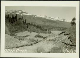
          Mining at Otter Creek, BC
          2009.5.2.69 · Item · 6 June 1937
          Part of Taylor-Baxter Family Photograph Collection

          Photograph depicts lumber piles and what appears to be a very long sluicing trough along Otter Creek. Forest and hills in background. Handwritten annotation on verso of photograph: "Otter Creek 6/6/37". See also item 2009.5.2.70.

          Mines
          2003.8.2.1.2 · Sub-subseries · 1970-1987
          Part of Adam Zimmerman fonds

          Sub-subseries consists of created or accumulated by Adam Zimmerman in his various roles with Noranda Mines (Comptroller, 1961-1966; Vice President and Comptroller, 1966-1974; Executive Vice President, 1974-1982). Records relate to the mines owned and operated by Noranda Mines, such as Pamour Porcupine, Tara Mine, Brenda Mines, Horne Mine, Gaspe Copper, Mattagami Mines, and Hemlo, among many others. Includes records about some of these individual mines and copper/zinc operations, as well as records from a managerial level regarding the various mines.

          Noranda Mines Ltd.
          2023.2.2.2.1 · Item · 1997
          Part of Dr. Paul Sanborn fonds

          "Mineralogy of clay and sand fractions of soils developed from till, glaciofluvial and glaciolacustrine deposits in central interior British Columbia" was a preliminary internal report that provides some background to Arocena and Sanborn's regional soil mineralogy study, as well as a compilation of the mineralogical data.

          The key results from this work were later published as:
          J.M. Arocena and P. Sanborn. 1999. Mineralogy and genesis of selected soils and their implications for forest management in central and northeastern British Columbia. Canadian Journal of Soil Science 79: 571-592. https://doi.org/10.4141/S98-07

          2023.2.2.15.1.2 · File · 1999-2005
          Part of Dr. Paul Sanborn fonds

          Includes the following data sets:

          • 084996.CSV [whole-rock elemental analyses for < 2 mm fractions of C horizon of Kenneth Creek (KC) ( = “Bowron”) reference pedon; also includes data for C horizon of Holy Cross (HC) pedon related to E.P. 886.15 documented in https://www.for.gov.bc.ca/hfd/pubs/Docs/Tr/Tr020.htm ]
          • 99-479ps.xls [particle size analysis (pipette method) data for plot composites of 1999 mineral soil samples by 0-20 cm and 20-40 cm depths]
          • Kenneth Creek Db (1999).xls [bulk density data for 2 sampling locations per subplot = 8 per plot; cores collected at 10-14 cm (U) and 30-34 cm (L) depths]
          • EP886.13 (Kenneth Ck) Db data.xls [provides additional detail on fine fraction and total bulk density along with plot and treatment means]
          • Kenneth Creek pedon Db (2005).xls [bulk density data collected from the same pit where the “Bowron” pedon was sampled for Arocena and Sanborn (1999)]

          The 1996 chemical data for forest floor and mineral soil (0-15 cm) are in:

          • D96MIN1.xls
          • D96MIN2.xls
          • D96FOR1.xls
          • D96FOR2.xls
            [In the “Installation” column, 1 = Sheridan Creek and 2 = Kenneth Creek.]

          Consolidated versions of the 1996 data:

          • EP886.13 Mineral Soil Chemistry (1996).xls
          • EP886.13 Forest Floor Chemistry (1996).xls

          The forest floor mass / area data are given in:

          • Kenneth Creek 1999 Forest Floor Mass.xls
          • Kenneth Creek 2005 forest floor mass.xls

          Comparison of the 1999 and 2005 forest floor mass data is given by:

          • Kenneth Creek 1999-2005 Forest Floor Mass Comparison.xls

          The original laboratory data reports for 1999 identified the samples only with a sequential lab sample number (1-72). The complete sample identifications showing the lab sample number, plot, and sub-plot are in 1999 Soil Sample Lists.xls. For the 2005 samples, the laboratory data reports contain the complete identifying information.

          • S370finl.xls [1999 mineral soil 0-20 cm]
          • S371finl.xls [1999 mineral soil 20-40 cm]
          • S375finl2.xls [1999 forest floor]
          • S821finl.xls [2005 mineral soil 0-20 cm]
          • S822finl.xls [2005 mineral soil 20-40 cm]
          • S824finl.xls [2005 forest floor]

          More complete versions of the soil chemical data with plot and treatment means, including calculations of elemental mass / hectare by plot and treatment (for 1999 only), are given in:

          • EP886.13 Forest Floor Chemistry (1999).xls
          • EP886.13 Mineral Soil Chemistry (1999) 0-20 cm.xls
          • EP886.13 Mineral Soil Chemistry (1999) 20-40 cm.xls
          • EP886.13 Forest Floor Chemistry (2005).xls
          • EP886.13 Mineral Soil Chemistry (2005) 0-20 cm.xls
          • EP886.13 Mineral Soil Chemistry (2005) 20-40 cm.xls

          Calculations of carbon mass by plot and treatment (1999 only) are given in:

          • EP886.13 Forest Floor Mass and Carbon Content (1999).xls
          • EP886.13 Mineral Soil Carbon Content and Mass(1999).xls

          Nutrient pools (kg/ha) are summarized by treatment (1999 only) in:

          • Kenneth Creek Nutrient Pools Summary (1999).xls
          2023.2.2.15.1 · Sub-subseries · 1999-2005
          Part of Dr. Paul Sanborn fonds

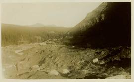
          At the Kenneth Creek installation (Ministry of Forests E.P. 886.13), forest floors and mineral soils were sampled on 3 occasions: 1996 (by Brockley), 1999 (by Sanborn), and 2005 (by Sanborn). In addition, bulk density measurements and geochemical analyses were conducted for selected depths on the "Bowron" pedon previously published in the mineralogical study by Arocena and Sanborn (1999); this pedon was sampled on the southeastern edge of the installation beside the main access trail.

          The 1996 sampling (2 years after treatments began) involved forest floors and 0-15 cm depth mineral soils, sampled at 10 random points in each plot; there were no measurements of forest floor mass or mineral soil bulk density.

          The 1999 and 2005 sampling was more intensive, and included forest floor mass and mineral soil bulk density measurements, as well as a greater depth of mineral soil sampling (0-20 cm; 20-40 cm). Note that the mineral soil bulk density measurements were not repeated in 2005; 1999 values were used in subsequent analyses.

          Results from the 2005 soil sampling were published along with those from the Crow Creek (spruce) installation in:
          Brockley, R.P. and P.T. Sanborn. 2009. Effects of repeated fertilization on forest floor and mineral soil properties in young lodgepole pine and spruce forests in central British Columbia. Technical Report 052. B.C. Ministry of Forests., Research Branch, Victoria, B.C. http://www.for.gov.bc.ca/hfd/pubs/Docs/Tr/Tr052.htm [Note that this publication included mineral soil data only for the 0-20 cm depth.]

          Mined-out hilltop
          2003.8.3.4.13.06 · Item · 1973
          Part of Adam Zimmerman fonds

          Photograph is part of a series of photographs depicting Olin Corporation's Fria location.

          2000.1.1.3.13.42 · Item · 1978
          Part of Cassiar Asbestos Corporation Ltd. fonds

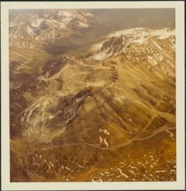
          Photograph depicts the Cassiar mine, switchback road in foreground, mountain range in background. Pit is visible behind the West peak. The new mine garage can be seen on West peak just above "#7 switchback" in centre of image. Photograph was taken from the air, portion of plane visible in top left of image.

          2000.1.1.3.13.44 · Item · 1978
          Part of Cassiar Asbestos Corporation Ltd. fonds

          Photograph depicts the Cassiar mine, switchback road in foreground, mountain range in background. Pit is visible behind the West peak. The new mine garage can be seen on West peak just above "#7 switchback" in centre of image. Photograph was taken from the air, portion of plane visible in top left of image.

          2000.1.1.3.13.53 · Item · 1978
          Part of Cassiar Asbestos Corporation Ltd. fonds

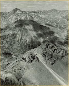
          Photograph depicts the Cassiar mine above valley, north mountain range in background. Tramline station and crushing plant visible to west of pit. Photograph was taken from the air, portion of plane visible in top left of image.

          2000.1.1.3.13.51 · Item · 1978
          Part of Cassiar Asbestos Corporation Ltd. fonds

          Photograph depicts the Cassiar mine in foreground, north east mountain range in background. Tramline station and crushing plant visible in foreground in front of pit. Photograph was taken from the air, portion of plane visible in top left of image.

          2000.1.1.3.13.52 · Item · 1978
          Part of Cassiar Asbestos Corporation Ltd. fonds

          Photograph depicts the Cassiar mine in foreground, north east mountain range in background. Tramline station and crushing plant visible in foreground, west of pit. Photograph was taken from the air, portion of plane visible in top left of image.

          2000.1.1.3.13.45 · Item · 1978
          Part of Cassiar Asbestos Corporation Ltd. fonds

          Photograph depicts the Cassiar mine, switchback road in foreground, mountain range in background. Pit is visible to right of West peak. The new mine garage can be seen on West peak just above "#7 switchback" in centre of image.

          Mine Garage & West Peak
          2000.1.1.3.15.09 · Item · [ca. 1958]
          Part of Cassiar Asbestos Corporation Ltd. fonds

          Photograph depicts buildings near West Peak of Cassiar mine. Haul trucks parked near old mine garage in background, new mine garage and unknown buildings in foreground. Mine valley crosses midground, expansive western mountain range in background.

          Mine (1973 to 1991)
          2000.1.1.3.16 · File · 1973-1991
          Part of Cassiar Asbestos Corporation Ltd. fonds

          File contains photographs featuring:

          • the pit mine: fault line, geology, snowdrifts, plowed snow, blast patterns marked by orange cones, mist, and surrounding mountains.
          • Pit mine is depicted by aerial photographs and a profile diagram.
          • Several photographs also depict what is speculated to be the portal to the underground mine adit in the early phases of development.
          • One photograph depicts the shop building in the pit mine, used for maintenance of mining equipment and to house the primary crusher.
          • Several photographs show office interiors and personnel and it is speculated that these photographs were taken in the upper floor of the shop building.
          • Several photographs depict small sinkholes in the pit mine.
          • Mining equipment depicted includes pickup trucks, front end loaders (including a Cat 988), ore haulage trucks, scoop trams, D8 Caterpillar dozer, grader, mining drill rig, jumbo drill, rock hammer, P&H excavator, and wireline extensometer. Photolab envelopes accompanying these materials were annotated “R. Tyne” and “falling ground”. Slide sleeves were annotated “Mine Nov-Dec 1975”, “AERIAL SHOTS OF MINE 1976” and “Phase 8 Dec 1975”.
          • Photographs of a Gardner Denver blasting drill at the mine and other ground drills working
          • Photograph of proposed power line to #1 switchback in 1975,
          • Collection of photographs of a Wsbco truck with corresponding mechanical transfers of those photographs.
          • Also photographs a Gardner Denver drill and a Bucyrus Erie drill that was rented to Cassiar Mine in 1974. This collection includes a depiction of an accident with these drills.
          • An additional collection of photographs of #709 Drill that was involved in minor accident. A pipe was either damaged or was the cause of the accident.
          • Negative collection of photographs with corresponding notes of descriptions.
          • Photographs of G.D. 80 Drill - Blasthole drill at work in the open pit.
          • Photographs part of Month End Reports from January - June 1980
          • Photographs of portable toilets used on Mine site.
          • Photograph collection of mine garage January 21, 1988
          • Photograph collection of what is believed to be the inside of the mine garage and various storage units and equipment. Marked "Receiver File" in original enclosure.
          • Photos of Crane in 1984.
          • An Album of 192 photographs of machinery in March of 1976 working at the mine site. Some of the equipment from either the plantsite or the mill is also depicted.
          Mine (1952 to 1972)
          2000.1.1.3.15 · File · 1953 - 1970
          Part of Cassiar Asbestos Corporation Ltd. fonds

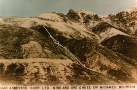
          File contains photographs depicting machinery, individuals, buildings, and mining processes at the open mine on McDame Mountain, Cassiar, B.C. Some photos depict benches from open strip mining, and two images feature models of the mine (1955 and 1970). Machinery depicted includes shovels, bulldozers, tractors, ore haul trucks (Kenworth, International Harvester, and Wabco), air track drills, blasthole drills, and Ingersoll-Rand Drill. Identified individuals include Fred Murray, R.R. [Kiresan?], C.E. Bronson, Bill Giachino, and "Sam".

          Mike Halleran papers
          2023.7.4.37 · File · 1979-1984
          Part of Grant Hazelwood fonds

          File consists of papers and speeches written by Mike Halleran, including "Wilderness Discussion Paper", "In Search of Wilderness" (1983), and "The Politics of Scarcity" (1979).

          2003.4.4.1.39 · File · May 1989
          Part of Kemano Completion Project Dispute Collection

          File consists of a photocopy of Levings and Lauzier's paper, "Migration Patterns of Wild and Hatchery-Reared Juvenile Chinook Salmon (oncorhynchus tshawytscha) in the Nicola River, British Columbia", from the "Proceeding of the 1988 Northeast Pacific Chinook and Coho Salmon Workshop".