Land, Settlement and Immigration

Elements area

Taxonomy

Code

Scope note(s)

  • Claiming, settling, and moving to a new land

  • Land titles, distribution, grants, etc.

  • Community and regional settlement patterns

  • Land settlement companies

  • Land surveys and surveyors

  • Real estate companies and activities

  • Organizations involved in sponsoring and supporting immigrants

Source note(s)

  • MemoryBC Subject Groups

Display note(s)

    Hierarchical terms

    Land, Settlement and Immigration

      Equivalent terms

      Land, Settlement and Immigration

        Associated terms

        Land, Settlement and Immigration

          1387 Archival description results for Land, Settlement and Immigration

          1387 results directly related Exclude narrower terms
          Mike Lamanes
          2003.11.1.22 · File · 1999-2000
          Part of Island Cache Recovery Project Collection

          File consists of an oral history given by Mike Lamanes, which was gathered as part of Dr. Mike Evan's Island Cache Recovery Project. Includes consent forms, transcripts, and the recorded oral history on the original media.

          Miscellaneous
          2020.4.3.28 · File · 1995
          Part of G. Gary Runka fonds

          File consists of various papers, communications, correspondence, pamphlets, and publications. Includes the following:

          • "Speaking Notes - Joan Sawicki, MLA, Parl. Sec. Georgia Basin Initiative to Planning 425 - Dr. Alan Artibise - UBC - September 20, 1995"
          • "Principles of Sustainability" (ca. 1995)
          • "Preliminary Working Draft of a Background Report on Agriculture and Sustainability in the Fraser Basin" by Wendy R. Holm (1996)
          • Agriculture and Sustainability in the Fraser Basin workshop materials from Fraser Basin Management Program
          • 1995 Fraser Basin Management Program Board Report Card
          • "Speaking Notes for Joan Sawicki, MLIA Burnaby-Willingdon & Parliamentary Secretary, Georgia Basin Initiative, "Peatlands for People": A Conference sponsored by the Burns Bog Conservation Society" (27 January 1996)
          • BC Mining Watch! Fact Sheets
          • A letter to Gary Runka from Burnaby RCMP regarding a marijuana cultivation report
          • Newspaper article "Views sought on land claims" by Joan Sawicki
          • Newsletters from the Valhalla Wilderness Society including updates on their local, boreal, and Spirit Bear campaigns
          • A letter from David Anderson, Minister of Fisheries and Oceans
          • "Drinking Canada Dry: The Threat to Canada's Water under the Proposed Multilateral Agreement on Investment" by Wendy R. Holm
          • "Tulsequah Chief Mine Re-opening Project: Report and Recommendations of the Taku River Tlingit First Nation" (1998)
          • "1998 British Columbia Electoral Boundaries Commission" pamphlet
          • Correspondence and Runka's interview transcript for his participation in the UBC study "Building Consensus in a Complex World: A Study of the Theory and Practice of Participatory Multistakeholder Decision-Making" (1999)
          • Winter 1999 newsletter for the Northwest Institute for Bioregional Research in Smithers
          • "Knox McCusker: Dominion Land Surveyor" article from BC Historical News (Summer 1999)
          • SkyTrain development informational newsletter (Spring 1999)
          • Letter from Paul Sanborn to Gary Runka & Joan Sawicki (2002)
          • Email from Joan Sawicki to Bella Coola Valley residents regarding the Nascall Power Project
          • BC Hydro pamphlet about marijuana grow ops (2006)
          • Bella Coola Airport Dike Upgrade Referendum informational documents
          • Tweedsmuir-Wright Creek Crossing Rehabilitation and Flood Protection Plan
          2020.4.9.3.023 · File · 1995-1997
          Part of G. Gary Runka fonds

          Floppy consists of G.G. Runka Land Sense Ltd. client file records for jobs.

          Floppy directories and file listing:

          • 346RESGN.LTR
          • ATNARK.AGR
          • ATNARK.DOC
          • ATNARKO.LTR
          • BCMAFF.PRO
          • BNGIFT.LTR
          • BULKLEY.LTR
          • BURNABY.QTE
          • CARRNOV.LTR
          • COLBASIN.LTR
          • CURTIS.LTR
          • GAERTNER.LTR
          • GARTH.DOC
          • GGRTAX.LTR
          • GIBSON.EST
          • GLOVER.FAX
          • GREATA.LTR
          • GREEN.DOC
          • HANNA.LTR
          • INSUR.DOC
          • INSURE.TBL
          • ISRAEL.DOC
          • JOHNS.LTR
          • JUL10ROB.LTR
          • JUL3ROB.LTR
          • KOCHMAR8.LTR
          • MAYO.LTR
          • MOFPROJ.LST
          • MOFSPE9.LTR
          • OKNOV8.FAX
          • OVTFAOCT.LTR
          • PHILLIPS.FAX
          • PRIORITY.MGT
          • RBFNOV22.FAX
          • RFIFEB7.FAX
          • ROSSNO20.FAX
          • SCHNARE.TBL
          • SEVERES.DOC
          • SFU.FAX
          • STEWART.LTR
          • WESAPR30.LTR
          • ZBEETNOF.FAX
          2020.4.9.3.025 · File · 1991-1995
          Part of G. Gary Runka fonds

          Floppy consists of G.G. Runka Land Sense Ltd. client file records for jobs.

          Floppy directories and file listing:

          • 152REF
          • 306
          • 319TBL.CNT
          • 363LYN.FIL
          • 376WRK.PLN
          • 390
          • APP12
          • APPCALC
          • BCA1
          • BEHOLD
          • CAVELEG.DOC
          • COMM329
          • CR306
          • DACY.MAP
          • ED306
          • EVALCR
          • GEOL101
          • LAND.MAP
          • LANDSENS.MAP
          • LEG&REG.DOC
          • LUND.MAP
          • LYN.MAP
          • LYND.MAP
          • MSWORD.DOC
          • MSWORD.STY
          • REF
          • REF306
          • REFERENC
          • RUNKA.MAP
          • TC101
          • THESIS
          • TODAY.MAP
          2020.4.9.3.026 · File · 1991-1995
          Part of G. Gary Runka fonds

          Floppy consists of G.G. Runka Land Sense Ltd. client file records for jobs.

          Floppy directories and file listing:

          • 152REF
          • 152REF.BK!
          • 306
          • 306.BK!
          • 319TBL.CNT
          • 363LYN.FIL
          • 376WRK.BK!
          • 376WRK.PLN
          • 390
          • 390.BK!
          • APP12
          • APP12.BK!
          • APPCALC
          • APPCALC.BK!
          • BCA1
          • BEHOLD
          • CAVELEG.DOC
          • COMM329
          • CR306
          • DACY.MAP
          • ED306
          • ED306.BK!
          • EVALCR
          • EVALCR.BK!
          • GEOL101
          • GEOL101.BK!
          • LAND.MAP
          • LANDSENS.MAP
          • LEG&REG.DOC
          • LUND.MAP
          • LYN.MAP
          • LYND.MAP
          • MSWORD.DOC
          • MSWORD.STY
          • REF
          • REF306
          • REFERENC
          • RUNKA.MAP
          • TC101
          • TC101.BK!
          • THESIS
          • THESIS.BK!
          • TODAY.MAP
          2020.4.2.2.08 · Item · 1972
          Part of G. Gary Runka fonds

          Item is an original copy of "Moran Dam Environmental Analysis" by the Cariboo Land Capability Analysis Committee and Intersector Special Study Committee of the British Columbia Canada Land Inventory. The committee members were A. Bedwany, D. Benn, D. Blower, R. Marshall, and G. Runka. Includes 24 original colour photographic prints pasted into the report.

          2009.7.1.265 · Item · 24 April 1913
          Part of Archdeacon W. H. Collison fonds

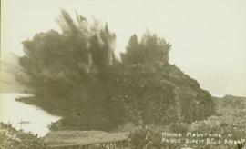
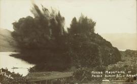
          Photograph of a large explosion on a rocky shoreline. A bridge is visible in the foreground and a body of water is partially visible in the background. Annotation on recto reads: "McRae Bros Moving Mountains at Prince Rupert BC Apr 24th"

          2011.3.3.86 · Item · 17 July 1913
          Part of North Coast & Central BC Postcard Collection

          Photograph of a large explosion on a rocky shoreline. A bridge is visible in the foreground and a body of water is partially visible in the background. Printed annotation on recto reads: "McRae Bros Moving Mountains at Prince Rupert BC Apr 24th" Handwritten annotation on verso reads: "Rupert. July 17 1913. Dear [illegible]. Just a card for that album if you've got any room left by now. This is one of the blasts for the clearing of the drydock up here. [Illegible] W.M." Postcard is addressed to: "Miss C.M. Ranip[??] 931 Northlane Av.[sic] Seattle Wash." Two Canadian one cent stamps are affixed on verso. Postmark reads: "Prince Rupert BC. PM Jul 17 13."

          2020.05.05 · Item · October 1936
          Part of Gordon Wyness Album

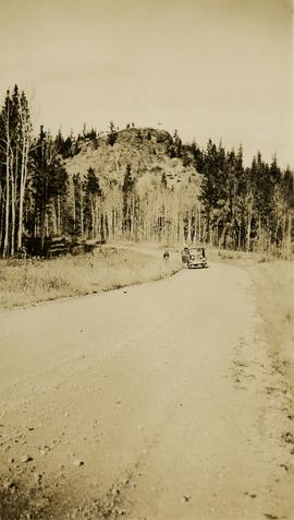
          Photograph depicts Mount Begbie, noted by Wyness to be the highest point on the Cariboo Highway at mile 85. Mount Begbie is located at approximately 51°28'33''N, 121°22'00''W, on the east side of Cariboo Hwy, between 70 Mile House and 100 Mile House, in the Lillooet Land District. Wyness annotated this photograph with the statement that they "tied this one in"; 'tying in' is a land survey term, implying that the crew may have also been surveying in this area.

          Mud River Elementary School
          2012.13.2.16.29 · File · [2001?]
          Part of J. Kent Sedgwick fonds

          File consists of notes and reproductions relating to Mud River Elementary School. Also includes photographs depicting old Mud River buildings and roads.

          Municipal subdivision maps
          1996.8.4.28 · File · [between 1970 and 1990]
          Part of Chander Suri fonds

          File consists of zoning and property information including Regional District of Fraser Fort-George public hearing notifications, Quesnel subdivision and zoning bylaws, subdivision application guide, land use assessments, and multiple topographic and lot maps for Prince George, Burns Lake, Quesnel, and Fraser Lake.

          Murray Krause
          2003.11.1.20 · File · 1999-2000
          Part of Island Cache Recovery Project Collection

          File consists of an oral history given by Murray Krause, which was gathered as part of Dr. Mike Evan's Island Cache Recovery Project. Includes consent forms, transcripts, and the recorded oral history on the original media.

          1996.8.4.75 · File · 1990-1996
          Part of Chander Suri fonds

          File consists of Carrier Sekani Tribal Council correspondence, briefs, plans, register population data, cost estimates, maps, planning background report, and physical development plan.

          2012.13.2.01.02 · File · 1985, 2004-2009
          Part of J. Kent Sedgwick fonds

          File consists of clippings, notes, and reproductions relating to the naming of the city of Prince George and the origins of the name. Includes: "Proclamation" photocopy of British Columbia Gazette discussing the naming of the city of Prince George (1915); "Prince George needs a new name" print of pgcitizen.ca article by Neil Godbout including comments on the article (July 2009); "Prince George" in Prince George Citizen, Northern Explorer (May 2006); and "History of Prince George" in a Prince George Towncenter Business Association publication (July 1985).

          Nelson Homes brochure
          1996.8.4.31 · File · [199-?]
          Part of Chander Suri fonds

          File consists of a brochure for Nelson Homes, a home construction company with a range of predesigned homes to choose from, with a business card of Prince George based home specialist R.J. (Bob) Fines stapled to the brochure.

          2020.4.2.3.019 · Item · 1966
          Part of G. Gary Runka fonds

          Item is a copy of the "North American Water and Power Alliance (NAWAPA)" presentation to Cornell University Water Resources Center, Ithaca, New York by Roland P. Kelly, Edward R. Trapnell, and Ralph M. Parsons Company.

          Northern Planners
          1996.8.4.41 · File · 1981
          Part of Chander Suri fonds

          File consists of correspondence between the Northern Planners and the Planning Institute of BC (PIBC) regarding the formation of the northern group. Includes correspondence between the Northern Planners and PIBC as well as meeting minutes from the Northern Planners.

          2020.4.2.1.13 · File · [ca. 1975]
          Part of G. Gary Runka fonds

          File consists of notes written by Joan Sawicki for an untitled pending speech by Gary Runka.

          Commentary on this speech by Barry Smith of the Ministry of Agriculture and Lands:
          "Despite this being only 4 pages of rough notes, its focus on the initial work of the Commission and challenges of designating the ALR make it an historically important document.

          For example it was initially thought the ALR would be guided by class 1 - 4 CLI ratings but this proved impractical in the north and range areas. An additional challenge was that parts of the province only had the benefit of 1:50000 mapping. This presented a very real problem for establishing the ALR.

          One concern with this document is that because it is written in point form and consists of rough notes, it could be open to a degree of misinterpretation if not considered by an individual with experience in the administration of the ALR. For a much more refined statement on the B.C. Agricultural Land Preservation program and the designation of the ALR see Items [2020.4.2.1.23, 2020.4.2.1.24, and 2020.4.2.1.25]."
          1996.8.4.11 · File · 1990-1993
          Part of Chander Suri fonds

          File consists of correspondence between Chander Suri and Kent Sedgwick regarding the development of the Official Community Plan bylaw no. 5909 for Prince George. Includes newspaper clippings, bylaw no. 3848, and a schedule for public hearings.

          1996.8.4.14 · File · 1997-2006
          Part of Chander Suri fonds

          File consists of documents concerning the drafting of the City of Prince George's Official Community Plan between 1997 and 2006. Includes correspondence between planners, handwritten notes, questionnaires, staff reports, cost charge fee schedules and reviews, and a Department of Development Services bylaw update.

          2020.4.9.2.19 · File · 2011
          Part of G. Gary Runka fonds

          This CD-ROM contains digital records compiled for Gary Runka in relation to the OCP for Rural Graham Island, possibly for his consultancy work for client job 664, Misty Isles Economic Development Society's "Food Planning Presentations on Haida Gwaii" project or another Haida Gwaii based project. Includes correspondence, Canada Land Inventory maps for Haida Gwaii, the draft 2009 Official Community Plan for Rural Graham Island, Graham Island zoning documents, and population information for Graham Island and Tlell.

          Omineca region
          2012.13.2.19.18 · File · 1990-2004
          Part of J. Kent Sedgwick fonds

          File consists of a clipping, printed emails, and reproductions relating to the Omineca region and Sedgwick's research. Includes: "Have you been to Hyder, friendliest ghost town in Alaska" large sticker (199-); and "Historical Museum Stewart B.C". large sticker (199-).