Land, Settlement and Immigration

Elements area

Taxonomy

Code

Scope note(s)

  • Claiming, settling, and moving to a new land

  • Land titles, distribution, grants, etc.

  • Community and regional settlement patterns

  • Land settlement companies

  • Land surveys and surveyors

  • Real estate companies and activities

  • Organizations involved in sponsoring and supporting immigrants

Source note(s)

  • MemoryBC Subject Groups

Display note(s)

    Hierarchical terms

    Land, Settlement and Immigration

      Equivalent terms

      Land, Settlement and Immigration

        Associated terms

        Land, Settlement and Immigration

          1387 Archival description results for Land, Settlement and Immigration

          1387 results directly related Exclude narrower terms
          2020.4.2.2.11 · Item · Apr. 1979
          Part of G. Gary Runka fonds

          Item is an original copy of "Interior Program Feasibility Study: A report submitted to Dr. W. D. Kitts, Dean of Faculty of Agricultural Sciences by the Dean's Interior Program Committee". The report was prepared in consultation with G. G. Runka Land Sense Ltd.

          2003.11 · Collection · 1998-2000

          Collection consists of material resulting from Dr. Mike Evan's Island Cache Recovery Project Collection. Includes oral history interviews of former Island Cache (Cottonwood Island) residents on recording media (cassette and VHS) as well as transcripts of the oral histories. Also includes administrative records for the project and photocopies of background research material used for the project, such as Prince George city records, newspaper clippings, photographs, and correspondence.

          Evans, Michael John
          2003.11.3 · Series · 1999-2000
          Part of Island Cache Recovery Project Collection

          Series consists of research material collected for the Island Cache Recovery Project. Includes resources photocopied from participants in the study (particularly material collected by Bob Parris), including newspaper articles, photographs, and personal correspondence. Also includes research material gathered by the researchers from other sources, such as copies of maps, articles, and public records.

          2020.4.9.2.24 · File · 2000
          Part of G. Gary Runka fonds

          This CD-ROM contains the digital publication "Issues, Trends and Concerns about Agricultural Nutrient Management in the Lower Fraser Valley" by H. Schreier, R. Bestbier, G. Derksen and P. Brisbin. Software install on a compatible computer is required to access the content. Annotation on case: "This multimedia CD-ROM highlights the spatial and temporal variability of nutrients, namely nitrogen, phosphorus and potassium, within 20 Management Units in the Lower Fraser Valley. Five year trends in animal numbers (1986-1996) and trends in nutrient balances between 1991 and 1996 were determined. Scenarios were developed to evaluate nutrient surplus areas that have the potential to pollute surface and groundwater resources."

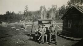
          2020.05.41 · Item · 1936
          Part of Gordon Wyness Album

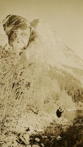
          Photograph depicts Jack Lee (front) and Gordon Wyness drinking lakeside in Marble Canyon. The survey crew had been travelling along Marble Canyon Road, which is now Highway 99. The lakes in Marble Canyon are now named Turquoise Lake, Crown Lake, and Pavilion Lake. Wyness notes the blueness of these lakes and the white mountains of this area.

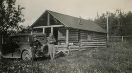
          2020.05.52 · Item · 1936
          Part of Gordon Wyness Album

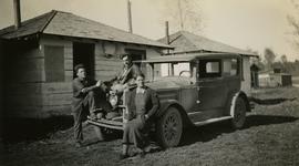
          Photograph depicts (from left) Jack Lee and Gordon Wyness sitting on a car next to their equipment while surveying at an Indian Reserve. A cabin on the reserve is also depicted. According to the transcription on the photograph verso, they were surveying road through an "Indian Reserve South of South bank François Lake".

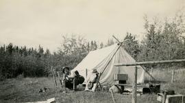
          2020.05.54 · Item · 1936
          Part of Gordon Wyness Album

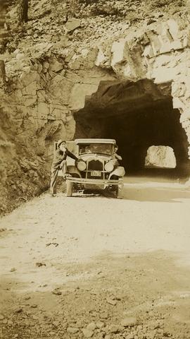
          Photograph depicts (from left) Jack Lee and Philip Monckton leaning up against their 1930 Buick Series 40 car before leaving for Southbank Francois Lake. Behind them is the cabin they stayed in at Burns Lake, which was owned by Ben[?] Smith.

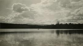
          2020.05.17 · Item · [Sept. or Oct. 1936]
          Part of Gordon Wyness Album

          Photograph depicts Jack Lee rafting with a sail on Bobtail Lake, as he was going over to other side of the lake to locate traverse posts (without success, according to the annotation on the photograph verso).

          2020.05.13 · Item · [Sept. or Oct. 1936]
          Part of Gordon Wyness Album

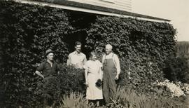
          Photograph depicts (from left to right) Jack Lee, Gordon Wyness, Jessie McInnes, and Archie McInnes at Pioneer Ranch.

          In 1903, brothers Neil and Archie McInnes pre-empted a section of land two miles east of Cote Flat, each taking half. Archie McInnes' land later became known as Pioneer Ranch (later known as the Barnett Ranch); Neil McInnes' land became Meadowbrook Ranch. Archie McInnes married Jessie Aitken in October 1905. Pioneer Ranch became known as a stop-over for travellers en route from Hazelton to the Ootsa Lake area via the Telegraph Trail. Archie and Jessie McInnes had three daughters: Vera (m. Ivan Frank), Ivy (m. Eric Strimbold), and Neva (m. John Ivan Nickolichuk).

          2020.05.14 · Item · [Sept. or Oct. 1936]
          Part of Gordon Wyness Album

          Photograph depicts (from left to right) Jack Lee, Philip Monckton, Jessie McInnes, and Archie McInnes at Pioneer Ranch.

          In 1903, brothers Neil and Archie McInnes pre-empted a section of land two miles east of Cote Flat, each taking half. Archie McInnes' land later became known as Pioneer Ranch (later known as the Barnett Ranch); Neil McInnes' land became Meadowbrook Ranch. Archie McInnes married Jessie Aitken in October 1905. Pioneer Ranch became known as a stop-over for travellers en route from Hazelton to the Ootsa Lake area via the Telegraph Trail. Archie and Jessie McInnes had three daughters: Vera (m. Ivan Frank), Ivy (m. Eric Strimbold), and Neva (m. John Ivan Nickolichuk).

          James Larson
          2003.11.1.24 · File · 1999-2000
          Part of Island Cache Recovery Project Collection

          File consists of an oral history given by James Larson, which was gathered as part of Dr. Mike Evan's Island Cache Recovery Project. Includes consent forms, transcripts, and the recorded oral history on the original media.

          2012.13.2.17.15 · File · 2010
          Part of J. Kent Sedgwick fonds

          File consists of notes and reproductions relating to Japanese internment and work at Sinclair Mills during World War II. File also includes photographs depicting the pit and field site for the old North Road camp for Sinclair Mills, where Japanese internment workers worked (2010).

          Jerline Doucette
          2001.58.06 · File · 1997-1998
          Part of Prince George Metis Elders Oral History Project Collection

          File consists of an oral history given by Jerline Doucette, which was gathered as part of Dr. Mike Evan's oral history project with the Prince George Metis Elders Society. Includes consent forms, transcripts, and the recorded oral history on the original cassette.

          2003.11.1.36 · File · 1999-2000
          Part of Island Cache Recovery Project Collection

          File consists of an oral history given by Joan Paulson and Sharlene Leepart, which was gathered as part of Dr. Mike Evan's Island Cache Recovery Project. Includes consent forms, transcripts, and the recorded oral history on the original media.

          2020.4.6.102 · File · 1982-1983
          Part of G. Gary Runka fonds

          File consists of records created and accumulated by Gary Runka over the course of his consultancy work for White Lake Ranch Ltd. for the "Ranch Land Use Consultation" project in Kaleden. This file was numbered as G.G. Runka Land Sense Ltd. client file #102; that client number may be seen referenced elsewhere in the G. Gary Runka fonds. The Land Sense Ltd. client files generally include records such as correspondence, contracts, invoices, project reports, publications, ephemera, memoranda, maps or map excerpts, legal documents, meeting materials, clippings, and handwritten notes.

          2020.4.6.107 · File · 1984
          Part of G. Gary Runka fonds

          File consists of records created and accumulated by Gary Runka over the course of his consultancy work for Corporation of the Township of Richmond for the "Preparation of Background Agriculture Study for Community Plan" project in Richmond. This file was numbered as G.G. Runka Land Sense Ltd. client file #107; that client number may be seen referenced elsewhere in the G. Gary Runka fonds. The Land Sense Ltd. client files generally include records such as correspondence, contracts, invoices, project reports, publications, ephemera, memoranda, maps or map excerpts, legal documents, meeting materials, clippings, and handwritten notes.

          Includes:

          • Township of Richmond Planning Department, "The Richmond Official Community Plan", Sept. 1986
          • Township of Richmond Planning Department, "Official Community Plan Issue Paper No. 3 - Agricultural Issues", Sept. 1984.
          2020.4.6.109 · File · 1984
          Part of G. Gary Runka fonds

          File consists of records created and accumulated by Gary Runka over the course of his consultancy work for Environment Canada, Lands Directorate, Environmental Protection Service for the "Siting Hydrocarbon Facilities on the Arctic Coast" project. This file was numbered as G.G. Runka Land Sense Ltd. client file #109; that client number may be seen referenced elsewhere in the G. Gary Runka fonds. The Land Sense Ltd. client files generally include records such as correspondence, contracts, invoices, project reports, publications, ephemera, memoranda, maps or map excerpts, legal documents, meeting materials, clippings, and handwritten notes.

          2020.4.6.011 · File · 1976-1982
          Part of G. Gary Runka fonds

          File consists of records created and accumulated by Gary Runka over the course of his consultancy work for BCFA/B.C. Cattlemen's Association (BCCA) for the "Environmental Impact of Proposed B.C. Hydro Hat Creek Power Project" in Hat Creek. This file was numbered as G.G. Runka Land Sense Ltd. client file #011; that client number may be seen referenced elsewhere in the G. Gary Runka fonds. The Land Sense Ltd. client files generally include records such as correspondence, contracts, invoices, project reports, publications, ephemera, memoranda, maps or map excerpts, legal documents, meeting materials, clippings, and handwritten notes.

          Includes the following reports:

          • BC Hydro, "British Columbia Hydro and Power Authority Hat Creek Project Environmental Impact Statement" (April 1981)
          • British Columbia Institute of Agrologists, "Environmental Concerns of the Hat Creek Project", May 1982.
          • S.A. Ridley, "Hat Creek Project Described (The Engineering and Environmental Evolution)", October 1981.
          2020.4.6.112 · File · 1984
          Part of G. Gary Runka fonds

          File consists of records created and accumulated by Gary Runka over the course of his consultancy work for Richmond Landfill Ltd. for the "Assessment of Land Use Opportunities and Conflicts" project in Richmond. This file was numbered as G.G. Runka Land Sense Ltd. client file #112; that client number may be seen referenced elsewhere in the G. Gary Runka fonds. The Land Sense Ltd. client files generally include records such as correspondence, contracts, invoices, project reports, publications, ephemera, memoranda, maps or map excerpts, legal documents, meeting materials, clippings, and handwritten notes.

          Maps include:

          • "Fraser Richmond" showing legal lots, Fraser River Harbour Commission, May 1980 ;
          • "Posting Plan of Portion of Sections 10, 15, 22, 27 and 28, Block 4 North; Range 5 West, New Westminster District", Crockford, Scobbie & Associates Surveyors & Engineers, Jan. 1977.
          2020.4.6.120 · File · 1984
          Part of G. Gary Runka fonds

          File consists of records created and accumulated by Gary Runka over the course of his consultancy work for Yukon River Basin Committee for the "Review of Tourism, Parks and Recreation Opportunities" project in Whitehorse. This file was numbered as G.G. Runka Land Sense Ltd. client file #120; that client number may be seen referenced elsewhere in the G. Gary Runka fonds. The Land Sense Ltd. client files generally include records such as correspondence, contracts, invoices, project reports, publications, ephemera, memoranda, maps or map excerpts, legal documents, meeting materials, clippings, and handwritten notes.

          2020.4.6.122 · File · 1984
          Part of G. Gary Runka fonds

          File consists of records created and accumulated by Gary Runka over the course of his consultancy work for Boundary Bay Farms Ltd. for the "Boundary Bay Airport Farmland" project in Delta. This file was numbered as G.G. Runka Land Sense Ltd. client file #122; that client number may be seen referenced elsewhere in the G. Gary Runka fonds. The Land Sense Ltd. client files generally include records such as correspondence, contracts, invoices, project reports, publications, ephemera, memoranda, maps or map excerpts, legal documents, meeting materials, clippings, and handwritten notes. File also includes 5 accompanying photographs.

          2020.4.6.123 · File · 1984
          Part of G. Gary Runka fonds

          File consists of records created and accumulated by Gary Runka over the course of his consultancy work for Richmond Museum for the "Museum Program: "The Changing Face of Agriculture in Richmond"" project in Richmond. This file was numbered as G.G. Runka Land Sense Ltd. client file #123; that client number may be seen referenced elsewhere in the G. Gary Runka fonds. The Land Sense Ltd. client files generally include records such as correspondence, contracts, invoices, project reports, publications, ephemera, memoranda, maps or map excerpts, legal documents, meeting materials, clippings, and handwritten notes.

          2020.4.6.128 · File · 1985
          Part of G. Gary Runka fonds

          File consists of records created and accumulated by Gary Runka over the course of his consultancy work for ALDA Reclamation Ltd. for the "Burns Bog" project in Delta. This file was numbered as G.G. Runka Land Sense Ltd. client file #128; that client number may be seen referenced elsewhere in the G. Gary Runka fonds. The Land Sense Ltd. client files generally include records such as correspondence, contracts, invoices, project reports, publications, ephemera, memoranda, maps or map excerpts, legal documents, meeting materials, clippings, and handwritten notes.

          2020.4.6.129 · File · 1985
          Part of G. Gary Runka fonds

          File consists of records created and accumulated by Gary Runka over the course of his consultancy work for Community & Regional Planning, UBC for the "Course Director: Natural Resource Management for Indian Band Planning" project in Vancouver. This file was numbered as G.G. Runka Land Sense Ltd. client file #129; that client number may be seen referenced elsewhere in the G. Gary Runka fonds. The Land Sense Ltd. client files generally include records such as correspondence, contracts, invoices, project reports, publications, ephemera, memoranda, maps or map excerpts, legal documents, meeting materials, clippings, and handwritten notes.

          2020.4.6.013 · File · 1978-1980
          Part of G. Gary Runka fonds

          File consists of records created and accumulated by Gary Runka over the course of his consultancy work for BC Ministry of Lands, Parks and Housing for the "Review of Agricultural Policy - Crownland Allocation and Administration" project. This file was numbered as G.G. Runka Land Sense Ltd. client file #013; that client number may be seen referenced elsewhere in the G. Gary Runka fonds. The Land Sense Ltd. client files generally include records such as correspondence, contracts, invoices, project reports, publications, ephemera, memoranda, maps or map excerpts, legal documents, meeting materials, clippings, and handwritten notes.

          2020.4.6.131 · File · 1985
          Part of G. Gary Runka fonds

          File consists of records created and accumulated by Gary Runka over the course of his consultancy work for Transport Canada for the "Drainage and Integrated Land Use Investigation - Boundary Bay Airport" project in Vancouver. This file was numbered as G.G. Runka Land Sense Ltd. client file #131; that client number may be seen referenced elsewhere in the G. Gary Runka fonds. The Land Sense Ltd. client files generally include records such as correspondence, contracts, invoices, project reports, publications, ephemera, memoranda, maps or map excerpts, legal documents, meeting materials, clippings, and handwritten notes. File also includes an accompanying oversize aerial photograph.

          2020.4.6.133 · File · 1985
          Part of G. Gary Runka fonds

          File consists of records created and accumulated by Gary Runka over the course of his consultancy work for Parson Watershed Alliance for the "Consultation on Watershed Use Conflict Resolution" project in Parson. This file was numbered as G.G. Runka Land Sense Ltd. client file #133; that client number may be seen referenced elsewhere in the G. Gary Runka fonds. The Land Sense Ltd. client files generally include records such as correspondence, contracts, invoices, project reports, publications, ephemera, memoranda, maps or map excerpts, legal documents, meeting materials, clippings, and handwritten notes.

          2020.4.6.134 · File · 1985
          Part of G. Gary Runka fonds

          File consists of records created and accumulated by Gary Runka over the course of his consultancy work for Soowahlie Indian Band for the "Physical Development Plan" project in Vedder Crossing. This file was numbered as G.G. Runka Land Sense Ltd. client file #134; that client number may be seen referenced elsewhere in the G. Gary Runka fonds. Includes correspondence, invoices, photocopied map areas, terms of reference, handwritten notes, and newspaper clippings. File also includes an accompanying oversize aerial photograph.

          Includes the following:

          • Draft handwritten report by Gary Runka entitled "Soowahlie Resource Inventory Report - Agriculture and Forestry"
          • Map "Photomap of Skowkale Indian Reserve 10, 11 and Yakweakwioose Indian Reserve 12, New Westminster District, BC", Canadian Department of Energy, Mines and Resources Surveys and Mapping Branch, 5 March 1985.
          2020.4.6.135 · File · 1985
          Part of G. Gary Runka fonds

          File consists of records created and accumulated by Gary Runka over the course of his consultancy work for BC Buildings Corporation for the "Land Resource Inventory of Colony Farm Institution" project in Coquitlam. This file was numbered as G.G. Runka Land Sense Ltd. client file #135; that client number may be seen referenced elsewhere in the G. Gary Runka fonds. The Land Sense Ltd. client files generally include records such as correspondence, contracts, invoices, project reports, publications, ephemera, memoranda, maps or map excerpts, legal documents, meeting materials, clippings, and handwritten notes. File also includes an accompanying 11 aerial photographs, one of which is oversize.

          Maps include:

          • "Plan of Provincial Mental Hospital Colony Farm, Essondale, British Columbia", Department of Lands and Forests, n.d.;
          • "Plan of Provincial Mental Hospital Colony Farm, Essondale, British Columbia", Department of Lands and Forests, n.d.;
          • "Plan of Provincial Mental Hospital Colony Farm, Essondale, British Columbia", Department of Lands and Forests, n.d.;
          • "Reference Plan of Easement over portion of District Lots 23, 60, 170, Group 1, New Westminster District", Murray & Associates, April 1985;
          • "City of Port Coquitlam Official Community Plan Schedule B", n.d.;
          • "Plan of Right-of-Way through Portion of Lot 41 (Plan 53659), District Lots 22 and 67, Group 1, New Westminster District", Underhill & Underhill Engineers & Surveyors, 1980;
          • "District of Coquitlam Legal Metric Series", District of Coquitlam, n.d.;
          • "City of Port Coquitlam";
          • "New Water Distribution System Colony Farm, Essondale, BC", BC Department of Public Works, n.d.;
          • "Plan of Statutory Right-of-Way over portions of District Lots 23, 60, 168, 169, 170, 341, 343, Group 1, New Westminster District", Murray & Associates, 1985;
          • "Plan of Right-of-Way through portion of District Lots 22 and 60, Group 1, New Westminster District", May 1980;
          • "City of Port Coquitlam Official Community Plan Schedule C", n.d.;
          • "Colony Farm", BC Buildings Corporation, 30 June 1981 - 2 copies;
          • "Sketch Plan of Proposed Subdivision of Part District Lots 22 and 23 Group 1, New Westminster District showing Setbacks of Existing Buildings from Proposed Property & Zoning Lines", Murray & Associates;
          • "Colony Farm: Internal Drainage Improvements", BC Ministry of Agriculture Agricultural Engineering Branch, 1979;
          • "Colony Farm: Internal Drainage Improvements", BC Ministry of Agriculture Agricultural Engineering Branch, 1978;
          • "Colony Farm: Outlet Investigation", BC Ministry of Agriculture Agricultural Engineering Branch, 1978;
          • Untitled legal lot plan for Colony Farm area;
          • "Present and Surrounding Land Use", G. G. Runka Land Sense Ltd., 1984;
          • "Present and Surrounding Land Use", G. G. Runka Land Sense Ltd., 1984;
          • "Conceptual Land Use Plan", G. G. Runka Land Sense Ltd., 1984;
          • "Legal and Jurisdictional", G. G. Runka Land Sense Ltd., 1984;
          • "Drainage and Dykes", G. G. Runka Land Sense Ltd., 1984;
          • "Land Suitability for Agriculture", G. G. Runka Land Sense Ltd., 1984;
          • "Land Suitability for Agriculture", G. G. Runka Land Sense Ltd., 1984.
          2020.4.6.138 · File · 1985
          Part of G. Gary Runka fonds

          File consists of records created and accumulated by Gary Runka over the course of his consultancy work for Angelus Ventures Ltd. for the "Delta Community Plan" project in Delta. This file was numbered as G.G. Runka Land Sense Ltd. client file #138; that client number may be seen referenced elsewhere in the G. Gary Runka fonds. The Land Sense Ltd. client files generally include records such as correspondence, contracts, invoices, project reports, publications, ephemera, memoranda, maps or map excerpts, legal documents, meeting materials, clippings, and handwritten notes.

          2020.4.6.014 · File · 1978-1980
          Part of G. Gary Runka fonds

          File consists of records created and accumulated by Gary Runka over the course of his consultancy work for Peace Valley Environmental Association for the "Peace River Site C" project. This file was numbered as G.G. Runka Land Sense Ltd. client file #014; that client number may be seen referenced elsewhere in the G. Gary Runka fonds. The Land Sense Ltd. client files generally include records such as correspondence, contracts, invoices, project reports, publications, ephemera, memoranda, maps or map excerpts, legal documents, meeting materials, clippings, and handwritten notes.

          Includes the following reports:

          • BC Hydro and Power Authority, "Peace Site C Project Environmental Impact Statement", July 1980
          • BC Hydro, "Highlights of the Proposed Peace River Site C Project", October 1980
          • Peace Valley Environmental Association, "Final Argument in the matter of the Utilities Commission Act, SBC 1980, c.60 and in the matter of an application by the British Columbia Hydro and Power Authority for an Energy Project Certificate for the Peace Site C Generation/Transmission Project", October 28, 1982
          • British Columbia Hydro and Power Authority, "Peace Site C Project Application for an Energy Project Certificate with Supplementary Material", 1980
          • F.F. Slaney and Company Limited and Associates, "Summaries and Critiques - Environmental - Land Use - Social and Economic Impacts - Application by B.C. Hydro and Power Authority for Energy Project Certificate Site C Peace River", January 1982 (Volumes 1 and 2).
          • Thurber Consultants Ltd., "Lower Peace River sites C and E hydroelectric development proposals : environmental resource atlas, part of a report to B.C. Hydro and Power Authority", June 1976
          2020.4.6.140 · File · 1985
          Part of G. Gary Runka fonds

          File consists of records created and accumulated by Gary Runka over the course of his consultancy work for Urban Systems Ltd. for Westbank Indian Band for the "Westbank Indian Band Agricultural Community Plan - Mission Creek Site" project in Kelowna. This file was numbered as G.G. Runka Land Sense Ltd. client file #140; that client number may be seen referenced elsewhere in the G. Gary Runka fonds. Includes correspondence, invoices, memoranda, photocopied map areas, terms of reference, and handwritten notes. File also includes 2 accompanying aerial photographs.

          Includes the following:

          • G. G. Runka Land Sense Ltd., "Draft Explanatory Notes to Accompany Mapping - Westbank Indian Band - Agricultural Community Plan - Mission Creek Site - Land Capability for Agriculture, Land Suitability for Agriculture, Hazard Lands and Geo-technical Considerations", July 1985
          • Arcus Consulting Ltd. for G. G. Runka Land Sense Ltd., "The Agricultural Development of the Tsinstikeptum Indian Reserve 7: Economic Considerations", August 1985
          • "Grazing Area - Grazing Licence - Mission Creek C.R.M.P.", January 1985
          • "Tsinstikeptum Indian Reserve 7: Land Capability for Agriculture", Urban Systems Ltd., 1995;
          • "Tsinstikeptum Indian Reserve 7: Land Suitability for Agriculture", Urban Systems Ltd., 1995;
          • "Tsinstikeptum Indian Reserve 7: Areas of Geotechnical Concern", Urban Systems Ltd., 1995;
          • "Tsinstikeptum Indian Reserve 7: Proposed Farm Units", Urban Systems Ltd., 1995;
          • [Tsinstikeptum Indian Reserve 7?] photomap, [1995?].
          2020.4.6.144 · File · 1985
          Part of G. Gary Runka fonds

          File consists of records created and accumulated by Gary Runka over the course of his consultancy work for Department of Indian Affairs and Northern Development for the "Impact Analysis of Proposed Mining Road Access, Casino Trail" project in Carmacks, Yukon. This file was numbered as G.G. Runka Land Sense Ltd. client file #144; that client number may be seen referenced elsewhere in the G. Gary Runka fonds. The Land Sense Ltd. client files generally include records such as correspondence, contracts, invoices, project reports, publications, ephemera, memoranda, maps or map excerpts, legal documents, meeting materials, clippings, and handwritten notes.

          Includes the following reports:

          • Government of Yukon Department of Community and Transportation Services, "Proposed Casino Trail Route Location and Terrain Analysis Study", January 1986
          • Casino Trail Project Advisory Committee, "Summary Report", Dec. 1985
          • Spencer Environmental Management Services Ltd. for Indian and Northern Affairs Canada, "Socio-Economic/Environmental Overview for Proposed Casino Trail", December 1985.

          Maps include:

          • "Casino Trail Key Plan", Yukon Department of Community and Transportation Services, 17 Oct. 1985;
          • Annotated section of NTS map "Snag, Yukon Territory";
          • Annotated NTS map "Carmacks, Yukon Territory";
          • Untitled Casino Trail area, Spencer Environmental Management Services Ltd. - 2 copies;
          • "(2116) MacMillan River World Aeronautical Chart", Canada Department of Mines and Technical Surveys, 1965;
          • Annotated combined duplicated copies of NTS maps for Snag and Carmacks, Yukon Territory;
          • Untitled soil map for Casino Trail area, possibly by G.G. Runka Land Sense Ltd., n.d.;
          • Copy of combined annotated NTS maps for Carmacks, Rowlinson Creek, and Mount Nansen, Yukon Territory showing soil types, possibly by G.G. Runka Land Sense Ltd.
          2020.4.6.145 · File · 1985
          Part of G. Gary Runka fonds

          File consists of records created and accumulated by Gary Runka over the course of his consultancy work for Municipality of Summerland for the "Irrigation Suitability of Lands not Currently Allocated Irrigation - Summerland Official Community Plan Review" project in Summerland. This file was numbered as G.G. Runka Land Sense Ltd. client file #145; that client number may be seen referenced elsewhere in the G. Gary Runka fonds. The Land Sense Ltd. client files generally include records such as correspondence, contracts, invoices, project reports, publications, ephemera, memoranda, maps or map excerpts, legal documents, meeting materials, clippings, and handwritten notes.
          2020.4.6.148 · File · 1985
          Part of G. Gary Runka fonds

          File consists of records created and accumulated by Gary Runka over the course of his consultancy work for Environment Canada, Land Use Monitoring Division for the "Monitoring for Change Workshop" project in Ottawa. This file was numbered as G.G. Runka Land Sense Ltd. client file #148; that client number may be seen referenced elsewhere in the G. Gary Runka fonds. The Land Sense Ltd. client files generally include records such as correspondence, contracts, invoices, project reports, publications, ephemera, memoranda, maps or map excerpts, legal documents, meeting materials, clippings, and handwritten notes.
          2020.4.6.149 · File · 1985
          Part of G. Gary Runka fonds

          File consists of records created and accumulated by Gary Runka over the course of his consultancy work for BC Buildings Corporation for the "Land Resource Inventory of Tranquille Institution" project in Kamloops. This file was numbered as G.G. Runka Land Sense Ltd. client file #149; that client number may be seen referenced elsewhere in the G. Gary Runka fonds. The Land Sense Ltd. client files generally include records such as correspondence, contracts, invoices, project reports, publications, ephemera, memoranda, maps or map excerpts, legal documents, meeting materials, clippings, and handwritten notes. File also includes 4 accompanying aerial photographs (2 with overlays) and 1 photographic print. Includes report by G. G. Runka Land Sense Ltd. for B.C. Buildings Corporation entitled "Tranquille Farm, Kamloops, B.C., Land Resource Attributes and Constraints", January 1986.

          Maps include:

          • British Columbia Buildings Corporation, "Tranquille School & Farm", Aug. 1979
          • British Columbia Buildings Corporation, "Tranquille", Feb. 1980
          • British Columbia Buildings Corporation, "Tranquille Wasterwater Management System Upgrading", Feb. 1981 (2 copies)
          • R. B. Stothers, City of Kamloops, "Posting Plan of Outer Boundaries of DL 341,342 & 343 all of Group 1 KDYD; LS6,11 & 12 of Sec 25; and NW Cor Sec 25, TP 20 Rge 19 W6M KDYD, Dec. 1985 (3 copies, 1 of which is annotated)
          • Untitled map of D.L. 342 & 343 etc.
          • Enlargement of Untitled map of D.L. 342 & 343 etc.
          • Reproduction of [1916?] "Plan of Part of Lot 343 G1 Kamloops District"
          • Reproduction of Canada Department of Agriculture Water Development Branch, "General Plan - Tranquille Farm Lands", Dec. 1953
          • Annotated draft map showing Red Plateau grazing permit, Tranquille Reserve, existing fence, and proposed fence, circa [198-?]
          • Reproduction of Department of Lands and Forests, "Plan of Tranquille School", Oct. 1961
          • G.G. Runka Land Sense Ltd., draft mylar map negative depicting Tranquille Farm entitled "Map 1: Landforms", 1985
          • G.G. Runka Land Sense Ltd., draft mylar map negative depicting Tranquille Farm entitled "Map 2: Land Capability for Agriculture", 1985
          • G.G. Runka Land Sense Ltd., draft mylar map negative depicting Tranquille Farm entitled "Map 3: Land Suitability for Agriculture", 1985 (with overlays)
          • G.G. Runka Land Sense Ltd., draft mylar map negative depicting Tranquille Farm entitled "Map 4: Present and Surrounding Use", 1985
          • G.G. Runka Land Sense Ltd., draft mylar map negative depicting Tranquille Farm entitled "Map 5: Legal and Jurisdictional", 1985
          • G.G. Runka Land Sense Ltd., draft mylar map negative depicting Tranquille Farm entitled "Map 6: Proposed Land Use and Legal Parcel Replot", 1985
          • BC Ministry of Environment, 92I.078.1.4.1 Orthophoto map, Jan. 1985
          • BC Ministry of Environment, 92I.078.1.4.1 Orthophoto map (reproduced with overlay), Jan. 1985
          • BC Ministry of Environment, 92I.078.1.4.2 Orthophoto map, Jan. 1985
          • BC Ministry of Environment, 92I.078.1.4.2 Orthophoto map (reproduced with overlay), Jan. 1985
          • BC Ministry of Environment, 92I.078.1.4.4 Orthophoto map, Jan. 1985
          • BC Ministry of Environment, 92I.078.2.3.1 Orthophoto map, Jan. 1985
          • BC Ministry of Environment, 92I.078.2.3.1 Orthophoto map (reproduced with overlay), Jan. 1985
          • BC Ministry of Environment, 92I.078.2.3.3 Orthophoto map, Feb. 1985
          • Partial photocopy reduction of "Soil Map of Tranquille Sanatorium Farm", 1957 (on 2 sheets)
          • Department of Lands and Forests Topographic Division Surveys & Mapping Branch, "Plan of Tranquille School" original detailed large reproduction annotated in colour, October 1961
          • Large original reproduction of "Plan of Tranquille School", undated, possibly circa 1958-1961