Land, Settlement and Immigration

Elements area

Taxonomy

Code

Scope note(s)

  • Claiming, settling, and moving to a new land

  • Land titles, distribution, grants, etc.

  • Community and regional settlement patterns

  • Land settlement companies

  • Land surveys and surveyors

  • Real estate companies and activities

  • Organizations involved in sponsoring and supporting immigrants

Source note(s)

  • MemoryBC Subject Groups

Display note(s)

    Hierarchical terms

    Land, Settlement and Immigration

      Equivalent terms

      Land, Settlement and Immigration

        Associated terms

        Land, Settlement and Immigration

          1387 Archival description results for Land, Settlement and Immigration

          1387 results directly related Exclude narrower terms
          Maps, plans, and drawings
          2023.5.1 · Series · 1976-2020
          Part of UNBC School of Planning and Sustainability fonds

          Series consists of maps, plans, and drawings collected by faculty in the UNBC School of Planning and Sustainability. The majority of these maps reflect the planning history of the City of Prince George and include large format, hand-drawn plans created by the City Planning Department from the 1970s and 1980s. Maps from City of Prince George Official Community Plans are also included.

          Manpower and Immigration
          2009.6.13.21 · Subseries · 1974-1979
          Part of The Honourable Iona Campagnolo fonds

          Subseries consists of correspondence and accompanying informational material related to the Department of Manpower and Immigration as well as immigration and unemployment issues in general, particularly as they pertain to northern British Columbia. Records include news releases, newsletters, brochures, speeches from the Minister of Manpower and Immigration, reports, applications. Includes correspondence regarding unemployment insurance, wage scales, immigration policies, the Green Paper on Immigration and Population, and job creation programs. Includes project status summaries and applications for grants from the Local Employment Assistance Program, the Opportunity for Youth Program, the Canada Works Program, and the Young Canada Works Program.

          2020.4.2.2.12 · Item · Mar. 1981
          Part of G. Gary Runka fonds

          Item is an original copy of the "Manitoba Land Use Conference Proceedings" on March 11-12, 1981 in Winnipeg. Gary Runka presented on his paper, "Expanding Needs from a Finite Resource: The Necessity for Sound Land Use Planning".

          2020.4.2.1.08 · File · 21 Aug. 1973
          Part of G. Gary Runka fonds

          File consists of a speech given by Gary Runka to the Agricultural Institute of Canada entitled "Managing Our Land Resources for Survival and Pleasure".

          Commentary on this speech by Barry Smith of the Ministry of Agriculture and Lands:
          "This speech is aimed at land use planning and planners, and GGR provides his definition of "ecology" which includes:
          "...the basic characteristics of the land - its geology, soils, climate, vegetation, and animal life, including the devil that does the most damage, man. It also includes the interrelationships within these basic characteristics and of course this is where the word "complexities" comes in. There are no two places where these components combine in exactly the same manner and each ecological unit, if you like, is unique."

          GGR mentions the importance of considering options.

          This package includes a copy of the speech as well as a second, 2 page document, with the same title in which GGR is noted as 'Manager of the BC Land Commission'. This second document is largely a summary of the more formal speech."

          2020.4.2.1.67 · File · Sept. 2009
          Part of G. Gary Runka fonds

          File consists of a speech given by Gary Runka entitled "Managing Conservation Lands to keep Nature's Pulse Beating" for the BC Trust for Public Lands.

          Commentary on this speech by Barry Smith of the Ministry of Agriculture and Lands:
          "GGR's was the opening address at the workshop. While this speech is focused on the issue of Best Management Practices (BMP), comments about the ALR are woven into the presentation. This copy of the speech appears to be a draft version and includes several hand-written amendments with some points crossed out.

          In the opening, mention is made of the grounding that the 2008 document "Taking Nature's Pulse: the Status of Biodiversity in British Columbia" has provided the workshop.

          This speech provides an historical overview of the broader provincial context of BMP's drawn from 40 years of GGR's experience. The following is a selection of his comments:

          • BMP's are part of the "tool kit" of policy and management mechanisms that have been experimented with over the decades to try to rationalize human economic activities with the needs of other species and overall ecosystem well-being.
          • Historically the 1960s and 70s Canada Land Inventory program that emerged from the Resources for Tomorrow conferences was a significant benchmark mapping land capability for agriculture, forestry, recreation, wildlife and waterfowl use (of which GGR was centrally involved).
          • Within BC, using the CLI, the 1973 Land Commission Act authorized the establishment of a provincial zone to protect those sacred lands with the biophysical capability to grow food.

          One point was not used in the speech (crossed out). The speaking notes, however, include a reference to the Land Commission legislation originally having a complimentary conservation objective that had since been removed. GGR makes the point that still having the conservation function may have contributed positively to current struggles to preserve natural habitat. Regardless, it is noted that the concept of the ALR has been a unique, effective and, most importantly a lasting management practices tool for conserving lands identified as biophysically significant.

          A further selection of points made:

          • We need to evolve BMP tools that are adaptable yet resilient in the face of changing knowledge, climate change and ever-evolving social priorities.
          • Traditionally, planning has been most associated with local governments in the form of official community, regional and neighbourhood plans and as an outgrowth of the ALR - Agricultural Area Plans.
          • Environment Farm Planning - by agreeing to engage in the conservation planning process, participating farmers and ranchers have qualified for funding to carry out farm improvements benefitting conservation and biodiversity.
          • The work of the Delta Farmland and Wildlife Trust is outlined (p. 8)
          • "My final words of wisdom are - Be focused and be pragmatic"
          • "Many of the best intentions to standardize land management practices for conservation lands have been great on paper - but never quite make it on the ground."
          • And, if BMP are not implemented effectively on the ground, they cannot play the critical role they need to play in 'keeping nature's pulse beating'."
          Lower Mainland Planning
          1996.8.2 · Series · 1954-1967
          Part of Chander Suri fonds

          Series consists of planning documents relating to the British Columbia Lower Mainland collected by planner Chander Suri, reflecting his early career activity in that region. These records include metropolitan transportation and housing studies as well as industrial, residential, and agricultural land reports.

          2020.05.07 · Item · October 1936
          Part of Gordon Wyness Album

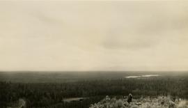
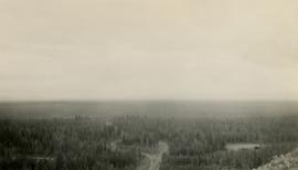
          Photograph depicts Mount Begbie, noted by Wyness to be the highest point on the Cariboo Highway at mile 85. Mount Begbie is located at approximately 51°28'33''N, 121°22'00''W, on the east side of Cariboo Hwy, between 70 Mile House and 100 Mile House, in the Lillooet Land District. Also visible in this photograph is the Cariboo Highway road.

          2020.05.06 · Item · October 1936
          Part of Gordon Wyness Album

          Photograph depicts Mount Begbie, noted by Wyness to be the highest point on the Cariboo Highway at mile 85. Mount Begbie is located at approximately 51°28'33''N, 121°22'00''W, on the east side of Cariboo Hwy, between 70 Mile House and 100 Mile House, in the Lillooet Land District. Also visible in this photograph is the Cariboo Highway road.

          Lone Butte, BC
          2020.05.22 · Item · Oct. 1936
          Part of Gordon Wyness Album

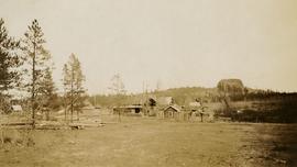
          Photograph depicts a view of Lone Butte, BC. The butte formation of the same name (Lone Butte) is visible in the background; a ranch or residence is visible in the foreground. Wyness notes that Lone Butte was the "last one [they] tied in". "Tying in" is a land surveying technique. Since the photograph is dated October 1936 and Wyness described the survey trip as lasting June 5 - October 8, 1936, that implies that Lone Butte was the last location they surveyed on this trip.

          Lois Richet
          2003.11.1.40 · File · 1999-2000
          Part of Island Cache Recovery Project Collection

          File consists of an oral history given by Lois Richet, which was gathered as part of Dr. Mike Evan's Island Cache Recovery Project. Includes consent forms, transcripts, and the recorded oral history on the original media.

          1996.8.4.55 · File · 1983
          Part of Chander Suri fonds

          File consists of a letter to Chander Suri from Burkhard Franz regarding interest in mining lots at multiple sites in the southern interior of BC. Accommpanied by a preliminary report by Rain, Metro and Memphis Groups of Claims for Mile Point Resources Mining Company examining mineral occurences near Slocan Lake. Includes a letter to Chander Suri, three mineral occurence photocopies, and a preliminary report evaluation of mineral occurences.

          Leo and Roseanne Goulet
          2001.58.11 · File · 1997-1998
          Part of Prince George Metis Elders Oral History Project Collection

          File consists of an oral history given by Leo and Roseanne Goulet, which was gathered as part of Dr. Mike Evan's oral history project with the Prince George Metis Elders Society. Includes consent forms, transcripts, and the recorded oral history on the original cassettes.

          Lena Loveng
          2001.58.15 · File · 1997-1998
          Part of Prince George Metis Elders Oral History Project Collection

          File consists of an oral history given by Lena Loveng, which was gathered as part of Dr. Mike Evan's oral history project with the Prince George Metis Elders Society. Includes consent forms, transcripts, and the recorded oral history on the original cassette.

          "Lease of Crownland 1972"
          1996.8.3.56 · File · 1973
          Part of Chander Suri fonds

          File consists of a planning study for the Regional District of Fraser-Fort George regarding the leasing of crown land in 1972.

          Lawrence Gervais
          2001.58.08 · File · 1997-1998
          Part of Prince George Metis Elders Oral History Project Collection

          File consists of an oral history given by Lawrence Gervais, which was gathered as part of Dr. Mike Evan's oral history project with the Prince George Metis Elders Society. Includes consent forms, transcripts, and the recorded oral history on the original cassettes.

          Larry Peters
          2003.11.1.37 · File · 1999-2000
          Part of Island Cache Recovery Project Collection

          File consists of an oral history given by Larry Peters, which was gathered as part of Dr. Mike Evan's Island Cache Recovery Project. Includes consent forms, transcripts, and the recorded oral history on the original media.

          2020.4.4.33 · Item · 2000
          Part of G. Gary Runka fonds

          Item is a report entitled "Landscaped Buffer Investigation" a summary prepared by BC Ministry of Agriculture, Fisheries and Food for the Land Reserve Commission.

          2020.4.2.1.62 · File · [June 1994]
          Part of G. Gary Runka fonds

          File consists of a speech given by Gary Runka entitled "Landscape Level Planning - Fitting People into the Watershed" at the Stewarding Our Watersheds Conference.

          Commentary on this speech by Barry Smith of the Ministry of Agriculture and Lands:
          "The first half of this speech takes a very broad sweep in defining landscape units and the provincial planning system. In the second section "Entering the People Use Maze", the paper focuses more locally on the Salmon River watershed and discusses the findings of a survey associated with the Langley Rural Plan.

          The survey results demonstrated that for both rural and non-rural residents in Langley, 'the country atmosphere' was why they had chosen to live in Langley. Residents also disagreed with the statement that it was unpleasant to live in an agriculture area.

          The third section - "Techniques of Integrating Balanced, Sustainable People Use" into the Watershed" considers eight tools that will assist achieving "landscape level" planning, one of which is the ALC Act.

          Besides these direct references to agriculture, country atmosphere and ALC Act; the Langley Rural Plan drew heavily on the survey that GGR refers to and the Plan, which was largely comprised of agricultural lands, was inspirational in the development of the Commission of work "Planning for Agriculture".

          2020.4.2.2.06 · Item · 1969
          Part of G. Gary Runka fonds

          Item is an original copy of "Lands of the East Kootenay: Their characteristics and capability for agriculture and forestry - Report to the B.C. Soil Capability for Agriculture and Forestry Committee", a co-operative interim report comprising sections and maps, compiled by G. G. Runka, Soils Division, BC Department of Agriculture. Other authors include J.R. Jungen, T. Lewis, J.R. Marshall, M.J. Romaine, J. van Barneveld, and U. Wittneben.

          2020.4.2.1.09 · File · 1974
          Part of G. Gary Runka fonds

          File consists of a speech given by Gary Runka entitled "Land Use Planning as it affects the Vegetable Industry".

          Commentary on this speech by Barry Smith of the Ministry of Agriculture and Lands:
          "GGR gives this speech as a representative of the B.C. Land Commission and is directed at vegetable industry reps.

          The ALR is mentioned a number of times and it is noted that only 1 - 2% of BC is suitable for vegetable production. Several examples (8) of pressures on agricultural land are given.

          GGR draws his audience's attention to the impact of speculation when stating:
          "Substantial capital gain from land development or speculation unfortunately can to some degree subvert even the best planning. .... Fortunately, this type of speculation is now on somewhat shaky ground because of the Land Commission Act in B.C."

          The overall message is that vegetable producers should involve themselves in land use planning."

          2020.4.2.1.33 · File · Jan. 1979
          Part of G. Gary Runka fonds

          File consists of a speech given by Gary Runka entitled "Land Use Planning and the Nursery Trades" to the BC Nursery Trades Association.

          Commentary on this speech by Barry Smith of the Ministry of Agriculture and Lands:
          "The primary thrust of the speech is to outline several pieces of legislation and other land uses that may have an impact on the nursery trade use of land including:

          1. Federal Fisheries Act;
          2. Municipal & regional district bylaws and plans;
          3. Agricultural Land Commission Act;
          4. Soil Conservation Act;
          5. Water Act and Floodplain Regulation;
          6. Forest and Range Acts; and
          7. Your neighbours changing land-use activities.

          GGR comments (p 2) that, "...exclusion (of land from the ALR) is only allowed on lands not capable of agricultural use where no impact would be effected on adjacent farmlands, or where absolutely no alternative for the alternate use proposed exists." This clarifies that land in the ALR, even if it is proven unsuitable for agriculture, may remain in the ALR if its exclusion impacts adjacent farmland. On the other hand, pressure on the ALR is acknowledged where claims can be successfully mounted that no alternative exists for a proposed use, demonstrating the continual vulnerability of the ALR and the need to be able to clearly assess claims of "no alternative".

          Foreshadowing the need for agricultural area planning, GGR suggests (p. 3) that it is important that, "... attempts be made to encourage local agricultural use planning so as to reduce conflicts within agriculture and with your urban neighbours."

          2020.4.2.1.24 · File · 2 Mar. 1978
          Part of G. Gary Runka fonds

          File consists of a speech given by Gary Runka to the BC Provincial Seed Fair in Fort St. John entitled "Land Use Planning and the Farmer".

          Commentary on this speech by Barry Smith of the Ministry of Agriculture and Lands:
          "Given the title and the audience, this speech reads like a wake-up call to farmers to pay attention to land use planning issues and get involved. Despite the available copy of the speech appearing as a draft the nature of the topic - farmers needing to get involved in land use planning - establishes a point that GGR obviously feels is important in the overall effort to preserve agricultural land.

          The speech includes several examples of land use planning that can affect the agricultural industry including:

          • Rural zoning by local governments and the provincial ALR zoning;
          • Hydro-electric planning (a reference in all probability to Site C);
          • Preparation of regional, community and particularly settlement plans;
          • Industrial land development strategies;
          • Federal fisheries legislation;
          • Transportation planning;
          • Crown land lease proposals;
          • Water resources;
          • Various other land use initiatives involving wildlife habitat, open space recreation, historic and archeological sites; and
          • Taxation and assessment policy

          Stapled to the original typed speech is a set of hand written notes (not copied) that are largely identical to the typed version. The typed version does have a few mysterious blanks but when checking the handwritten version the blanks may simply represent illegibility problems with the hand writing at the time of typing. Given these blanks, this may in fact have been a first draft of the speech with a cleaner copy typed up prior to delivery."

          2020.4.2.1.17 · File · 29 Sept. 1976
          Part of G. Gary Runka fonds

          File consists of a speech given by Gary Runka to the Canadian Council on Rural Development entitled "Land Use Control".

          Commentary on this speech by Barry Smith of the Ministry of Agriculture and Lands:
          "This is another important document.

          GGR covers several points including a discussion of the impact of changes to rural areas from the food producer's perspective. He notes that local governments are not well positioned to effectively achieve farmland preservation - but there is a need for a coordinated approach.

          The point is made that good rural planning depends on good urban planning.

          A summary is made of efforts at rural planning and farmland preservation in other North American jurisdictions. An example is outlined of the complexity of overlapping land use controls and returns to a common theme - "merging the reality of land as a commodity with the ethic of land as a natural resource"."

          2020.4.2.1.12 · File · 7 Nov. 1974
          Part of G. Gary Runka fonds

          File consists of a speech given by Gary Runka to the Agricultural Institute of Canada Land Use Committee entitled "Land Use Control and Jurisdictional Rights".

          Commentary on this speech by Barry Smith of the Ministry of Agriculture and Lands:
          "This is a first draft position paper written by GGR was developed for the Agricultural Institute of Canada, Land Use Committee.

          The paper notes that attitudes are shifting from land being considered as a commodity to considering land as a natural resource. There are several references to governmental relationships, the inability to count on local governments to preserve agricultural land and the need for a federal land use policy supporting farmland preservation.

          The use of a zoning tool as an effective means to preserve agricultural land is explored. The paper makes a strong case for there being no legal need for compensating land owners for regulatory land use zoning.

          Included with the package are two letters written by GGR (November 7,1974) sent to Jim Lore (Alberta) and Steve Hart (Ottawa) requesting their review of the paper and input. A copy of the finalized paper, which may have been a jointly authored paper, is not included and it is not known if the paper was eventually published by the Agricultural Institute of Canada."

          "Land Settlement: A Report"
          2012.13.2.02.64 · File · 1941
          Part of J. Kent Sedgwick fonds

          File consists of a bound typescript book titled "Land Settlement (A report by a C.S.T.A Committee)" produced by the Canadian Society of Technical Agriculturists in 1941.

          2020.4.5.03 · File · 1978-2005
          Part of G. Gary Runka fonds

          File contains a "Master Key" for geographical locations of G. Gary Runka Land Sense Ltd. client jobs located in the Lower Fraser Valley between Vancouver and Langley. The "Master Key" consists of an annotated book: "Soils of the Langley-Vancouver Map Area - Report No. 15 British Columbia Soil Survey - Volume 1 Soil Map Mosaics and Legend, Lower Fraser Valley (Scale 1:25,000)" by H.A. Luttmerding. The numbers adjacent to the annotated outlined areas are LSL client numbers, which not only provide a key to work locations within the region but may also assist in matching unidentified aerial photographs to corresponding client files.

          Land Sense Ltd. job ledger
          2020.4.5.04 · File · 1978-1980
          Part of G. Gary Runka fonds

          File contains the first G. Gary Runka Land Sense job ledger (1 Dec. 1978 - 1 Dec. 1980). Includes detailed handwritten daily accounting and travel records that correlates to work for clients and jobs.

          2020.4.5.01 · File · 1978-2018
          Part of G. Gary Runka fonds

          File consists of folders containing company information for G. G. Runka Land Sense Limited. Includes photocopied documents of company incorporation (30 Nov. 1978) and dissolution (30 Nov. 2018) for G. G. Runka Land Sense Limited. Also includes a company description, a philosophy statement, a services summary, a brief biography and resume of G. Gary Runka, a client list, a completed projects list, blank letterhead, a presentation pamphlet, company logo, and business cards.