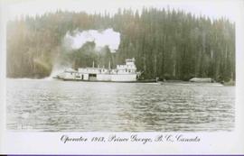
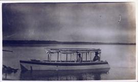
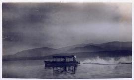
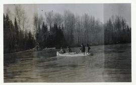
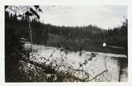
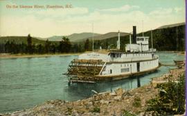
Postcard photograph depicts sternwheeler in river, trees on opposite shore in background.
Printed annotation on recto reads: “Operator 1913, Prince George, B.C. Canada”, handwritten in pencil on verso: “Operator 1913”.
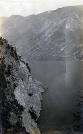
Photograph depicts a Pacific Great Eastern Railway tunnel along Anderson Lake. The current railway mileage for the location is 125.6 (historical mileage point would have differed). The location is 3.7 miles north of D'Arcy, near the southern end of Anderson Lake. This photograph was likely taken from vantage point of the summer-only Highline Road.
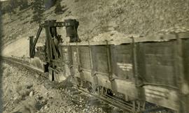
Photograph depicts an early model Jordan Spreader used in the construction of the Pacific Great Eastern Railway. A railway worker is standing on the spreader. The stencil on equipment states "P.G.W.R.R.". The flora suggests that this photograph may have been taken somewhere in the Lillooet/Clinton area.
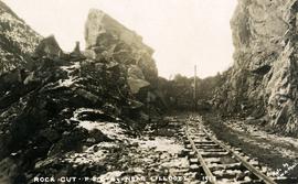
Photograph depicts the making of a rock cut on the Pacific Great Eastern Railway line at the Lillooet end of Seton Lake during railway construction.
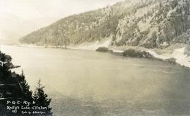
Photograph depicts "Kelly's Lake" (now known as Kelly Lake) in Clinton, as well as the Pacific Great Eastern Railway line along the lake.
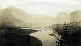
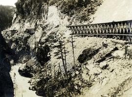
Photograph depicts a view of the Pacific Great Eastern Railway bridge across the Fraser River at Lillooet.
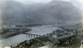
Photograph depicts a view of the Pacific Great Eastern Railway bridge across the Fraser River and the nearby Lillooet surrounding area. The photograph shows Lillooet looking up Town Creek Valley. Chinese gold washing activity is visible nearby the bridge.
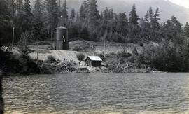
Photograph depicts a railway water tower, a small building, and a rail line along a lake shore. This is a close-up of the area depicted in image 2020.08.84. The water tank is a typical PGE 25,000 gallon water tank. The station would be a little over 400 feet south of the tank.
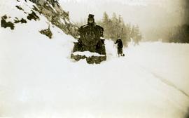
Photograph depicts a Pacific Great Eastern Railway locomotive in deep snow. A person, possibly a woman, stands near the train as snow continues to fall. The location is unknown, but may be Alta Lake or Squamish.
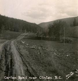
Photograph depicts the Cariboo Road near Clinton, B.C.
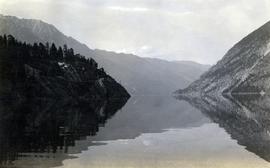
Photograph depicts a view of Anderson Lake at D'Arcy looking northeast. The Pacific Great Eastern Railway line is visible, including a small railway trestle.
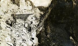
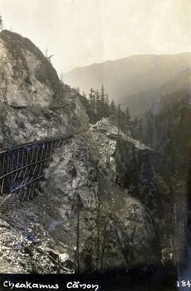
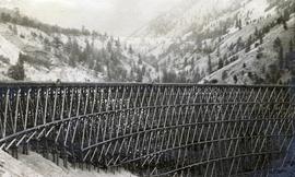
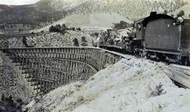
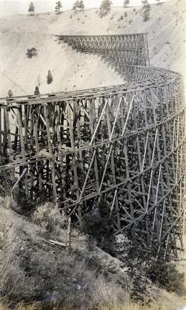
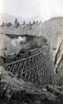
Photograph depicts a Pacific Great Eastern Railway wooden trestle in Cheakamus Canyon at 19 mile.
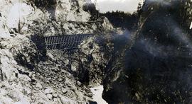
Photograph depicts a Pacific Great Eastern Railway wooden trestle in Cheakamus Canyon.
Photograph depicts a Pacific Great Eastern Railway wooden trestle in Cheakamus Canyon.
Photograph depicts a Pacific Great Eastern Railway wooden trestle in Cheakamus Canyon.
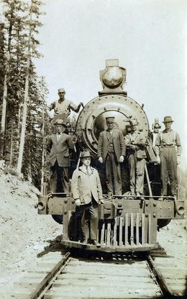
Photograph depicts Pacific Great Eastern Railway #52 locomotive with railway workers posed on the locomotive for a posed portrait.
More information about the locomotive:
Pacific Great Eastern #52 locomotive was built by Montreal Locomotive Works in 1913 and delivered to the PGE in November of that year together with a second identical locomotive, Pacific Great Eastern #51. They were relatively light road locomotives of the Consolidation type (2-8-0 wheel arrangement) and, prior to dieselization of the railway in the late 1940s - early 1950s, were the only Montreal-built locomotives the railway owned. All subsequent steam locomotives built new for the Railway came from the Canadian Locomotive Company in Kingston, Ontario. There were also two earlier second-hand locomotives which the PGE acquired when it took over the Howe Sound & Northern Railway (previously the Howe Sound, Pemberton Valley & Northern Railway) and two additional steam locomotive purchased second-hand from the U.S.
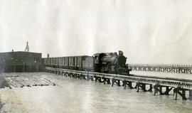
Photograph depicts a Pacific Great Eastern Railway train at the Squamish dock.
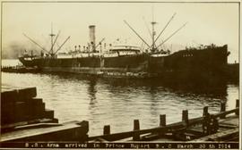
Photograph of ocean liner SS Arna docked in a harbour. Foreground shows two individuals on a dock in the lower right corner and a large pile of lumber in the lower left corner. Annotation on recto reads: "S.S. Arna arrived in Prince Rupert B.C March 30th 1914"
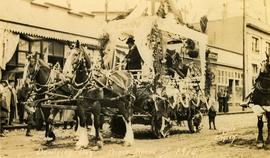
Photograph depicts a team of Clydesdale horses pulling a decorated wagon. Printed annotation on recto reads: “Dominion Day Prince Rupert BC 1914” Handwritten annotation in pencil on verso reads: “1914 Dominion Day Prince Rupert.” Handwritten annotation in ink on verso is addressed to “Mrs. Herbert Hampton New Harvey House Niagara Falls New York” Cancelation mark on Canadian 1 cent stamp is dated: July 22, 14
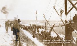
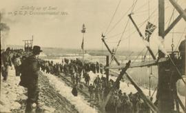
The last spike ceremony was held on April 7, 1914 one mile east of Fort Fraser, BC.
Photograph taken from a small hill looking down on a crowd of men gathered around the Grand Trunk Pacific railway tracks in the winter. Printed annotation on recto reads: "Linking up of Steel on G.T.P. Transcontinental 1914."
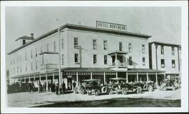
Photograph depicts hotel on corner of street, crowd and cars in foreground.
Handwritten annotation on verso “Albert Johnson’s 'Northern Hotel' South Fort George 1914".
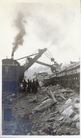
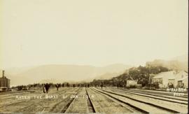
Wide angle photograph of a crowd milling around railroad tracks. A large pile of rubble and various buildings are visible on the right side. Annotation on recto reads: "After the Blast 21 Jan 1914 McRae Bros Photo."
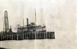
Photograph depicts the "MV Ballena" docked at a wharf. The Ballena was a passenger ferry built in 1892 by the Albion Iron Works Company of Victoria and originally named the Joan. This ship was sold to the Terminal Steam Navigation Company in 1914 and renamed the Ballena. It was later acquired by the Union Steamship Company in 1920 but burned at the Union dock in November of that year.
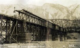
Photograph depicts the Pacific Great Eastern Railway bridge under construction on the original route at Lillooet, which was active 1915 to 1931. Including its approach spans, the bridge was 2,630 ft. long, almost exactly half a mile. The mileage on the PGE's original mileage system was 120.6.
Photograph depicts the Pacific Great Eastern Railway bridge under construction on the original route at Lillooet, which was active 1915 to 1931. Including its approach spans, the bridge was 2,630 ft. long, almost exactly half a mile. The mileage on the PGE's original mileage system was 120.6.
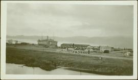
Photograph depicts a large ship behind dock buildings. Railroad crosses foreground, hills visible on shore in background.
Handwritten annotation on verso reads: "Drydock Prince Rupert".
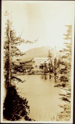
Photograph depicts buildings visible through clearing in trees. Water crosses foreground, hills visible in background.
Handwritten annotation on verso reads: "Dry dock / Prince Rupert B.C."
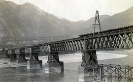
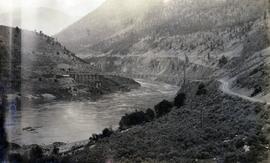
Photograph depicts the Pacific Great Eastern Railway bridge when the railway operated on the east side of the Fraser River.
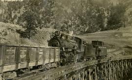
Photograph depicts a Pacific Great Eastern Railway train on Pavilion Creek trestle at Mile 20.3. The train includes Locomotive #56, built by Canadian Locomotive Company of Kingston, Ontario, in August 1914, together with caboose C2, built by National Steel Car of Hamilton, Ontario in 1914 and a “Hart Convertible Car” #140 stencilled with indeterminable initials. These cars were convertible gondolas which were used as ballast cars with the ability to dump ballast either between or outside the rails depending on whether the centre floor doors or the side doors were opened. This particular car, which was scrapped in 1949, was part of a group of 15 cars remaining in number series 131 - 195 (not all numbers used) known on the PGE as “Red Harts” to distinguish them from a somewhat more modern version in number series 201 - 240 (again, not all numbers used) known as “Black Harts”.
The ca. 1921-1927 “PGE Bridge List” from the notebook of William H. Hewlett (1914-1968) references a 389.4 foot long, 34 ft. high, framed trestle with 26 spans of 14.8 feet at Mile 20.3 carrying the line over Pavilion Creek. There was a water tank at Pavilion located between the North end of the siding and the South end of the trestle. A track profile chart confirms that the track at this point is on a 12 degree curve.
"Canadian Railway and Marine World" reported in their January 1916 issue (p. 11, c.1), that track had been laid to within ½ mile of Clinton (Mile 45.0) on Dec. 14, 1915. If a constant rate of construction had been maintained from Mile 14, reached on July 30, 1915 as previously discussed, to Clinton, the approximate date of completion to Pavilion would be around the end of August, 1915 which is probably the earliest possible date for this photograph.
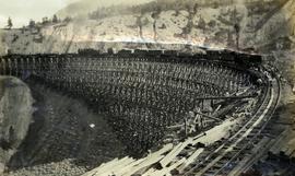
Photograph depicts a Pacific Great Eastern Railway work train on a trestle located near Sallus Creek in the area around Lillooet, Fountain, and Pavilion. The work train appears to be carrying railway ties. Railway workers work on the track behind the train with piles of unused rail ties nearby.
Photographs 2020.08.68, 2020.08.69, and 2020.08.70 are three views of track laying on the Sallus Creek trestle. These form a sequence: 2020.08.68, 2020.08.70, 2020.08.69 in order as track laying proceeds from the South end of the trestle toward the North end. The piece of equipment at the North end of the train in all three images is a track laying machine that lifted a piece of rail and delivered it to the workmen ahead of the machine. "Canadian Railway and Marine World" reported that track had been laid to 14 miles North of Lillooet by July 30, 1915 (CR&MW , Sept 1915, p341, c2). 14 miles North of Lillooet is approximately 20 rail lengths beyond the North end of this trestle, leading to a "best estimate" of late July 1915 as the date for this photograph.
The ca. 1921-1927 “PGE Bridge List” from the notebook of William H. Hewlett (1914-1968) references a Mile 13.7, 14 Mile Creek, frame trestle, 905 ft. long, 182 ft. high, 61 spans of 14.8 feet in the Lillooet Subdivision. A “PGE Track Profile” drawing shows this trestle was on a 1.55% grade and a 12 degree left hand curve. While the drawing had been revised at least twice (with an unknown date for the most recent revision), the pre-“Lillooet Diversion of 1931" mileage figures confirm that the 1915 “Mile 13.7" was in agreement with a more recent hand written note “Sallus Creek”. The trestle appears to have gone by the names "14 Mile" trestle, "13.7 Mile Trestle", and "Sallus Creek" trestle.
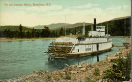
Stern wheeler “Port Simpson” tied to riverbank. Printed annotation on recto reads: “On the Skeena river, Hazelton, B.C.” Handwritten message on verso is addressed to “Mrs. Flossie Strong 6 Nah St. Watermill ME, U.S.A” 1 cent Canadian postage stamp has been canceled with a date of “Dec 24, 5:30 PM 1915 Buffalo N.Y.”
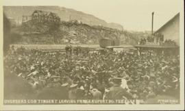
Slightly overhead shot of a large crowd gathered by general store and railroad. Annotation on recto reads: "Overseas contingent leaving Prince Rupert BC Feb 26th 1915. McRae Bros."
Photograph depicts the Pacific Great Eastern Railway trestle located near Sallus Creek in the area around Lillooet, Fountain, and Pavilion. "Canadian Railway and Marine World" reported that track had been laid to 14 miles North of Lillooet by July 30, 1915 (CR&MW , Sept 1915, p341, c2). 14 miles North of Lillooet is approximately 20 rail lengths beyond the North end of this trestle, leading to a "best estimate" of very late July 1915 or later as the earliest dates for this photograph.
The ca. 1921-1927 “PGE Bridge List” from the notebook of William H. Hewlett (1914-1968) references a Mile 13.7, 14 Mile Creek, frame trestle, 905 ft. long, 182 ft. high, 61 spans of 14.8 feet in the Lillooet Subdivision. A “PGE Track Profile” drawing shows this trestle was on a 1.55% grade and a 12 degree left hand curve. While the drawing had been revised at least twice (with an unknown date for the most recent revision), the pre-“Lillooet Diversion of 1931" mileage figures confirm that the 1915 “Mile 13.7" was in agreement with a more recent hand written note “Sallus Creek”. The trestle appears to have gone by the names "14 Mile" trestle, "13.7 Mile Trestle", and "Sallus Creek" trestle.
Photograph depicts a Pacific Great Eastern Railway work train on a trestle located near Sallus Creek in the area around Lillooet, Fountain, and Pavilion. The work train appears to be carrying railway workers and a load of rails.
Photographs 2020.08.68, 2020.08.69, and 2020.08.70 are three views of track laying on the Sallus Creek trestle. These form a sequence: 2020.08.68, 2020.08.70, 2020.08.69 in order as track laying proceeds from the South end of the trestle toward the North end. The piece of equipment at the North end of the train in all three images is a track laying machine that lifted a piece of rail and delivered it to the workmen ahead of the machine. "Canadian Railway and Marine World" reported that track had been laid to 14 miles North of Lillooet by July 30, 1915 (CR&MW , Sept 1915, p341, c2). 14 miles North of Lillooet is approximately 20 rail lengths beyond the North end of this trestle, leading to a "best estimate" of late July 1915 as the date for this photograph.
The ca. 1921-1927 “PGE Bridge List” from the notebook of William H. Hewlett (1914-1968) references a Mile 13.7, 14 Mile Creek, frame trestle, 905 ft. long, 182 ft. high, 61 spans of 14.8 feet in the Lillooet Subdivision. A “PGE Track Profile” drawing shows this trestle was on a 1.55% grade and a 12 degree left hand curve. While the drawing had been revised at least twice (with an unknown date for the most recent revision), the pre-“Lillooet Diversion of 1931" mileage figures confirm that the 1915 “Mile 13.7" was in agreement with a more recent hand written note “Sallus Creek”. The trestle appears to have gone by the names "14 Mile" trestle, "13.7 Mile Trestle", and "Sallus Creek" trestle.
Photograph depicts a partially constructed Pacific Great Eastern Railway trestle located near Sallus Creek in the area around Lillooet, Fountain, and Pavilion. "Canadian Railway and Marine World" reported that track had been laid to 14 miles North of Lillooet by July 30, 1915 (CR&MW , Sept 1915, p341, c2). 14 miles North of Lillooet is approximately 20 rail lengths beyond the North end of this trestle, leading to a "best estimate" of early-mid July 1915 as the latest date for this photograph.
The ca. 1921-1927 “PGE Bridge List” from the notebook of William H. Hewlett (1914-1968) references a Mile 13.7, 14 Mile Creek, frame trestle, 905 ft. long, 182 ft. high, 61 spans of 14.8 feet in the Lillooet Subdivision. A “PGE Track Profile” drawing shows this trestle was on a 1.55% grade and a 12 degree left hand curve. While the drawing had been revised at least twice (with an unknown date for the most recent revision), the pre-“Lillooet Diversion of 1931" mileage figures confirm that the 1915 “Mile 13.7" was in agreement with a more recent hand written note “Sallus Creek”. The trestle appears to have gone by the names "14 Mile" trestle, "13.7 Mile Trestle", and "Sallus Creek" trestle.
Photograph depicts a Pacific Great Eastern Railway work train on a trestle located near Sallus Creek in the area around Lillooet, Fountain, and Pavilion. The work train appears to be carrying railway ties.
Photographs 2020.08.68, 2020.08.69, and 2020.08.70 are three views of track laying on the Sallus Creek trestle. These form a sequence: 2020.08.68, 2020.08.70, 2020.08.69 in order as track laying proceeds from the South end of the trestle toward the North end. The piece of equipment at the North end of the train in all three images is a track laying machine that lifted a piece of rail and delivered it to the workmen ahead of the machine. In this photograph, the machine is at the current end of track and is ready to advance the next length of rail."Canadian Railway and Marine World" reported that track had been laid to 14 miles North of Lillooet by July 30, 1915 (CR&MW , Sept 1915, p341, c2). 14 miles North of Lillooet is approximately 20 rail lengths beyond the North end of this trestle, leading to a "best estimate" of late July 1915 as the date for this photograph.
The ca. 1921-1927 “PGE Bridge List” from the notebook of William H. Hewlett (1914-1968) references a Mile 13.7, 14 Mile Creek, frame trestle, 905 ft. long, 182 ft. high, 61 spans of 14.8 feet in the Lillooet Subdivision. A “PGE Track Profile” drawing shows this trestle was on a 1.55% grade and a 12 degree left hand curve. While the drawing had been revised at least twice (with an unknown date for the most recent revision), the pre-“Lillooet Diversion of 1931" mileage figures confirm that the 1915 “Mile 13.7" was in agreement with a more recent hand written note “Sallus Creek”. The trestle appears to have gone by the names "14 Mile" trestle, "13.7 Mile Trestle", and "Sallus Creek" trestle.
Photograph depicts a Pacific Great Eastern Railway train on Pavilion Creek trestle at Mile 20.3. Also visible are a water tank and possibly the graveyard at Pavilion.
The ca. 1921-1927 “PGE Bridge List” from the notebook of William H. Hewlett (1914-1968) references a 389.4 foot long, 34 ft. high, framed trestle with 26 spans of 14.8 feet at Mile 20.3 carrying the line over Pavilion Creek. There was a water tank at Pavilion located between the North end of the siding and the South end of the trestle. A track profile chart confirms that the track at this point is on a 12 degree curve. This photograph was taken from a vantage point up the hill to the North. The structures at the lower left of this image (2020.08.82) are consistent with a small construction camp, which accounts for the presence of a camp cook in image 2020.08.83.
"Canadian Railway and Marine World" reported in their January 1916 issue (p. 11, c.1), that track had been laid to within ½ mile of Clinton (Mile 45.0) on Dec. 14, 1915. If a constant rate of construction had been maintained from Mile 14, reached on July 30, 1915 as previously discussed, to Clinton, the approximate date of completion to Pavilion would be around the end of August, 1915 which is probably the earliest possible date for this photograph.
Postcard photograph depicts sternwheeler tied to riverbank.
Printed annotation on recto reads: “On the Skeena river, Hazelton, B.C.” Handwritten message on verso is addressed to “Mrs. Flossie Strong 6 Nah St. Watermill ME, U.S.A” 1 cent Canadian postage stamp has been canceled with stamp reading “Dec 24, 5:30 PM 1915 Buffalo N.Y.”
