Giscome, BC

Elements area

Taxonomy

Code

Scope note(s)

    Source note(s)

      Display note(s)

        Hierarchical terms

        Giscome, BC

          Equivalent terms

          Giscome, BC

            Associated terms

            Giscome, BC

              80 Archival description results for Giscome, BC

              80 results directly related Exclude narrower terms
              2011.12 · Collection · September 1950 - June 1951

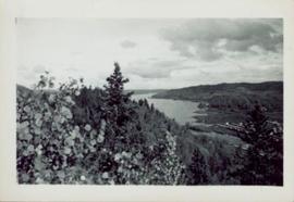
              This photograph collection consists of 53 photographs featuring primarily Giscome with a few of Prince George. Subjects include the Eagle Lake Sawmill, Eagle Lake, Giscome townsite (including specific buildings and general road perspectives), Giscome School, Division II class photos (1950-51), and the Giscome School teacherage.

              2011.12.05 · Item · [ca. September 1950- June 1951]
              Part of Giscome, BC Historical Photograph collection

              Photograph of various plant life with Eagle Lake visible in the background. Handwritten annotation in pen on verso reads: “Eagle Lake from the top of the bluff. Eagle Lake is about 7 miles long & about 1 mile wide. It is a fair sized lake.”

              2011.12.09 · Item · [ca. September 1950- June 1951]
              Part of Giscome, BC Historical Photograph collection

              Street view featuring a dirt road leading directly to Giscome School, a three room institution. On the right the steeple of the Catholic church is visible, beside which was Neff’s (sp?) corner store. Handwritten annotation in pen on verso reads: “Looking up our street. The school is at the end.”

              East Line Duplicate Slides
              2012.13.1.087 · Subseries · [between 1970 and 2000]
              Part of J. Kent Sedgwick fonds

              File contains slides depicting places along the east line of the BC Railway. Some are duplicates of the images found in the "East Line, Dome Creek - Lamming Mills - Misc" file.

              Open Field in Giscome
              2012.13.1.87.068 · Item · [between 1975 and 1995]
              Part of J. Kent Sedgwick fonds

              Image depicts a field in Giscome, B.C. On the right side of the image, in the background, is a grey strip that appears to be a mine, possibly the quarry at Eaglet Lake in Giscome, B.C. Map coordinates 54°03'52.9"N 122°22'10.0"W

              Open Field in Giscome
              2012.13.1.87.069 · Item · [between 1975 and 1995]
              Part of J. Kent Sedgwick fonds

              Image depicts a field in Giscome, B.C. On the right side of the image, in the background, is a grey strip that appears to be a mine, possibly the quarry at Eaglet Lake in Giscome, B.C. Map coordinates 54°03'52.9"N 122°22'10.0"W

              Giscome Landscape
              2012.13.1.87.071 · Item · [between 1975 and 1995]
              Part of J. Kent Sedgwick fonds

              Image depicts an open area with Eaglet Lake in the background. It depicts the previous site of the mill at Giscome, B.C. Map coordinates 54°04'19.7"N 122°22'04.7"W

              Houses in Giscome
              2012.13.1.87.072 · Item · [between 1975 and 1995]
              Part of J. Kent Sedgwick fonds

              Image depicts the Giscome B.C. townsite from across the railroad tracks looking southeast. Map coordinates 54°04'19.7"N 122°22'04.7"W

              Houses and Train in Giscome
              2012.13.1.87.073 · Item · [between 1975 and 1995]
              Part of J. Kent Sedgwick fonds

              Image depicts the Giscome B.C. townsite from across the railroad tracks looking southeast. Map coordinates 54°04'19.7"N 122°22'04.7"W

              Giscome Quarry
              2012.13.1.87.074 · Item · [between 1975 and 1995]
              Part of J. Kent Sedgwick fonds

              Image depicts what is possibly the quarry located at Eaglet Lake in Giscome, B.C.

              House - Elevated Main Floor
              2012.13.1.87.079 · Item · [between 1975 and 1995]
              Part of J. Kent Sedgwick fonds

              Image depicts a house with the main floor and entrance high off the ground. The location is uncertain, likely Giscome, B.C.

              Giscome Dairy Farm
              2012.13.1.87.083 · Item · [between 1975 and 1995]
              Part of J. Kent Sedgwick fonds

              Image depicts a large, old and collapsing barn, as well as a nearby house of the dairy farm in Giscome, B.C. Map coordinates 54°03'53.3"N 122°21'22.6"W

              Giscome School - Before
              2012.13.1.87.084 · Item · [between 1980 and 2000?]
              Part of J. Kent Sedgwick fonds

              Image depicts the Giscome mill site in Giscome, B.C. The bunkhouse is in the background on the left and the school is in the foreground on the right. Map coordinates 54°04'04.8"N 122°22'04.7"W

              Giscome School - After
              2012.13.1.87.085 · Item · [between 1975 and 1995]
              Part of J. Kent Sedgwick fonds

              Image depicts the Giscome mill site in Giscome, B.C. The bunkhouse is no longer there and the school is in the foreground on the right. Map coordinates 54°04'04.8"N 122°22'04.7"W

              2012.13.1.87.086 · Item · [between 1980 and 2000]
              Part of J. Kent Sedgwick fonds

              Image depicts the Giscome mill site in Giscome, B.C. The bunkhouse is the large building with many windows. A train and railroad tracks are in the foreground. Map coordinates 54°04'17.6"N 122°22'06.1"W

              2012.13.1.87.087 · Item · [between 1975 and 1995]
              Part of J. Kent Sedgwick fonds

              Image depicts the Giscome mill site in Giscome, B.C. The railroad tracks are in the foreground. Map coordinates 54°04'17.6"N 122°22'06.1"W

              Giscome - Eaglet Lake
              2012.13.1.87.090 · Item · [between 1980 and 2000]
              Part of J. Kent Sedgwick fonds

              Image depicts mill site and dock in Giscome, B.C. with Eaglet Lake in the background covered in ice. There is a large crowd of people gathered near the dock. Map coordinates 54°04'34.9"N 122°21'50.0"W

              Street in Giscome - Before
              2012.13.1.87.093 · Item · [between 1980 and 2000]
              Part of J. Kent Sedgwick fonds

              Image depicts a street in Giscome B.C. The Giscome Store is located on the left side of the image with the church in the background. Map coordinates 54°04'18.5"N 122°21'57.7"W

              Street in Giscome - After
              2012.13.1.87.094 · Item · [between 1980 and 2000]
              Part of J. Kent Sedgwick fonds

              Image depicts a street in Giscome. The store was previously located on the left. The church is in the background. Map coordinates 54°04'18.5"N 122°21'57.7"W

              Giscome - Power Poles
              2012.13.1.87.098 · Item · [between 1975 and 1995]
              Part of J. Kent Sedgwick fonds

              Image depicts the remains of a street of houses in Giscome, B.C. The quarry is slightly visible in the background. Map coordinates 54°04'20.9"N 122°21'53.1"W

              Giscome Dairy Farm
              2012.13.1.87.141 · Item · [between 1975 and 1995]
              Part of J. Kent Sedgwick fonds

              Image depicts the dairy farm in Giscome, B.C. Map coordinates 54°03'53.3"N 122°21'22.6"W

              Giscome Dairy Farm
              2012.13.1.87.152 · Item · [between 1975 and 1995]
              Part of J. Kent Sedgwick fonds

              Image depicts the dairy farm in Giscome, B.C. Map coordinates 54°03'53.3"N 122°21'22.6"W