Buildings and Structures

Elements area

Taxonomy

Code

Scope note(s)

  • Includes: buildings; monuments and statues; bridges and trestles; building management; construction.
  • DO NOT USE for records pertaining to activities carried out in or on a building or structure, unless the building and the activity are directly related (e.g. hotels).

Source note(s)

  • MemoryBC Subject Groups

Display note(s)

    Hierarchical terms

    Buildings and Structures

      Equivalent terms

      Buildings and Structures

        Associated terms

        Buildings and Structures

          4441 Archival description results for Buildings and Structures

          4441 results directly related Exclude narrower terms
          2009.5.3.29 · Item · [ca. 1912]
          Part of Taylor-Baxter Family Photograph Collection

          Photograph depicts two men standing in street at the Fort George Reserve. A church with steeple stands in midground, on left side of street. Forest in background. Handwritten annotation on verso and recto of this photograph reads: "Fort George Temple." See item 2009.5.3.28 for photograph depicting this reserve which belonged to the Lheidli T'enneh Band.

          Church
          2012.13.1.6.098 · Item · Aug. 1979
          Part of J. Kent Sedgwick fonds

          Image depicts a church, somewhere between Hazelton and Hagwilget, B.C.

          Chimney Lake
          2012.13.1.52.01 · Item · May 1979
          Part of J. Kent Sedgwick fonds

          Image depicts Chimney lake with a number of houses near the shore, and a child in the foreground.

          2009.7.1.056 · Item · [between 1874 and 1901]
          Part of Archdeacon W. H. Collison fonds

          Several unidentified individuals can be seen on front steps of church and a group of small children in white stand in line below steps. Other community buildings are visible in background, white fence crosses foreground. Photograph depicts the first church built in Metlakatla, which was burned in a fire in 1901, and replaced in 1903.

          Handwritten annotation on verso reads: "Church (of England) at Metlakahtla - British Columbia. Built by the people of the village - largest church then on the pacific coast."

          2009.7.1.057 · Item · [between 1874 and 1901]
          Part of Archdeacon W. H. Collison fonds

          Several unidentified individuals can be seen on front steps of church and a group of small children in white stand in line below steps. Other community buildings are visible in background, white fence crosses foreground. Photograph depicts the first church built in Metlakatla, which was burned in a fire in 1901, and replaced in 1903.

          Handwritten annotation on verso reads: "Old church at Metlakatla Before fire. Built by Fr. Duncan & the village people".

          Children at play
          2009.7.1.164 · Item · [ca. 1910]
          Part of Archdeacon W. H. Collison fonds

          Seven young boys enjoying a game of tug-a-war alongside a wooden track. Track runs along a picket fence through a village. A small girl watches the fun from the sidelines and older woman carries a basket in the background. Handwritten annotation in pen on verso reads: “Native children at play”.

          2012.13.1.65.07 · Item · May 1975
          Part of J. Kent Sedgwick fonds

          Image depicts a sign titled "Chilcotin Wildlife Management Area" somewhere near Riske Creek, B.C. It reads: "This trail has been provided by the Fish and Wildlife Branch in co-operation with Riske Creek Ranching Ltd., as access to the Chilcotin Wildlife Management Area. Please do not leave the the trail as the surrounding land is private property."

          2009.7.1.104 · Item · [ca. 1878 - ca. 1915]
          Part of Archdeacon W. H. Collison fonds

          Photograph depicts two men standing at base of totem pole in front of large elaborate lodge building with post reading "MINESQU". Smaller structure stands in background (elevated cache?).

          Handwritten annotation on verso reads: "Chapter XXIV. No. 3. A chief's lodge and totem Nass River."

          2009.7.1.154 · Item · [ca. 1880 - ca. 1915]
          Part of Archdeacon W. H. Collison fonds

          Two carved poles stand in foreground, a third smaller pole visible by wood structure in background.

          The pole at left is the Chief Skedans mortuary pole, which was raised in the Haida village of Skidegate about 1870. It honours the Raven Chief of Skedans and depicts the chief's hereditary crests. The two tiny figures in the bear's ears are the chief's daughter and son-in-law who erected the pole and gave a potlach for the chief's memorial. The rectangle board at the top of the original pole covered a cavity that held the chief's remains.

          The pole at left may be a whale pole.

          Handwritten annotation on verso reads: "For heading of Page 12. Fin Back Whale Crest. [?] Totems, S.E. Alaska". This original annotation is believed to be incorrect.

          Chetwynd
          2012.13.1.91.32 · Item · Nov. 1978
          Part of J. Kent Sedgwick fonds

          Image depicts a view of Chetwynd, possibly from Highway 97.

          2009.5.3.24 · Item · [ca. 1914]
          Part of Taylor-Baxter Family Photograph Collection

          Photograph depicts four men standing near fully packed horse-drawn cart in front of wood buildings, including a long building with a porch and chairs. Trees on hill visible in background. Handwritten annotation on recto of photograph: "Changing teams on the Cariboo Road".

          Chander Suri fonds
          1996.8 · Fonds · 1954-2009

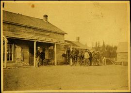
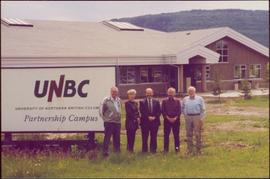
          This fonds encompasses the planning career of Chander Suri. The head planner for the Regional District of Fraser-Fort George from 1969 to 1977, Chander Suri embarked on numerous community plan projects in the Prince George area. Suri also worked as an independent planning consultant for local businesses and organizations. Chander Suri's records encompass numerous urban and rural projects facilitating population and industry growth within the RDFFG that spanned beyond Suri's career.

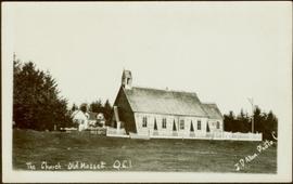
          Textual records comprise official and draft planning documents, development reports, planning proposals, contracts, published regulations, socio-economic studies of regions near Prince George, financial and other studies for development sites, illustrated promotional packages/proposals for developments, regional/provincial guides and standards, and correspondence relating to Suri's professional consulting activities. The fonds contains a wide array of maps, architectural plans, and technical drawings ranging from municipal planning layouts, industrial land developments, and private property (commercial and residential) development projects, mainly from in and around Prince George.

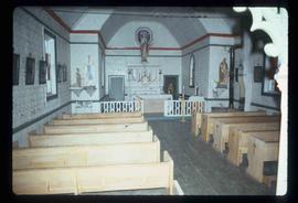
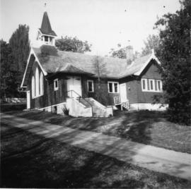
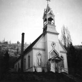
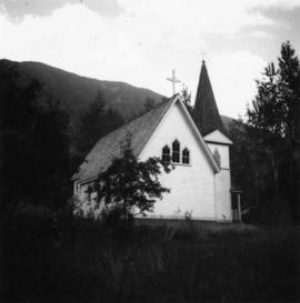
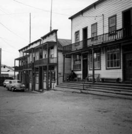
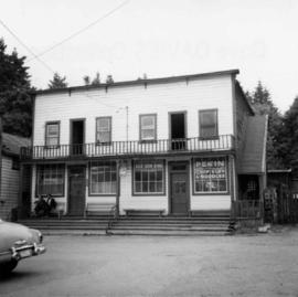
          These records are relevant to researchers of the subjects of land use, land development and land planning issues in the Prince George and Fraser-Fort George Regional District in the second half of the 20th century.

          Series include:

          1. Maps and Plans relating to development projects in British Columbia, predominantly in the Prince George area
          2. Lower Mainland Planning material from Suri's early career period
          3. Regional District of Fraser Fort George Planning records and resource material collected by Suri during his employment at the RDFFG
          4. Planning Consultancy records relating to Suri’s independent planning consultancy work in his later career period
          Suri, Chander
          2009.6.1.553 · Item · [1992?]
          Part of The Honourable Iona Campagnolo fonds

          Left to right: Charles Jago and unidentified woman, David Fish, Dennis Macknak, Deborah Poff, unidentified woman and child, Iona Campagnolo, Lee Morrison, Ellen Facey, two unidentified women. Teepees visible in background. Photograph was taken during the chancellor's tour of Xats'ull Heritage Village, Soda Creek First Nation, Williams Lake, B.C.

          2009.6.1.556 · Item · [1992?]
          Part of The Honourable Iona Campagnolo fonds

          Unidentified women stands in centre background with arm raised, and a young girl sits on post in foreground. Photograph was taken during the chancellor's tour of Xats'ull Heritage Village, Soda Creek First Nation, Williams Lake, B.C.

          Handwritten annotation on verso reads: "UNBC 1992".