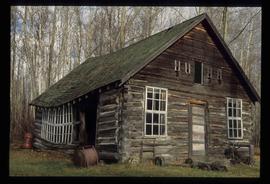
Photograph depicts (from left to right) Philip Monckton, Gordon Wyness, and Lavender Monckton at the Beaverly Geodetic Station, 7 miles west of Prince George. Surveying equipment (tripod, theodolite, and wire) are stationed at centre.
Beaverly, BC
8 Archival description results for Beaverly, BC
2020.05.28
·
Item
·
[Sept. or Oct. 1936]
Part of Gordon Wyness Album
2012.13.2.18
·
Subseries
·
1979-2010
Part of J. Kent Sedgwick fonds
Subseries contains material collected and created by Kent Sedgwick for research regarding various areas surrounding Prince George. Includes materials on the Crooked River area; Summit Lake; Ferguson Lake; Chief Lake; Salmon Valley; Mud River; Beaverly; Buckwater; Chilako River; Indian Reserve no. 4; Blackburn; Pineview; Stone Creek; Red Rock; Woodpecker; and Hixon. The files primarily consist of research notes and photographs depicting the communities.
2012.13.1.2.009
·
Item
·
Nov. 2001
Part of J. Kent Sedgwick fonds
Image depicts a log cabin, possibly in Beaverly.
2012.13.1.2.006
·
Item
·
Nov. 2001
Part of J. Kent Sedgwick fonds
Image depicts a log cabin in Beaverly.
2012.13.1.2.007
·
Item
·
Nov. 2001
Part of J. Kent Sedgwick fonds
Image depicts a log cabin in Beaverly.
2012.13.1.2.008
·
Item
·
Nov. 2001
Part of J. Kent Sedgwick fonds
Image depicts a log cabin in Beaverly.
2012.13.1.2.010
·
Item
·
Nov. 2001
Part of J. Kent Sedgwick fonds
Image depicts a log cabin, possibly in Beaverly.
2012.13.1.2.005
·
Item
·
Nov. 2001
Part of J. Kent Sedgwick fonds
Image depicts a log cabin in Beaverly.