Photographs within this file document natural and artificial features across the landscape of Northern British Columbia. This landscape also includes the physical, built, urban and industrial landscapes; topography; site plans; boundaries, districts, reserves, parks, sanctuaries, towns, villages and cities, etc.
Atlin Lake, BC
20 Archival description results for Atlin Lake, BC
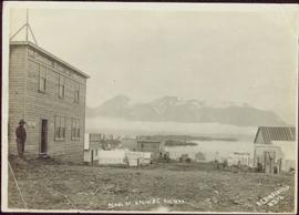
Photograph depicts buildings and signage on either side of dirt road. Unidentified man stands on far left, Atlin Lake and mountains can be seen in background.
Hand inscribed annotation on recto of photograph reads: “Pearl St., Atlin, B.C. Aug. 1899. A.C. Hirschfeld, No.74”.
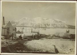
Photograph depicts tent buildings on either side of dirt road. Unidentified men are visible on left, Atlin Lake and mountains can be seen in background.
Hand inscribed annotation on recto of photograph reads: “Pearl Av. looking towards Atlin Lake, Atlin, B.C., A.C. Hirschfeld, No. 174”
This photograph album consists of photographs, membership cards and correspondence of Herbert F. Glassey. Subjects identified in this album include: automobiles, landscape vistas, hunting scenes, snowshoeing, dog sledding, provincial government offices and waterscapes. Identified geographic locations include: Nesutlane Trading Post, Atlin, Teslin Lake, Atlin Lake, McKee Creek, Taku Glacier and Otter Creek. The following of Mr. Glassey’s membership cards are also included within this album: “White Pass & Yukon Route, No. 308: Government Agent, Atlin account, 1939-1940”; “White Pass & Yukon Route, No. 283: Government Agent account, 1941-1942”; “Registration Certificate, 1940”; “The Wartime Prices and Trade Board, no.1305, 1942”; “Dominion Bureau of Statistics, no.252”; “The Society of Notaries Public Membership Card, 1956”; and “Prince Rupert Liberal Association, 1953”.
Glassey, SarahGraph depicting the water levels from the years 1955 to 1964 in Atlin Lake.
Graph depicting the water levels from the years 1965 to 1974 in Atlin Lake.
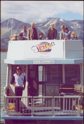
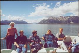
Left to right: Deborah Poff, Dennis Macknak, Charles Jago, an unidentified woman, Iona Campagnolo, an unidentified man, Ellen Facey, and an unidentified woman. Unknown man stands on lower deck in foreground. Mountains visible in background. Photograph taken during the Chancellor's 1996 regional tour through Atlin and Whitehorse; see also items 2009.6.1.578 - 2009.6.1.581.
Handwritten annotation on verso reads: "#3 Chancellor's Tour".
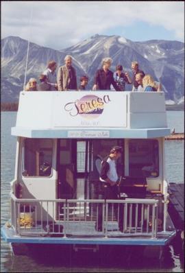
Left to right: Deborah Poff, Dennis Macknak, Charles Jago, an unidentified woman, Iona Campagnolo, Ellen Facey, Nick Petraryszak, an unidentified man, and an unidentified woman. Unknown man stands on lower deck in foreground. Mountains visible in background. Photograph taken during the Chancellor's 1996 regional tour through Atlin and Whitehorse; see also items 2009.6.1.578 - 2009.6.1.580.
Left to right: Chancellor Iona Campagnolo, Nick Petraryszak, Ellen Facey, unidentified woman and men. Mountains visible in background. Photograph taken during the Chancellor's 1996 regional tour through Atlin and Whitehorse; see also items 2009.6.1.578 - 2009.6.1.581.
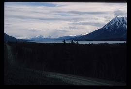
Image depicts what is possibly Atlin Lake, with numerous mountains in the distance and Atlin Mountain visible on the right of the image.
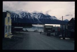
Image depicts Atlin Lake as well as a small section of Atlin, B.C. The mountain is possibly Atlin Mountain.
Image depicts Atlin Lake.
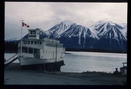
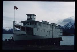
Image depicts a boat named "the Tarahne," which is located in Atlin, B.C. Atlin Lake and Mountain are visible in the background.
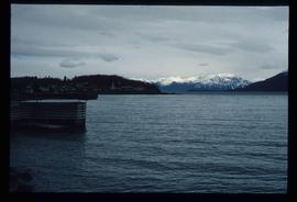
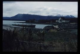
Image depicts a dock on the shore of Atlin Lake, as well as a building that may have once been a hospital. The slide is simply labelled "hospital."
Image depicts a boat named "the Tarahne," which is located in Atlin, B.C. Atlin Lake and Mountain are visible in the background.
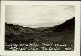
Photograph depicts dry creek bed, tall banks on either side. Hills and lake cross midground, mountains visible in background. Handwritten annotation on verso of photograph: "Looking down McKee Creek across Atlin Lake Towards Taku Glacier 6/27/37."
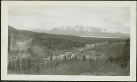
Photograph depicts Pine Creek winding through forest and hills. Altin Lake and mountains in background. Handwritten annotation on recto of photograph: "Atlin: Looking down lower Pine Ck, westerly towards Atlin, Atlin Lk, & the Atlin Mts. (part of Coast Range)."
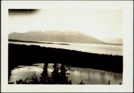
Photograph depicts a large lake, trees in foreground, mountains in background. Area speculated to be near Atlin, B.C. Handwritten annotations on recto of photograph: "36", "Aug 3 on way to A '[Homell?]'."
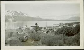
Photograph depicts town site in foreground, lake and mountains in background. Handwritten annotation on recto of photograph: "Atlin: Atlin, Atlin Lk, & Atlin Mts. looking N.west from Glassey's (Govt. Agent) window."
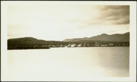
Photograph depicts town in distance, believed to be Atlin, B.C. Lake in foreground, hills in background. See also items 2009.5.2.63 & 2009.5.2.64.
