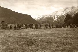
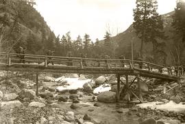
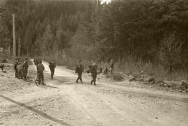
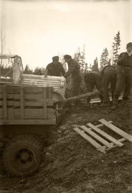
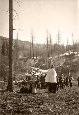
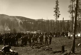
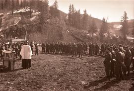
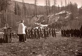
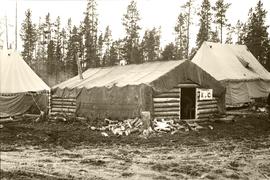
These photographs were taken by an unknown photographer from Department of National Deference Public Relations (Pacific Command) during the 1945 Polar Bear Exercise. This exercise was held in northern British Columbia in February and March 1945, using some 1,150 soldiers of the 6th Division. The intent of the exercise was to test the effects of "wet cold" conditions on military men and material. The scenario for the Polar Bear Exercise was that: "Action will be based on reports of a Japanese force having been landed at Bella Coola from submarines, having rendered useless RCAF installations at Bella Bella, and giving positive indication that this force is composed in great part of construction personnel with a comparatively small protective element; the assumption being that it will try to construct a useable road from Bella Coola to permit movement inland of a larger fighting force to follow at some later date". The exercise itself was conducted in three overlapping phases. Between 12 February and 5 March the force moved from Prince George to Anahim Lake, chiefly using an array of motor transport but with some pack horses. The second phase ran from 4 March to early April. This was a series of marches from Anahim Lake to Bella Coola and return; a secondary force of 19 men split off from the main body and, travelling by snowmobile and snowshoe, traversed the Rainbow Mountains to Bella Coola; on the return march this detachment was increased to 120 men and dubbed "Y" Force. The third phase was removal of all troops by vehicle from Anahim Lake to Williams Lake. These photographs are believed to document the return from Bella Coola.
Anahim Lake, BC
59 Archival description results for Anahim Lake, BC
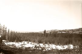
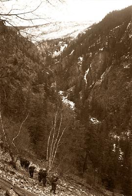
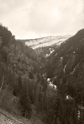
Photograph depicts a mountainous area between Bella Coola and Anahim Lake.
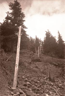
Photograph depicts a row of utility poles between Bella Coola and Anahim Lake during the WWII Polar Bear training exercise.
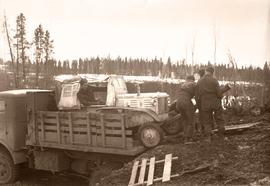
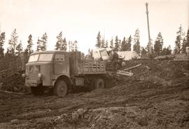
Photograph depicts the unloading of a jeep from a CMP truck between Bella Coola and Anahim Lake during the WWII Polar Bear training exercise.
Photograph depicts the unloading of a jeep from a CMP truck between Bella Coola and Anahim Lake during the WWII Polar Bear training exercise.
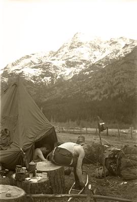
Photograph depicts a two soldiers in their undershirts by their tent, likely somewhere between Bella Coola and Anahim Lake during the WWII Polar Bear training exercise. Morning coffee supplies sit on a stump nearby. One of the soldiers is seated, trying on his snowshoes.
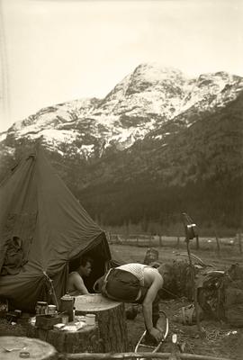
Photograph depicts a two soldiers in their undershirts by their tent, likely somewhere between Bella Coola and Anahim Lake during the WWII Polar Bear training exercise. Morning coffee supplies sit on a stump nearby. One of the soldiers is seated, trying on his snowshoes.
Al Elsey compiled his original footage from 1965 to produce this commercial film that deals with trapping beaver, the Anahim Lake Stampede and Caribou migration. The video provides a compilation of film footage shot by Elsey and is narrated by him describing the activities documented in the footage
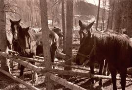
Photograph depicts a tethered pack horses in makeshift log stalls between Bella Coola and Anahim Lake during the WWII Polar Bear training exercise.
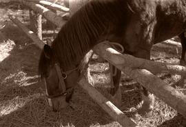
Photograph depicts a tethered pack horse between Bella Coola and Anahim Lake during the WWII Polar Bear training exercise.
Footage of a group of swans on a lake, possibly Anahim Lake. Footage of what is believed to be Al Elsey's front yard.
Photograph depicts a large number of soldiers bearing packs walking in a line through a rancher's field, possibly somewhere between Bella Coola and Anahim Lake during the WWII Polar Bear training exercise.
Photograph depicts a soldiers with packs walking over a wooden log bridge, possibly somewhere between Bella Coola and Anahim Lake during the WWII Polar Bear training exercise.
Photograph depicts soldiers walking along road with children watching nearby, possibly somewhere between Bella Coola and Anahim Lake during the WWII Polar Bear training exercise.
Photograph depicts soldiers unloading an American military jeep from a military truck, possibly somewhere between Bella Coola and Anahim Lake during the WWII Polar Bear training exercise.
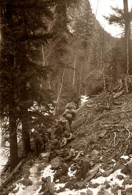
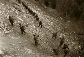
Photograph depicts soldiers trekking uphill with pack horses in mountainous terrain between Bella Coola and Anahim Lake during the WWII Polar Bear training exercise.
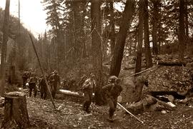
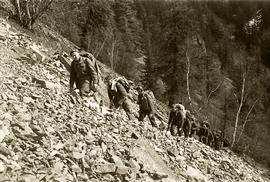
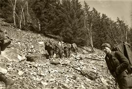
Photograph depicts soldiers trekking uphill in mountainous terrain between Bella Coola and Anahim Lake during the WWII Polar Bear training exercise.
Photograph depicts soldiers trekking through mountainous terrain between Bella Coola and Anahim Lake during the WWII Polar Bear training exercise.
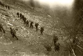
Photograph depicts a line of soldiers hiking up switchbacks on a steep rocky slope between Bella Coola and Anahim Lake during the WWII Polar Bear training exercise.
Photograph depicts a line of soldiers hiking up switchbacks on a steep rocky slope between Bella Coola and Anahim Lake during the WWII Polar Bear training exercise.
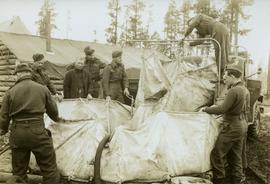
Photograph depicts a soldiers transferring water from military truck water bag to a large water bag on the ground, possibly somewhere between Bella Coola and Anahim Lake during the WWII Polar Bear training exercise.
Photograph depicts a line of soldiers hiking up switchbacks on a steep rocky slope between Bella Coola and Anahim Lake during the WWII Polar Bear training exercise.
Photograph depicts a line of soldiers hiking up switchbacks on a steep rocky slope between Bella Coola and Anahim Lake during the WWII Polar Bear training exercise.
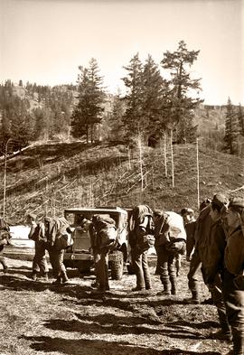
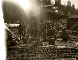
Photograph depicts a number of soldiers wearing packs near a military truck, likely somewhere between Bella Coola and Anahim Lake during the WWII Polar Bear training exercise.
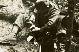
Photograph depicts a solider mending his uniform likely somewhere between Bella Coola and Anahim Lake during the WWII Polar Bear training exercise.
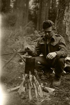
Photograph depicts a soldier cooking over a campfire, likely somewhere between Bella Coola and Anahim Lake during the WWII Polar Bear training exercise.
Footage of a horse ranch called "Cless Pocket Ranch" and hay fields surrounding. There is men at work using a sawmill to cut wood into planks and men working in the hay field with their young sons on the ranch. Cless Pocket Ranch is located in the Chilcotin area of BC near Anahim Lake.
Also included is footage of the Anahim Lake stampede, the people watching and playing, the arena and the concession stand.
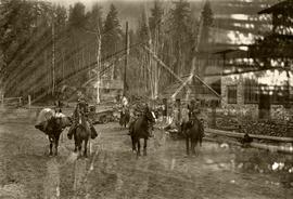
Photograph depicts a three mounted soldiers with a pack horse in front of a stone building, possibly somewhere between Bella Coola and Anahim Lake during the WWII Polar Bear training exercise. Another man and a woman stand in the background near a truck and a flagpole.
Photograph depicts a narrow mountain gorge between Bella Coola and Anahim Lake during the WWII Polar Bear training exercise.
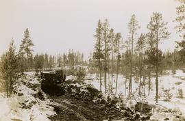
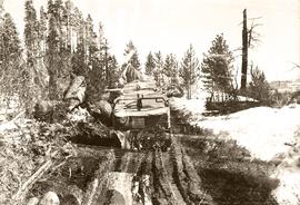
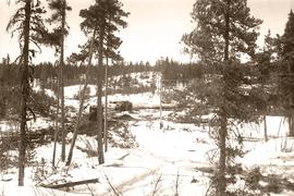
Photograph depicts two military vehicles traversing a rough dirt road between Bella Coola and Anahim Lake during the WWII Polar Bear training exercise.
Photograph depicts two military vehicles traversing a rough dirt road between Bella Coola and Anahim Lake during the WWII Polar Bear training exercise. The vehicle at the back of the convoy is marked with a notice: "CAUTION - RIGHT HAND DRIVE - NO SIGNALS".
Photograph depicts two military vehicles traversing a rough dirt road between Bella Coola and Anahim Lake during the WWII Polar Bear training exercise.
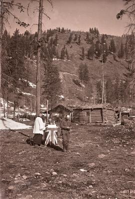
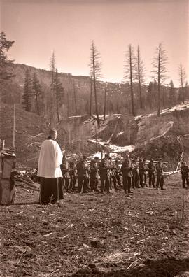
Photograph depicts a military chaplain standing by a makeshift altar with a cabin and group of soldiers in background, likely somewhere between Bella Coola and Anahim Lake during the WWII Polar Bear training exercise.
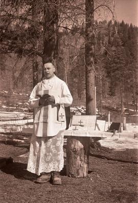
Photograph depicts a second military chaplain reading by a makeshift tree stump altar, likely somewhere between Bella Coola and Anahim Lake during the WWII Polar Bear training exercise.
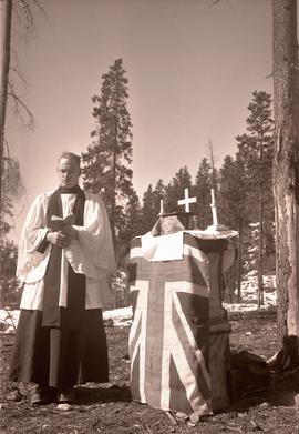
Photograph depicts a military chaplain reading by a makeshift altar with the Union Jack flag, likely somewhere between Bella Coola and Anahim Lake during the WWII Polar Bear training exercise.
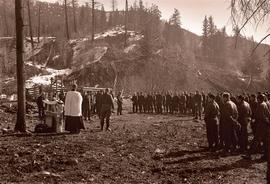
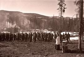
Photograph depicts a military chaplain reading by a makeshift altar to a large group of soldiers, likely somewhere between Bella Coola and Anahim Lake during the WWII Polar Bear training exercise.
Photograph depicts a military chaplain reading by a makeshift altar to a large group of soldiers, likely somewhere between Bella Coola and Anahim Lake during the WWII Polar Bear training exercise.
Photograph depicts a military chaplain reading by a makeshift altar to a large group of soldiers, likely somewhere between Bella Coola and Anahim Lake during the WWII Polar Bear training exercise.
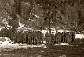
Photograph depicts a military chaplain reading by a makeshift altar to a large group of soldiers, likely somewhere between Bella Coola and Anahim Lake during the WWII Polar Bear training exercise.
Photograph depicts a military chaplain reading by a makeshift altar to a large group of soldiers, likely somewhere between Bella Coola and Anahim Lake during the WWII Polar Bear training exercise.
Photograph depicts a military chaplain reading by a makeshift altar to a large group of soldiers, likely somewhere between Bella Coola and Anahim Lake during the WWII Polar Bear training exercise.
Photograph depicts a military chaplain reading by a makeshift altar to a large group of soldiers, likely somewhere between Bella Coola and Anahim Lake during the WWII Polar Bear training exercise.
Photograph depicts a military chaplain reading by a makeshift altar to a large group of soldiers, likely somewhere between Bella Coola and Anahim Lake during the WWII Polar Bear training exercise.
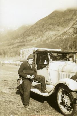
Photograph depicts a man (possibly a soldier out of uniform) smoking a cigarette by a vehicle, likely somewhere between Bella Coola and Anahim Lake during the WWII Polar Bear training exercise.
Photograph depicts a three military tent buildings, possibly somewhere between Bella Coola and Anahim Lake during the WWII Polar Bear training exercise. One of the buildings has a "K of C" (Knights of Columbus) sign on it.
File consists of records created and accumulated by Gary Runka over the course of his consultancy work for Anahim Lake Round Table for the "Charlotte-Alplands Wilderness Tourism and Forest Recreation Opportunities Study" project in West Chilcotin. This file was numbered as G.G. Runka Land Sense Ltd. client file #491; that client number may be seen referenced elsewhere in the G. Gary Runka fonds. The Land Sense Ltd. client files generally include records such as correspondence, contracts, invoices, project reports, publications, ephemera, memoranda, maps or map excerpts, legal documents, meeting materials, clippings, and handwritten notes. File also includes 32 accompanying photographs.
Includes the following:
- Anahim Round Table Sub Regional Plan: Report of Objectives and Strategies. Recommended Options. 2000.
Maps include:
- G.G. Runka Land Sense Ltd. and Shearwater Mapping Ltd., "Charlotte-Alplands Snow Based Wilderness Tourism Product Capability Map", March 1998.
- G.G. Runka Land Sense Ltd. and Shearwater Mapping Ltd., "Charlotte-Alplands Land Based Wilderness Tourism Product Capability Map", March 1998.
- G.G. Runka Land Sense Ltd. and Shearwater Mapping Ltd., "Charlotte-Alplands Water Based Wilderness Tourism Product Capability Map", March 1998.
- G.G. Runka Land Sense Ltd. and Shearwater Mapping Ltd., "Charlotte-Alplands Biogeoclimatic Based Wilderness Tourism Product Capability Map", March 1998.
- Photocopy of map of Fraser Plateau with overlap depicting Hwy 20 corridor, Hotnarko LRUP, and other areas, n.d. (3 copies, various sizes)
- Combination of NTS maps joined together and annotated to show the Fraser Plateau area, n.d.
- Combination of NTS maps joined together and annotated to show the Coast Mountains Pacific Ranges area, n.d.
- G.G. Runka Land Sense Ltd., "Land Based Tourism Product Capability, Map Sheet 3" hand drawn annotations on printed base map, c. 1998.
- G.G. Runka Land Sense Ltd., "Land Based Tourism Product Capability, Map Sheet 2" hand drawn annotations on printed base map, c. 1998.
- G.G. Runka Land Sense Ltd., "Land Based Tourism Product Capability, Map Sheet 1" hand drawn annotations on printed base map, c. 1998.
- G.G. Runka Land Sense Ltd., "Snow Based Tourism Product Capability, Map Sheet 3" hand drawn annotations on printed base map, c. 1998.
- G.G. Runka Land Sense Ltd., "Snow Based Tourism Product Capability, Map Sheet 2" hand drawn annotations on printed base map, c. 1998.
- G.G. Runka Land Sense Ltd., "Snow Based Tourism Product Capability, Map Sheet 1" hand drawn annotations on printed base map, c. 1998.
- Topographical map of Charlotte Lake area, n.d.
- Topographical map of Charlotte Lake area with hand-drawn annotations, n.d. (3 copies with different annotations)
- Topographical map of Crazy Bear (Ginny) Lake area with hand-drawn annotations, n.d. (2 copies with different annotations)
- Topographical map of Bussel Creek and Fraser Plateau area with hand-drawn annotations, n.d. (2 copies with different annotations)
- Topographical map of Banana Lake area, n.d.
- Topographical map of Banana Lake area with hand-drawn annotations, n.d. (3 copies with different annotations)
- Hand-drawn and coloured map showing alpine flower meadows, lakes, hiking trails, and the alpine tundra boundary in Mt McClinchy area, n.d.
- G.G. Runka Land Sense Ltd., "Wildlife Presence", n.d.
- B.C. Forest Service, "Recreation Resource Inventory" 92N.083, 1993.
- B.C. Forest Service, "ART [Anahim Round Table] Interest Area, Access Management Plan" draft version, Nov. 1997
- BC Ministry of Forests, "Highway 20 #4, Chilcotin Forest District Landscape Inventory & Analysis Legend", mapsheets 92N 084-86, 094-96, 93C 003-06
- BC Ministry of Forests, "Highway 20 #5, Chilcotin Forest District Landscape Inventory & Analysis Legend", mapsheets 93C 013-15, 023-026, 033-35
- L.A. West Landscape Architects Environmental Planners, "Chilcotin Forest District, Visually Sensitive Area Inventory", Feb. 1994
- Photocopy of annotations on 93C.012-13 base map
- Photocopy of annotations on 93C.004 base map
- Photocopy of annotations on Charlotte-Alplands base map
- "Anahim Round Table Interest Area Geographical Units" annotated on combined NTS maps
File consists of records created and accumulated by Gary Runka over the course of his consultancy work for BC Commission on Resources & Environment for the "Facilitation of Multi-interest Resource Management - Anahim Round Table" project in Anahim Lake. This file was numbered as G.G. Runka Land Sense Ltd. client file #327; that client number may be seen referenced elsewhere in the G. Gary Runka fonds. The Land Sense Ltd. client files generally include records such as correspondence, contracts, invoices, project reports, publications, ephemera, memoranda, maps or map excerpts, legal documents, meeting materials, clippings, and handwritten notes. File also includes 28 accompanying photographs.
Includes the following:
- Anahim Round Table Resource Management Plan, including Draft Consensus Report, June 1993 and Interim Report, August 1993. Commission on Resources and Environment. 1994.
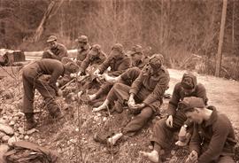
Photograph depicts a group of soldiers seated on the ground with their shoes off and caring for their feet, likely somewhere between Bella Coola and Anahim Lake during the WWII Polar Bear training exercise.
Photograph depicts a group of seated soldiers, relaxing with their packs nearby, likely somewhere between Bella Coola and Anahim Lake during the WWII Polar Bear training exercise.
Footage includes salmon jumping in a river, men filleting fish in fishing boat in tide water, a beaver in the water, and a bird, probably a heron, flying.
Recordings from the boat on a river, some loons on a lake, either Anahim or Fenton lake, and a panoramic view of the lake with mountains in background.
Also some footage of men fishing from the shore of a river, children catching fish, children swimming, some river rapids, footage of an eagle, a pelican on the lake, a group of birds, probably sand pipers, in water.
There are two young girls playing on a boat near shore, a view of white and brown house, and an older boy pulling a young girl in a wagon.
Include is footage of a backyard BBQ picnic, two young girls fishing, a cabin at a lake, and general scenery of birch trees, a boat house, and a dock at lake.
There is also a sign that reads "Breezy Cove," people relaxing on porch in front of cabin, and footage of a woman believed to be Mrs. Elsey and a friend walking on a forest path.
The film ends with footage of more fishing off a motor boat and unloading the motor boat at a dock.
Possible locations of the filming include the Bella Coola River, the Bella Coola Valley, the Bulkley Valley, the Hagensborg area, and Nimpo Lake.
