2013.6.36.1.007.021
·
Item
·
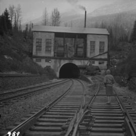
Oct. 1965
Part of David Davies Railway Collection
Photograph depicts the western portal of the C.P.R. Connaught Tunnel under Rogers Pass. The Glacier Station is a quarter mile to the rear of the camera. Fans are operated to force air through the tunnel against the direction of the trains, these therefore used for all westbound traffic. Diesel driven, steam for ancillary equipment.