2020.05.15
·
Item
·
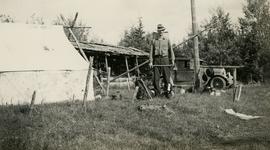
[Sept. or Oct. 1936]
Part of Gordon Wyness Album
Photograph depicts (from left to right) Gordon Wyness and Jack Lee at a camp scene "at Bobtail" (possibly Bobtail Lake) near Vanderhoof. As noted in the album caption, the crew had "just returned from Vanderhoof". The telegraph cabin roof and their 1930 Buick Series 40 car is visible at right.