Showing 658 results
Archival description
"Railroad Map of Washington"
"Railroad Map of Washington"
Central British Columbia Map
Central British Columbia Map

PP 160 - Conditions after Logging of a Spruce-Balsam Forest in Relation to Spruce Reproduction and to the Rate of Growth of the Second Story

Map showing Mining Properties in Vicinity of Stewart and Salmon River. Portland Canal Mining Division. British Columbia
"Pre-Emptor's Map Fort George Sheet" 1930
"Pre-Emptor's Map Fort George Sheet" 1930
"Pre-Emptor's Map Fort George Sheet" 1930
"Pre-Emptor's Map Fort George Sheet" 1930

TSX9696, Plot 160 - Sketches Showing Location of Plots, Roads, and Traverse Posts

Timber Sale X9696 Osoyoos District

Timber Sale X9696 Osoyoos District annotated

Timber Sale X9696

Preliminary Plan Showing Travelled Route of the Bedaux Sub-arctic Exploration
"Pre-Emptor's Map Quesnel Sheet" 1935
"Pre-Emptor's Map Quesnel Sheet" 1935
"Canadian National Railways Western Region: Plan of part of Central Fort George showing Hammond Street diversion as proposed"
"Canadian National Railways Western Region: Plan of part of Central Fort George showing Hammond Street diversion as proposed"
Geography and Natural Resources
Geography and Natural Resources
J. Kent Sedgwick fonds
J. Kent Sedgwick fonds
Research Subject Files
Research Subject Files
Prince George Land Survey, Development, and Settlement
Prince George Land Survey, Development, and Settlement
Forestry Work and Training series
Forestry Work and Training series
Trans-Canadian Alaska Railway Survey: Plan showing progress of survey parties
Trans-Canadian Alaska Railway Survey: Plan showing progress of survey parties
Trans-Canadian Alaska Railway Proposed Route
Trans-Canadian Alaska Railway Proposed Route
"Pre-Emptor's Map Fort George Sheet" 1943
"Pre-Emptor's Map Fort George Sheet" 1943
River crossing exercise, Prince George, B.C.
River crossing exercise, Prince George, B.C.
Grant Hazelwood fonds
Grant Hazelwood fonds
Parks and Conservation Areas in British Columbia
Parks and Conservation Areas in British Columbia
"Fort George" 1944 map
"Fort George" 1944 map
"Tourism British Columbia, Southwestern British Columbia Map"
"Tourism British Columbia, Southwestern British Columbia Map"
"Provincial Parks of Northern British Columbia"
"Provincial Parks of Northern British Columbia"
"City of Prince George Park and Trail Map"
"City of Prince George Park and Trail Map"
"Cranbrook Hill Greenway Multi-use Trail"
"Cranbrook Hill Greenway Multi-use Trail"
"Bateman Forestry Route"
"Bateman Forestry Route"
"Prince George" map
"Prince George" map
"Nechako River / Isle Pierre"
"Nechako River / Isle Pierre"
"West Lake Pulp Harvesting Forest"
"West Lake Pulp Harvesting Forest"
"Fort George" 1944 map
"Fort George" 1944 map
"West Lake Pulp Harvesting Forest"
"West Lake Pulp Harvesting Forest"
"Revised Site Plan, Salmon Valley Ranch"
"Revised Site Plan, Salmon Valley Ranch"
"West Lake Pulp Harvesting Forest"
"West Lake Pulp Harvesting Forest"
"West Lake Forest"
"West Lake Forest"
Collected Works
Collected Works

G. Gary Runka fonds
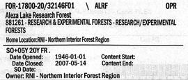
Aleza Lake Research Forest - Volume 1
"Canadian National Railway System"
"Canadian National Railway System"

Forest Cover Series, Map 93 J/1, Giscome
"Pre-Emptor's Map Fort George Sheet" 1949
"Pre-Emptor's Map Fort George Sheet" 1949

Aleza Lake Maps
Maps
Maps
Community Involvement
Community Involvement
Prince George Heritage Commission
Prince George Heritage Commission
"Chilcotin" 1950 map
"Chilcotin" 1950 map
"Eagle Lake Sawmills Ltd. Giscome BC Plan of Sawmill and Adjacent Buildings"
"Eagle Lake Sawmills Ltd. Giscome BC Plan of Sawmill and Adjacent Buildings"