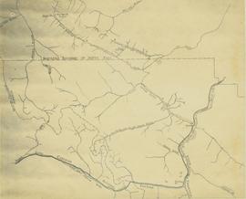
This map depicts the ore type and geology that can be found among each of the bench layers. Classifications and grades of ore are included within it. Different bench layers are included in the map. Annotations include a title in the back of the map written out as "1972 BENCH PLANS".
Map depicts existing oil lines, oil lines proposed or under construction, product lines, existing gas lines, gas lines proposed or under construction, LPG lines, and LPG lines proposed in Canada and Northern USA.
Large-format map depicts Northwood Pulp & Timber operating areas in 1975.
Item is an original 1980 map depicting travel and recreation across northwestern British Columbia, published by the Canadian Cartographers Ltd. in Coquitlam, BC.
Item is a hand drawn and coloured map by the City of Prince George Planning Department depicting the North Nechako and Hart neighbourhood area proposed land use in 1976.
Item is a hand drawn and coloured map by the City of Prince George Planning Department depicting North Nechako neighbourhood area existing land use in 1976.
Subseries reflects Dr. Ainley's extensive research on indigenous science and traditional knowledge and how it transferred to European settlers in Canada, Australia, and New Zealand. Much of this research culminated in Dr. Ainley's unfinished monograph project "Re-explorations: new perspectives on gender, environment and the transfer of knowledge in 19th and 20th century Canada and Australia." Material is, predominately, arranged by individual, with files largely consisting of bibliographies, articles and notes about and by the individual on topics related to the environment and interaction with indigenous peoples. Subseries also contains research notes, interviews, and correspondence. As much of Ainley's research focused on women, see subseries on women in science and engineering research (2002.14.1.5) for related materials.
Item is an original map depicting the Nechako River and Isle Pierre in British Columbia.
Subseries consists of material relating to the Nechako Fisheries Conservation Program, predominantly publications and reports. Includes some correspondence between NFCP and the Department of Fisheries and Oceans. Also includes air photo maps of the Nechako River from 1990.
Shirvell, ColeThe map depicts British Columbia, including outlines of Indigenous tribal territories and a smaller map of Canada with Indigenous language families. The reverse side of the map is titled, "What Are You Ready For" and includes a timeline of information and Indigenous history.
Item is an original 1972 map depicting the Nass River in British Columbia, published by the Department of Lands, Forests and Waster Resources of British Columbia.
The item is a promotional map depicting Prince George in 1966 and its amenities including businesses, activities, highways and the Fraser and Nechako rivers. The back depicts the Central Interior and the 1966 directory.
Item is an original 1984 map depicting Mount Waddington in British Columbia, published by the Energy Mines and Resources of Canada.
Item is an original 1969 map depicting Mount Waddington in British Columbia, published by the Department of Energy, Mines and Resources in Ottawa Canada.
Large-format map depicts the Monkman Public Sustained Yield Unit (PSYU) and Tree Farm Licence 30 east of Prince George.
Large-format map depicts the Monkman Public Sustained Yield Unit (PSYU) east of Prince George.
This series consists of material created by various societies, companies, railways, unions and government branches for the use and instruction of railway companies and employees. Includes publications, time tables, training materials, union materials, forms, maps and plans related to rail operations in North and South America, but predominately related to Canadian railway operations. Also comprises material created by several American and Canadian railways and transportation companies.
File contains miscellaneous notes, a hand-drawn map and an itinerary for the Mission.
The Miscellaneous Forest History Material series consists of material created or used by various logging and pulp mill companies. Includes forms, union materials, maps, plans and other records related to the forestry sector in British Columbia. The series also comprises publications related to equipment and employee training, and correspondence and memorandum developed by B.C. Chemicals, a division of Canfor.
This file consists of 10 photographs pertaining to the Hixon Creek Cariboo Gold Company, and the Quesnel Quartz Mine; as well as two sheets of letterhead from the "Hixon Gold Recovery Ltd." a handwritten speech re: a mineral claim, and a hand drawn map and overlay pertaining to the Wellington and Highland (Belle or Lass) mineral claims.
The map depicts where minerals can be found and also includes railways, highways, and roadways for easy access to desired minerals.
The map depicts mineral deposits in Northern British Columbia.
Photocopied map depicts mineral and coal mining properties in north western British Columbia.
Item is McNaughton Lake, B.C. Map 83D and Part of 83C Second Status Edition (1975) from "Classification and Interpretation of some Ecosystems of the Rocky Mountain Trench, Prince George Forest Region, British Columbia: First Approximation" (1984).
Item is an original 1969 map depicting McLeod Lake in British Columbia, published by the Department of Energy, Mines and Resources in Ottawa.
Forest cover map showing a crossing area of the McGregor River is annotated with a road and ferry crossing.
Item is McBride, B.C. Sheet 93H and Part of 83E Second Status Edition (1971) from "Classification and Interpretation of some Ecosystems of the Rocky Mountain Trench, Prince George Forest Region, British Columbia: First Approximation" (1984).
Subseries consists of maps, plans and posters pertaining to forestry in British Columbia and includes maps and plans depicting pre-emptor lots, communities, and industrial sites.
Series consists of maps, plans, and drawings collected by faculty in the UNBC School of Planning and Sustainability. The majority of these maps reflect the planning history of the City of Prince George and include large format, hand-drawn plans created by the City Planning Department from the 1970s and 1980s. Maps from City of Prince George Official Community Plans are also included.
Subseries contains maps and technical drawings produced by Canadian National Railways. Predominantly consists of record plans of the B.C. Mountain Region. Also includes technical drawings of CN railway equipment.
Series consists of maps, and road maps, and trail guides from various communities and regions in Northern and Central BC. Series includes Forest Cover Maps and maps related to BC forest and natural resource management.
Subseries contains maps and technical drawings produced Pacific Great Eastern Railways. Predominantly consists of plans of the rail line in the B.C. area. Also includes technical drawings of Pacific Great Eastern Railway structures.
Subseries contains maps and technical drawings produced by Grand Trunk and Grand Trunk Pacific Railways. Predominantly consists of plans of the rail line in the BC area. Also includes technical drawings of Grand Trunk Railway structures.
File consists of maps and aerial photographs of Prince George. Includes: "Record of gift" typed document to Kent Sedgwick (10 July 1989); "Map showing topography of the incorporated area of Prince George" reproduction of a map depicting topography and lot areas of Prince George, originally drawn 1926; BC5553 No 237" aerial photo reproduction depicting Prince George [ca. 1980]; "Prince George September 1969" aerial photo reproduction (Sept. 1969); and "3rd and Johnson" reproduction of an aerial photo depicting 3rd Avenue and Johnson St in Prince George [ca. 1970]."
Series consists of maps, technical drawings, and other oversize material collected by Gary Runka that are not associated with specific Land Sense Ltd. client jobs.
File contains two maps of the Columbia River system.
Series consists of cartographic materials including maps and blueprints of the Aleza Lake Research Forest. The maps reflect permanent sample plots and other study areas. The blueprints outline details for the development of a Ranger Station.
Series consists of maps collected by Kent Sedgwick covering historical and contemporary British Columbia. The maps include originals and photocopies that depict Fort George; Indian Reserve No.1; Anahim Lake, Bella Colla, Quesnel; Salmon Valley; the Cariboo district; the Peace River Country; Prince Rupert; Terrace; Bowron River; Giscome; Prince George; and Isle Pierre. The maps include tourism and recreation maps, pre-emptor maps, and resource maps created by the Province of British Columbia.
File contains three maps of the Project area.
The item is a reproduction of a map originally printed in 1926. The original was lost in the Fort George museum fire. The map depicts topography and lot areas of Prince George. Map also highlights the area of industrial development on DL 417. Annotations state, "Blue Print copy in Eng. Records original burned in museum fire 1926."
Map depicts the rivers, railways, and select lakes and towns located at Jasper Park between the northern boundary of the park and the townsite of Jasper. Part of the border between Alberta and British Columbia is visible on the west of the map.


