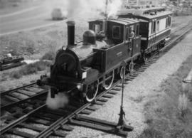
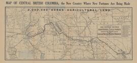
The David Davies Railway Collection encompasses all facets of railway history specifically in the province of British Columbia and the Yukon territory. The collection consists of research material accumulated over the course of more than fifty years, and includes monographs, periodicals, articles, clippings, railway timetables, photographs, maps and plans, and excerpts. Material covers public, tourist, and private (industrial) railways, including: CPR, KVR, E&N; CNR, CNoR, GTPR; and PGER, BCR. The collection excludes material regarding streetcar systems and rapid transit, but includes long distance electric interurbans.
Reproduced map on mylar depicts the Aleza Lake timber reserve near Aleza Lake, BC.
Reproduced map on mylar depicts locations of elevations and benchmarks at the Aleza Lake forest.
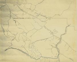
Map depicts the rivers, railways, and select lakes and towns located at Jasper Park between the northern boundary of the park and the townsite of Jasper. Part of the border between Alberta and British Columbia is visible on the west of the map.
Reproduced map on mylar depicts a proposed railway spur for the Aleza Lake Forest Experiment Station.
Map of Timber Sale X9696 shows the area for the TSX with the location of plots, roads, traverse posts, and the Forest Branch cabin. Location is 4 miles from the Myra Station of the Kettle Valley Railway.
Map of Timber Sale X9696 shows topography for the area. Location is 4 miles from the Myra Station of the Kettle Valley Railway.
Map of Timber Sale X9696 shows topography for the area. Location is 4 miles from the Myra Station of the Kettle Valley Railway.
Map of Timber Sale X9696 shows the area for the TSX with spruce balsam timber. Location is 4 miles from the Myra Station of the Kettle Valley Railway.
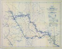
Item is a preliminary plan showing traveled route of the Bedaux Sub-Arctic Expedition in 1934.
This fonds illustrates the life and work of G. Gary Runka and his contributions to the province of British Columbia. Gary Runka was the first General Manager of British Columbia's Agricultural Land Commission and helped establish the provincial Agricultural Land Reserve. After transitioning from a government career to private consulting, Runka provided comprehensive professional services through his land consultancy business, G.G. Runka Land Sense Ltd., offering land capability and environmental assessments, integrated resource management, land and water use conflict resolution, and interdisciplinary land use planning. Described by colleagues as one of BC's most highly respected agrologists and influential land use planners, Runka had a 52-year career working on (or against) an incredible number of landmark projects in British Columbia, such as the Site C Project. Gary Runka’s partner in life and vocation, Joan M. Sawicki, worked with Gary on many of these projects—as well as her own; her contributions are also represented throughout the records of this fonds.
Gary Runka's deep connection to the land is evident from his earliest papers on aerial photo interpretation, his work with the Canada Land Inventory, through his speeches and his work establishing the BC Agricultural Land Reserve and in his subsequent consulting career through G.G. Runka Land Sense Ltd. Gary Runka's influence and legacy was recognized in the tributes paid after his death, including the post-humus award as the Real Estate Foundation's "Land Champion" for 2014.
The G. Gary Runka fonds has been divided into the following nine series:
1) Personal Records
2) Speeches & Publications
3) Professional Records
4) Agricultural Land Commission
5) Land Sense Ltd.
6) Client Files
7) Maps
8) Photographs
9) Digital Records
Original forest cover map shows timber history in the area of Giscome, BC.
Map is a mylar reproduction of an Aleza Lake Forest Reserve map.
Map reflects reserve boundary, roads, trails, 20 feet contour intervals, air photo centre, declination, swamps, and mile post at the Aleza Lake Forest Reserve.
Map is an uncontrolled mosaic of aerial photography of the Aleza Lake Research Forest, with a July 1955 date of the air photography. Duplicate exists.
Map is a photocopy reproduction of the Aleza Lake Experiment Forest working circle timber sale map that was included in the appendix to the 1957 Aleza working plan.
Map is a photocopy reproduction of the Aleza Lake Experiment Forest development map that was included in the appendix to the 1957 Aleza working plan.
Map is a photocopy reproduction of the Aleza Lake Experiment Forest permanent plot map that was included in the appendix to the 1957 Aleza working plan.
Map is a photocopy reproduction of the Aleza Lake Experiment Forest map that was included in the appendix to the 1957 Aleza working plan.
This fonds consits of the administrative and business papers of Mr. Adam Zimmerman during his tenure as a senior level executive with Noranda Inc., Noranda Mines Ltd, and Macmillan Bloedel Ltd., particularly in Ontario, Quebec, and British Columbia with the majority of these records relating to the senior level operations of these companies. It includes textual records relate to the creation and development of Northwood Pulp & Timber Ltd. in Prince George including all aspects of its regional operations throughout Northcentral BC). The fonds also includes records related to Noranda Inc.’s successful and unsuccessful attempts at business acquisitions in both forestry and mining operations internationally, particularly in Mexico, Brazil, the Netherlands and Tasmania.
The fonds also contains textual records generated by Zimmerman in his directorship and chairman positions on various forest industry association boards. It includes his notes, general correspondence, minutes, as well as booklets and brochures notably from the Canadian Forest Industries Council, the Canadian Pulp and Paper Association, the Forest Sector Advisory Council and other similar industry associations. Much of this material relates to the issue of the softwood lumber dispute and Zimmerman’s involvement in the lobbying efforts regarding Canada/U.S. Free Trade issues and includes bound reports, agreements, and publications as well as correspondence to/from Zimmerman and his handwritten notes within the files. The fonds also includes general business information (annual reports, brochures, publications) pertaining to other Canadian forestry and mining companies.
The fonds also contains Adam Zimmerman’s speeches and correspondence related to his involvement in numerous charities, foundations and corporate fundraising initiatives with numerous Canadian educational institutions, non-profit societies and federal election campaigns.
Business records of Noranda Inc. are extensive and include administrative, business, personnel, financial and legal records. Record types include correspondence, memos, handwritten notes, business proposals and meeting notes, merger proposals and notes, prospectuses, board meeting agendas and minutes, annual reports, financial statements, resumes, portfolios, printed brochures, publications and other ephemera related to the business operations of Noranda Inc., Noranda Mines and MacMillan Bloedel [during Noranda Mines take-over of MB] all during Zimmerman’s tenure as Chair and/or CEO. The fonds includes correspondence, financial reports, legal testimony transcripts resulting from the Gaspe Copper Mine labour strike in Quebec in 1957 and the subsequent Gaspe Law Suit of 1960 between Noranda and the United Steel Workers of America. The fonds also includes extensive correspondence between Zimmerman and various levels of government regarding the lobbying of government on forestry policy and correspondence with various environmental lobbying groups in the 1980s including correspondence with well-known environmentalist David Suzuki.
Subjects include all facets of business operations pertaining to Canadian forestry and mining sectors including labour issues, environmental impacts of industrial developments, industry and effects on the Canadian economy, the free trade debate, the softwood lumber issue etc.
The fonds provides a detailed archival record of Mr. Zimmerman’s contribution to the building of Noranda Forest in Canada, Northwood Pulp & Timber in BC and Noranda Inc. as a resource-based conglomerate. Many records were utilized by Mr. Zimmerman in the writing of his book, Who’s in Charge Here, Anyway?: reflections from a life in business, (Don Mills, Ontario: Stoddart; Distributed in Canada by General Distribution Services), 1997.
Zimmerman, AdamMap is a photocopy reproduction of the "Aleza Lake Experiment Forest" map that was included in the appendix to the 1957 Aleza working plan.
Map of Timber Sale X72108 shows area to be scarified, as well as previously logged areas. Location is outside Prince George in the Upper Fraser area near Kenneth Creek.
Map of Timber Sale X72108 shows area to be scarified. Location is outside Prince George in the Upper Fraser area near Kenneth Creek.
Map of Timber Sale X72108 shows area to be scarified. Location is outside Prince George in the Upper Fraser area near Kenneth Creek.
Logging plan of Sinclair Spruce Lumber Company's T.S.X. 73378 at Hubble Creek shows areas to be cut.
Logging plan of Sinclair Spruce Lumber Company's T.S.X. 73378 at Hubble Creek shows areas to be cut. Annotations show areas logged.
Map reflects reserve boundary, roads, trails, 20 feet contour intervals, air photo centre, declination, swamps, and mile post at the Aleza Lake Experiment Forest.
Map reflects reserve boundary, roads, trails, 20 feet contour intervals, air photo centre, declination, swamps, and mile post at the Aleza Lake Experiment Forest.
Map reflects reserve boundary, roads, trails, 20 feet contour intervals, air photo centre, declination, swamps, and mile post at the Aleza Lake Experiment Forest.
Map reflects reserve boundary, roads, trails, 20 feet contour intervals, air photo centre, declination, swamps, and mile post at the Aleza Lake Forest Reserve.
Map reflects lot and STL lines, timber sale boundaries, Highway 16, roads, beetle infested areas, and plots X91971 to X91980, and X89946.
This very large drawing shows CN leases and private property buildings on Island Cache in detail.
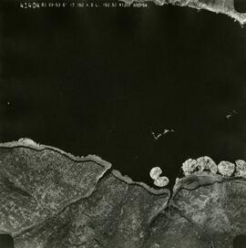
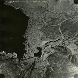
Lockwood Survey Corporation Ltd.This remote-sensing aerial photograph was taken by Lockwood Survey Corporation Ltd. under contract for the B.C. Forest Service. This historically important aerial photograph depicts the headwaters of Williston Reservoir soon after its creation in 1968 with the building of the W.A.C. Bennett Dam on the Peace River.
The identification coding on these photographs can be interpreted as follows:
- The largest number on the leftmost side is the frame number for the photograph.
- The following code to the right in the format B) 69-53 is currently unknown, but may refer to an internal project number for the Lockwood Survey Corporation.
- The 6" may refer to the camera's focal length in inches.
- Next is "17,150 ASL" which is 17,150 feet Above Sea Level.
- Following is "152.52" which refers to the camera's focal length in millimeters, which equals 6 inches.
- The "W1307" may refer to the reel, but that is unconfirmed.
- "8 SEP 69" is the date the photo was taken.
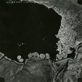
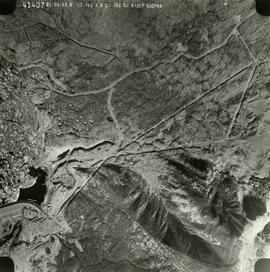
This remote-sensing aerial photograph was taken by Lockwood Survey Corporation Ltd. under contract for the B.C. Forest Service. This historically important aerial photograph depicts the W.A.C. Bennett Dam and Williston Reservoir soon after its flooding in 1968.
The identification coding on these photographs can be interpreted as follows:
- The largest number on the leftmost side is the frame number for the photograph.
- The following code to the right in the format B) 69-53 is currently unknown, but may refer to an internal project number for the Lockwood Survey Corporation.
- The 6" may refer to the camera's focal length in inches.
- Next is "17,150 ASL" which is 17,150 feet Above Sea Level.
- Following is "152.52" which refers to the camera's focal length in millimeters, which equals 6 inches.
- The "W1307" may refer to the reel, but that is unconfirmed.
- "8 SEP 69" is the date the photo was taken.
Forest cover map showing a crossing area of the McGregor River is annotated with a road and ferry crossing.
Map reproduction of the Aleza Lake Research Forest depicts timber sale areas, forest cover, and other details.
Map reproduction of the Sinclair Spruce Lumber Co. Ltd. T.S.H.L. A01848 C.P. 310 cutting area, likely in the Aleza Lake Research Forest.
Map reflects soil and landforms of Giscome area.
Map reproduction depicts major areas of the Aleza Lake Experiment Forest.
Item is a hand drawn and coloured map by the City of Prince George Planning Department depicting zoning proposed by the Prince George City Planner for the VLA neighbourhood.
