Showing 196 results

Archival description
44 results with digital objects Show results with digital objects
A look at Canada
2000.23.1.070.10 · Item · 1977
Part of Audrey Smedley L'Heureux fonds

The map of Canada is part of a greater booklet on Canadian history. This booklet was intended to help those preparing for their Canadian citizenship interview.

"Fort Fraser Division"
2012.13.6.22 · File · 1915
Part of J. Kent Sedgwick fonds

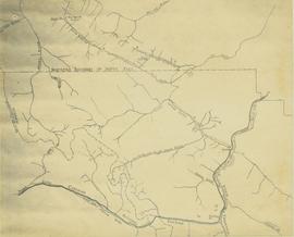
Item is a photocopied 1915 map depicting the Fort Fraser Division, published by the British Columbia Department of Lands.

2012.13.6.51 · File · 1989
Part of J. Kent Sedgwick fonds

Item is an original 1989 map depicting Bella Coola in British Columbia, published by the Department of Energy Mines and Resources in Ottawa, Canada. The map also includes Kent Sedgwick's travels in the Bella Coola area highlighted in red.

"Giscome" 1961 map
2012.13.6.73 · File · 1961
Part of J. Kent Sedgwick fonds

Item is an original 1961 partial map depicting Giscome, published by the Army Service Establishment, R.C.E. Map includes pen markings.

"Salmon Valley" 1986 map
2012.13.6.81 · File · 1986
Part of J. Kent Sedgwick fonds

Item is an original 1986 map depicting Salmon Valley in British Columbia and was published by the Department of Energy, Mines and Resources Ottawa Canada.

Research Subject Files
2012.13.2 · Series · 1937-2011
Part of J. Kent Sedgwick fonds

Kent Sedgwick’s research subject files contain original research notes, interviews and oral histories, news clippings, and collected primary and secondary sources. The series also includes both original and reproduction photographs, audio recordings, and maps. The subject files primarily relate to the history, urban planning, and historical geography of the Central Interior of British Columbia, especially Prince George area and the East Line communities over the course of the 20th century. They also include extensive notes on geographic features, landscapes, interpretative trails, architectural history, industrial history, history of Western exploration and land survey, and the First Nations history of the region.
Parks and Outdoor Recreation
2012.13.2.14 · Subseries · 1970-2011
Part of J. Kent Sedgwick fonds

Subseries consists of material collected and created by Kent Sedgwick for research regarding parks and outdoor recreation in Prince George. Material on parks includes Fort George Park (renamed to Lheidli T’enneh Memorial Park in 2015); Cottonwood Island Park; Connaught Hill; Moore's Meadow; L.C. Gunn Park; the Nechako Cutbanks; Paddlewheel Park; Monkman Provincial Park; Fraser Canyon Park; and Carp Lake. Also includes information on the creation of plaques and monuments, including the Alexander Mackenzie monument; the “Arrival of Steel” CN railway plaque; heritage interpretative signs for the Grand Trunk Pacific Railway; the Millar addition; and flooding and rivers. The files consists of various pamphlets and correspondence regarding the development of parks and the creation of interpretive materials.

2023.5.1.23 · Item · [after 1975]
Part of UNBC School of Planning and Sustainability fonds

Item is Map 1 of a group of five maps relating to a City of Prince George Study of Construction Aggregates by the firm Willis, Cunliffe, Tair & Company Limited. Map 1 shows development areas and population for 1984 and 1994. As the map is undated, it is unclear whether the 1984 and 1994 dates are future estimates.

2023.5.1.26 · Item · [after 1975]
Part of UNBC School of Planning and Sustainability fonds

Item is Map 4 of a group of five maps relating to a City of Prince George Study of Construction Aggregates by the firm Willis, Cunliffe, Tair & Company Limited. Map 4 shows development areas, aggregate sources, and requirements for 1984 and 1994. As the map is undated, it is unclear whether the 1984 and 1994 dates are future estimates.