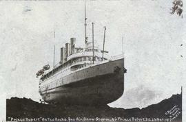
Photograph depicts the steamship Prince Rupert run aground on a rocky shoreline. Annotation on recto of photograph states: ""Prince Rupert" On The Rocks. Yes Sir. Snow Storm. Near Prince Rupert, B.C. 23 Mar: 1917. F. Button Photo. Pr. Rupert. No. 576"
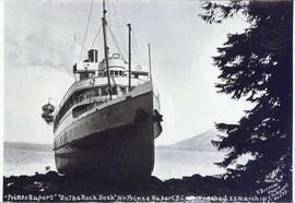
Photograph depicts the steamship Prince Rupert run aground on a rocky shoreline with a tree in the foreground. Annotation on recto of photograph states: ""Prince Rupert" "On The Rock Dock" Nr Prince Rupert B.C. Wrecked 23 March 1917. F. Button Photo Pr. Rupert no.575."
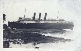
Photograph depicts the steamship Prince Rupert after being run aground on a rocky shoreline. Annotation on recto of photograph states: "STR. PRINCE RUPERT ASHORE NEAR RUPERT MAR 23. 1917."
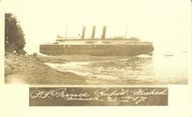
Photograph depicts the steamship Prince Rupert run aground on a rocky shoreline. Annotation on recto of photograph states: "S.S. Prince Rupert Wrecked March 23rd 17."
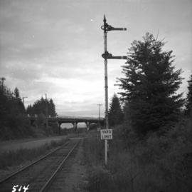
Photograph depicts yard signals of the MacMillan Bloedel & Powell River Logging Railway, primarily protecting the Comox Logging & Railway Company crossing. The Esquimalt and Nanaimo Railway is about 300 yards to the north. Crossing is near Ladysmith. It is most unusual to find signal in B.C. at this point.
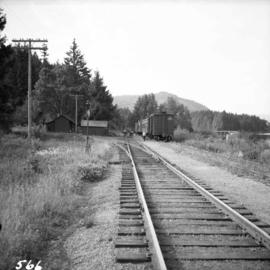
Photograph depicts CPR buildings near Shawnigan Lake depot on Vancouver Island. The buildings in the centre are a section house (left) and a speeder or tool shed (right). They sit inside a wye track. Spur on the left is all that is left of "Y" turning center. The view is looking south. The Shawnigan Lake station (not depicted) is located at mile post 27.8 approximately 1/2 mile to the railway south of these buildings which are to the south of the photographer.
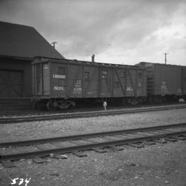
Photograph depicts the service car of the Esquimalt and Nanaimo Railway in front of the E & N freight shed. The Nanaimo passenger depot (not depicted) is located behind the photographer.
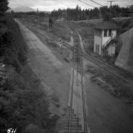
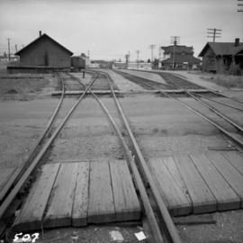
Photograph depicts a railway track crossover. The Comox Logging & Railway Co. tracks (left to right) cross the Esquimalt & Nanaimo tracks (bottom to top). The MacMillan Bloedel & Powell River Logging Railway tracks join the Esquimalt & Nanaimo Railway just above the crossing. The Velco Tower appears to the right of the crossing. This crossing is one mile north of Ladysmith, with the view looking north to Nanaimo.
Photograph depicts the Nanaimo passenger depot of the Esquimalt and Nanaimo Railway (at right) and the E & N freight shed (at left).
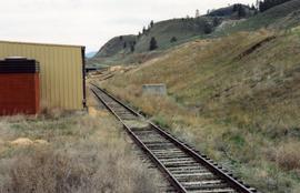
The building of this spur in 1977 was a late and short lived attempt to move yearling cattle to Ontario for fattening by rail. The Last stock train ran in 1985. The CN rail track was still in use in August 1998. This photograph shows the spur running east and down grade to a stockyard owned by BC Interior Cattlemen's Association. Additional information is available in article, "Moving Livestock by Rail: An inquiry into an extinct traffic" in The Sandhouse journal, Issue 121, Spring 2006.
Photograph depicts what was believed to be locomotive #3 that was built by Jeffrey and was found on the main yard line.
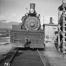
Photograph depicts 3-truck Shay locomotive #114 at the Vancouver Wharves Ltd. in North Vancouver. It was built in July 1928 as #3320. The ability of geared locomotives to exert maximum traction at low speeds was an asset when moving loaded grain cars to dockside elevators. The shay did this work until its boiler certificate expired. The hut at night contains a vertical steam boiler which appears to heat the fuel oil for locomotives coming from a fixed rail tank car.
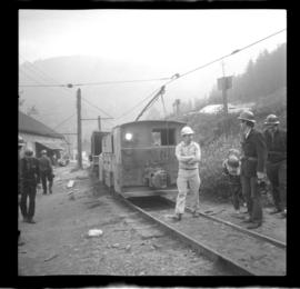
Photograph depicts large trailer truck parked at what is believed to be the loading station on the Cassiar plant (possibly in mill building).
Footage of ducks on a lake and flying away, horses in a corral, a campsite, caribou in the high country of the mountains, probably the Rainbow Mountains, a campsite where men are packing horses and game kill and their journey home in pack train.
Possible locations of filming include Anahim Lake, Chilcotin area, Holt Homestead, Rainbow Mountains, Tweedsmuir Provincial Park, or Wells Gray Provincial Park.
Collection consists of three original color film reels that compile footage clips from various dates. Subjects include the following:
Premier W.A.C. Bennett on the PGE Railway:
- Vancouver to Prince George Trip with Premier Bennett, 1958
- Fort St. James Opening of Line with Premier Bennett, 1 August 1968
- Opening of Squamish Car Shop with Premier Bennett, 1970
- Fort Nelson Opening of Line with Premier Bennett, September 1971
- First Revenue Train South from Fort Nelson with Premier Bennett, 1971
PGE Track Inspection and New Construction:
- V-8 PGE Track Inspection
- V-10 PGE Track Inspection
- V-10 Track Inspection
- Fort Nelson South to Fort St. John, October 1971
- Cariboo, Williams Lake Stampede, and PGE Track Inspection
Seton Lake:
- Seton Portage Steam Train Wreck Recovery, 1 April 1954
- Open Air Passenger Cars riding along Seton and Anderson Lake
- Budd Car from Shalath and Seton Lake to Kelly Lake
- Budd Car running along Seton Lake
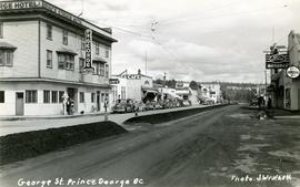
Handwritten annotation on verso of photograph reads: "George St. Prince George BC Photo. S Wrathall". Prince George Hotel and Cafe stand on left side of street in foreground, and many other buildings and businesses can be seen. Vehicles line the street, cut banks visible in background. Photograph believed to have been taken while George Street was being prepared for a new lawyer of asphalt.
This clip of original film footage depicts Pacific Great Eastern Railway (PGE) track inspection with a V-8 vehicle.
Clip description with timing reference to scenes:
- 0.01 The Fraser River above Marble Canyon near Moran
- 0.22 At the Tunnel at mile 168.9 between Fountain and Glenfraser
- 0.25 Scenes at Moran mile 181
- 0.37 Inspecting the 2 tunnels at mile 186.5
- 0.44 Water tank just north of Kelly Lake and south of the wye at Kelly Lake Mile Mile 191.5
- 1.04 Wood Trestle at 51 mile creek Mile 206
- 1.15 Lac La Hache station and section house in the background
- 1.30 Williams Lake station
- 1.43 Lone Butte Water tower
- 1.46 The Lone Butte rock formation
- 2.01 Alta Lake station right and Water tower in distance
- 2.06 Outside the east side of the Squamish roundhouse. Track ahead of car leads to yard. Water tower to right
- 2.15 A shot of the back side of the Squamish roundhouse looking south. 563 has had its trucks converted from 6 wheel to 4 wheel and is looking real clean. This must be late 1954. Steam locomotive 163 in final months of service and was cut up for scrap in July 1956
- 2.20 Cheakamus
- 2.24 Garibaldi Mile 59.5. Line to the left goes to the sawmill there
- 2.27 Inspecting the bridge at mile 55.6 in the Cheakamus canyon. Looking south from the south end of the bridge. Telegraph wires in the right of clip
- 2.31 Same bridge looking north
- 2.37 Bridge at mile 56.5 in the Cheakamus Canyon
- 2.42 Stopped at the water tank at the place called Watertank mile 62.5. Section house to the right of tracks.
- 2.58 Heading north around Pinecrest Mile 64 or 65
- 3.07 Stopped at the mill at Parkhurst around mile 80 on the east side of Green lake
- 3.23 Watching a south bound train pass at Tisdall
- 3.32 Diesel hauled train coming to Tisdall at the old location of the north switch. Locomotives still with their 6 wheel trucks so before 1954. Note locomotives spread out in the train so all the weight was not on small bridges at one time
- 3.50 In the canyon north of Lillooet; man in brown suit and fedora is W.H. (Harry) Nichols
- 3.58 Along Alta Lake
- 4.12 Scenes along Anderson Lake north of Darcy
- 4.35 Royal Engineers bridge at Lillooet
- 4.42 GE diesel with either steam ditcher or steam crane just north of Lillooet
- 4.47 General Store at Pavillion Mile 178.2
- 4.52 Quesnel Station
- 5.04 Unknown Location
- 5.20 Gang working with tamping machine?
- 5.31 Cottonwood River Bridge. New just before the line to Prince George opened in 1952. Also scenes around the Cottonwood River
- 5.57 Ahbau Creek Bridge Mile 406.1 Prince George Subdivision. The last spike to complete the line to Prince George was driven at the north end of this bridge. Ahbau Creek was named after a local Chinese prospector and trapper
- 6.16 At the CN Prince George shops near to where the Correctional Facility is today. CN Bridge across the Fraser River in distance
- 6.37 Construction of the PGE crossing of the Fraser River at Prince George
- 6.59 PGE middle yard at Prince George
- 7.10 Heading back south to the main yard. CN Fraser River bridge in shot
- 7.22 Marguerite station
- 7.35 Hawks Creek or Deep Creek Bridge mile 329.9. One of the worlds highest railroad bridges at 312 feet high
Note: The miles in the notes are the current mileages. At the time of the filming the line to North Vancouver had not been completed. The mileages at that time would have read 40 miles less in the mile boards.
Map depicts location of treasure hidden between Clearwater and Clemina, BC.
Map depicts the Shuswap Lakes, Rogers Pass, Kamloops, Yellowhead Pass, Thompson Valley, and the Nicola Valley. Also includes the first clues to a treasure hunt.
This collection consists of photographs and "real photo" postcards that depict the construction and operation of the Pacific Great Eastern Railway line, communities nearby the railway line, and regional geography of areas adjacent to the PGE line.
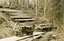
Six men visible on hillside and wood plank roadway, working together to roll cut logs down the hill and load them onto the truck.
Handwritten annotation in pencil on verso read: “logs up to 32 feet in length.”
This booklet, published by the Cunard Steam Ship Company, Ltd., provides an overview of Canada, England's emigration agents in Canada, and of the amenities provided by the Cunard Lines to its passengers immigrating to Canada from England via steamship. Booklet was printed in England.
Photograph depicts a steamship "Camosun" in water with mountains in the background. Possibly near Stewart B.C.
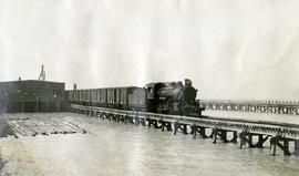
Photograph depicts a Pacific Great Eastern Railway train at the Squamish dock.
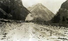
Photograph depicts the Pacific Great Eastern Railway line at Pavilion looking south. An irrigation ditch line is also visible.
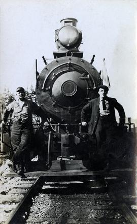
Photograph depicts the Pacific Great Eastern Railway #3 locomotive from the Davenport Locomotive Works. Two railway workers lean against the front of the locomotive for a posed portrait. The individual at left may be Angus McRae, a PGE locomotive engineer.
More information about the locomotive, Pacific Great Eastern #3:
The locomotive was built by Davenport Locomotive Works in Davenport, Iowa in February 1914, serial number 1477, for Patrick Welch, one of the developers (Foley, Welch & Stewart) of the PGE railway. Most of the early equipment, although lettered with the Pacific Great Eastern name, was owned by Patrick Welch. The Provincial Archives in Victoria holds a document showing that Welch sold all the equipment to the newly incorporated Pacific Great Eastern Equipment Company, of which he was also a director, on 14 June 1916 in exchange for 6000 shares in the company. Much, if not all, of the equipment had PGEEC "ownership plates" applied during the 1916-1918 period. It was not until the Provincial Government acquired the railway (and the Equipment Company) in 1918 that the equipment actually became the property of the railway. Pacific Great Eastern #3 was a switching locomotive with an 0-6-0 wheel arrangement and eight-wheel tender built to a standard Davenport design.
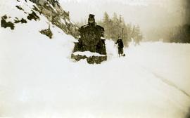
Photograph depicts a Pacific Great Eastern Railway locomotive in deep snow. A person, possibly a woman, stands near the train as snow continues to fall. The location is unknown, but may be Alta Lake or Squamish.
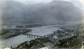
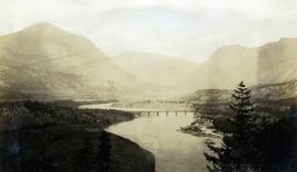
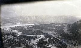
Photograph depicts a view of the Pacific Great Eastern Railway bridge across the Fraser River and the nearby Lillooet surrounding area. The photograph shows Lillooet looking up Town Creek Valley. Chinese gold washing activity is visible nearby the bridge.
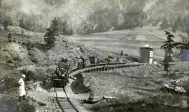
Photograph depicts a Pacific Great Eastern Railway train on Pavilion Creek trestle at Mile 20.3. Also visible are a water tank and possibly the graveyard at Pavilion.
The ca. 1921-1927 “PGE Bridge List” from the notebook of William H. Hewlett (1914-1968) references a 389.4 foot long, 34 ft. high, framed trestle with 26 spans of 14.8 feet at Mile 20.3 carrying the line over Pavilion Creek. There was a water tank at Pavilion located between the North end of the siding and the South end of the trestle. A track profile chart confirms that the track at this point is on a 12 degree curve. This photograph was taken from a vantage point up the hill to the North. The structures at the lower left of this image (2020.08.82) are consistent with a small construction camp, which accounts for the presence of a camp cook in image 2020.08.83.
"Canadian Railway and Marine World" reported in their January 1916 issue (p. 11, c.1), that track had been laid to within ½ mile of Clinton (Mile 45.0) on Dec. 14, 1915. If a constant rate of construction had been maintained from Mile 14, reached on July 30, 1915 as previously discussed, to Clinton, the approximate date of completion to Pavilion would be around the end of August, 1915 which is probably the earliest possible date for this photograph.
Photograph depicts a view of the Pacific Great Eastern Railway bridge across the Fraser River at Lillooet.
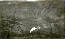
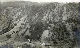
Photograph depicts a view of a train on the Pacific Great Eastern Railway line approximately 2 miles south of the Pavilion station.
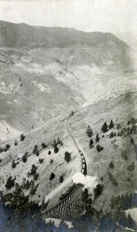
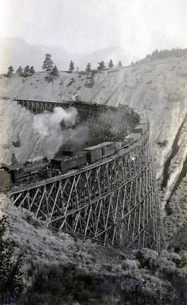
Photograph depicts a view of a train crossing the Sallus Creek wooden trestle along the Pacific Great Eastern Railway line near Lillooet, Fountain, and Pavilion. The angle of the photograph is looking north towards the Fraser River.
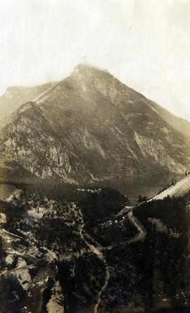
Photograph depicts a view of Seton Lake and the surrounding area, including the Pacific Great Eastern railway line. The railway grade is visible at left. Also visible is the Seton Lake fish hatchery at the east end of the lake and its employee boarding house, superintendent's cottage, and weir at the head of what was then referred to as "Lake Creek". The road seen in the centre foreground travelled from Lillooet to Seton Lake then to Golden Cache Mine.
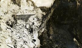
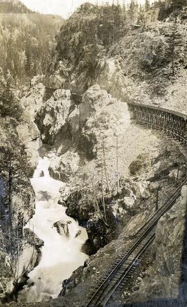
Photograph depicts a Pacific Great Eastern Railway wooden trestle in Cheakamus Canyon at 19 mile.
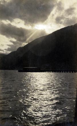
Photograph depicts the Squamish dock in late afternoon sunshine.
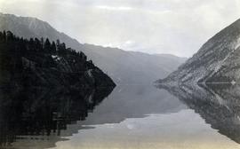
Photograph depicts a view of Anderson Lake at D'Arcy looking northeast. The Pacific Great Eastern Railway line is visible, including a small railway trestle.
Photograph depicts Pacific Great Eastern Railway track laying near Lillooet during railway construction. In the foreground, the railway grade along the south side of Cayoosh Creek about 1.5 miles before the junction with the Fraser River is depicted.
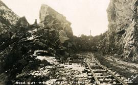
Photograph depicts the making of a rock cut on the Pacific Great Eastern Railway line at the Lillooet end of Seton Lake during railway construction.
Photograph depicts the confluence of the Cayoosh Creek outflow into the Fraser River in Lillooet, BC. Seton River is visible in the foreground. This area is Cayoose Creek Band (Sekw'el'wás First Nation) territory and includes land currently encompassed within Cayoosh Creek Indian Reserve 1. The Pacific Great Eastern Railway bridge over the Fraser River is also visible in the background.
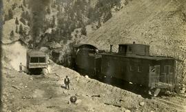
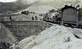
Photograph depicts a Pacific Great Eastern Railway locomotive, caboose (C2), and train cars operating as a work train, possibly on the south side of the Sallus Creek cut. A steam shovel may be loading gravel to or from the train cars. Location appears to be around the Lillooet area. The locomotive appears to be #56, a Canadian Locomotive Corporation 2-8-0, which was later lost in an Anderson Lake accident on August 8, 1944.
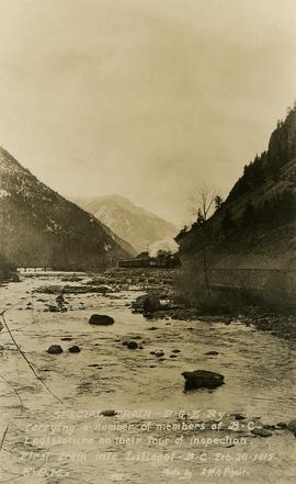
Photograph depicts a Pacific Great Eastern Railway "Special Train" that is "carrying a number of members of B.C. Legislature on their tour of inspection. First train into Lillooet, B.C. Feb. 20, 1915, 5 p.m." The train is depicted on the grade along the Seton River as it leaves Seton Lake.
Photograph depicts a Pacific Great Eastern Railway wooden trestle in Cheakamus Canyon.
Photograph depicts Mr. Crysdale sitting on a velocipede on the Sallus Creek ("14 Mile") Pacific Great Eastern Railway trestle with an estimated date of very late July 1915 or later. "Canadian Railway and Marine World" reported that track had been laid to 14 miles North of Lillooet by July 30, 1915 (CR&MW , Sept 1915, p341, c2). 14 miles North of Lillooet is approximately 20 rail lengths beyond the North end of this trestle, leading to a "best estimate" of very late July 1915 as the earliest date for this photograph. The velocipede depicted is a 3-wheel, manually propelled vehicle operated by a push-pull (back & forth) action on the actuating handle.
The ca. 1921-1927 “PGE Bridge List” from the notebook of William H. Hewlett (1914-1968) references a Mile 13.7, 14 Mile Creek, frame trestle, 905 ft. long, 182 ft. high, 61 spans of 14.8 feet in the Lillooet Subdivision. A “PGE Track Profile” drawing shows this trestle was on a 1.55% grade and a 12 degree left hand curve. While the drawing had been revised at least twice (with an unknown date for the most recent revision), the pre-“Lillooet Diversion of 1931" mileage figures confirm that the 1915 “Mile 13.7" was in agreement with a more recent hand written note “Sallus Creek”. The trestle appears to have gone by the names "14 Mile" trestle, "13.7 Mile Trestle", and "Sallus Creek" trestle.
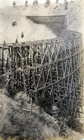
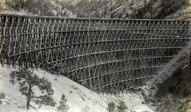
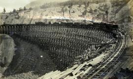
Photograph depicts a partially constructed Pacific Great Eastern Railway trestle located near Sallus Creek in the area around Lillooet, Fountain, and Pavilion. "Canadian Railway and Marine World" reported that track had been laid to 14 miles North of Lillooet by July 30, 1915 (CR&MW , Sept 1915, p341, c2). 14 miles North of Lillooet is approximately 20 rail lengths beyond the North end of this trestle, leading to a "best estimate" of early-mid July 1915 as the latest date for this photograph.
The ca. 1921-1927 “PGE Bridge List” from the notebook of William H. Hewlett (1914-1968) references a Mile 13.7, 14 Mile Creek, frame trestle, 905 ft. long, 182 ft. high, 61 spans of 14.8 feet in the Lillooet Subdivision. A “PGE Track Profile” drawing shows this trestle was on a 1.55% grade and a 12 degree left hand curve. While the drawing had been revised at least twice (with an unknown date for the most recent revision), the pre-“Lillooet Diversion of 1931" mileage figures confirm that the 1915 “Mile 13.7" was in agreement with a more recent hand written note “Sallus Creek”. The trestle appears to have gone by the names "14 Mile" trestle, "13.7 Mile Trestle", and "Sallus Creek" trestle.
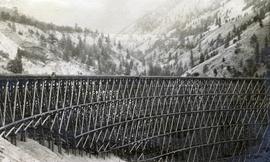
Photograph depicts the Pacific Great Eastern Railway trestle located near Sallus Creek in the area around Lillooet, Fountain, and Pavilion. A number of men are working along the trestle, possibly completing final construction work or performing repairs. "Canadian Railway and Marine World" reported that track had been laid to 14 miles North of Lillooet by July 30, 1915 (CR&MW , Sept 1915, p341, c2). 14 miles North of Lillooet is approximately 20 rail lengths beyond the North end of this trestle, leading to a "best estimate" of very late July 1915 or later as the earliest dates for this photograph.
The ca. 1921-1927 “PGE Bridge List” from the notebook of William H. Hewlett (1914-1968) references a Mile 13.7, 14 Mile Creek, frame trestle, 905 ft. long, 182 ft. high, 61 spans of 14.8 feet in the Lillooet Subdivision. A “PGE Track Profile” drawing shows this trestle was on a 1.55% grade and a 12 degree left hand curve. While the drawing had been revised at least twice (with an unknown date for the most recent revision), the pre-“Lillooet Diversion of 1931" mileage figures confirm that the 1915 “Mile 13.7" was in agreement with a more recent hand written note “Sallus Creek”. The trestle appears to have gone by the names "14 Mile" trestle, "13.7 Mile Trestle", and "Sallus Creek" trestle.
Photograph depicts the Pacific Great Eastern Railway trestle located near Sallus Creek in the area around Lillooet, Fountain, and Pavilion. "Canadian Railway and Marine World" reported that track had been laid to 14 miles North of Lillooet by July 30, 1915 (CR&MW , Sept 1915, p341, c2). 14 miles North of Lillooet is approximately 20 rail lengths beyond the North end of this trestle, leading to a "best estimate" of very late July 1915 or later as the earliest dates for this photograph.
The ca. 1921-1927 “PGE Bridge List” from the notebook of William H. Hewlett (1914-1968) references a Mile 13.7, 14 Mile Creek, frame trestle, 905 ft. long, 182 ft. high, 61 spans of 14.8 feet in the Lillooet Subdivision. A “PGE Track Profile” drawing shows this trestle was on a 1.55% grade and a 12 degree left hand curve. While the drawing had been revised at least twice (with an unknown date for the most recent revision), the pre-“Lillooet Diversion of 1931" mileage figures confirm that the 1915 “Mile 13.7" was in agreement with a more recent hand written note “Sallus Creek”. The trestle appears to have gone by the names "14 Mile" trestle, "13.7 Mile Trestle", and "Sallus Creek" trestle.
Photograph depicts a Pacific Great Eastern Railway work train on a trestle located near Sallus Creek in the area around Lillooet, Fountain, and Pavilion. The work train appears to be carrying railway workers and a load of rails.
Photographs 2020.08.68, 2020.08.69, and 2020.08.70 are three views of track laying on the Sallus Creek trestle. These form a sequence: 2020.08.68, 2020.08.70, 2020.08.69 in order as track laying proceeds from the South end of the trestle toward the North end. The piece of equipment at the North end of the train in all three images is a track laying machine that lifted a piece of rail and delivered it to the workmen ahead of the machine. "Canadian Railway and Marine World" reported that track had been laid to 14 miles North of Lillooet by July 30, 1915 (CR&MW , Sept 1915, p341, c2). 14 miles North of Lillooet is approximately 20 rail lengths beyond the North end of this trestle, leading to a "best estimate" of late July 1915 as the date for this photograph.
The ca. 1921-1927 “PGE Bridge List” from the notebook of William H. Hewlett (1914-1968) references a Mile 13.7, 14 Mile Creek, frame trestle, 905 ft. long, 182 ft. high, 61 spans of 14.8 feet in the Lillooet Subdivision. A “PGE Track Profile” drawing shows this trestle was on a 1.55% grade and a 12 degree left hand curve. While the drawing had been revised at least twice (with an unknown date for the most recent revision), the pre-“Lillooet Diversion of 1931" mileage figures confirm that the 1915 “Mile 13.7" was in agreement with a more recent hand written note “Sallus Creek”. The trestle appears to have gone by the names "14 Mile" trestle, "13.7 Mile Trestle", and "Sallus Creek" trestle.
Photograph depicts a Pacific Great Eastern Railway work train on a trestle located near Sallus Creek in the area around Lillooet, Fountain, and Pavilion. The work train appears to be carrying railway ties.
Photographs 2020.08.68, 2020.08.69, and 2020.08.70 are three views of track laying on the Sallus Creek trestle. These form a sequence: 2020.08.68, 2020.08.70, 2020.08.69 in order as track laying proceeds from the South end of the trestle toward the North end. The piece of equipment at the North end of the train in all three images is a track laying machine that lifted a piece of rail and delivered it to the workmen ahead of the machine. In this photograph, the machine is at the current end of track and is ready to advance the next length of rail."Canadian Railway and Marine World" reported that track had been laid to 14 miles North of Lillooet by July 30, 1915 (CR&MW , Sept 1915, p341, c2). 14 miles North of Lillooet is approximately 20 rail lengths beyond the North end of this trestle, leading to a "best estimate" of late July 1915 as the date for this photograph.
The ca. 1921-1927 “PGE Bridge List” from the notebook of William H. Hewlett (1914-1968) references a Mile 13.7, 14 Mile Creek, frame trestle, 905 ft. long, 182 ft. high, 61 spans of 14.8 feet in the Lillooet Subdivision. A “PGE Track Profile” drawing shows this trestle was on a 1.55% grade and a 12 degree left hand curve. While the drawing had been revised at least twice (with an unknown date for the most recent revision), the pre-“Lillooet Diversion of 1931" mileage figures confirm that the 1915 “Mile 13.7" was in agreement with a more recent hand written note “Sallus Creek”. The trestle appears to have gone by the names "14 Mile" trestle, "13.7 Mile Trestle", and "Sallus Creek" trestle.
Photograph depicts a Pacific Great Eastern Railway work train on a trestle located near Sallus Creek in the area around Lillooet, Fountain, and Pavilion. The work train appears to be carrying railway ties. Railway workers work on the track behind the train with piles of unused rail ties nearby.
Photographs 2020.08.68, 2020.08.69, and 2020.08.70 are three views of track laying on the Sallus Creek trestle. These form a sequence: 2020.08.68, 2020.08.70, 2020.08.69 in order as track laying proceeds from the South end of the trestle toward the North end. The piece of equipment at the North end of the train in all three images is a track laying machine that lifted a piece of rail and delivered it to the workmen ahead of the machine. "Canadian Railway and Marine World" reported that track had been laid to 14 miles North of Lillooet by July 30, 1915 (CR&MW , Sept 1915, p341, c2). 14 miles North of Lillooet is approximately 20 rail lengths beyond the North end of this trestle, leading to a "best estimate" of late July 1915 as the date for this photograph.
The ca. 1921-1927 “PGE Bridge List” from the notebook of William H. Hewlett (1914-1968) references a Mile 13.7, 14 Mile Creek, frame trestle, 905 ft. long, 182 ft. high, 61 spans of 14.8 feet in the Lillooet Subdivision. A “PGE Track Profile” drawing shows this trestle was on a 1.55% grade and a 12 degree left hand curve. While the drawing had been revised at least twice (with an unknown date for the most recent revision), the pre-“Lillooet Diversion of 1931" mileage figures confirm that the 1915 “Mile 13.7" was in agreement with a more recent hand written note “Sallus Creek”. The trestle appears to have gone by the names "14 Mile" trestle, "13.7 Mile Trestle", and "Sallus Creek" trestle.
Photograph depicts a Pacific Great Eastern Railway work train on Pavilion Creek trestle at Mile 20.3. laden with workers, railway ties, and a steam donkey. The work train may be returning to a work camp, as a man dressed in the attire of a camp cook is standing beside the track.
The ca. 1921-1927 “PGE Bridge List” from the notebook of William H. Hewlett (1914-1968) references a 389.4 foot long, 34 ft. high, framed trestle with 26 spans of 14.8 feet at Mile 20.3 carrying the line over Pavilion Creek. There was a water tank at Pavilion located between the North end of the siding and the South end of the trestle. A track profile chart confirms that the track at this point is on a 12 degree curve. This photograph was taken at trackside. The structures at the lower left of image 2020.08.82 are consistent with a small construction camp, which accounts for the presence of a camp cook in this image (2020.08.83).
"Canadian Railway and Marine World" reported in their January 1916 issue (p. 11, c.1), that track had been laid to within ½ mile of Clinton (Mile 45.0) on Dec. 14, 1915. If a constant rate of construction had been maintained from Mile 14, reached on July 30, 1915 as previously discussed, to Clinton, the approximate date of completion to Pavilion would be around the end of August, 1915 which is probably the earliest possible date for this photograph.
