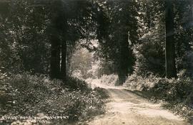
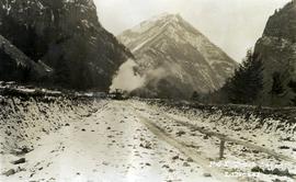
Photograph depicts a stagecoach road near Newport (Squamish).
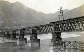
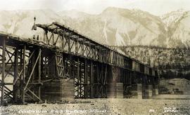
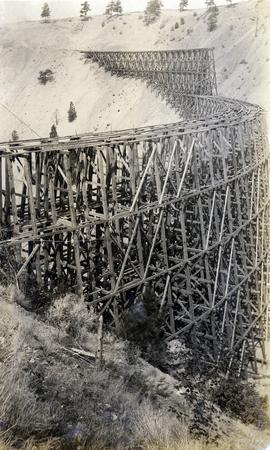
Photograph depicts the Pacific Great Eastern Railway bridge under construction on the original route at Lillooet, which was active 1915 to 1931. Including its approach spans, the bridge was 2,630 ft. long, almost exactly half a mile. The mileage on the PGE's original mileage system was 120.6.
Photograph depicts the Pacific Great Eastern Railway bridge under construction on the original route at Lillooet, which was active 1915 to 1931. Including its approach spans, the bridge was 2,630 ft. long, almost exactly half a mile. The mileage on the PGE's original mileage system was 120.6.
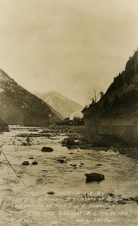
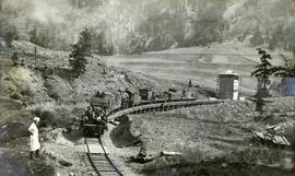
Photograph depicts a Pacific Great Eastern Railway "Special Train" that is "carrying a number of members of B.C. Legislature on their tour of inspection. First train into Lillooet, B.C. Feb. 20, 1915, 5 p.m." The train is depicted on the grade along the Seton River as it leaves Seton Lake.
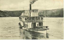
Stern wheeler in river. Printed annotation on recto reads: “S.S. “Charlotte,” Quesnel. B.C.” Handwritten message on verso is addressed to “Mr. O. Winter 1016 V Park St. Victoria B.C.” The dates on the canceled 1 cent Canadian stamp on verso are not readable.
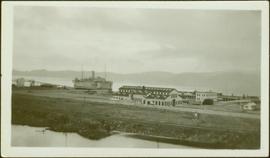
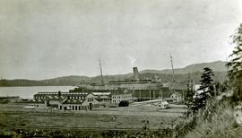
Photograph depicts a large ship behind dock buildings. Railroad crosses foreground, hills visible on shore in background.
Handwritten annotation on verso reads: "Drydock Prince Rupert".
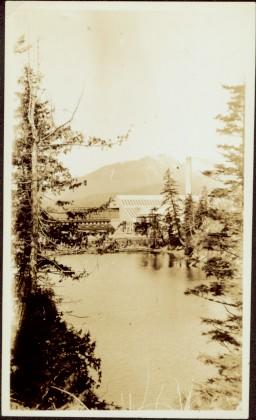
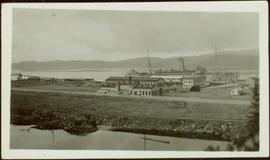
Photograph depicts buildings visible through clearing in trees. Water crosses foreground, hills visible in background.
Handwritten annotation on verso reads: "Dry dock / Prince Rupert B.C."
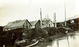
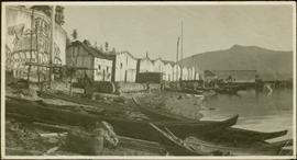
Photograph depicts totem poles (crest poles?) in front of lodge buildings on river shore. Canoes can be seen floating in foreground, hills in background.
Handwritten annotation on verso reads: "Chapter XII. Number 1. Section of Indian Village on Nass River showing lodges and totems".
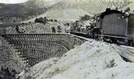
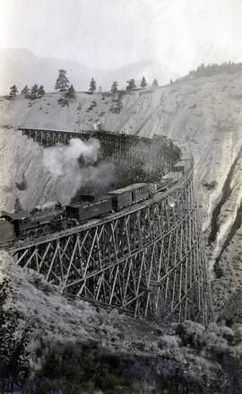
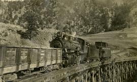
Photograph depicts a Pacific Great Eastern Railway work train on a trestle located near Sallus Creek in the area around Lillooet, Fountain, and Pavilion. The work train appears to be carrying railway ties. Railway workers work on the track behind the train with piles of unused rail ties nearby.
Photographs 2020.08.68, 2020.08.69, and 2020.08.70 are three views of track laying on the Sallus Creek trestle. These form a sequence: 2020.08.68, 2020.08.70, 2020.08.69 in order as track laying proceeds from the South end of the trestle toward the North end. The piece of equipment at the North end of the train in all three images is a track laying machine that lifted a piece of rail and delivered it to the workmen ahead of the machine. "Canadian Railway and Marine World" reported that track had been laid to 14 miles North of Lillooet by July 30, 1915 (CR&MW , Sept 1915, p341, c2). 14 miles North of Lillooet is approximately 20 rail lengths beyond the North end of this trestle, leading to a "best estimate" of late July 1915 as the date for this photograph.
The ca. 1921-1927 “PGE Bridge List” from the notebook of William H. Hewlett (1914-1968) references a Mile 13.7, 14 Mile Creek, frame trestle, 905 ft. long, 182 ft. high, 61 spans of 14.8 feet in the Lillooet Subdivision. A “PGE Track Profile” drawing shows this trestle was on a 1.55% grade and a 12 degree left hand curve. While the drawing had been revised at least twice (with an unknown date for the most recent revision), the pre-“Lillooet Diversion of 1931" mileage figures confirm that the 1915 “Mile 13.7" was in agreement with a more recent hand written note “Sallus Creek”. The trestle appears to have gone by the names "14 Mile" trestle, "13.7 Mile Trestle", and "Sallus Creek" trestle.
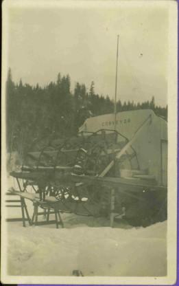
Stern wheeler “Conveyor” on land, snow on ground, treed hills in background. Handwritten annotation on verso in pencil reads: “Tete Jaune B.C.”
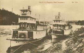
2 Stern wheelers tied to the river bank. Printed annotation on recto reads: “The B.C. Express mail Steamers No. 102.”
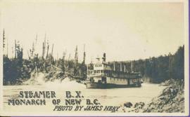
Stern wheeler in river. Printed annotation on recto reads: “Steamer B.X. Monarch of New B.C. Photo by James Heay”
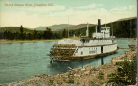
Stern wheeler “Port Simpson” tied to riverbank. Printed annotation on recto reads: “On the Skeena river, Hazelton, B.C.” Handwritten message on verso is addressed to “Mrs. Flossie Strong 6 Nah St. Watermill ME, U.S.A” 1 cent Canadian postage stamp has been canceled with a date of “Dec 24, 5:30 PM 1915 Buffalo N.Y.”
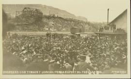
Slightly overhead shot of a large crowd gathered by general store and railroad. Annotation on recto reads: "Overseas contingent leaving Prince Rupert BC Feb 26th 1915. McRae Bros."
Photograph depicts Pacific Great Eastern Railway track laying near Lillooet during railway construction. In the foreground, the railway grade along the south side of Cayoosh Creek about 1.5 miles before the junction with the Fraser River is depicted.
Photograph depicts a Pacific Great Eastern Railway work train on a trestle located near Sallus Creek in the area around Lillooet, Fountain, and Pavilion. The work train appears to be carrying railway workers and a load of rails.
Photographs 2020.08.68, 2020.08.69, and 2020.08.70 are three views of track laying on the Sallus Creek trestle. These form a sequence: 2020.08.68, 2020.08.70, 2020.08.69 in order as track laying proceeds from the South end of the trestle toward the North end. The piece of equipment at the North end of the train in all three images is a track laying machine that lifted a piece of rail and delivered it to the workmen ahead of the machine. "Canadian Railway and Marine World" reported that track had been laid to 14 miles North of Lillooet by July 30, 1915 (CR&MW , Sept 1915, p341, c2). 14 miles North of Lillooet is approximately 20 rail lengths beyond the North end of this trestle, leading to a "best estimate" of late July 1915 as the date for this photograph.
The ca. 1921-1927 “PGE Bridge List” from the notebook of William H. Hewlett (1914-1968) references a Mile 13.7, 14 Mile Creek, frame trestle, 905 ft. long, 182 ft. high, 61 spans of 14.8 feet in the Lillooet Subdivision. A “PGE Track Profile” drawing shows this trestle was on a 1.55% grade and a 12 degree left hand curve. While the drawing had been revised at least twice (with an unknown date for the most recent revision), the pre-“Lillooet Diversion of 1931" mileage figures confirm that the 1915 “Mile 13.7" was in agreement with a more recent hand written note “Sallus Creek”. The trestle appears to have gone by the names "14 Mile" trestle, "13.7 Mile Trestle", and "Sallus Creek" trestle.
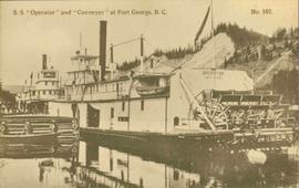
Stern wheelers “Operator” and “Conveyor” in dock. Printed annotation on recto reads: “S.S. “Operator” and “Conveyer” at Fort George, B.C. No. 107.”
B.C. Express Steamer, Fraser River. Trees and mountains in background. Printed annotation on recto reads: “B.C. Express Steamer, Fraser River.” Handwritten annotation in pencil on verso reads: “BC Express Fraser River BC”
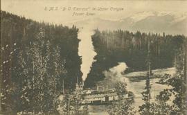
Lofty view of stern wheeler in river, snow capped mountains in background. Printed annotation on recto reads: “R.M.S. B.C. Express in Upper Canyon Fraser River.”
Canoes sit on shore in foreground beside village buildings. A dock is visible above water in background.
Handwritten annotation on verso reads: "Alert Bay Indian Ranch No. 14 Alert Bay. To be shown on page 69 or 70, re Alert Bay Mission."
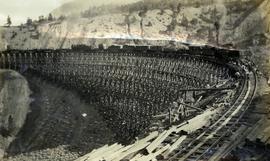
Photograph depicts a partially constructed Pacific Great Eastern Railway trestle located near Sallus Creek in the area around Lillooet, Fountain, and Pavilion. "Canadian Railway and Marine World" reported that track had been laid to 14 miles North of Lillooet by July 30, 1915 (CR&MW , Sept 1915, p341, c2). 14 miles North of Lillooet is approximately 20 rail lengths beyond the North end of this trestle, leading to a "best estimate" of early-mid July 1915 as the latest date for this photograph.
The ca. 1921-1927 “PGE Bridge List” from the notebook of William H. Hewlett (1914-1968) references a Mile 13.7, 14 Mile Creek, frame trestle, 905 ft. long, 182 ft. high, 61 spans of 14.8 feet in the Lillooet Subdivision. A “PGE Track Profile” drawing shows this trestle was on a 1.55% grade and a 12 degree left hand curve. While the drawing had been revised at least twice (with an unknown date for the most recent revision), the pre-“Lillooet Diversion of 1931" mileage figures confirm that the 1915 “Mile 13.7" was in agreement with a more recent hand written note “Sallus Creek”. The trestle appears to have gone by the names "14 Mile" trestle, "13.7 Mile Trestle", and "Sallus Creek" trestle.
Photograph depicts a Pacific Great Eastern Railway work train on a trestle located near Sallus Creek in the area around Lillooet, Fountain, and Pavilion. The work train appears to be carrying railway ties.
Photographs 2020.08.68, 2020.08.69, and 2020.08.70 are three views of track laying on the Sallus Creek trestle. These form a sequence: 2020.08.68, 2020.08.70, 2020.08.69 in order as track laying proceeds from the South end of the trestle toward the North end. The piece of equipment at the North end of the train in all three images is a track laying machine that lifted a piece of rail and delivered it to the workmen ahead of the machine. In this photograph, the machine is at the current end of track and is ready to advance the next length of rail."Canadian Railway and Marine World" reported that track had been laid to 14 miles North of Lillooet by July 30, 1915 (CR&MW , Sept 1915, p341, c2). 14 miles North of Lillooet is approximately 20 rail lengths beyond the North end of this trestle, leading to a "best estimate" of late July 1915 as the date for this photograph.
The ca. 1921-1927 “PGE Bridge List” from the notebook of William H. Hewlett (1914-1968) references a Mile 13.7, 14 Mile Creek, frame trestle, 905 ft. long, 182 ft. high, 61 spans of 14.8 feet in the Lillooet Subdivision. A “PGE Track Profile” drawing shows this trestle was on a 1.55% grade and a 12 degree left hand curve. While the drawing had been revised at least twice (with an unknown date for the most recent revision), the pre-“Lillooet Diversion of 1931" mileage figures confirm that the 1915 “Mile 13.7" was in agreement with a more recent hand written note “Sallus Creek”. The trestle appears to have gone by the names "14 Mile" trestle, "13.7 Mile Trestle", and "Sallus Creek" trestle.
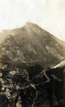
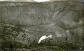
Photograph depicts a view of Seton Lake and the surrounding area, including the Pacific Great Eastern railway line. The railway grade is visible at left. Also visible is the Seton Lake fish hatchery at the east end of the lake and its employee boarding house, superintendent's cottage, and weir at the head of what was then referred to as "Lake Creek". The road seen in the centre foreground travelled from Lillooet to Seton Lake then to Golden Cache Mine.
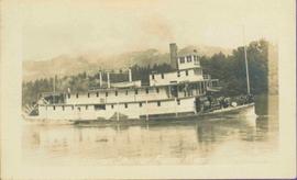
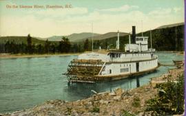
Postcard photograph depicts sternwheeler tied to riverbank.
Printed annotation on recto reads: “On the Skeena river, Hazelton, B.C.” Handwritten message on verso is addressed to “Mrs. Flossie Strong 6 Nah St. Watermill ME, U.S.A” 1 cent Canadian postage stamp has been canceled with stamp reading “Dec 24, 5:30 PM 1915 Buffalo N.Y.”
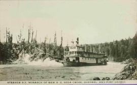
Stern wheeler in river. Printed annotation on recto reads: “Steamer B.X. Monarch of New B.C. Soda Creek, Quesnel and Fort George”
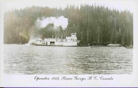
Stern wheeler in river. Printed annotation on recto reads: “Operator 1913, Prince George, B.C. Canada” Handwritten annotation in pencil on verso reads: “Operator 1913”
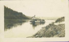
Stern wheeler in river. Handwritten annotation in pencil on verso reads: “Prince George to Tete Jaune” Hand written message in ink on verso is addressed to “Mademoiselle Elisabeth Joliet, Terrguy – Les Dijore Cote a Or France”
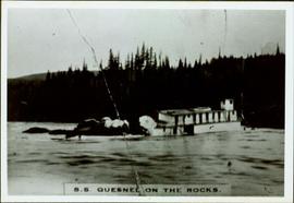
Photograph depicts what appears to be a sternwheeler in distress. Water in foreground, trees on opposite shore in background.
Handwritten annotation on verso: “S. S. Quesnel on rocks in Fort George Canyon. 1911 – 1915".
Photograph depicts a large ship behind dock buildings. Railroad crosses foreground, hills visible on shore in background.
Handwritten annotation on verso reads: "Ship in Pr. Rupert dry dock during Great War 1915?".
Photograph depicts a large ship behind dock buildings. Railroad crosses foreground, hills visible on shore in background.
Handwritten annotation on verso reads: "Pr. Rupert Drydock".
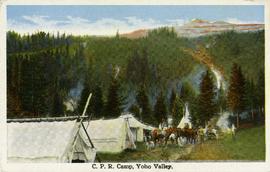
Postcard taken along the CPR line, at a camp in Yoho Valley.
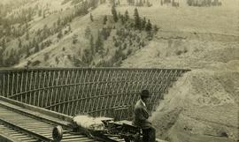
Photograph depicts Mr. Crysdale sitting on a velocipede on the Sallus Creek ("14 Mile") Pacific Great Eastern Railway trestle with an estimated date of very late July 1915 or later. "Canadian Railway and Marine World" reported that track had been laid to 14 miles North of Lillooet by July 30, 1915 (CR&MW , Sept 1915, p341, c2). 14 miles North of Lillooet is approximately 20 rail lengths beyond the North end of this trestle, leading to a "best estimate" of very late July 1915 as the earliest date for this photograph. The velocipede depicted is a 3-wheel, manually propelled vehicle operated by a push-pull (back & forth) action on the actuating handle.
The ca. 1921-1927 “PGE Bridge List” from the notebook of William H. Hewlett (1914-1968) references a Mile 13.7, 14 Mile Creek, frame trestle, 905 ft. long, 182 ft. high, 61 spans of 14.8 feet in the Lillooet Subdivision. A “PGE Track Profile” drawing shows this trestle was on a 1.55% grade and a 12 degree left hand curve. While the drawing had been revised at least twice (with an unknown date for the most recent revision), the pre-“Lillooet Diversion of 1931" mileage figures confirm that the 1915 “Mile 13.7" was in agreement with a more recent hand written note “Sallus Creek”. The trestle appears to have gone by the names "14 Mile" trestle, "13.7 Mile Trestle", and "Sallus Creek" trestle.
Photograph depicts the Pacific Great Eastern Railway trestle located near Sallus Creek in the area around Lillooet, Fountain, and Pavilion. A number of men are working along the trestle, possibly completing final construction work or performing repairs. "Canadian Railway and Marine World" reported that track had been laid to 14 miles North of Lillooet by July 30, 1915 (CR&MW , Sept 1915, p341, c2). 14 miles North of Lillooet is approximately 20 rail lengths beyond the North end of this trestle, leading to a "best estimate" of very late July 1915 or later as the earliest dates for this photograph.
The ca. 1921-1927 “PGE Bridge List” from the notebook of William H. Hewlett (1914-1968) references a Mile 13.7, 14 Mile Creek, frame trestle, 905 ft. long, 182 ft. high, 61 spans of 14.8 feet in the Lillooet Subdivision. A “PGE Track Profile” drawing shows this trestle was on a 1.55% grade and a 12 degree left hand curve. While the drawing had been revised at least twice (with an unknown date for the most recent revision), the pre-“Lillooet Diversion of 1931" mileage figures confirm that the 1915 “Mile 13.7" was in agreement with a more recent hand written note “Sallus Creek”. The trestle appears to have gone by the names "14 Mile" trestle, "13.7 Mile Trestle", and "Sallus Creek" trestle.
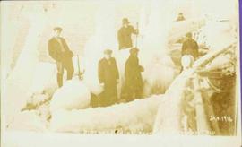
Photograph depicts 6 Men on a fishing boat with water in the background. Equipment on the boat is covered with a very thick layer of ice. Printed annotation on recto reads: “Rupert Fishing Boat After Stormy Trip Jan 1916”. Handwritten annotation in pencil on verso reads: “Rupert Fishing Boat , A Stormy Trip”.
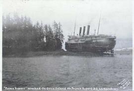
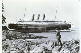
Photograph depicts the steamship Prince Rupert run aground on a rocky shoreline beside a forested area. Annotation on recto of photograph states: ""Prince Rupert" Wrecked On Genn Island Nr Prince Rupert B.C. 23 March 1917. F. Button Photo Pr. Rupert No.568"
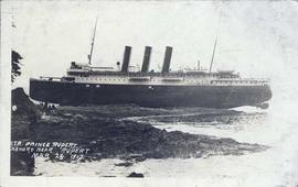
Photograph depicts the steamship Prince Rupert after being run aground on a rocky shoreline. Annotation on recto of photograph states: "STR. PRINCE RUPERT ASHORE NEAR RUPERT MAR 23. 1917."
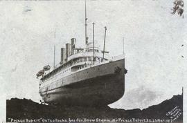
Photograph depicts the steamship Prince Rupert run aground on a rocky shoreline. Annotation on recto of photograph states: ""Prince Rupert" On The Rocks. Yes Sir. Snow Storm. Near Prince Rupert, B.C. 23 Mar: 1917. F. Button Photo. Pr. Rupert. No. 576"
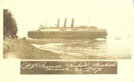
Photograph depicts the steamship Prince Rupert run aground on a rocky shoreline. Annotation on recto of photograph states: "S.S. Prince Rupert Wrecked March 23rd 17."
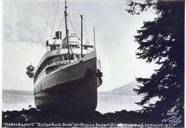
Photograph depicts the steamship Prince Rupert run aground on a rocky shoreline with a tree in the foreground. Annotation on recto of photograph states: ""Prince Rupert" "On The Rock Dock" Nr Prince Rupert B.C. Wrecked 23 March 1917. F. Button Photo Pr. Rupert no.575."
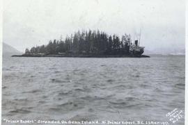
Photograph depicts the forested Genn Island with the steamship Prince Rupert run aground on the rocky shore of the island. Annotation on recto of photograph states: ""Prince Rupert" Stranded On Genn Island. Nr. Prince Rupert. B.C. 23 Mar: 1917. F. Button. Photo Pr. Rupert. No 567."
Photograph depicts a man standing in front of the steamship Prince Rupert run aground on a rocky shoreline. Annotation on recto of photograph states: "Prince Rupert" Wrecked On Genn Island Nr Prince Rupert B.C. 23 Mar' 1917. F. Button. Photo Pr Rupert No. 573" Annotation on verso of photograph states: "Dear Ted.- I am just writing you a note to remind you you have not written me since the last time. This is the way the Rupert is now she sure looks fine. I had a fine time in Rupert during the holidays. I wish you would send me some stamps. I traded Willie quite a few and two dandy, Montenegro ones. I am using my fountain pen now, it writes fine. I guess I will close your loving brother Gordon"
Plan depicts Granville Island industrial sites in False Creek, Vancouver. Shows revised trackage from 1955 annotated in colour by Davies.
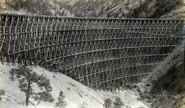
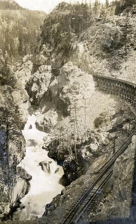
Photograph depicts a Pacific Great Eastern Railway wooden trestle in Cheakamus Canyon.
Photograph depicts a Pacific Great Eastern Railway train on Pavilion Creek trestle at Mile 20.3. Also visible are a water tank and possibly the graveyard at Pavilion.
The ca. 1921-1927 “PGE Bridge List” from the notebook of William H. Hewlett (1914-1968) references a 389.4 foot long, 34 ft. high, framed trestle with 26 spans of 14.8 feet at Mile 20.3 carrying the line over Pavilion Creek. There was a water tank at Pavilion located between the North end of the siding and the South end of the trestle. A track profile chart confirms that the track at this point is on a 12 degree curve. This photograph was taken from a vantage point up the hill to the North. The structures at the lower left of this image (2020.08.82) are consistent with a small construction camp, which accounts for the presence of a camp cook in image 2020.08.83.
"Canadian Railway and Marine World" reported in their January 1916 issue (p. 11, c.1), that track had been laid to within ½ mile of Clinton (Mile 45.0) on Dec. 14, 1915. If a constant rate of construction had been maintained from Mile 14, reached on July 30, 1915 as previously discussed, to Clinton, the approximate date of completion to Pavilion would be around the end of August, 1915 which is probably the earliest possible date for this photograph.
Photograph depicts a Pacific Great Eastern Railway work train on Pavilion Creek trestle at Mile 20.3. laden with workers, railway ties, and a steam donkey. The work train may be returning to a work camp, as a man dressed in the attire of a camp cook is standing beside the track.
The ca. 1921-1927 “PGE Bridge List” from the notebook of William H. Hewlett (1914-1968) references a 389.4 foot long, 34 ft. high, framed trestle with 26 spans of 14.8 feet at Mile 20.3 carrying the line over Pavilion Creek. There was a water tank at Pavilion located between the North end of the siding and the South end of the trestle. A track profile chart confirms that the track at this point is on a 12 degree curve. This photograph was taken at trackside. The structures at the lower left of image 2020.08.82 are consistent with a small construction camp, which accounts for the presence of a camp cook in this image (2020.08.83).
"Canadian Railway and Marine World" reported in their January 1916 issue (p. 11, c.1), that track had been laid to within ½ mile of Clinton (Mile 45.0) on Dec. 14, 1915. If a constant rate of construction had been maintained from Mile 14, reached on July 30, 1915 as previously discussed, to Clinton, the approximate date of completion to Pavilion would be around the end of August, 1915 which is probably the earliest possible date for this photograph.
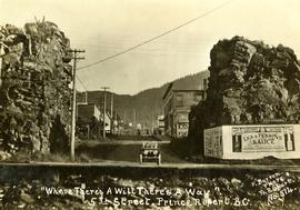
Handwritten annotation on recto of postcard reads: “Were there’s a will there’s a way, 5th Street, Prince Rupert, B.C., F. Button photo Pr. Rupert. No. 514.” Handwritten annotation in pen on verso of postcard reads: “Miss Belding, 33 Marlbro Avenue, Hull Yorkshire, England. S.S. Prince George. Dec. 1918. Dear Bertha, This is a street in the centre of the town Prince Rupert. There is a capacity list of passengers on board. The boat is registered to hold 384. We left at midnight and exped to arrive in Vancouver tomorrow at 3:30 pm. Love from Edie.”
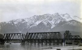
Photograph depicts the the Lillooet River Bridge north of Pemberton, BC. Mt. Currie is visible in the background.
Photograph depicts a Pacific Great Eastern Railway train on Pavilion Creek trestle at Mile 20.3. The train includes Locomotive #56, built by Canadian Locomotive Company of Kingston, Ontario, in August 1914, together with caboose C2, built by National Steel Car of Hamilton, Ontario in 1914 and a “Hart Convertible Car” #140 stencilled with indeterminable initials. These cars were convertible gondolas which were used as ballast cars with the ability to dump ballast either between or outside the rails depending on whether the centre floor doors or the side doors were opened. This particular car, which was scrapped in 1949, was part of a group of 15 cars remaining in number series 131 - 195 (not all numbers used) known on the PGE as “Red Harts” to distinguish them from a somewhat more modern version in number series 201 - 240 (again, not all numbers used) known as “Black Harts”.
The ca. 1921-1927 “PGE Bridge List” from the notebook of William H. Hewlett (1914-1968) references a 389.4 foot long, 34 ft. high, framed trestle with 26 spans of 14.8 feet at Mile 20.3 carrying the line over Pavilion Creek. There was a water tank at Pavilion located between the North end of the siding and the South end of the trestle. A track profile chart confirms that the track at this point is on a 12 degree curve.
"Canadian Railway and Marine World" reported in their January 1916 issue (p. 11, c.1), that track had been laid to within ½ mile of Clinton (Mile 45.0) on Dec. 14, 1915. If a constant rate of construction had been maintained from Mile 14, reached on July 30, 1915 as previously discussed, to Clinton, the approximate date of completion to Pavilion would be around the end of August, 1915 which is probably the earliest possible date for this photograph.
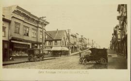
Street view of Third Avenue in Prince Rupert. One horse drawn delivery cart and one delivery car are parked on the street. Printed annotation on recto reads: "3rd Ave. Prince Rupert. B.C." Handwritten annotation on verso reads: "Book & parcel find[??] received, love & many thanks, u.w. as you know, just what I needed. [Illegible] R.W." Postcard is addressed to: "Mrs. J.W. Cawfsious [??] 1136 Barclay St. Vancouver B.C." Verso is affixed with a 2 cent Canadian Stamp, and is postmarked: "Prince Rupert B.C. Sep 19 6-PM."
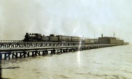
Photograph depicts a Pacific Great Eastern Railway train on the original dock at Squamish (Newport); the vessel in the distance behind the warehouse is quite likely the "MV Ballena", the subject of photograph 2020.08.01.
The equipment shown in this photograph is: Locomotive 51 or 52, built by Montreal Locomotive Works in 1913; caboose C-1, built by National Steel Car, Hamilton, Ontario in 1914; baggage-mail car 51 or 52; passenger coach 2, 3 or 4; and an unknown flat car outfitted as a sightseeing car with canopy. The time-frame for the photograph is between June 8, 1915 (when baggage-mail cars 51 & 52 arrived at Newport Dock) and some time in 1918 (when caboose C-1 was re-numbered to 1801).
Additional information on baggage-mail cars 51 & 52 and coaches 2, 3 & 4:
Baggage and mail cars 51 and 52 were purchased from E.H. Wilson & Co. of Philadelphia at a total cost of $2806.74 each. They were received on line June 4, 1915 and were barged to Newport on June 8. These cars had a length of 64 ft. over buffers, an inside length of 60 ft. and an inside width of 9 ft. 2½ in. and rode on 6-wheel trucks. Although not confirmed, these cars are believed to be of Pennsylvania Railroad heritage with PRR Class MM baggage and mail cars being the most likely candidates. Certainly, all the other cars purchased from E.H. Wilson & Co. were ex-Pennsylvania and the gasoline lighting system with which these cars were delivered was used extensively by the PRR.
Coaches 2, 3, & 4 are former Pennsylvania Railroad Class “PK” closed vestibule coaches #s 3077, 3080, & 3092 which were received on June 10, 1914 after being purchased from E.H. Wilson & Co. for $3859.11, $3858.87 & $3858.87 respectively. They were built by the PRR in 1905, 3070 and 3088 at Altoona Car Shops and 3092 at the Wilmington, Delaware shops of subsidiary Philadelphia, Baltimore and Washington. All had been assigned to P.B. & W. service. The Official Railway Equipment Register lists these cars as 62 ft. long with a capacity of 60 passengers.
