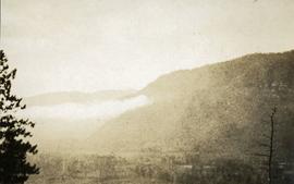
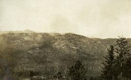
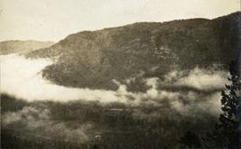
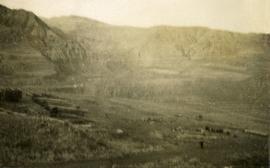
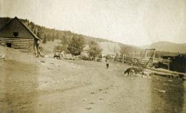
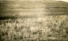
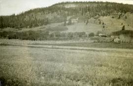
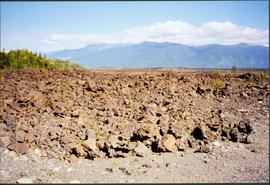
Geographic Features

Elements area

Taxonomy

Code

Scope note(s)

  • Includes both natural and artificial features

  • Physical landscape, built landscape

  • Urban and industrial landscapes

  • Topography

  • Site plans

  • Boundaries, districts, reserves, parks, sanctuaries, towns, etc.

  • NOTE: Mainly but not exclusively pertaining to photographic and cartographic records

  • SEE ALSO: Land, Settlement and Immigration

Source note(s)

  • MemoryBC Subject Groups

Display note(s)

    Hierarchical terms

    Geographic Features

      Equivalent terms

      Geographic Features

        Associated terms

        Geographic Features

          4130 Archival description results for Geographic Features

          4130 results directly related Exclude narrower terms
          2011.3 · Collection · 1901 - [ca.1930]

          A collection of postcard photographs of Port Essington BC, Port Simpson BC, Atlin, Quesnel, McBride, Hagwilget Village, Giscome, Likely, Kitwanga, Smithers, Prince Rupert BC, Prince (Fort) George BC Images depict street scenes, water scenes, community events, businesses, buildings, and aerials of the towns. Collection also depicts a number of Northern BC paddle wheelers.

          Newlands?
          2012.13.1.89.028 · Item · Mar. 1975
          Part of J. Kent Sedgwick fonds

          Image depicts what is possibly the community of Newlands, B.C.

          2000.1.1.2.06 · File · 1 August - 11 March 1971
          Part of Cassiar Asbestos Corporation Ltd. fonds

          Photographs depict construction of the new mill, each taken from approximately the same distance and featuring two different angles of the building. Construction work progresses from framework to sheeting and siding. Vehicles, piles of building supplies, and a construction trailer are often in foreground, mountains in background. It is believed that these photographs were taken during a labour dispute. Each photo has been annotated on recto with the date and time of day, and some document the number of workers on site. Annotations include: "2 days work", "work gets less & less", "not much for 4 men", "very little done - less than usual low performance", "0° - 20° weather must have thickened their blood".

          2012.13.3.2.02 · File · 1985-1986
          Part of J. Kent Sedgwick fonds

          File consists of notes, clippings, and reproductions relating to a New Caledonia theme for the Heritage Society of British Columbia Seventh Annual Conference. Includes: "New Caledonia: The Frontier Yesterday and Today" typescript document by Garvin Moles and Kent Sedgwick (June 1985) and "Horizon 2" journal publication vol. 24 no. 2 (1986).

          Nelson
          2012.13.1.027 · Subseries · 1981
          Part of J. Kent Sedgwick fonds

          File contains slides depicting places in Nelson.

          Nechako Sheet
          2008.2.1.23 · Item · 1 December 1942
          Part of Northern BC Cartographic Collection

          Colour-coded topographic map depicts surveyed lands alienated, available for purchase or lease under Land Act, and available for pre-emption. Depicts land districts, land recording districts, provincial forests, parks, triangulation stations, communities, bodies of water, transport routes, and communication lines.

          Nechako River?
          2012.13.1.23.08 · Item · 1973
          Part of J. Kent Sedgwick fonds

          Image depicts what is possibly a small section of the Nechako River on Cottonwood Island.

          Nechako River?
          2012.13.1.22.19 · Item · 1970
          Part of J. Kent Sedgwick fonds

          Image depicts a body of water in Island Cache. It is possibly a small section of the Nechako River.

          2012.13.2.14.15 · File · 1996
          Part of J. Kent Sedgwick fonds

          File consists of notes and reproductions relating to the Nechako cutbanks in Prince George. Includes: "The Cutbanks" typed document by Kent Sedgwick (1 Feb. 1996). File also includes a photograph depicting heritage river trail signs erected at the cutbanks and describing the significance of the cutbanks in Prince George (1996).

          Nechako Cutbanks Trail
          2012.13.1.3.092 · Item · 12 Oct. 1989
          Part of J. Kent Sedgwick fonds

          Image depicts the cutbanks on the other side of the Nechako, taken from the nature trail at Island Cache. Map coordinates 53°55'34.6"N 122°45'52.4"W

          Nechako Cutbanks Trail
          2012.13.1.3.091 · Item · 12 Oct. 1989
          Part of J. Kent Sedgwick fonds

          Image depicts the cutbanks on the other side of the Nechako, taken from the nature trail at Island Cache. Map coordinates 53°55'34.6"N 122°45'52.4"W

          Nechako Cutbanks
          2012.13.1.3.090 · Item · 12 Oct. 1989
          Part of J. Kent Sedgwick fonds

          Image depicts the cutbanks on the other side of the Nechako, taken from the nature trail at Island Cache. Map coordinates 53°55'34.6"N 122°45'52.4"W

          2009.5.3.89 · Item · [ca. 1917]
          Part of Taylor-Baxter Family Photograph Collection

          Photograph depicts bridge over Nechako River. Sloped cutbanks on opposite shore in background. Railroad tracks can be seen on town shore in right foreground. Handwritten annotation on verso of photograph: "NECHAKO RIVER NEAR PRINCE GEORGE B.C. N.H.D."

          Near Williams Lake
          2012.13.1.50.032 · Item · 1974
          Part of J. Kent Sedgwick fonds

          Image depicts an aerial view of some scenery near Williams Lake, B.C. The highway and BCR tracks are visible among the trees.