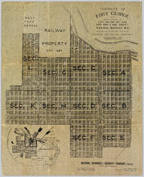
Consists of 1 plan entitled "Plan of Subdivision of S.W. 1/4, D.L. 4041 : Cariboo District," surveyed and signed by P.A. Landry, of South Fort George.
Fort George, BC
71 Archival description results for Fort George, BC
Consists of legal records and documents related to the holdings and activities of J. B. Henderson-Roe and his father, C.H. Henderson-Roe, including a hand-drawn map of Prince George, Fort George, and South Fort George, as well as a surveyor's plan for a subdivision.
File contains postcards portraying life in Prince George, B.C. Images depict street scenes (George Street, Central Avenue, and Hamilton Avenue), government buildings, Hotels, a theatre, a baseball game, and construction of a pier.
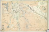
Colour-coded map depicting lands open for pre-emption, lands in “University Reserve,” and lands reserved for public auction. Depicts land recording divisions, communities, bodies of water, transport routes, and game reserves.
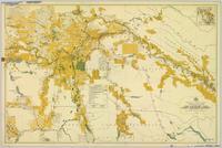
Colour-coded map depicting lands surveyed as alienated, reserved, Statutory Timber Lands, B.C. Land Settlement Board Area, or open for pre-emption. Depicts land districts, land recording divisions, communities, game reserves, bodies of water, transport routes, and communication lines.
Collection contains photographs depicting community life in Prince George, B.C. Images depict holiday events, sports teams, government buildings, businesses (hotels, banks, retail, newspaper office), riverboats, railroad construction, fishing, a cemetery, street scenes, aerials, and landscapes. Also includes photos taken outside of the Prince George vicinity including Prairie Creek, Thomas Creek and Barkerville, B.C.
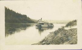
Stern wheeler in river. Handwritten annotation in pencil on verso reads: “Prince George to Tete Jaune” Hand written message in ink on verso is addressed to “Mademoiselle Elisabeth Joliet, Terrguy – Les Dijore Cote a Or France”
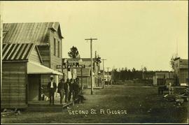
Photograph depicts a street scene along Second St. in Fort George. Wagons line the dirt road which is flanked by wooden buildings. A group of unidentified men stand on the boardwalk outside of Rigg's Restaurant. Handwritten annotation along bottom of photograph: "Second St. Ft. George".
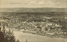
Overhead view of downtown Prince George with a forested area in the background. Printed annotation on recto reads: "South Fort George- 1914."
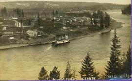
Lofty view of stern wheeler in river. Scattered buildings and tents in background. Printed annotation on recto reads: “South Fort George Oct 30th 1910”
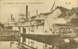
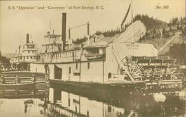
Postcard photograph depicts two sternwheelers in dock. Group of men can be seen standing on dock. Steep banks of opposite shore visible in background.
Printed annotation on recto reads: “S.S. “Operator” and “Conveyer” at Fort George, B.C. No. 107.”
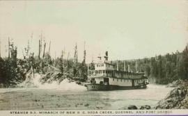
Stern wheeler in river. Printed annotation on recto reads: “Steamer B.X. Monarch of New B.C. Soda Creek, Quesnel and Fort George”
This Collection consists of photographs documenting early development of the Central Interior including such subjects as: homesteading, railway construction, packing & freighting, modes and routes of transportation, schools, mercantile development, leisurely activities, sports, natural resource development and exploitation, political movements, town-site development and policing. This collection also provides a look at history of the Taylor-Baxter Family - a long time pioneering family of this region, including: A.K. & Lillian Bourchier; Hugh & Hermina "Minnie" (nee Wessel) Taylor and family; Herbert & Sarah (nee Wessel) Glassey; and Bob & Violet (nee Taylor) Baxter and family.
Consists of a Fort George promotional pamphlet with map illustrations. Contains maps of Fort George as a railway hub and Fort George property lots. Includes articles describing Fort George as the "Last Great Metropolis of North America", Fort George's "Ideal Land for the Farmer", and "Here are some of our reasons for claiming that we have made good at Fort George". Also includes full page promotional ad for the "Fast Disappearing Opportunity to get in on the ground floor prices at Fort George".
Stern wheelers “Operator” and “Conveyor” in dock. Printed annotation on recto reads: “S.S. “Operator” and “Conveyer” at Fort George, B.C. No. 107.”
This photograph album consists of images pertaining to early settlements, bridges, riverboats, railways, cross-land travel companies, and family and social life including portraits and such events as cross country skiing, picnics, family gatherings, basketball team photos, masquerade dances, dramatic plays, hockey games and team dinners. Identified individuals include: the Tillicums, Bill Bennett, Jean Caux, Frank Johnstron, the Taylor Family (Hermina, Hugh, Ellen, Violet, Lucy, Dixon, Arthur, Virginia, Tom and Hugh Jr.), H.G.T. Perry, Betty Angus, Mrs. Kirkpatrick and Mrs. Davis. Identified geographic locations include: South Fort George, Prince George, Hagwilget Bridge, Walcott, Prince Rupert, Finlay River Rapids, Lulu Island, Ashcroft, Skeena River, Nechako River, Bulkley River, Kispiox and Hazelton.
This file also contains a one way Canadian National Railways ticket in the name of Miss V.B. (Violet Bourchier) Taylor to travel from Prince Rupert to Vancouver in July 1927.
Taylor, HughPhotographs within this file pertain to modes of transportation and transportation routes (including construction, surveying and traveling).
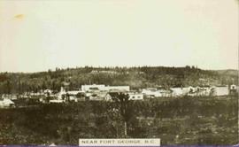
View of Cluster of buildings with treed hill in the background. Printed annotation on verso reads: “NEAR FORT GEORGE B.C.”
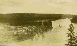
Lofty view of Fort George, B.C., river and paddle wheeler on right. Treed hills can be seen in background. Printed annotation on verso reads: “Fort George B. C.”
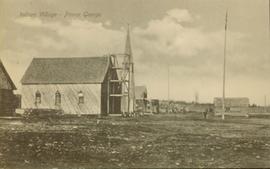
Side view of a wooden church, possibly under construction, and other buildings. Printed annotation on recto reads: "Indian Village- Prince George."
