Exploration, Discovery and Travel

Elements area

Taxonomy

Code

Scope note(s)

  • Travel or exploration for personal, geographical, scientific or mapping reasons
  • Expeditions, exploration, adventure, prospecting, guiding
  • Individuals and groups involved in exploration or travel (eg. explorers, adventurers, prospectors, guides, outfitters)
  • Expedition planning, reports and accounts
  • Personal travels for discovery and education (eg. travel diaries)
  • Early contact with First Nations
  • SEE ALSO: Land, Settlement and Immigration

Source note(s)

  • MemoryBC Subject Groups

Display note(s)

    Hierarchical terms

    Exploration, Discovery and Travel

      Equivalent terms

      Exploration, Discovery and Travel

        Associated terms

        Exploration, Discovery and Travel

          1199 Archival description results for Exploration, Discovery and Travel

          2000.1.1.1.06 · File · 1966 - 1991
          Part of Cassiar Asbestos Corporation Ltd. fonds

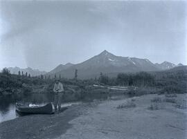
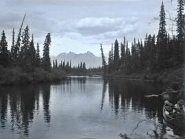
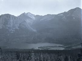
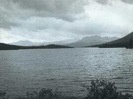
          This collection is of Kutcho Creek Camp that was set up by a crew led by Cassiar's Chief Geologist Bill Plumb in 1966.

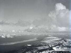
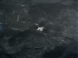
          There are six photographs showing the temporary buildings, paths and barrels. These photos were taken from a high hill looking down at the camp. Two photographs depicts the valley of Kutcho Creek area, and the exploration camp is in the distance at foot of hill. One photograph depicts valley of Kutcho Creek area with a body of water in foreground, and mountains in background.
          Another photograph depicts man believed to be Matt Bell standing in Kutcho Creek exploration camp. There are tents on either side, a wood structure in background and a sign on wood post: "PLUMB BLVD."
          One photograph believed to have been taken near Kutcho Creek, during the initial exploration trip led by Cassiar's Chief Geologist Bill Plumb. Bill stands to left of man believed to be Matt Bell in right foreground. Bulldozer works along talus slope in left foreground.
          Another photograph of this initial trip shows a bulldozer working along talus slope in centre of image.

          2006.25.1.75 · Item · Apr. 1966
          Part of Al Elsey Moving Images Collection

          Film begins with short introduction of girl pointing to a map and drawing a line to where the men will be hunting.

          Footage from a small plane overlooking the landscape of what is believed to be either the Bella Coola Valley, Tweedsmuir Provincial Park, Rainbow Mountains, or Chilcotin area.

          Footage of hunting party setting up camp in the high country of the mountains. There is a herd of caribou and footage of caribou trophy kill. There is filming of two marmots and additional recordings of camp cooking and socializing.

          The film ends with the hunters entering the plane again and returning to their original camp, believed to be Nimpo lake.

          2006.25.1.74 · Item · Oct. 1964
          Part of Al Elsey Moving Images Collection

          Footage from a small plane overlooking the landscape of what is believed to be either the Bella Coola Valley, Tweedsmuir Provincial Park, Rainbow Mountains, or Chilcotin area.

          Footage of hunting party setting up camp in the high country of the mountains. There is a herd of caribou and footage of caribou trophy kill. There is filming of two marmots and additional recordings of camp cooking and socializing.

          The film ends with the hunters entering the plane again and returning to their original camp, believed to be Nimpo lake.

          Bill Plumb Exploration
          2000.1.1.1.07 · File · 1963 - 1965
          Part of Cassiar Asbestos Corporation Ltd. fonds

          Photograph of Cassiar's Chief Geologist Bill Plumb who led many exhibitions for the purposes of Cassiar's outside exploration endeavors. Various photos in this collection depict Bill on some of these exhibitions.

          2006.25.1.79 · Item · Apr. 1963
          Part of Al Elsey Moving Images Collection

          There are three different sections of film footage on this reel.

          The first is of two men and a young boy going fishing from a river bank, gutting and cleaning the fish they catch and baiting their hooks with mill eggs. There is more filming of three other men going down the river in a small boat and then banking it to fish. They gut and clean their fish as-well. They load their small boat into the back of a red pick-up truck after they are finished their day.

          The second part of this film reel begins with a map of Tweedsmuir Provincial Park. Men on snowmobiles traveling to an abandoned log home and acreage. They then break through the ice on the nearby lake and begin to retrieve their previously set beaver trap, which has a caught beaver. The men then travel to a different location and set up a beaver trap. There is some additional footage of two moose in the snow as the men travel to a third location and retrieve another caught beaver from under the ice. The men return to their cabin and skin the beavers.

          The third part of this film is footage of Anahim Lake village, birds in the area, wild flowers, cattle drive, children fishing on the river and swimming, a pelican on a lake, and people in a boat traveling.

          Possible other locations of filming include Bella Coola River, Dean River, Ulkatcho, Ulkatcho Mountains, and Tweedsmuir Provincial park.

          Pack Train in High Country
          2006.25.1.01 · Item · April 1963
          Part of Al Elsey Moving Images Collection

          Footage of a pack train in the high country, which is likely an upper valley of the mountain foothills. Probable locations of this footage include Holt homestead, Rainbow Mountains or Tweedsmuir Provincial Park.

          Moose Hunt
          2006.25.1.45 · Item · Oct. 1962
          Part of Al Elsey Moving Images Collection

          Footage of a moose hunt, moose kill, and butchering of the moose.

          Possible locations of this footage are the Chilcotin region, Rainbow Mountains or Tweedsmuir Provincial Park.

          2006.25.1.71 · Item · Nov. 1962
          Part of Al Elsey Moving Images Collection

          Footage of ducks on a lake and flying away, horses in a corral, a campsite, caribou in the high country of the mountains, probably the Rainbow Mountains, a campsite where men are packing horses and game kill and their journey home in pack train.

          Possible locations of filming include Anahim Lake, Chilcotin area, Holt Homestead, Rainbow Mountains, Tweedsmuir Provincial Park, or Wells Gray Provincial Park.

          2006.25.1.62 · Item · [between 1961 - 1967]
          Part of Al Elsey Moving Images Collection

          Footage of large animal, most likely a moose, along a steep bank. Two men and their pack horse traveling along an open landscape, a close shot of their campfire at night, then footage of them preparing for a journey early in the morning. Also a view of a herd of caribou, the men traveling in a pack train over a stream and through upper valleys of the mountains, various sunset shots, a lake full of birds feeding, and finally the men packing the horses with killed game meat, most likely caribou.

          The location of the filming is most likely the Rainbow Mountains.

          2006.25 · Collection · 1961 - 2000, predominant 1961-1967

          Fonds consists of original, silent 16mm reels that portray the natural, social and land use history of the Bella Coola and Chilcotin regions named the "Natural and Guiding History of the Bella Coola and Chilcotin Regions".

          Possible locations that Al Elsey filmed include: Bella Coola, Bella Bella, Anahim Lake, Alert Bay, Nimpo Lake, Bulkey Valley, the Rainbow Mountains, Tweedsmuir Provincial Park, Dean River, Bella Coola River, Tchaha Lake, the Chilcotin region, the Ulkatcho Mountains, Lassard Lake, Fenton Lake, Atnarko River, Wells Gray Park, and Holt Homestead.

          Pictures and postcards
          2000.23.1.083 · File · 1960-1980
          Part of Audrey Smedley L'Heureux fonds

          File consists of reproduced photographs from the BC Provincial Archives and postcards collected from various places in British Columbia. Also includes newspaper clippings, negatives, maps, and articles. Highlights include:

          • Signed Christmas card from William K. Blackburn, director of the B.C. Canoe Racing Association, which includes an original photograph of a canoe team alongside a canoe painted with the names "British Columbia" and "Simon Fraser" (possibly for a BC centennial event).
            • BC Provincial Archives reproduction, "Bates Camp, on Summit Near Headwaters of Omineca River", [189?] (photograph reproduction)
            • BC Provincial Archives reproduction, "View from Camp XX., on Summit near Headwaters of Sustut River", [189?] (photograph reproduction)
            • BC Provincial Archives reproduction, "Athabascan Indians at Stoney Creek, Fort Fraser District", 1905 (photograph reproduction)
            • Original photographs of Huble homestead, "Front View", [197-?]
            • Original photographs of Huble homestead, "Side View", [197-?]
            • Original photographs of Huble homestead, "House and Barn view", [197-?]
            • BC Provincial Archives reproduction, "Mile 145-2nd crossing on the Fraser River", 1913 (photograph reproduction)
            • BC Provincial Archives reproduction, "Ferrying across the Fraser, Quesnel-Xmas", 1910 (photograph reproduction)
            • BC Provincial Archives reproduction, "Old Mining cabins Vitai[?] Creek", 1913 (photograph reproduction)
            • BC Provincial Archives reproduction, "Hudson's Bay Company Post at Fort McLeod (McLeod Lake). Founded in 1805 First post built West of the Rocky Mountains", [191-?] (photograph reproduction)
            • Seven photograph reproductions taken from an unknown book, [191-?]
            • BC Provincial Archives reproduction, "Colonel Charles Bulkley", [189?] (photograph reproduction)
            • BC Provincial Archives reproduction, "Cassiar M.C. Hydraulic Plant Kleanza Creek Omineca", [191-?] (photograph reproduction)
            • BC Provincial Archives reproduction, "Mile Hydraulic Kleanza Creek, Omineca Mining District", [189?] (photograph reproduction)
            • BC Provincial Archives reproduction, "Stuart River Ferry ", 1912 (photograph reproduction)
            • BC Provincial Archives reproduction, "Sinkut? Lake Telegraph Cabin- Atlin- Quesnel Telegraph Line", [191-?] (photograph reproduction)
            • BC Provincial Archives reproduction, "Ah Hao- A Miner of 1871- Aged 63 Years, Germansen Creek", 1913 (photograph reproduction)
            • BC Provincial Archives reproduction, "Ferry Across the Fraser River Quesnel", [191-??] (photograph reproduction)
            • BC Provincial Archives reproduction, "Deserter Canyon- Blasting out lodge Finlay River", 1913 (photograph reproduction)
          Documented Exploration
          2000.1.1.1.02 · File · June 1951
          Part of Cassiar Asbestos Corporation Ltd. fonds

          A collection of 10 photographs of documented exploration in the early 1950s in and around the Cassiar area. Noted locations are Quartz Creek, Mocassin Mines, Blue River Bridge and the Alaska Highway.

          2001.1.019 · File · 1934-1935
          Part of NBCA Document and Ephemera Collection

          File consists of eight newspaper clippings, seven of which are a series of articles on the findings of the Oxford University Ellesmere Land Expedition, with the eighth being a photograph of the Expedition’s winter quarters in Etah, Greenland. Five of the articles were written by the expedition leader, Mr. Noel Humphreys and the other two were written by members of the Expedition, Mr. Moore and Mr. Haig-Thomas. The articles were originally published in the “Times” of London but the clippings appear to be from the “New Zealand Herald”.

          Humphreys, Noel
          2021.06.100 · Item · Apr. 1932
          Part of Emil Bronlund Photograph Collection

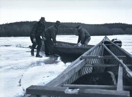
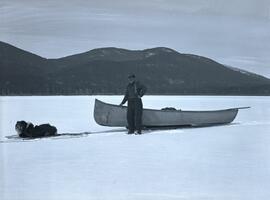
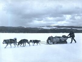
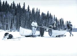
          Photograph depicts Emil Bronlund, H. Witter, and rescue party alongside two canoes on sleds. A dog is harnessed to one of the sleds. The searching party consisted of E.H. Burden, C.H. Van Somer and Clarence Waldof from Prince George.

          The following Prince George Citizen newspaper articles describe the incident:

          “Searching Party Sets Out to Look for Emil Bronlund”
          Prince George Citizen, April 21, 1932, p. 5

          A searching party consisting of E.H. Burden, C.H. Van Somer and Clarence Waldof started out on Tuesday afternoon to look for Emil Bronlund, an engineer connected with the Consolidated Company who has been associated with a local syndicate in prospecting at the headwaters of the McLeod river. According to arrangements made Mr. Bronlund was to have arrived in Prince George last week, coming out by way of Fort McLeod, but in the absence of means of communication it was impossible to learn whether he started or whether he was detained in the vicinity of the area being prospected. Mr. Burden had the broadcasting station CKCD send out a message to J.E. McIntrye, in charge of the Hudson’s Bay post at McLeod, advising that Mr. Bronlund failed to arrive here, and suggesting a search if the missing man had passed the post.
          The search party from the end will travel by canoe from Summit Lake to Davie Lake, from which point it will mush over the trail to McLeod. It may be several days before word is received from it.

          “Emil Bronlund was held up by bad weather”
          Prince George Citizen, April 28, 1932, p. 1

          Emil Bronlund, whose delay on the trip from the headwaters of McLeod River occasioned his friends in this city much uneasiness, reached Prince George on Saturday afternoon, accompanied by E.H. Burden and Henry Waldof, who started out some days ago to search for him. Messrs. Burden and Waldof had difficult going. Summit Lake is still frozen, and it was necessary for them on Thursday morning to drag their canoe over four miles of ice until they could strike open water in the Crooked River. Davie Lake was also covered with ice, and they were dragging their canoe over this when they came upon Bronlund and Ham Witter, making their way south in the same tedious way, dragging their boat over the ice. Bronlund explained he had been held up at Fort McLeod on his way out as it was impossible to travel. There was about a foot of water on the ice, and the trail being close to the water level it would have been foolhardy to attempt to come through.
          It was at McLeod that Bronlund fell in with Witter. The latter had been trapping in the Nation River section but had been taken ill. He was delirious and unable to eat, and his boys decided to bring him out as far as the fort, and having the patient strapped to a toboggan. Witter improved rapidly at the fort and when Bronlund started south on Wednesday morning he decided to accompany him. They had been on the trail two days when they met Burden and Waldof.
          The local syndicate, with which Bronlund is associated, has made a number of locations on the headwaters of McLeod River, and is preparing to do further prospecting to determine more fully the probable values contained in the gravels.
          2021.06.055 · Item · [June 1931 or July 1931]
          Part of Emil Bronlund Photograph Collection

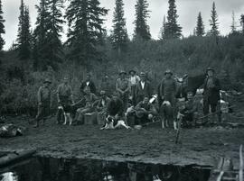
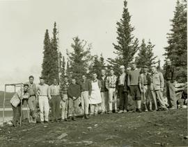
          Photograph depicts a group portrait of Frank Swannell's and Emil Bronlund's crews surrounded by camping supplies, dogs, and a horse along the shore of Thutade Lake. Skook Davidson is in the back row in front of the horse. Frank Swannell is in the front row 3rd from left, petting a dog.