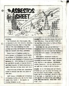
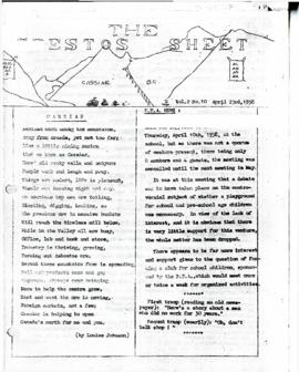
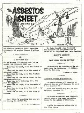
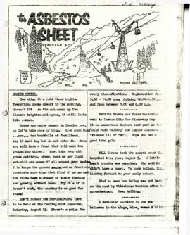
"The Asbestos Sheet" is a newspaper that documents the community and work life of the residents of Cassiar BC. Content includes text and photographs, as well as jokes, comics, and games.
Clinton Creek, YT
369 Archival description results for Clinton Creek, YT
"The Asbestos Sheet" is a newspaper that documents the community and work life of the residents of Cassiar BC. Content includes text and photographs, as well as jokes, comics, and games.
"The Asbestos Sheet" is a newspaper that documents the community and work life of the residents of Cassiar BC. Content includes text and photographs, as well as jokes, comics, and games.
"The Asbestos Sheet" is a newspaper that documents the community and work life of the residents of Cassiar BC. Content includes text and photographs, as well as jokes, comics, and games.
On March 7, 1956 the Cassiar Reporters Guild published one issue of an untitled newspaper simply titled "The Cassiar?" (vol.1, no.1) along with a "name that newspaper" contest call out to the local community. It is believed that no other issue of this first volume was published until December 7, 1957 when The Asbestos Sheet (vol.2, no.1) was published. The Asbestos Sheet, was generally published twice a month and ran from December 1957 to September 1976; after which time both its name and its format changed: the 8-1/2 x 10" news bulletin changing to an 11 x 17" newspaper; and The Asbestos Sheet becoming the Cassiar Courier. The Courier was published monthly from fall 1976 until February 1991 when it stopped circulation shortly before the closure of both the mine and the company town.
File contains photographs pertaining to the transportation of asbestos fibre.
- These include portraits of Clinton trailer trucks, trucks from the Cassiar Transport Division at Mile 860 on the Alaskan Highway, the assembly of large freight trucks, an unidentified bridge, and ships and buildings at the Cassiar Shipping Facilities at Pier 94 on the Asbestos Warf in North Vancouver, B.C.
- Twenty-three photographs dated 1982 depict asbestos fiber bales on pallets and inside shipping containers, with accompanying annotations commenting on the quality of the packing. Several images show fibre bales broken during shipment. An accompanying note reads: "SMD - please ensure this cannot reoccur.", and a photo caption reads: "pierced bags are resulting as an environmental problem as fibre is beginning to build up in certain containers." One of the photographs depicting the Cassiar Transport Division was used for promotional posters with the following commentary: "The Cassiar Transport Division operates out of Whitehorse, Yukon Territory and is responsible for delivering the asbestos to the White Pass and Yukon Route terminal in Whitehorse. Fuel oil and supplies are backhauled to the mines. By the end of 1967, the fleet will consist of 65 tractor-trailer units, each of which will carry 23 tons of asbestos. The distance from Whitehorse to Cassiar is 357 miles and Clinton is 403 miles. During the past year, the Division's trucks traveled 2,213,534 miles and handled 75,100 tons, and the mileage to 3.5 million miles. This is a year-round operation and convoys arrive at the mine daily in spite of the long difficult haul. The Division currently employs 43 drivers and 35 mechanics and operates its own maintenance and rebuild facilities in Whitehorse. Over the years these men have established and enviable record of safety, cost and performance."
- Additional photographs that have been integrated depict the Asbestos wharf and its condition, 31 slides of wharf, maps of shipping routes, storage, forklifts, shipping trucks, and packaged asbestos.
- Also included in this file are two copies of a "Photo Survey - Cassiar Ton Units - "Amstelveld & Trojoland" on arrival to Brisbane & Sidney - August 1967." This collection of photographs is a part of an assessment of the efficiency of shipping and transport to Australia from Cassiar. Pictures include: loading, forklifts, storage, ripped bags, broken straps, wharfs, trucks, slings. There are accompanied annotations with each of the photos explaining the safety hazards or inefficiency of the situation. This report was found inside a box linked to James Hardie Industries Ltd. This company is not mentioned in the photograph annotations, but could be related to the report since James Hardie Industries Ltd. was a key player in asbestos mining and manufacturing in Australia.
- Collection of photos of roadside spill of Asbestos, depicting a man with shovel cleaning up on 5 June 1985
- Photos from Eternit Societe Anonyme (a European company that Cassiar shipped to) of packaged Asbestos in storage in 1967
- Collection of photos of James Hardie Coy. Pty. Ltd. shipment of asbestos that was not stored or transported effectively. Many photos depict broken bags as a result of inadequate storage and forklift punctures.
- Collection of photos of Cassiar/Stewart Road Proposal. Photos depict tests of the various stages of shipping and transportation process including forklift tests, Marineo Sling tests, stacking tests, durability tests, container loading tests, problems with current units etc. Also included is a marketing drawing if proposed shipping plan - drawn by "Stewart 1977."
- Photos of shipping process of Turners Asbestos Fibres Lmt. Photos depict lowering asbestos pallets onto barge with swing, and storage on barge.
- Collection of photos of a shipment of asbestos, but the bags of fibre are not identified as a Cassiar shipment therefore the location is unknown.
The Publications series consists of news bulletins and newspapers documenting the community and work life of the residents of Cassiar, BC. Content includes text and photographs, as well as jokes, comics and games.
On March 7, 1956 the Cassiar Reporters Guild published one issue of an untitled newspaper simply titled “The Cassiar?” (vol.1, no.1) along with a “name that newspaper” contest call out to the local community. It is believed that no other issue of this first volume was published until December 7, 1957 when The Asbestos Sheet (vol.2, no.1) was published. The Asbestos Sheet, was generally published twice a month and ran from December 1957 to September 1976; after which time both its name and its format changed: the 8-1/2 x 10” news bulletin changing to an 11 x 17” newspaper; and The Asbestos Sheet becoming the Cassiar Courier. The Courier was published monthly from fall 1976 until February 1991 when it stopped circulation shortly before the closure of both the mine and the company town.
Photograph depicts a party of ambassadors wearing hardhats while inspecting the inside of the mine at Clinton Creek.
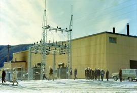
Photograph depicts a party of ambassadors wearing hardhats and walking outdoors past a building at Clinton Creek.
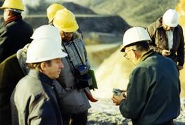
Photograph depicts a party of ambassadors standing outdoors and looking at asbestos at Clinton Creek.
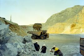
Photograph depicts a party of ambassadors standing outdoors near a dumptruck that is being loaded with dirt at Clinton Creek.
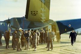
Photograph depicts a party of ambassadors standing outside a Canadian military airplane at Clinton Creek.
File contains 6 slide presentations depicting training material for the operation of a P&H excavator published by the Harnischfeger Institute. The presentations depict an introduction to excavator controls and techniques for proper hoist motion, proper swing motion, concerning haulage units, proper propel motion, and proper crowd motion.
Cassiar Asbestos Corporation Ltd opened a second mine in 1967 at what became the one-industry town of Clinton Creek, Y.T. File contains photographs depicting different areas of operations at Clinton Creek. Locations include the mine, plant, town, tailings pile, main office, the 40 Mile River, and surrounding area. Town photos depict the grocery store, cafeteria, medical clinic, school, auditorium residential area, Connell Street and power house. File also includes aerial photographs and images depicting forest fighting, photographers capturing the tailings pile, asbestos samples, mining machinery, staff offices, and operations in the mill, lab, and garage.
Additional photographs integrated into file depict Clinton Creek's surrounding area, and three slides of a tailing pile explosion believed to be Clinton Creek.
Cassiar Asbestos Corporation Ltd opened a second mine in 1967 at what became the one-industry town of Clinton Creek, Y.T. File contains photographs depicting progressive construction of buildings at the Clinton Creek mine, plant, townsite and powerhouse. Mine photos depict the crusher site and tramline station. Plant photos depict the dryer, fibre storage, mill, service, vault, and office buildings, as well as the dry rock storage tunnel, reclaim tunnel, and loading dock. Construction living quarters are depicted as well as the construction of residences at the townsite. The power house was built south of the town and plant, on the shore of the 40 Mile River. Some annotations describe the type of material being used for construction.
A collection of aerial photos of the Clinton Creek area.
Included is a flight index for 68 aerial photographs. Map depicts Clinton Creek area, identifying airfield and mine.
Aerial photograph of Clinton Creek, south east of plant site.
Aerial photograph of Clinton Creek, south east of plant site.
Aerial photograph of Clinton Creek, south east of plant site.
Aerial photograph of Clinton Creek, south east of plant site.
Aerial photograph of Clinton Creek, south east of plant site.
Aerial photograph of Clinton Creek, south east of plant site.
Aerial photograph of Clinton Creek, south east of plant site.
Aerial photograph of Clinton Creek, south east of plant site.
Aerial photograph of Clinton Creek, south east of plant site.
Aerial photograph of Clinton Creek, south east of plant site.
Aerial photograph of Clinton Creek, south east of plant site.
Aerial photograph of Clinton Creek, south east of plant site.
Aerial photograph of Clinton Creek, south east of plant site.
Aerial photograph of Clinton Creek, south east of plant site.
Aerial photograph of Clinton Creek, south east of plant site.
Aerial photograph of Clinton Creek, south east of plant site.
Aerial photograph of Clinton Creek, south east of plant site.
Aerial photograph of Clinton Creek, south east of plant site.
Aerial photograph of Clinton Creek, south east of plant site.
Aerial photograph of Clinton Creek, south east of plant site.
Aerial photograph of Clinton Creek, south east of plant site.
Aerial photograph of Clinton Creek, east of plant site.
Aerial photograph of Clinton Creek, north east of plant site.
Aerial photograph of Clinton Creek, north east of plant site.
Aerial photograph of Clinton Creek, east of plant site.
Aerial photograph of Clinton Creek, south of plant site.
Aerial photograph of Clinton Creek, south of plant site.
Aerial photograph of Clinton Creek, south of plant site.
Aerial photograph of Clinton Creek, south of plant site.
Aerial photograph of Clinton Creek, south of plant site.
Aerial photograph of Clinton Creek, south of plant site.
Aerial photograph of Clinton Creek, south of plant site.
Aerial photograph of Clinton Creek, south of plant site.
Aerial photograph of Clinton Creek, south west of plant site.
