Land, Settlement and Immigration

Elements area

Taxonomy

Code

Scope note(s)

  • Claiming, settling, and moving to a new land
  • Land titles, distribution, grants, etc.
  • Community and regional settlement patterns
  • Land settlement companies
  • Land surveys and surveyors
  • Real estate companies and activities
  • Organizations involved in sponsoring and supporting immigrants

Source note(s)

  • MemoryBC Subject Groups

Display note(s)

    Hierarchical terms

    Land, Settlement and Immigration

      Equivalent terms

      Land, Settlement and Immigration

        Associated terms

        Land, Settlement and Immigration

          1213 Archival description results for Land, Settlement and Immigration

          1213 results directly related Exclude narrower terms
          2001.1.053 · Item · 1911
          Part of NBCA Document and Ephemera Collection

          Advertisement reads:
          A FORTUNE IS WITHIN YOUR REACH
          The Natural Center for a Great Metropolis in Central British Columbia
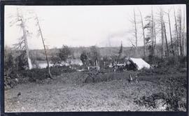
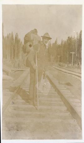
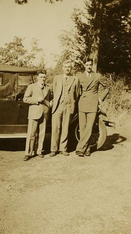
          50,000 people have written to this company in the past few months for information on Fort George and Central British Columbia. This spring this section will see its real awakening--of course the shrewd investor of small capital appreciates what it means to buy land or town lots in the path of great industrial development, which development is not merely contemplated, but is actually in progress. The person who sees Fort George and its wonderfully rich tributary country today and invests a small sum there and revisits it again in 1915 would find himself financially independent, and the whole face of things so completely changed that he could not realize it as the same spot where his small investment had been made in 1911.
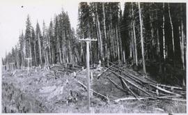
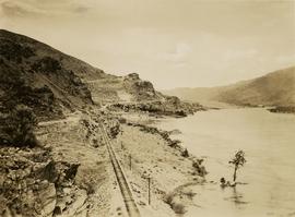
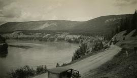
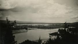
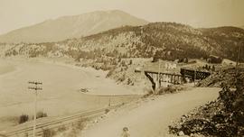
          These statements are not dreams, but real existing facts based on the solid foundation of an immense virgin country, marvelously rich in natural resources being opened to the world by the greatest transcontinental railway system on the American continent, 1,100 miles, of navigable waterways radiate from Fort George.
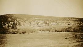
          Fort George is on the line of seven railroads projected and under construction. We issue a monthly periodical, The British Columbia Bulletin of Information--full of intensely interesting reading and pictures of British Columbia, which we will mail to you every month if you will ask.

          Henderson-Roe collection
          2002.17 · Collection · 1912-1914

          Collection consists of materials related to Fort George surveying and preemption, including both legal and personal correspondence, legal documents and records, plans of lots, photographs, and a map. Includes records from the Cariboo Investment Company, Ltd., J.B. Henderson-Roe and C.H. Henderson Roe.

          Photographs
          2002.17.1 · Series · [between 1912 and 1914]
          Part of Henderson-Roe collection

          Photographs consist of 16 black & white photographs depicting Fort George land and surveying, including 3 photographs of Jack Henderson-Roe in front of his log cabin that he constructed in Fort George in 1913.

          2001.1.054 · Item · Feb. 1912
          Part of NBCA Document and Ephemera Collection

          Item is issue Vol. 2 No. 4 from February 1912 of the "British Columbia Bulletin of Information", a promotional mouthpiece of the Natural Resources Security Company. The publication is self-described as "About the vast natural resources and commercial, agricultural and mining progress, together with a synopsis of the laws regulating public lands, timber, coal and other minerals, and current record of development in British Columbia, Alberta and Saskatchewan for the business man, the farmer and the investor". The headline of this issue is "B.C. Government Guarantees Bonds of Railway to connect Fort George with Vancouver". The Natural Resources Security Company was a development company that sold a significant amount of land in Fort George.

          2009.7.1.260 · Item · 24 April 1913
          Part of Archdeacon W. H. Collison fonds

          Foreground shows a rocky shore covered in debris. A small crowd is visible along the coastline, and there are foggy outlines of hills beyond the water. Annotation on recto reads: "McRae Bros After the Blast 24th Apr. 13."

          2009.7.1.265 · Item · 24 April 1913
          Part of Archdeacon W. H. Collison fonds

          Photograph of a large explosion on a rocky shoreline. A bridge is visible in the foreground and a body of water is partially visible in the background. Annotation on recto reads: "McRae Bros Moving Mountains at Prince Rupert BC Apr 24th"

          Album 2
          2003.13.1.2 · File · [after 1913]
          Part of Parker Bonney Photograph Collection

          Consists of a photograph album that contains photographs that depict Parker Bonney's early years as a Forest Engineer. Includes photographs of the expedition to the Nass Valley undertaken by Parker Bonney, Sam Brown, and others. May also include photographs of later surveying expeditions.

          Personal Correspondence 1913
          2002.17.3 · Series · 1913
          Part of Henderson-Roe collection

          Consists of 6 letters written by Jack Henderson-Roe, of Fort George, to his father, C.H. Henderson-Roe, of England, regarding proposed land acquisitions in Fort George.

          2011.3.3.86 · Item · 17 July 1913
          Part of North Coast & Central BC Postcard Collection

          Photograph of a large explosion on a rocky shoreline. A bridge is visible in the foreground and a body of water is partially visible in the background. Printed annotation on recto reads: "McRae Bros Moving Mountains at Prince Rupert BC Apr 24th" Handwritten annotation on verso reads: "Rupert. July 17 1913. Dear [illegible]. Just a card for that album if you've got any room left by now. This is one of the blasts for the clearing of the drydock up here. [Illegible] W.M." Postcard is addressed to: "Miss C.M. Ranip[??] 931 Northlane Av.[sic] Seattle Wash." Two Canadian one cent stamps are affixed on verso. Postmark reads: "Prince Rupert BC. PM Jul 17 13."

          Plans and Legal Records
          2002.17.2 · Series · 1913-1914
          Part of Henderson-Roe collection

          Consists of legal records and documents related to the holdings and activities of J. B. Henderson-Roe and his father, C.H. Henderson-Roe, including a hand-drawn map of Prince George, Fort George, and South Fort George, as well as a surveyor's plan for a subdivision.

          2009.7.1.263 · Item · 21 January 1914
          Part of Archdeacon W. H. Collison fonds

          Photograph of a large explosion next to a huge pile of debris. Buildings are visible on either side and railroad track can be seen in the foreground. Annotation on recto reads: "The Last Big Blast, Prince Rupert BC 21 Jan 1914 McRae Bros. Photo"

          2009.5.2.324 · Item · 1914
          Part of Taylor-Baxter Family Photograph Collection

          This commemorative souvenir was produced by the Prince Rupert Pioneers’ Association in 1914. Its content provides a textual overview of the individual persons who pioneered the establishment of Prince Rupert, as well as, their associated portrait photographs. This publication also provides a brief introduction to the history of Prince Rupert and includes some related historical photographs.

          2009.7.1.267 · Item · 30 March 1914
          Part of Archdeacon W. H. Collison fonds

          Photograph of ocean liner SS Arna docked in a harbour. Foreground shows two individuals on a dock in the lower right corner and a large pile of lumber in the lower left corner. Annotation on recto reads: "S.S. Arna arrived in Prince Rupert B.C March 30th 1914"

          Personal Correspondence 1914
          2002.17.4 · Series · 1914
          Part of Henderson-Roe collection

          Consists of 5 letters written by Jack Henderson-Roe, of Fort George, to his father, C.H. Henderson-Roe, of England, regarding investments and proposed land acquisitions in Fort George.

          2009.5.4.57 · Item · [ca. 1920]
          Part of Taylor-Baxter Family Photograph Collection

          This booklet, published by the Cunard Steam Ship Company, Ltd., provides an overview of Canada, England's emigration agents in Canada, and of the amenities provided by the Cunard Lines to its passengers immigrating to Canada from England via steamship. Booklet was printed in England.

          2009.7.1.268 · Item · 28 September 1920
          Part of Archdeacon W. H. Collison fonds

          Photograph of a partially sunken sailboat near a harbour. Individuals on debris and in a rowboat are surveying the damage. Annotation on recto reads: "GTP. SS Prince Rupert Sept 28th 1920 McRae." Handwritten annotation on verso reads "CTP "Prince Rupert" Sunk at Prince Rupert BC 1920."

          Hudson's Hope
          2000.19.2.33 · Item · 29 Aug. 1927-26 Sept. 1927
          Part of Prentiss Gray Collection

          Photograph depicts the townsite of Hudson's Hope featuring a number of small wooden buildings clustered in a field. The Hudson's Bay post is building visible on far left.

          Gordon Wyness Album
          2020.05 · Collection · 1936

          In 1936, Gordon Young Wyness was employed by Philip M. Monckton, a B.C. Land Surveyor. Between June 5 and October 8, Wyness joined Monckton and a group of others on a land survey expedition in northwestern BC. The survey crew travelled to various locations in the area including Telkwa, Hazelton, Burns Lake, Francoise Lake, Vanderhoof, Prince George, Quesnel, Lytton, and Hope. Wyness documented their journey in this photograph album. Based on the photographs, it appears that the crew led by Philip Monckton consisted of Jack Lee and Gordon Wyness; Mrs. Lavender Monckton (nee O'Hara) also accompanied the group.

          In addition to the 50 photographs included in the album, this collection also includes five additional unique photographs that accompanied the album.

          Wyness, Gordon Young
          Snoqualmie Pass summit
          2020.05.01 · Item · 6 June 1936
          Part of Gordon Wyness Album

          Photograph depicts a man, likely Gordon Wyness, sitting on the front of a 1930 Buick Series 40 car at the Snoqualmie Pass summit.

          Chasm
          2020.05.48 · Item · 1936
          Part of Gordon Wyness Album

          Photograph depicts "The Chasm" or "The Painted Chasm", located 11 miles north of Clinton, adjacent to the route of the Cariboo Road. In 1940, four years after this photograph was taken, Chasm Provincial Park was created in 1940 to preserve and promote the Painted Chasm feature, a gorge created from melting glacial waters eroding a lava plateau over a 10 million year span.

          Chasm, BC
          2020.05.47 · Item · 1936
          Part of Gordon Wyness Album

          Photograph depicts "The Chasm" or "The Painted Chasm", located 11 miles north of Clinton, adjacent to the route of the Cariboo Road. In 1940, four years after this photograph was taken, Chasm Provincial Park was created in 1940 to preserve and promote the Painted Chasm feature, a gorge created from melting glacial waters eroding a lava plateau over a 10 million year span.

          François Lake from ferry
          2020.05.49 · Item · 1936
          Part of Gordon Wyness Album

          Photograph depicts a view of François Lake taken from the ferry going to Northbank Point on right-hand side. The survey crew camped there in June 1936.

          Town of Clinton
          2020.05.39 · Item · 1936
          Part of Gordon Wyness Album

          Photograph depicts the town of Clinton. Wyness noted on the photograph verso that the survey crew had dinner here on their return trip in October 1936. In addition, the album caption notes that Clinton was the location of British Columbia's oldest hotel.