Showing 249 results

Archival description
168 results with digital objects Show results with digital objects
Research projects
2023.2.2 · Reeks · 1960-2024
Part of Dr. Paul Sanborn fonds

Series consists of records created and collected in relation to research projects Dr. Paul Sanborn was engaged in, often with other colleagues, during his employment with the BC Ministry of Forests and/or the University of Northern British Columbia. These archival research records are predominantly unpublished documents, reports, data, and photographs. Some of Sanborn's research projects did not result in a formal scientific publication. In other instances, some of Sanborn's research projects resulted in only a portion of the collected data utilized for a formal publication.

Sanborn compiled details about each research project and its associated records in a summary note. Each of these notes is provided in PDF format along with its research project series. These notes serve as an essential guide for researchers who wish to interpret, utilize, and repurpose Sanborn's data for other future research projects.

Dr. Paul Sanborn fonds
2023.2 · Archief · 1960-2024

Fonds consists of the research records of Dr. Paul Sanborn, a University of Northern British Columbia faculty member in the Department of Ecosystem Science and Management.

Zonder titel
2006.18 · Archief · 2001-2019

The Aleza Lake Research Forest Society (ALRFS) records encompass material that was created or collected by the Society over its existence (2001-present). Records created by the ALRFS consist of administrative and operational records, as well as publications from the Society. Collected records include historical records relating to the Aleza Lake Experiment Forest gifted to the Society or its members. These include maps, photographs, reference material, and documents. Members and associates of the ALRFS also documented the history of the forest through the creation of oral history recordings and written histories such as John Revel's "Devil's Club, Black Flies, and Snowshoes".

The fonds includes a significant amount of reproduced archival material about Aleza Lake from other institutions, such as BC Archives, the Canadian Forest Service, and the BC Forest Service. Many of these reproductions were created as part of the 2006 ALRFS Natural Resources History Internship in an effort to compile the history of the research forest.

Also included are cartographic and photographic materials that depict the Aleza Lake Research Forest and surrounding areas.

2016.5.1 · Reeks · 1941-2018
Part of Harry Coates fonds

Series consists of records pertaining to Harry Coates work and training as a BC Forest Service Research Technician. Series includes documentation for various Sx trials and experimental plots (E.P.) Harry Coates worked on.

E.P. 646.3
2016.5.1.87 · Bestanddeel · [1970-2015]
Part of Harry Coates fonds

File consists of photocopied documentation for E.P. 646.3 Reciprocal Planting of Spruce Provenances in the Rocky Mountain Trench along with printed satellite maps from Bing Maps. File also includes a map of Buckhorn Barn showing reserve no. EP 505, research & R.N. projects. Map includes annotations for EP 646.3.

Grant Hazelwood fonds
2023.7 · Archief · 1943-2015

Fonds consists of material created and collected by wildlife biologist Grant Hazelwood in relation to his work and research regarding wildlife, habitat, and wilderness parks. Includes material regarding Hazelwood's Tailed Frog (Ascaphus truei) research. Also includes records regarding his contracted biologist work via his consultancy business, Alpenglow Resources, on the BC Ministry of Environment's "Upper Nass Assessment Project", a project that included the biophysical mapping of the Northwest-Klappan Road Access Area.

Zonder titel
Harry Coates fonds
2016.5 · Archief · 1957-2014

Fonds consists of records Harry Coates created or received and retained during his career as a BC Forest Service Research Technician and into his retirement as a Sustainable Forest Management activist. Fonds includes materials from his work at the Aleza Lake Research Forest.

Zonder titel
Maps & Oversize
2020.4.7 · Reeks · 1965-2009
Part of G. Gary Runka fonds

Series consists of maps, technical drawings, and other oversize material collected by Gary Runka that are not associated with specific Land Sense Ltd. client jobs.

2023.7.3 · Reeks · 1943-2005
Part of Grant Hazelwood fonds

Series consists of materials and records created or collected by Grant Hazelwood in relation to parks and conservation areas in British Columbia. Grant Hazelwood was a BC Parks wildlife biologist and later a consultant via his business, Alpenglow Resources Ltd.; much of his work was in relation to wildlife in parks and conservation areas.

Clones etc. 1999
2016.5.1.74 · Bestanddeel · 1997-2002
Part of Harry Coates fonds

File consists of documentation for various field sites. File also includes Harry Coates employment contracts (restricted). File also includes a Forest Cover Map Series 93H.093 1998-JUN-02 010, produced by the inventory branch of the Ministry of Forests, Province of British Columbia; Timber supply area: Prince George.

2016.5.5.01 · Bestanddeel · [19-?]
Part of Harry Coates fonds

File consists of trail maps and recreation guides from various places in British Columbia, especially Northern British Columbia. Maps include:

  • British Columbia Road Map and Parks Guide
  • Northwood Pulp and Timber Limited Forest Operations Recreation Map
  • Provincial Parks of Northern British Columbia
  • Visitor's Guide: Mackenzie Woodlands
  • Visitors Guide: Mackenzie Woodlands
  • Mackenzie Forest District Recreation Map
  • Dawson Creek Forest District Recreation Map
  • Morice Forest District Recreation Map
  • Fort St. James Forest District Recreation Map
  • Lakes Forest District Recreation Map
  • Cariboo Forest Region Recreation Map
  • Lakes District Visitors Map
  • Prince George Forest District Recreation Map
  • Vanderhoof Forest District Recreation Map
  • Fort St. John Forest District Recreation Map
  • Cariboo Forest Region Recreation Map (East)
  • Robson Valley Forest District Recreation Map
  • Fort Nelson Forest District Recreation Map
  • Forest Service Recreation Sites: Valemount - Blue River
  • Forest Service Recreation Sites: McBride - Goat River
  • Forest Service Recreation Sites: Prince George West
  • Forest Service Recreation Sites: Moberly - Sukunka
  • Forest Service Recreation Sites: Nation - Takla
  • Forest Service Recreation Sites: Murrat - Kiskatinaw
  • Recreation Road Map for the Prince George Forest Area (1987-1988)
  • Recreation Road Map for the Prince George Forest Area (1997)
  • The Bobtail Forest Service Road Tour
  • Forest Recreation Map: Northwood Pulp and Timber Limited
  • Forest Operations Recreation Map: Northwood pulp and timber limited
  • Forest Service: Recreation Sites Williston/Mackenzie
  • Forest Service Recreation Sites Prince George West
  • The Official Prince George Tourist Street Map
  • Ecological Reserves in British Columbia (July 1990)
  • Prince George Forest District map (April 1990) with annotations regarding trials.
Wansa Thinning Trials
2016.5.1.35 · Bestanddeel · [19-?]
Part of Harry Coates fonds

File consists of photocopied data tables for Wansa Thinning Trials and map of Wansa Sanitation-Spacing Trials (Sx 80405).

Maps series
2016.5.5 · Reeks · [1964-1999]
Part of Harry Coates fonds

Series consists of maps, and road maps, and trail guides from various communities and regions in Northern and Central BC. Series includes Forest Cover Maps and maps related to BC forest and natural resource management.

2007.1.20 · Reeks · 1924-1999
Part of Aleza Lake Research Forest fonds

Series contains aerial photographs, stump data sheets, permanent sample plot summaries, correspondence, minutes from meetings, research proposals, budget reports, measurement charts, various historical documents, permits, field notes, overview diagrams, and an inventory of the 1994 Northwood Pulp and Timber donation to the Fraser Fort George Museum.

2007.1.20.2 · Bestanddeel · 1959-1999
Part of Aleza Lake Research Forest fonds

File contains various documents pertaining to the history of the Aleza Lake Experiment Station, correspondence regarding various administrative issues and research projects ranging from 1972 to 1996, field notes, 1996 meeting minutes, memoranda containing details on the management and preservation of the Aleza Lake Research Forest, various reports on research projects, 1987 permits, field notes, a 1970 working plan, and 6 colour photographs of the Aleza Lake Garbage Dump.

Historical Info
2007.1.25 · Reeks · 1913-1998
Part of Aleza Lake Research Forest fonds

Series contains historical information regarding the Aleza Lake Research Forest. Includes photographs and slides pertaining to the Aleza Lake Experiment Station.

Aleza Lake Maps
2007.1.80.1 · Bestanddeel · 1949-1998
Part of Aleza Lake Research Forest fonds

File contains datelines, small maps consisting of ecological site types, handwritten notes, overheads, terrain resource management information digital map data, and trail system maps.

2007.1.80.1.15 · Stuk · Sept. 1998
Part of Aleza Lake Research Forest fonds

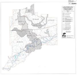
Map commissioned from Ministry of Forests Prince George Region from Madrone Consultants shows Aleza Lake Research Forest Management Compartments and Administrative Boundaries. Map is 1 of 6. Map shows the Aleza Lake Ecological Reserve, Natural Forest Reserve, the Special Management Area, and Riparian Management Research Area.

2007.1.80.1.20 · Stuk · Sept. 1998
Part of Aleza Lake Research Forest fonds

Map commissioned from Ministry of Forests Prince George Region from Madrone Consultants shows Aleza Lake Research Forest terrain themes. Map is 6 of 6. Map shows the following types of terrain units: typic, slope, percipitous, gullied, hummocky, rocky, alluvial, and organic. Ecosystem classification and mapping by Oikos Ecological Services Ltd.

Maps
2007.1.80 · Reeks · 1949-1998
Part of Aleza Lake Research Forest fonds

Series consists of cartographic materials including maps and blueprints of the Aleza Lake Research Forest. The maps reflect permanent sample plots and other study areas. The blueprints outline details for the development of a Ranger Station.

2007.1.80.1.18 · Stuk · Sept. 1998
Part of Aleza Lake Research Forest fonds

Map commissioned from Ministry of Forests Prince George Region from Madrone Consultants shows an Aleza Lake Research Forest TRIM Base Map. Map is 4 of 6. Map shows the following: roads, old roads, buildings, rail line, transmission line, definite streams, intermittent streams, indefinite streams, marshes, swamps, lakes, wooded area boundaries, intermediate contour lines (20m intervals), and index contour lines (100m intervals).

2007.1.80.1.17 · Stuk · Sept. 1998
Part of Aleza Lake Research Forest fonds

Map commissioned from Ministry of Forests Prince George Region from Madrone Consultants shows Aleza Lake Research Forest Access and Access Management. Map is 3 of 6. Map shows the following road types: all weather 1-lane gravel road, dry weather road, and proposed road access. Also shows areas for parking/turnaround, toilets, and information signs.

2007.1.80.1.19 · Stuk · Sept. 1998
Part of Aleza Lake Research Forest fonds

Map commissioned from Ministry of Forests Prince George Region from Madrone Consultants shows Aleza Lake Research Forest ecosystems. Map is 5 of 6. Map shows many sub-types of the following ecosystem types: upland, lowland wet forest, wetlands, and the Bowron floodplain benches. Ecosystem classification and mapping by Oikos Ecological Services Ltd.

2003.4.4.5 · Deelreeks · 1986-1998
Part of Kemano Completion Project Dispute Collection

Subseries consists of material relating to the Nechako Fisheries Conservation Program, predominantly publications and reports. Includes some correspondence between NFCP and the Department of Fisheries and Oceans. Also includes air photo maps of the Nechako River from 1990.

Zonder titel