Item is an original BC Parks report entitled "Preservation and Management of the Grizzly Bear in B.C. Provincial Parks: The Urgent Challenge".
Item is a BC Ministry of Environment and Parks report entitled "1987 Coastal Skeena Moose Survey".
Item is a compilation of reproductions titled "Methods Used in B.C. Ungulate Land Inventory".
Item is an original report by D.J. Robinson, Game Management Biologist, entitled "Interim Report re Status of Sayward Forest Deer Herds".
File consists of records and textual material related to wolf (predominantly in British Columbia) collected by Grant Hazelwood. Highlights include:
- L.N. Carbyn, "Preliminary Analysis of Wolf and Ungulate Interactions with Specific Reference to Moose in Riding Mountain National Park, Manitoba", 1977 (reproduction)
- Francis Singer, "Status and History of Timber Wolves in Glacier National Park, Montana", 1975 (reproduction)
- "Wolves and Trapping in British Columbia", 197-? (reproduction)
- Barbara Scott, "The Vancouver Island Wolf (Canus lupus crassodon), An Initial Study of Food Habits, Population Dynamics, and Social Organization", research proposal document and progress report document, 1978 and 1979 (reproductions)
- BC Fish and Wildlife Branch, "Wolf Predation", May 1969
- Canadian Nature Federation, "Perspective on Wolf Control in Quebec", Nov. 1972
- Warren Ballard et al. for Alaska Department of Fish and Game, "Susitna Hydroelectric Project 1982 Annual Report - Big Game Studies - Volume V - Wolf", Apr. 1983 (reproduction)
File consists of records and textual material related to cougar (predominantly in British Columbia) collected by Grant Hazelwood. Highlights include:
- D.W. Lay, "Report of Ralph River - Buttle Lake Campground", 1976
- P.E. and P.L. Dewar, "Proposed Research on Cougars in Strathcona Park", Nov. 1977 (reproduction)
- D.J. Spalding, "The Cougar in British Columbia", after 1970 (reproduction)
- Percy and Penny Dewar, "Summary of Cougar Study in the Northwest Bay Area (1972-1973), Sept. 1973 (reproduction)
File consists of records and textual material related to bear (predominantly in British Columbia) collected by Grant Hazelwood. Highlights include:
- A.N. Hamilton, "Kermode Bears in British Columbia" draft document, 1995 (reproduction)
- A. D. de Leeuw, "Conflicts and Interests in British Columbia Bear Management", Mar. 1997
- MacHutchon and Himmer, "Khutzeymateen Valley Grizzly Bear Study - Annual Progress Report - Year 2 (1990/91)", Mar. 1992
- Wayne McCrory and Stephen Herrero, "Preservation and Management of the Grizzly Bear in B.C. Provincial Parks: The Urgent Challenge", Mar. 1987 (reproduction)
File consists of records and textual material related to ungulates such as moose and mountain goat (predominantly in British Columbia) created or collected by Grant Hazelwood. Highlights include:
- Grant Hazelwood, "Early Winter Moose Survey - TFL 30 and McGregor River", Dec. 1979 (reproduction)
- Notes from "Moose - Wolf Surveys" in central and northern BC, Jan. 1979 (reproduction)
- "Preliminary Investigation of Goat Population in Management Unit 7-3", 1975 (reproduction)
- "Mountain Goat Surveys", [after 1980] (reproduction)
- BC Fish and Wildlife, "The Effect of Antlerless Seasons in British Columbia", 1969?
- Ian Smith, BC Fish and Wildlife, "Winter Feeding of Big Game Animals", 1969
- Ian Smith and Ray Demarchi, "The Ungulate Resources of the Libby Reservoir", Sept. 1969
- BC Fish and Wildlife Branch, "A Brief History of Game Administration in British Columbia", 1971 (reproduction)
- Jill Singleton, "Food Habits of Wild Ungulates in British Columbia", June 1976
- Dennis Demarchi and Bruce Pendergast, "Problem Analysis: Biotic Regions of British Columbia - An Ecological Land Classification for Fauna", Jan. 1983 (reproduction)
- G. Hazelwood, "A.R.D.A. Winter Flight Reports - January-February 1969"
- "Current Management of Ungulates and their Predators in the Yukon Territory", Mar. 1984
- Dennis Demarchi, "The Plant Communities of the Prophet River in the Rocky Mountain Foothills", Special Report for B.C. ARDA Ungulate Inventory, Aug. 1968 (reproduction)
- Val Geist, "Factors Influencing the Size of Ungulate Populations", student essay for Zoology 401, 1960
File consists of records and textual material related to caribou (predominantly in British Columbia) collected by Grant Hazelwood. Highlights include:
- BC Ministry of Environment, "Woodland Caribou in the Thompson-Nicola Resource Region", June 1981
- R.W. Ritcey, "Caribou and Forest Management in British Columbia", Jan. 1974
- W.G. Hazelwood, "Northern Tweedsmuir Park Flight - October 9, 1979"
- William Low, "A General Ecological Study of Mountain Caribou in Tweedsmuir Provincial Park, British Columbia", Mar. 1965 (reproduction)
- W.G. Hazelwood, Northwood Pulp and Timber, "Caribou Flight - March 19, 1980"
- Grant Hazelwood, manuscript notes for caribou flight over the Stikine, Mt. Edziza, Dease Lake areas, 9. Oct. 1979
- Report prepared for Dupont of Canada, "Caribou Studies in the Vicinity of Lawyers Pass, Northcentral B.C., Sept. 1980 to Aug. 1981", Mar. 1982 (reproduction)
- Spatsizi Association for Biological Research, "1980-81 Progress Report No. 8"
- Deborah Cichowski, "Habitat Use, Winter Feeding Ecology and Population Status of Woodland Caribou in West-Central British Columbia", 1990
- Dale R. Seip, "Ecology of Woodland Caribou in Wells Gray Provincial Park", Mar. 1990
File consists of records and textual material related to rare and endangered species (predominantly in British Columbia) collected by Grant Hazelwood. Highlights include:
- John Kelson for Kitamaat Village Council, "Investigation of Potential Marbled Murrelet Utilization of Lots 305 and 306", 1995
- Listings of rare and endangered species in British Columbia, various years
- Robert Jacobsen, "Legal Aspects of Critical Habitat Determinations", 1978? (reproduction)
- Grant Hazelwood and P.J. Bandy, "Wildlife Management Plan and Policy for Non-Game Species" (draft), 1973
- W. Grant Hazelwood, "Species of Management Concern on Kitsumkalum & Zymacord Drainages", Sept. 2001
File consists of records and textual material related to mammals (predominantly in British Columbia) collected by Grant Hazelwood. Highlights include:
- Robert E. LeResche, "Social and Ethical Considerations in Conservation" (reproduction)
- Grant Hazelwood, Resource Biologist, Northwood Pulp and Timber, "Fisheries Inventory - Driftwood River", 1981 (reproduction)
- Grant Hazelwood, Resource Biologist, Northwood Pulp and Timber, "Effect of Cut Block Size on Streams", 1981 (reproduction)
- David S. Shea, "A Wintertime Ecological Evaluation of the North Fork Flathead River Drainage, Glacier National Park", April 1976 (reproduction)
- A.L. "The Southern Half of the Alaska Highway and its Mammals", 1943 (reproduction)
- John P. Kelly, "Ecology of the Pine Marten (Martes americana) in North Central B.C.", 1977? (reproduction)
- V. Geist, "On the Management of Large Mammals in National Parks" in Park News, July 1972 (reproduction)
File consists of records and textual material related to Northern BC wildlife corridors collected by Grant Hazelwood. Includes manuscripts, notes, and summary documents. Discusses the following wildlife corridors:
- "Fort Nelson - 94 J (Alaska Highway)"
- "Charlie Lake - 94 A (Alaska Highway)"
- "Trutch - 94 G (Alaska Highway)"
- "Halfway River - 94 B (Alaska Highway)"
- "Alternate Corridor - Chetwind > Fort St. John by Dawson Creek"
- "Hart Highway Corridor 'A'"
- "Alaska Highway Corridor 'B'"
Also includes a 1972 photocopied document titled "Wildlife Oriented Sites within Corridor of Alaska Highway (Wildlife Sites Outside of H.S.S.A.'s).
File consists of records and textual material collected by Grant Hazelwood related to BC Provincial Museum wildlife reports. Includes correspondence, news releases, and reports. Highlights include:
- Ministry of Environment, "Wolf Research Released" news release, Jan. 1984
- Grant Hazelwood, Director of the B.C. Wildlife Federation, "Wilderness" paper and "Proposed Wilderness Policy" (reproduction)
- Grant Hazelwood, species sightings in British Columbia lists, 1980 (reproduction)
- British Columbia Provincial Museum, "Higher Vertebrates of British Columbia, 1986
- R. Wayne Campbell and Alton Harestad, BC Provincial Museum, "Proposal for an Atlas of British Columbia Vertebrates", May 1981 (reproduction)
File consists of records and textual material related to wildlife population collected by Grant Hazelwood. Includes journal reprints, reports, and leaflets. Highlights include:
- John G. Stockner, "Phytoplankton heterogeneity and paleolimnology of Babine Lake, British Columbia, Canada", Nov. 1975 (journal reprint)
- Western Guides and Outfitters Association, "Aims, Objectives and Policies", Oct. 1980 (reproduction)
- Information summary sheet leaflets for threatened and endangered Canadian wildlife including the white pelican, sea otter, Vancouver Island marmot, and wood bison, 1979
- D. Blower, "Population estimates for April 1977 caribou map", June 1977
Also includes a map:
- B.C. Fish and Wildlife Branch, "Wildlife Distribution Mapping - Big Game Series: Black Bear", 1978
Annotated air photograph depicts Scout Island Nature Centre in Williams Lake and surrounding areas.
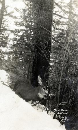
Photograph depicts a a mule deer hunting kill in Lillooet, BC.
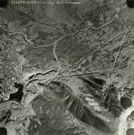
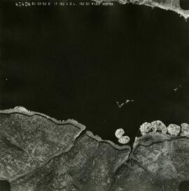
These remote-sensing aerial photographs were taken by Lockwood Survey Corporation Ltd. under contract for the B.C. Forest Service. Some photographs are annotated to show logging activity; clearcuts, slash piles, log booms, and tree debris on the water are also visible in some of the images. No detailed location information or index accompanies the photographs. These historically important aerial photographs depict Williston Lake soon after its creation in 1968 with the building of the W.A.C. Bennett Dam on the Peace River. Also depicted are the rivers and tributaries that empty into the Williston Reservoir, such as the Finlay River, the Ospika River, and the Omineca River.
The identification coding on these photographs can be interpreted as follows:
- The largest number on the leftmost side is the frame number for the individual photograph.
- The following code to the right in the format "B) 70-38" is currently unknown, but may refer to an internal project number for the Lockwood Survey Corporation.
- The 6" may refer to the camera's focal length in inches.
- Next is "17,150 ASL" which is 17,150 feet Above Sea Level.
- Following is "152.63" which refers to the camera's focal length in millimeters, which equals 6 inches.
- The "W1339" may refer to the reel, but that is unconfirmed.
- "1 AUG 70" is the date the photos were taken.
These remote-sensing aerial photographs were taken by Lockwood Survey Corporation Ltd. under contract for the B.C. Forest Service. Some photographs are annotated to show logging activity; clearcuts, slash piles, log booms, and tree debris on the water are also visible in some of the images. No detailed location information or index accompanies the photographs. These historically important aerial photographs depict Williston Lake soon after its creation in 1968 with the building of the W.A.C. Bennett Dam on the Peace River. Also depicted are the rivers and tributaries that empty into the Williston Reservoir, such as the Finlay River, the Ospika River, and the Omineca River.
The identification coding on these photographs can be interpreted as follows:
- The largest number on the leftmost side is the frame number for the individual photograph.
- The following code to the right in the format "B) 69-53" is currently unknown, but may refer to an internal project number for the Lockwood Survey Corporation.
- The 6" may refer to the camera's focal length in inches.
- Next is "17,150 ASL" which is 17,150 feet Above Sea Level.
- Following is "152.52" which refers to the camera's focal length in millimeters, which equals 6 inches.
- The "W1308" may refer to the reel, but that is unconfirmed.
- "10 SEP 69" is the date the photos were taken.
These remote-sensing aerial photographs were taken by Lockwood Survey Corporation Ltd. under contract for the B.C. Forest Service. Some photographs are annotated to show logging activity; clearcuts, slash piles, log booms, and tree debris on the water are also visible in some of the images. No detailed location information or index accompanies the photographs. These historically important aerial photographs depict Williston Lake soon after its creation in 1968 with the building of the W.A.C. Bennett Dam on the Peace River. Also depicted are the rivers and tributaries that empty into the Williston Reservoir, such as the Finlay River, the Ospika River, and the Omineca River.
The identification coding on these photographs can be interpreted as follows:
- The largest number on the leftmost side is the frame number for the individual photograph.
- The following code to the right in the format "B) 69-53" is currently unknown, but may refer to an internal project number for the Lockwood Survey Corporation.
- The 6" may refer to the camera's focal length in inches.
- Next is "17,150 ASL" which is 17,150 feet Above Sea Level.
- Following is "152.52" which refers to the camera's focal length in millimeters, which equals 6 inches.
- The "W1308" may refer to the reel, but that is unconfirmed.
- "9 SEP 69" is the date the photos were taken.
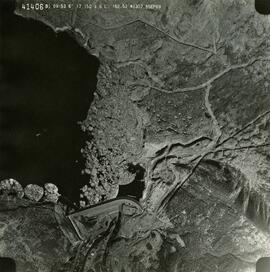
This remote-sensing aerial photograph was taken by Lockwood Survey Corporation Ltd. under contract for the B.C. Forest Service. This historically important aerial photograph depicts the W.A.C. Bennett Dam and Williston Reservoir soon after its flooding in 1968.
The identification coding on these photographs can be interpreted as follows:
- The largest number on the leftmost side is the frame number for the photograph.
- The following code to the right in the format B) 69-53 is currently unknown, but may refer to an internal project number for the Lockwood Survey Corporation.
- The 6" may refer to the camera's focal length in inches.
- Next is "17,150 ASL" which is 17,150 feet Above Sea Level.
- Following is "152.52" which refers to the camera's focal length in millimeters, which equals 6 inches.
- The "W1307" may refer to the reel, but that is unconfirmed.
- "8 SEP 69" is the date the photo was taken.
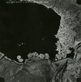
This remote-sensing aerial photograph was taken by Lockwood Survey Corporation Ltd. under contract for the B.C. Forest Service. This historically important aerial photograph depicts the headwaters of Williston Reservoir soon after its creation in 1968 with the building of the W.A.C. Bennett Dam on the Peace River.
The identification coding on these photographs can be interpreted as follows:
- The largest number on the leftmost side is the frame number for the photograph.
- The following code to the right in the format B) 69-53 is currently unknown, but may refer to an internal project number for the Lockwood Survey Corporation.
- The 6" may refer to the camera's focal length in inches.
- Next is "17,150 ASL" which is 17,150 feet Above Sea Level.
- Following is "152.52" which refers to the camera's focal length in millimeters, which equals 6 inches.
- The "W1307" may refer to the reel, but that is unconfirmed.
- "8 SEP 69" is the date the photo was taken.
These remote-sensing aerial photographs were taken by Lockwood Survey Corporation Ltd. under contract for the B.C. Forest Service. Some photographs are annotated to show logging activity; clearcuts, slash piles, log booms, and tree debris on the water are also visible in some of the images. No detailed location information or index accompanies the photographs. These historically important aerial photographs depict Williston Lake soon after its creation in 1968 with the building of the W.A.C. Bennett Dam on the Peace River. Also depicted are the rivers and tributaries that empty into the Williston Reservoir, such as the Finlay River, the Ospika River, and the Omineca River.
The identification coding on these photographs can be interpreted as follows:
- The largest number on the leftmost side is the frame number for the individual photograph.
- The following code to the right in the format B) 69-53 is currently unknown, but may refer to an internal project number for the Lockwood Survey Corporation.
- The 6" may refer to the camera's focal length in inches.
- Next is "17,150 ASL" which is 17,150 feet Above Sea Level.
- Following is "152.52" which refers to the camera's focal length in millimeters, which equals 6 inches.
- The "W1307" may refer to the reel, but that is unconfirmed.
- "8 SEP 69" is the date the photos were taken.
These remote-sensing aerial photographs were taken by Lockwood Survey Corporation Ltd. under contract for the B.C. Forest Service. Some photographs are annotated to show logging activity; clearcuts, slash piles, log booms, and tree debris on the water are also visible in some of the images. No detailed location information or index accompanies the photographs. These historically important aerial photographs depict Williston Lake soon after its creation in 1968 with the building of the W.A.C. Bennett Dam on the Peace River. Also depicted are the rivers and tributaries that empty into the Williston Reservoir, such as the Finlay River, the Ospika River, and the Omineca River.
The identification coding on these photographs can be interpreted as follows:
- The largest number on the leftmost side is the frame number for the individual photograph.
- The following code to the right in the format B) 67-326 is currently unknown, but may refer to an internal project number for the Lockwood Survey Corporation.
- The 6" may refer to the camera's focal length in inches.
- Next is "17,000 ASL" which is 17,000 feet Above Sea Level.
- Following is "152.17" which refers to the camera's focal length in millimeters, which equals 6 inches.
- The "W1245" may refer to the reel, but that is unconfirmed.
- "3 JUL 68" is the date the photos were taken.
These historically important aerial photographs depict Williston Lake soon after its creation in 1968 with the building of the W.A.C. Bennett Dam on the Peace River. Also depicted are the rivers and tributaries that empty into the Williston Reservoir, such as the Finlay River, the Ospika River, and the Omineca River.
These remote-sensing aerial photographs were taken by Lockwood Survey Corporation Ltd. under contract for the B.C. Forest Service. Some photographs are annotated to show logging activity; clearcuts, slash piles, log booms, and tree debris on the water are also visible in some of the images. No detailed location information or index accompanies the photographs.
Sans titreFile consists of a transcript of an oral history interview with Ken and Donna Quinn.
File consists of a transcript of an oral history interview with Jim Burbee.
File consists of a transcript of an oral history interview with Jack Boudreau. Also includes photocopies of Jack Boudreau's personal records, such as the Diary of Ada (Adelia) Sykes.
File consists of an audio recording of an interview with Ken and Donna Quinn. Includes one original recorded audio cassette and two copies.
File consists of an audio recording of an interview with Jim Burbee. Includes one original recorded audio cassette and one copy.
File consists of an audio recording of an interview with Jack Boudreau. Includes one original recorded audio cassette and one copy.
Photograph depicts a baby seal at C.N. log drop at Cowichan Lake on Vancouver Island.
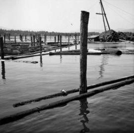
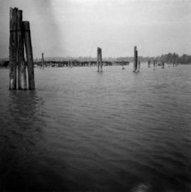
Photograph depicts the entrance to the Squamish River at Squamish, looking upstream. The pier on the left belongs to the original logging railway, circa 1909-1925.
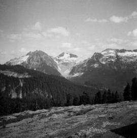
Photograph depicts the view looking north from Diamond Head Lodge in Garibaldi Park, about 20 miles northeast of Squamish. Believed to be "Bookworm range" at 7910 ft.
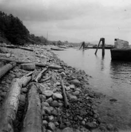
Photograph depicts a the shoreline of Vancouver Harbour, looking east from the property line of the Burrard Grain Elevator, 375 Low Level Rd, North Vancouver.
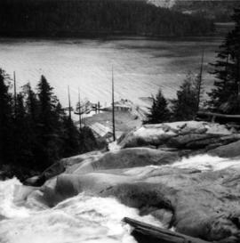
Photograph depicts Granite Falls and wharf at Indian Arm, looking west from the top of the falls.
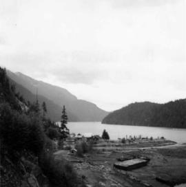
Photograph depicts a view of Indian Arm, looking south from Granite Falls.
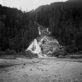
Photograph depicts Granite Falls near the Wigwam Inn, Indian Arm, Vancouver, B.C.
