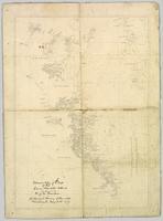
Wyld, James. "Map of the Colony of New Caledonia and the British & American Territory West of the Rocky Mountains including Vancouvers Island and the Gold Fields" by James Wyld, Geographer to the Queen & the Prince Consort, Charing Cross East & 2 Royal Exchange, London, July 16, 1858.
Item is an original 1862 map depicting various gold regions of British Columbia published by Britton & Company, San Francisco.
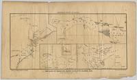
Pope, Frank L. “Sketch Map Showing the Proposed Route of the Western Union Telegraph Between Fort Frazer and the Stekine River, British Columbia. From exploration by the party under the command of Maj. Frank L. Pope Ass’t Engineer, 1866.
Item is an original 1879 map depicting northern British Columbia and the Peace River Country, created by G.M. Dawson and published in Geological Survey of Canada Report B 1879-80.
Government map depicts railway lands, lands "disposed of", grazing leases, and timber berths. Shows the British Columbia 'railway belt' running from Greater Vancouver to Field, B.C.
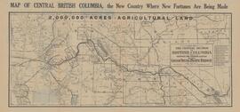
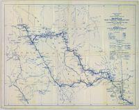
Item is a photocopy of a map depicting the central section of British Columbia showing the area served by the Grand Trunk Pacific Railway published by the Poole Brothers in Chicago.
Collection consists of materials related to Fort George surveying and preemption, including both legal and personal correspondence, legal documents and records, plans of lots, photographs, and a map. Includes records from the Cariboo Investment Company, Ltd., J.B. Henderson-Roe and C.H. Henderson Roe.
Item is a photocopied 1915 pre-emptor's map of Fort George, published by the British Columbia Department of Lands.
Item is a photocopied 1915 map depicting the Fort Fraser Division, published by the British Columbia Department of Lands.
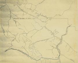
Item is a photocopy of Plan No. 1268 showing a subdivision of part of Indian Reserve no. 1 Lot 343 in the Cariboo District of British Columbia.
Item is a photocopy of Plan No. 1268 showing a subdivision of part of Indian Reserve no. 1 Lot 343 in the Cariboo District of British Columbia.
Colour-coded topographic map depicts forest stands of different heights.
Shows routes and ports of call from Smith Sound to Portland Canal including locations of many canneries and mines now no longer extent.
Item is an original 1919 pre-emptor's map of Tete Jaune, published by the British Columbia Department of Lands.
Item is a photocopied map depicting the Cariboo district of British Columbia, in the vicinity of Summit Lake and the Salmon River.
Item is a photocopied 1923 pre-emptor's map of Fort George, published by the British Columbia Department of Lands.
Map depicts passenger routes on the Canadian Pacific Railway and its connecting lines in 1925.
Reproduced map on mylar depicts locations of elevations and benchmarks at the Aleza Lake forest.
Item is a photocopied 1925 fire insurance plan depicting the Eagle Lake Spruce Mills Ltd. in Giscome, British Columbia published by the British Columbia Fire Underwriters Association.
Map depicts the rivers, railways, and select lakes and towns located at Jasper Park between the northern boundary of the park and the townsite of Jasper. Part of the border between Alberta and British Columbia is visible on the west of the map.
Reproduced map on mylar depicts a proposed railway spur for the Aleza Lake Forest Experiment Station.
Map depicts railway lines in the state of Washington, including those crossing over the border into British Columbia.
Reproduced map on mylar depicts the Aleza Lake timber reserve near Aleza Lake, BC.
Map depicts central British Columbia including Prince George, Queen Charlotte Island, Prince of Wales Island, Prince Rupert, and describes what these areas are known for.
Maps within this series document the placer streams, islands and harbours of the Queen Charlotte Islands; as well as the mining properties located within the vicinity of Stewart, BC.
Item is a photocopied 1930 pre-emptor's map of Fort George, published by the British Columbia Department of Lands.
Item is a photocopied 1930 pre-emptor's map of Fort George, published by the British Columbia Department of Lands.
Map of Timber Sale X9696 shows the area for the TSX with spruce balsam timber. Location is 4 miles from the Myra Station of the Kettle Valley Railway.
Map of Timber Sale X9696 shows the area for the TSX with the location of plots, roads, traverse posts, and the Forest Branch cabin. Location is 4 miles from the Myra Station of the Kettle Valley Railway.
Map of Timber Sale X9696 shows topography for the area. Location is 4 miles from the Myra Station of the Kettle Valley Railway.
Map of Timber Sale X9696 shows topography for the area. Location is 4 miles from the Myra Station of the Kettle Valley Railway.
Subseries contains maps and technical drawings produced by Grand Trunk and Grand Trunk Pacific Railways. Predominantly consists of plans of the rail line in the BC area. Also includes technical drawings of Grand Trunk Railway structures.
Item is a preliminary plan showing traveled route of the Bedaux Sub-Arctic Expedition in 1934.
Item is an original 1935 pre-emptor's map of Quesnel, published by the British Columbia Department of Lands.
The item is a map that depicts Canadian National Railway plans along Hammond street and the Fraser River. Includes the railway property, private property, proposed streets, and government owned property in the Prince George area.
The Grand Trunk Railway and Grand Trunk Pacific Railway series consists of administrative records, correspondence between railways, and ephemera. Also consists of maps and technical drawings depicting Grand Trunk Railway and Grand Trunk Pacific Railway rail lines and structures.
Accompanied by a 1942 job estimate cost summary sheet for the "Survey railway location west of Fairbanks" work to be done for the Alaska Western Railway project approved by a Colonel of the U.S. Army Corps of Engineers.
Item is an original 1943 pre-emptor's map of Fort George, published by the British Columbia Department of Lands.
Pennock, W.B. RIVER CROSSING EXERCISE. Prince George, B.C. 2 SEP 43. Presented to Major-General H.N. Ganong G.O.C. 8 CDN. DIV. by Lt-Col. W.B. Pennock C.R.C.E. 8 CDN. DIV. 1943. Oblong 4to. 24pp of text, color maps, one showing the proposed crossing of Nechako River. 20 b/w snapshot photos, mounted with corners, each with captions + Appendix A, B and C of facts and figures. A large folding contemporary map of Vernon is laid in, with one of the training zones (?) highlighted on the map in a red square box. Fabricoid spine and corners.
The original typescript for a (presumably confidential and secret) document listing the preparations for defensive manoeuvres in the event of war with Japan taking place in Northern British Columbia. This document describes a simulation of what events and defences could take place, including how to conduct river crossings; when in the war game, the author imagines what would happen should the Japanese invade Prince Rupert as a starting point for the invasion of Canada.
An important document providing insight into the thinking of the Canadian military while preparing for the possibility of Japan extending its war into the North Pacific Theatre during World War II.
Item is a photocopied 1944 map depicting Fort George, published by British Columbia Department of Lands.
