2020.4.7.028
·
Item
·
17 Sept. 1986
Part of G. Gary Runka fonds
201 results with digital objects
Show results with digital objects
2020.4.7.001
·
Item
·
[between 1975 and 1986]
Part of G. Gary Runka fonds
2000.23.1.070.04
·
Item
·
[between 1980 and 1987]
Part of Audrey Smedley L'Heureux fonds
The map depicts the town of Kitimat and on the other side of the map there is an advertisement for Northland Shipping.
2000.23.1.070.11
·
Item
·
[between 1967 and 1987]
Part of Audrey Smedley L'Heureux fonds
The map is part of an advertising pamphlet that depicts the Yellowhead Highway 16. The map highlights towns and tourist attractions along Highway 16 like Hazelton, Kitimat, Vanderhoof, Fraser Lake, Burns Lake, Fort St. James, Prince George, Terrace, and Smithers.
2003.8.4.9.33.1
·
Item
·
1987
Part of Adam Zimmerman fonds
Map is a "Recreation and Logging Road Guide to the Forest Lands of Vancouver Island Alberni Valley and the Surrounding Area" created for the public.

2023.5.1.42
·
Item
·
Nov. 1987
Part of UNBC School of Planning and Sustainability fonds
This municipal map of the City of Vancouver from 1987 shows street names and street widening information.
2000.23.1.070.09
·
Item
·
[between 1967 and 1987]
Part of Audrey Smedley L'Heureux fonds
The map is split into four time periods of colonial exploration. The map depicts pre-colonial, post-colonial, traditional, and colonial expansion.
2000.23.1.070.13
·
Item
·
[between 1970 and 1987]
Part of Audrey Smedley L'Heureux fonds
This map depicts where to find ghost towns, forts, First Nation villages, and sites with supposed hidden treasures in British Columbia.
2003.8.4.9.33.2
·
Item
·
1987
Part of Adam Zimmerman fonds
Map is a "Recreation and Logging Road Guide to the Forest Lands of Vancouver Island Alberni Valley and the Surrounding Area" created for the public. Backside states "Welcome to TFL 44", along with promotional imagery and information for backcountry travelers.

2007.1.80.1.09
·
Item
·
11 Feb. 1988
Part of Aleza Lake Research Forest fonds
Map reflects highways, main, branch and property roads, trails, public sustained yield unit boundaries, cutting permit boundary, contours, height of land, edge of lake, merchantable and immature timber, non-commercial cover, and swamps.
2020.4.7.021
·
Item
·
1988
Part of G. Gary Runka fonds
2013.6.35.33
·
Item
·
1988
Part of David Davies Railway Collection
Map depicts the cities of Summerland, Penticton, and Naramata. Annotated by Davies to emphasize the rail lines in the area.
2012.13.2.11.04.1
·
Item
·
[198?]
Part of J. Kent Sedgwick fonds
The item is a reproduction of a map originally printed in 1926. The original was lost in the Fort George museum fire. The map depicts topography and lot areas of Prince George. Map also highlights the area of industrial development on DL 417. Annotations state, "Blue Print copy in Eng. Records original burned in museum fire 1926."
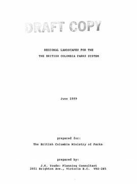
2023.7.3.08
·
Item
·
June 1989
Part of Grant Hazelwood fonds
Item is an original draft copy of "Regional Landscapes for the British Columbia Parks System".
2000.23.1.070.14
·
Item
·
1989
Part of Audrey Smedley L'Heureux fonds
The map is taken from the supplement of the Omineca Express/Bugle Caledonia Courier newspaper. The area map depicts highways, secondary roads, lakes, and gravel roads near Fort St. James, Stuart Lake, Fraser Lake, Fort Fraser, and Vanderhoof.
2020.4.7.018
·
Item
·
[198-?]
Part of G. Gary Runka fonds
Photocopied map depicts mineral and coal mining properties in north western British Columbia.
2020.4.7.011
·
Item
·
[198-?]
Part of G. Gary Runka fonds
2016.5.5.04
·
Item
·
1989
Part of Harry Coates fonds
Item is a map of Prince George Wood Preserving Ltd. Development Plan Forest Licence A27771 for the period of January 1, 1986 to January 1, 1991: Fraser Operating Area. Geographic features include the Fraser River.
2020.4.7.012
·
Item
·
1989
Part of G. Gary Runka fonds
Map depicts forest and non-forest land on Vancouver Island.
2012.13.2.02.33.04
·
Item
·
[1990?]
Part of J. Kent Sedgwick fonds
The item is a reproduction of a survey map drafted in January 1910. The reproduction was likely created in 1990. The subdivision is Lot 936 G. I. Cariboo District, B.C. The area covered is North of Twenty First Avenue, East of Quinn Street, South of Eighth Avenue and West of Carney Street. Annotations highlight "Owner Edgar McMickiny," "696" and "Jordan Brothel" written in red pen pointing to a specific location.
2012.13.2.02.33.05
·
Item
·
[1990?]
Part of J. Kent Sedgwick fonds
The item is a reproduction of a survey map drafted in September 1909. The reproduction was likely created in 1990. The annotations highlight owners of different lots up to approximately 1959. Th area covered is North of Fifteenth Avenue, East of Irwin Street, South of Eighth Avenue and West of Carney Street. Annotations on attached papers indicate different means of scale and measurement for the map.
2012.13.2.02.33.15
·
Item
·
[1990?]
Part of J. Kent Sedgwick fonds
The item is a reproduction of a survey map likely drafted in the 1910s. The reproduction was likely created in 1990. The area covered is South of Anderson Street, East of Simpson Street, North of Van Bien Avenue and West of 9th Street. Annotations state, "Pl 721 DL 1426."
2012.13.2.02.33.16
·
Item
·
[1990?]
Part of J. Kent Sedgwick fonds
The item is a reproduction of a survey map drafted on 1 March 1910. The reproduction was likely created in 1990. The area covered is South of Bernhardt Avenue, East of Simpson Street, North of the Fraser River and West of 9th Street. Annotations state, "DL 1426 Plan 721."
2012.13.2.02.33.17
·
Item
·
[1990?]
Part of J. Kent Sedgwick fonds
The item is a reproduction of a survey map drafted in 1909. The reproduction was likely created in 1990. The area covered are lots 931 and 417. Annotations state, "Plan 701," and various names are highlighted.

2006.18.5.23
·
Item
·
July 1990
Part of Aleza Lake Research Forest Society fonds
Map is an uncontrolled mosaic of aerial photography of the Aleza Lake Research Forest, with a July 1990 date of the air photography.
2012.13.2.02.33.03
·
Item
·
[1990?]
Part of J. Kent Sedgwick fonds
The item is a reproduction of a survey map drafted on 1 March 1910. The reproduction was likely created in 1990. The area highlighted is along the Fraser River. The map details subdivisions East of Ninth Street and South of Thapage Lane. Land Surveyor J. F. Templeton certified the plan. Annotation on the map states, "Pl. 727."
2012.13.2.02.33.06
·
Item
·
[1990?]
Part of J. Kent Sedgwick fonds
The item is a reproduction of a survey map drafted in approximately 1911 and revised in May 1914. The reproduction was likely created in 1990. The annotation states, "Plan 1391" and is circled in red ink. The area covered is along the Nechako and Fraser Rivers and Northeast of First Avenue.
2012.13.2.02.33.13
·
Item
·
[1990?]
Part of J. Kent Sedgwick fonds
The item is a reproduction of a survey map likely drafted in the 1910s. The reproduction was likely created in 1990. The area covered is South of Baillie Street, East of 22nd Avenue, North of Princess Street and West of 7th Avenue. Annotations state, "Pl. 833" and various lot descriptions.
2020.4.7.003
·
Item
·
December 1990
Part of G. Gary Runka fonds
2013.6.35.05
·
Item
·
[between 1970 and 1990]
Part of David Davies Railway Collection
Map depicts all current rail lines in Western Canada and Alaska and major railway stations. Includes insets for Alaska & Yukon, Edmonton area, Winnipeg area, and the Vancouver area.
2012.13.2.05.09.1
·
Item
·
1990
Part of J. Kent Sedgwick fonds
The map depicts British Columbia, including outlines of Indigenous tribal territories and a smaller map of Canada with Indigenous language families. The reverse side of the map is titled, "What Are You Ready For" and includes a timeline of information and Indigenous history.
2012.13.2.02.33.01
·
Item
·
[1990?]
Part of J. Kent Sedgwick fonds
The item is a reproduction of a section of survey map drafted on 18 March 1915 and revised on 23 May 1916. The reproduction was likely created in 1990. The Plan Number is 1268 and highlights the area along the Nechako and Fraser Rivers. The map details subdivisions East of Carney Street, North of Twentieth Avenue and South of Ninth Avenue. Annotations in pencil state different map scale variations and "cemetery setback."
2012.13.2.02.33.02
·
Item
·
[1990?]
Part of J. Kent Sedgwick fonds
The item is a reproduction of a section of survey map drafted in 1915. The reproduction was likely created in 1990. The Plan Number is 1268 and highlights the area along the Nechako River. The map details subdivisions East of Carney Street and North of Fifth Avenue. Some original street and avenue names have been crossed out and replaced with handwritten names. Annotation on reverse side of map states, "D.L. 343 Pl. 1268."
2012.13.2.02.33.08
·
Item
·
[1990?]
Part of J. Kent Sedgwick fonds
The item is a reproduction of a survey map drafted in July 1914. The reproduction was likely created in 1990. The area covered is along the Fraser River and east of Guelph Street. Annotations state, "PL 1409 D. L. 417 HBCo." and highlight different scales of measurement and changed street names.
2012.13.2.02.33.09
·
Item
·
[1990?]
Part of J. Kent Sedgwick fonds
The item is a reproduction of a survey map drafted in 1 Oct. 1913. The reproduction was likely created in 1990. The area covered is along the Fraser River and west of Linooln Avenue, south of Jackson Street and North of McKinley Street. Annotations state which maps and lots are adjacent to this one. An illegible signature is highlighted.
2012.13.2.02.33.11
·
Item
·
[1990?]
Part of J. Kent Sedgwick fonds
The item is a reproduction of a survey map drafted on 20 Nov. 1910. The reproduction was likely created in 1990. The subdivision is lot 2610 G. I. and part of lots 2507 and 2608 G. I. Cariboo District. The area covered is South of 8th Avenue, East of 19th Avenue, North of 8th Street and West of Quinn Street. Annotations state, "Pl. 847," and various notations regarding lot information.
2012.13.2.02.33.14
·
Item
·
[1990?]
Part of J. Kent Sedgwick fonds
The item is a reproduction of a survey map drafted on 27 July 1910. The reproduction was likely created in 1990. The area covered is South of Reserve Avenue, East of Victoria, North of Bird Avenue and West of 9th Street. Annotations state, "#796" and highlight the date and registered owner.
2012.13.2.20.01.2
·
Item
·
[ca. 1990]
Part of J. Kent Sedgwick fonds
The item is a map depicting the area surrounding the Hixon area in the Cariboo District. There are various annotations in pen and highlighted boundaries.
2012.13.2.02.33.07
·
Item
·
[1990?]
Part of J. Kent Sedgwick fonds
The item is a reproduction of a survey map drafted on 10 July 1956 and registered on 31 Oct. 1956. The reproduction was likely created in 1990. The plan number is 7782.
2012.13.2.02.33.10
·
Item
·
[1990?]
Part of J. Kent Sedgwick fonds
The item is a reproduction of a survey map drafted June 1912. The reproduction was likely created in 1990. The area covered is Central Fort George, South of 5th Street, East of Alden Avenue, North of 12th Street and West of Fraser Street. Annotations state, "Plan 1085 Carney Addition."
2012.13.2.02.33.12
·
Item
·
[1990?]
Part of J. Kent Sedgwick fonds
The item is a reproduction of a survey map drafted on 29 Oct. 1910. The reproduction was likely created in 1990. The area covered is South of Princess Street, East of James Avenue, North of 8th Street and West of Rupert Avenue. Annotations state, "Jesse Hodgeson Crown grand in 1910 for $800..."
2012.13.2.02.33.18
·
Item
·
[1990?]
Part of J. Kent Sedgwick fonds
The item is a reproduction of a survey map drafted in 1909. The reproduction was likely created in 1990. The area covered is South of Fort George Avenue, East of Fraser Street, North of Mount Stephen Avenue, and West of Simpson Street. Annotations state, "Pl. 649."
2012.13.4.09.3
·
Item
·
1991
Part of J. Kent Sedgwick fonds
The item is a map depicting the Salmon Portage area along the Salmon River. Various annotations are written in pen and sections of the map are coloured with pencil crayon. The Forest Cover Map identification number is 93J.027.

2007.1.28.29.2
·
Item
·
Mar. 1992
Part of Aleza Lake Research Forest fonds

2007.1.30.5.1
·
Item
·
Mar. 1992
Part of Aleza Lake Research Forest fonds

2007.1.28.29.1
·
Item
·
Mar. 1992
Part of Aleza Lake Research Forest fonds
2012.13.4.09.5
·
Item
·
1992
Part of J. Kent Sedgwick fonds
The item is a map depicting the Salmon Portage area along the Salmon River. Various annotations are written in pen and sections of the map are coloured with pencil crayon. The Forest Cover Map identification number is 93J.026.

2006.18.5.27
·
Item
·
[1992?]
Part of Aleza Lake Research Forest Society fonds
Item is a hand-drawn map of a plot in the Aleza Lake Research Forest. Individual trees are marked and numbered.

2006.18.5.41
·
Item
·
1992
Part of Aleza Lake Research Forest Society fonds
Item is a hand-drawn map of a plot in the Aleza Lake Research Forest. Individual trees are marked and numbered.
2023.7.3.01
·
Item
·
1992
Part of Grant Hazelwood fonds
Map depicts the Kitlope range, Kimsquit Watershed, and area around Kitlope Lake. Includes Indigenous place names, grease trails, Indigenous village sites, and wildlife information.