Showing 658 results

Archival description
236 results with digital objects Show results with digital objects
Research projects
2023.2.2 · Series · 1960-2024
Part of Dr. Paul Sanborn fonds

Series consists of records created and collected in relation to research projects Dr. Paul Sanborn was engaged in, often with other colleagues, during his employment with the BC Ministry of Forests and/or the University of Northern British Columbia. These archival research records are predominantly unpublished documents, reports, data, and photographs. Some of Sanborn's research projects did not result in a formal scientific publication. In other instances, some of Sanborn's research projects resulted in only a portion of the collected data utilized for a formal publication.

Sanborn compiled details about each research project and its associated records in a summary note. Each of these notes is provided in PDF format along with its research project series. These notes serve as an essential guide for researchers who wish to interpret, utilize, and repurpose Sanborn's data for other future research projects.
Dr. Paul Sanborn fonds
2023.2 · Fonds · 1960-2024

Fonds consists of the research records of Dr. Paul Sanborn, a University of Northern British Columbia faculty member in the Department of Ecosystem Science and Management.

Sanborn, Paul Thomas
Maps, plans, and drawings
2023.5.1 · Series · 1976-2020
Part of UNBC School of Planning and Sustainability fonds

Series consists of maps, plans, and drawings collected by faculty in the UNBC School of Planning and Sustainability. The majority of these maps reflect the planning history of the City of Prince George and include large format, hand-drawn plans created by the City Planning Department from the 1970s and 1980s. Maps from City of Prince George Official Community Plans are also included.

2013.6 · Collection · [before 2020]

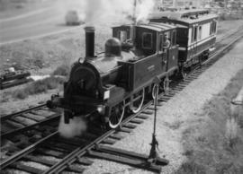
The David Davies Railway Collection encompasses all facets of railway history specifically in the province of British Columbia and the Yukon territory. The collection consists of research material accumulated over the course of more than fifty years, and includes monographs, periodicals, articles, clippings, railway timetables, photographs, maps and plans, and excerpts. Material covers public, tourist, and private (industrial) railways, including: CPR, KVR, E&N; CNR, CNoR, GTPR; and PGER, BCR. The collection excludes material regarding streetcar systems and rapid transit, but includes long distance electric interurbans.

2006.18 · Fonds · 2001-2019

The Aleza Lake Research Forest Society (ALRFS) records encompass material that was created or collected by the Society over its existence (2001-present). Records created by the ALRFS consist of administrative and operational records, as well as publications from the Society. Collected records include historical records relating to the Aleza Lake Experiment Forest gifted to the Society or its members. These include maps, photographs, reference material, and documents. Members and associates of the ALRFS also documented the history of the forest through the creation of oral history recordings and written histories such as John Revel's "Devil's Club, Black Flies, and Snowshoes".

The fonds includes a significant amount of reproduced archival material about Aleza Lake from other institutions, such as BC Archives, the Canadian Forest Service, and the BC Forest Service. Many of these reproductions were created as part of the 2006 ALRFS Natural Resources History Internship in an effort to compile the history of the research forest.

Also included are cartographic and photographic materials that depict the Aleza Lake Research Forest and surrounding areas.

2016.5.1 · Series · 1941-2018
Part of Harry Coates fonds

Series consists of records pertaining to Harry Coates work and training as a BC Forest Service Research Technician. Series includes documentation for various Sx trials and experimental plots (E.P.) Harry Coates worked on.

E.P. 646.3
2016.5.1.87 · File · [1970-2015]
Part of Harry Coates fonds

File consists of photocopied documentation for E.P. 646.3 Reciprocal Planting of Spruce Provenances in the Rocky Mountain Trench along with printed satellite maps from Bing Maps. File also includes a map of Buckhorn Barn showing reserve no. EP 505, research & R.N. projects. Map includes annotations for EP 646.3.

Grant Hazelwood fonds
2023.7 · Fonds · 1943-2015

Fonds consists of material created and collected by wildlife biologist Grant Hazelwood in relation to his work and research regarding wildlife, habitat, and wilderness parks. Includes material regarding Hazelwood's Tailed Frog (Ascaphus truei) research. Also includes records regarding his contracted biologist work via his consultancy business, Alpenglow Resources, on the BC Ministry of Environment's "Upper Nass Assessment Project", a project that included the biophysical mapping of the Northwest-Klappan Road Access Area.

Hazelwood, W. Grant
Harry Coates fonds
2016.5 · Fonds · 1957-2014

Fonds consists of records Harry Coates created or received and retained during his career as a BC Forest Service Research Technician and into his retirement as a Sustainable Forest Management activist. Fonds includes materials from his work at the Aleza Lake Research Forest.

Coates, Harry
2020.4.4 · Series · 1968-2013
Part of G. Gary Runka fonds

Series consists of records created and collected by Gary Runka during and after his time with the British Columbia Agricultural Land Commission. In the early 1970s, Runka served as the first general manager of the BC Agricultural Land Commission, the independent provincial body that has administered BC's Agricultural Land Reserve (ALR) for over 40 years. As the first manager, Runka spearheaded the establishment of the ALR undertaking the technical tasks of setting ALR agricultural use boundaries, policies and procedures, as well as the building awareness and support for farmland preservation within government and with the public. He later served as Commission chair. Records include correspondence, informational material, publications, clippings, news releases, memoranda, symposium/conference material, reports, speech notes, and other textual material. Also includes seven maps, two buttons, six floppies, eighty slides, and one audio cassette tape.

G. Gary Runka fonds
2020.4 · Fonds · 1945-2013

This fonds illustrates the life and work of G. Gary Runka and his contributions to the province of British Columbia. Gary Runka was the first General Manager of British Columbia's Agricultural Land Commission and helped establish the provincial Agricultural Land Reserve. After transitioning from a government career to private consulting, Runka provided comprehensive professional services through his land consultancy business, G.G. Runka Land Sense Ltd., offering land capability and environmental assessments, integrated resource management, land and water use conflict resolution, and interdisciplinary land use planning. Described by colleagues as one of BC's most highly respected agrologists and influential land use planners, Runka had a 52-year career working on (or against) an incredible number of landmark projects in British Columbia, such as the Site C Project. Gary Runka’s partner in life and vocation, Joan M. Sawicki, worked with Gary on many of these projects—as well as her own; her contributions are also represented throughout the records of this fonds.

Gary Runka's deep connection to the land is evident from his earliest papers on aerial photo interpretation, his work with the Canada Land Inventory, through his speeches and his work establishing the BC Agricultural Land Reserve and in his subsequent consulting career through G.G. Runka Land Sense Ltd. Gary Runka's influence and legacy was recognized in the tributes paid after his death, including the post-humus award as the Real Estate Foundation's "Land Champion" for 2014.

The G. Gary Runka fonds has been divided into the following nine series:
1) Personal Records
2) Speeches & Publications
3) Professional Records
4) Agricultural Land Commission
5) Land Sense Ltd.
6) Client Files
7) Maps
8) Photographs
9) Digital Records

Runka, G. Gary
2020.4.6 · Series · 1976-2012
Part of G. Gary Runka fonds

Series consists of the client file project records of G.G. Runka Land Sense Ltd., Gary Runka's consultancy business (co-owned with Joan Sawicki until 1991). G.G. Runka Land Sense Limited was incorporated as a company on 30 Nov. 1978 and dissolved on 30 Nov. 2018. Most business activity ceased after Gary Runka's death in July 2013. The company provided comprehensive professional services in land inventory, environmental assessment, integrated resource management, land and water use conflict resolution and interdisciplinary land use planning. Over the course of the company's operation, Gary Runka and his firm consulted on 681 assignments ranging from very large projects (such as the Site C project) to small residential/commercial land capability assessments.

The Land Sense Ltd. client files generally include records such as correspondence, contracts, invoices, project reports, publications, ephemera, memoranda, map excerpts, legal documents, meeting materials, clippings, and handwritten notes. Some client files are accompanied by related maps, photographs, aerial photographs, and/or digital records on storage media.

2020.4.6.671 · File · 2012
Part of G. Gary Runka fonds

File consists of records created and accumulated by Gary Runka over the course of his consultancy work for B.C. Women's Institutes for the "Site C - Environmental Impact Statement Technical Review" project in Site C. This file was numbered as G.G. Runka Land Sense Ltd. client file #671; that client number may be seen referenced elsewhere in the G. Gary Runka fonds. The Land Sense Ltd. client files generally include records such as correspondence, contracts, invoices, project reports, publications, ephemera, memoranda, maps or map excerpts, legal documents, meeting materials, clippings, and handwritten notes. Also includes an oversize bound map book by BC Hydro entitled "Preliminary Impact Lines and Preferred Highway 29 Realignments Maps" for the Site C project, published April 2012.

2012.13.2.01 · Subseries · 1970-2011
Part of J. Kent Sedgwick fonds

Subseries includes research material created and collected by Kent Sedgwick relating to the incorporation of the City of Prince George. Topics include the naming of the City of Prince George, city boundaries, the city amalgamation with Fort George and South Fort George, city census records, and mayors of Prince George.

2012.13.2.02 · Subseries · 1941-2011
Part of J. Kent Sedgwick fonds

Subseries includes research material created and collected by Kent Sedgwick relating to land survey, development, and settlement in Prince George and British Columbia. Land surveys were conducted in British Columbia by surveyors George Dawson, the North Coast Land Company, Alfred R.C. Selwyn, and the Geological Survey of Canada during the late 19th and early 20th centuries. James C. Anderson and engineer J. Gill conducted topographical surveys for the Grand Trunk Pacific Railway on Fort George and the Indian Reserve. Surveyors and land plot companies developed the land for sale to promote settlement in the area. Also includes materials regarding the continued development of the City of Prince George throughout the 20th century. The files primarily consist of newspaper clippings, research notes, and photocopied documents.

Central Fort George townsite
2012.13.2.03.02 · File · 1993-2011
Part of J. Kent Sedgwick fonds

File consists of clippings, notes, and reproductions relating to the Central Fort George townsite. File predominantly includes Kent Sedgwick's handwritten notes regarding land plots and development of Central Fort George. Includes: a map depicting Canadian National Railway plans along Hammond Street and the Fraser River (1936) and "Central Fort George lots" map depicting lot plans for the Central Fort George townsite (reproduced 1990).

Duke of Sutherland
2012.13.2.20 · Subseries · 1980-2011
Part of J. Kent Sedgwick fonds

Subseries includes material collected by Kent Sedgwick regarding the Duke of Sutherland. The Duke of Sutherland is a title in the Peerage of the United Kingdom. The fourth Duke of Sutherland was Cromartie Sutherland-Leveson-Gower who lived from 1851 to 27 June 1913. Toward the end of his life, the 4th Duke began moving his wealth and life to Canada. The Duke owned land across British Columbia and Alberta and contributed to various settlements, including Strathnaver, BC; Windermere, BC; Brooks, AB; and Clyde, AB. The Duke of Sutherland owned the Sutherland Land Company, creating and selling plots in BC and Alberta. He also worked closely with the Canadian Pacific Railway to support immigration and settlement of the area.

Community Involvement
2012.13.3 · Series · 1950-2011
Part of J. Kent Sedgwick fonds

Series contains material created and collected by Kent Sedgwick over the course of his work with the Prince George Heritage Commission, the Alexander Mackenzie Heritage Trail Association, and other local organizations. The files primarily consist of meeting minutes, typescript documents, and correspondence between Sedgwick and the organizations.

2012.13.3.1 · Subseries · 1950-2011
Part of J. Kent Sedgwick fonds

Subseries contains material created over the course of Kent Sedgwick’s involvement with the Prince George Heritage Commission between 1978 and 2006. The files include correspondence, meeting minutes, typed documents, and research materials collected for heritage projects. Some of the heritage projects Kent Sedgwick was involved in include the creation of a heritage inventory record, particularly heritage houses; developing L.C. Gunn Park; and creating interpretive signage for historic locations throughout Prince George.

2012.13.2.11 · Subseries · 1937-2011
Part of J. Kent Sedgwick fonds

Subseries consists of materials collected by Kent Sedgwick for research on the geography and natural resources in Prince George and its region. Includes material on the natural resource industry, including the opening of the McArthur Sawmill, the W. Lamb and Sons Lumber Sawmill, and mining; photocopied aerial photographs of Prince George; the climate, temperatures, and flooding; and the geographical features of Prince George.

J. Kent Sedgwick fonds
2012.13 · Fonds · 1937-2011

This fonds consists of material created and collected by Kent Sedgwick, author, professor, Prince George urban planner, and prominent local historian. This body of records documents Sedgwick’s research interests in the history and geography of the Central Interior of British Columbia. The fonds also reflects his work as a Prince George Senior City Planner, his involvement in local community organizations, and his teaching at the College of New Caledonia and the University of Northern British Columbia.

The fonds includes:
1) Photographs taken by Kent Sedgwick across British Columbia, predominantly in the Central Interior region;
2) Research subject files consisting of original research documentation and collected reference material, predominantly focusing on topics relating to local history, city planning, and geography in the Prince George area and the British Columbia Central Interior;
3) Documentation of Kent Sedgwick’s community involvement, including records created over the course of his work with the Prince George Heritage Commission, , the Alexander Mackenzie Heritage Trail Association, and other local organizations;
4) Writings, publications, and lectures written, edited, or conducted by Kent Sedgwick;
5) Professorial records consisting of lectures and material relating to Sedgwick’s teaching appointments at the College of New Caledonia and the University of Northern British Columbia;
6) Maps collected by Kent Sedgwick covering historical and contemporary British Columbia.

Sedgwick, J. Kent
Prince George street names
2012.13.2.02.20 · File · 1989-2011
Part of J. Kent Sedgwick fonds

File consists of notes, reproductions, and letters relating to the street names in Prince George. Includes: "Canadian Permanent Committee on Geographical Names" typescript document; email from Ramona Rose to Kent Sedgwick (8 Dec. 2000); "Future entrance sign on Tyner Boulevard" typescript letter to Mr. Hamer from Ruth Iversen (10 Jan. 1995); "South Fort George gardens plan of subdivision" reproduced map depicting subdivision lots along the Fraser River in Prince George (2011); and "Porter Creek" letter from the Province of British Columbia to Kent Sedgwick (16 May 1989).

2012.13.2.19 · Subseries · 1955-2011
Part of J. Kent Sedgwick fonds

Subseries contains material collected and created by Kent Sedgwick for research on various areas in British Columbia and Alberta. Includes written notes by Kent Sedgwick, pamphlets, and newspaper clippings relating to towns and settlements. These areas include Quesnel, Likely, the Yukon Telegraph Trail, Barkerville, Wells, the Cariboo region, Fort Alexandria, Soda Creek, the Chilcotin region, Jasper, the Rocky Mountains, Mackenzie, Tumbler Ridge, the Peace River region, Fort St. James, the Omineca region, Kitimat, Lethbridge, the Bulkley Valley, and Fort Mcleod. These files cover a variety of topics including Chinese people in British Columbia, land settlement, tourism, and historic information on the regions.

Oversize Material
2013.6.35 · Series · 1909-2011
Part of David Davies Railway Collection

Series consists of large format maps and plans relating to railways in British Columbia and Canada. Also includes oversize documents.

Research Subject Files
2012.13.2 · Series · 1937-2011
Part of J. Kent Sedgwick fonds

Kent Sedgwick’s research subject files contain original research notes, interviews and oral histories, news clippings, and collected primary and secondary sources. The series also includes both original and reproduction photographs, audio recordings, and maps. The subject files primarily relate to the history, urban planning, and historical geography of the Central Interior of British Columbia, especially Prince George area and the East Line communities over the course of the 20th century. They also include extensive notes on geographic features, landscapes, interpretative trails, architectural history, industrial history, history of Western exploration and land survey, and the First Nations history of the region.

"South Fort George Gardens"
2012.13.2.02.20.1 · Item · 2011
Part of J. Kent Sedgwick fonds

The item is a map that depicts subdivision lots along the Fraser River in Prince George. The subdivision is DL 745 and 747 of the Cariboo District. Map is certified by G. F. Templeton, a BC land surveyor.

Prince George Areas
2012.13.2.03 · Subseries · 1957-2011
Part of J. Kent Sedgwick fonds

Subseries consists of material collected and created by Kent Sedgwick for research regarding various areas within Prince George. These files include material on neighbourhoods and notable areas within the city, as well as the Regional District of Fraser-Fort George. Notable areas include the Fort George Canyon, downtown Prince George, and Cottonwood Island. The files primarily contain notes and newspaper clippings relating to the development and history of these areas.

Parks and Outdoor Recreation
2012.13.2.14 · Subseries · 1970-2011
Part of J. Kent Sedgwick fonds

Subseries consists of material collected and created by Kent Sedgwick for research regarding parks and outdoor recreation in Prince George. Material on parks includes Fort George Park (renamed to Lheidli T’enneh Memorial Park in 2015); Cottonwood Island Park; Connaught Hill; Moore's Meadow; L.C. Gunn Park; the Nechako Cutbanks; Paddlewheel Park; Monkman Provincial Park; Fraser Canyon Park; and Carp Lake. Also includes information on the creation of plaques and monuments, including the Alexander Mackenzie monument; the “Arrival of Steel” CN railway plaque; heritage interpretative signs for the Grand Trunk Pacific Railway; the Millar addition; and flooding and rivers. The files consists of various pamphlets and correspondence regarding the development of parks and the creation of interpretive materials.

Works by Kent Sedgwick
2012.13.4 · Series · 1966-2010
Part of J. Kent Sedgwick fonds

Series consists of material collected and created by Kent Sedgwick in relation to his writings, publications, editorial work, and lectures. The files contain material regarding Kent Sedgwick’s writing and lectures on the Lheidli T’enneh cemetery; his book "Monumental Transformation: The Story of Prince George's National Historic Monument"; his book chapter "Crossing the Divide: Northern Approaches to New Caledonia"; his book "Giscome Chronicle: The rise and demise of a sawmill community in central British Columbia, 1912-1976"; edits done to June Chamberland’s book "From Broadaxe to Clay Chinking: Stories about the Pioneers in and around the Prince George area"; writing for the Prince George Heritage Advisory Committee; and Sedgwick’s MA thesis on the Peyto Glacier. The files primarily consist of notes, correspondence, and completed works.

2012.13.2.04 · Subseries · 1983-2010
Part of J. Kent Sedgwick fonds

Subseries consists of materials collected by Kent Sedgwick for research relating to Lheidli T'enneh First Nations. The Lheidli T'enneh are a sub-group of the Dakelh people whose traditional territory includes the city of Prince George, British Columbia. These files primarily consist of material regarding the original Lheidli T'enneh reserve and cemetery, the reserve relocation, and the desecration of the cemetery.

2012.13.2.19.04 · File · 1968, 1980, 2002-2010
Part of J. Kent Sedgwick fonds

File consists of notes, clippings, and reproductions relating to Quesnel, Barkerville, and Wells. Includes: "An Historic Walk of Carson Avenue, Quesnel, B.C". pamphlet prepared by the Quesnel Branch Cariboo Historical Society (1990); "Wells, B.C". pamphlet by the Wells Historical Society (1980); "Cottonwood House Provincial Historic Park" pamphlet by the Province of British Columbia (1980); and vol. 1 of the Cariboo Gazette newspaper (2002). Also includes a map depicting Bowron Lake Park in British Columbia (1968).

Transportation
2012.13.2.15 · Subseries · 1970-2010
Part of J. Kent Sedgwick fonds

Subseries consists of material collected and created by Kent Sedgwick for research regarding transportation. Includes notes and research on airplanes, specifically Prince George aviation and the Junkers aircraft named "The City of Prince George"; highway transportation; the Grand Trunk Pacific Railway; ferry boat service including the Fraser River Fort George ferry, the Isle Pierre ferry, and the Miworth ferry; the Pacific Great Eastern Railway line; the British Columbia Railway; and the Canadian National Railway. Also includes essays and typed documents on railway history in Prince George.

Indigenous Peoples
2012.13.2.05 · Subseries · 1964-2010
Part of J. Kent Sedgwick fonds

Subseries consists of material collected and created by Kent Sedgwick for research regarding Indigenous Peoples within British Columbia. These files primarily consist of audio recordings and transcripts of personal oral interviews, documents regarding perceptions of Indigenous peoples, research on historical interactions, Dakelh (Carrier) language, and treaty information including the Nisga'a treaty and Treaty 8. Includes materials on the Carrier Sekani First Nations whose traditional territory includes north central British Columbia and includes the Ts'il Kaz Koh First Nation, Nadleh Whut'en, Saik'uz First Nation, Stellat'en First Nation, Takla Lake First Nation, and Wet'suwet'en First Nations.

2012.13.2.04.02 · File · 1983-2009
Part of J. Kent Sedgwick fonds

File consists of clippings, notes, and reproductions relating to the surrender of the original L'Heidli T'enneh reserve and its cemetery, and the subsequent reserve relocation. Includes "Indian cemetery Fort George Park" typescript document by Kent Sedgwick for the Heritage Advisory Committee, which includes photocopies of original documents for the sale of the Indian reserve to the Grand Trunk Pacific Railway (23 Mar. 1983) and "Plan of the Fort George Indian Reserves" map depicting the locations of the reserves in and around Prince George. File also includes photocopies and reproduced photographs of the Prince George Indian Reserves from the Royal BC Museum and Archives.

2020.4.6.650 · File · 2009
Part of G. Gary Runka fonds

File consists of records created and accumulated by Gary Runka over the course of his consultancy work for Canoe Creek Indian Band for the "Overview of Issues and Concerns Related to Transmission Line Corridor Component" project in Dog Creek. This file was numbered as G.G. Runka Land Sense Ltd. client file #650; that client number may be seen referenced elsewhere in the G. Gary Runka fonds. The Land Sense Ltd. client files generally include records such as correspondence, contracts, invoices, project reports, publications, ephemera, memoranda, maps or map excerpts, legal documents, meeting materials, clippings, and handwritten notes. File also includes 2 accompanying DVDs.

Maps include:

  • Reproduction of NTS map Bambrick Creek 92-O/11 Edition 2 showing photocopied overlay depicting planned transmission line corridor
  • Reproduction of NTS map Mount Alex 92-O/10 Edition 3 showing photocopied overlay depicting planned transmission line corridor
  • Reproduction of NTS map Gustafsen Lake 92-P/12 Edition 2 showing photocopied overlay depicting planned transmission line corridor
  • Reproduction of NTS map Dog Creek 92-O/9 Edition 3 showing photocopied overlay depicting planned transmission line corridor
  • Reproduction of NTS map Mount Tatlow 92-O/5 Edition 2 showing photocopied overlay depicting planned transmission line corridor
  • Reproduction of NTS map Elkin Creek 92-O/12 Edition 2 showing photocopied overlay depicting planned transmission line corridor
  • Jacques Whitford - AXYS Ltd. for Taseko Mines Ltd. Prosperity Project, "Taseko Transmission Corridor Orthophotography Series 1" draft map, August 2008 (revision #2).
  • Jacques Whitford - AXYS Ltd. for Taseko Mines Ltd. Prosperity Project, "Taseko Transmission Corridor Orthophotography Series 2" draft map, August 2008 (revision #2).
  • Jacques Whitford - AXYS Ltd. for Taseko Mines Ltd. Prosperity Project, "Taseko Transmission Corridor Orthophotography Series 3" draft map, August 2008 (revision #2).
  • Stswecem'c Xgat'tem Natural Resources Department, untitled map showing reserves and transmission corridor, scale 1:26,779, May 2009.
  • Stswecem'c Xgat'tem Natural Resources Department, untitled map showing reserves and transmission corridor and transmission line, scale 1:35,705, May 2009.
  • Stswecem'c Xgat'tem Natural Resources Department, untitled map showing reserves and transmission corridor, scale 1:63,476, May 2009.
Maps & Oversize
2020.4.7 · Series · 1965-2009
Part of G. Gary Runka fonds

Series consists of maps, technical drawings, and other oversize material collected by Gary Runka that are not associated with specific Land Sense Ltd. client jobs.

Collected Works
2020.4.2.3 · Subseries · 1945-2009
Part of G. Gary Runka fonds

Subseries includes works collected by G. Gary Runka. Runka collected a comprehensive resource library of publications, reports, and rare grey literature that reflected the depth and breadth of natural resource issues in British Columbia. Material from this resource library was intrinsically tied to Runka's work; selected unique items from the resource library are contained within this sub-series to contextualize the scope of land management issues.

2002.14.1.09 · Subseries · 1984-2008, predominant 2001-2006
Part of Marianne (Marika) Ainley fonds

Subseries reflects Dr. Ainley's extensive research on indigenous science and traditional knowledge and how it transferred to European settlers in Canada, Australia, and New Zealand. Much of this research culminated in Dr. Ainley's unfinished monograph project "Re-explorations: new perspectives on gender, environment and the transfer of knowledge in 19th and 20th century Canada and Australia." Material is, predominately, arranged by individual, with files largely consisting of bibliographies, articles and notes about and by the individual on topics related to the environment and interaction with indigenous peoples. Subseries also contains research notes, interviews, and correspondence. As much of Ainley's research focused on women, see subseries on women in science and engineering research (2002.14.1.5) for related materials.

2023.5 · Fonds · 1976-2008

Fonds consists of maps, plans, and drawings collected by faculty in the UNBC School of Planning and Sustainability. The majority of these maps reflect the planning history of the City of Prince George and include large format, hand-drawn plans created by the City Planning Department from the 1970s and 1980s. Maps from City of Prince George Official Community Plans are also included.

2002.14.1.09.168 · File · [after 2001]
Part of Marianne (Marika) Ainley fonds

File consists of research materials concerning First Nations science primarily in the Yukon but also in northern BC, North West Territories, and Native Americans in Alaska. File includes tourism promotional materials from the Yukon and Alaska.

2012.13.2.05.09 · File · 1970-2007
Part of J. Kent Sedgwick fonds

File consists of notes, clippings, and reproductions relating to Indigenous Peoples of British Columbia. Includes: "A selected list of publications on the Indians of British Columbia" published by the British Columbia Provincial Museum (1970) and "Les Indiens Des Cordilleres" printed by the National Museum of Canada (7 Feb. 1939). File also includes a map titled "Native Lands, then and now" depicting British Columbia including outlines of Indigenous territories and a smaller map of Canada with Indigenous language families; the backside of the map is titled "What are you ready for" and includes a timeline of information and Indigenous history in British Columbia (1990).

2009.7 · Fonds · 1870-2006

The Archdeacon W.H. Collison fonds consists of textual materials, maps, published materials and photographs all documenting Collison’s life and work with North Coastal First Nations communities in British Columbia. Types of records found within this fonds include manuscripts, sermon notes, correspondence, oral history summaries, monographs, cartographic items, photographs and postcards. The Collison fonds also includes some records created by his children and grandchildren as well as a family tree created in 1986. The Collison fonds has been divided into four series.

Collison, W.H. (Archdeacon)