Imprimir vista previa Cerrar

Mostrando 4534 resultados

Archival description
3113 resultados con objetos digitales Muestra los resultados con objetos digitales
Monkman Pass area
2012.13.2.14.24 · Dossiê · 1973-2006
Parte de J. Kent Sedgwick fonds

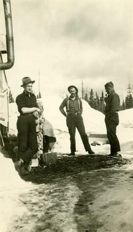
File consists of notes, clippings, and reproductions relating to the Monkman Pass area. Includes: "Monkman Pass Memorial Trail" brochure prepared by Tumbler Ridge (2006); "The trail to Monkman Pass" clipped article from BC Outdoors magazine (July 1983); "Regional District of Fraser-Fort George" typescript letter from Y.D. Kennedy to Kent Sedgwick (5 Sept. 1973); and "Alberta Wilderness Association Newsletter" newspaper vol. 13 no. 1 (1983).

Volkssport trail, Prince George
2012.13.2.14.19 · Dossiê · 2004-2006
Parte de J. Kent Sedgwick fonds

File consists of notes, clippings, and reproductions relating to the Volksport trail in Prince George. The trail starts at the Prince George Railway and Forestry Museum and follows the Heritage River Trail through parks along the Fraser and Nechako Rivers with some residential walking. Includes: "Prince George Railway & Forestry Museum 11 km trail for Volkssporting members" typed document (2004) and "Presentation for Railway and Forestry Museum Directors Meeting" typed document by Audrey L'Heureux (Jan. 2004).

Monkman Pass in newspapers
2012.13.2.14.25 · Dossiê · [between 1970 and 1980]
Parte de J. Kent Sedgwick fonds

File consists of notes, clippings, and reproductions relating to the Monkman Pass mentioned in newspapers.

Tweedsmuir Provincial Park
2012.13.2.14.30 · Dossiê · 1986-1987
Parte de J. Kent Sedgwick fonds

File consists of a book and typescript correspondences. Includes: "Tweedsmuir Provincial Park Background Document" by the Province of British Columbia (1986).

"The Quesnel-Lillooet Bulletin Area"
2012.13.2.19.29 · Dossiê · 1972
Parte de J. Kent Sedgwick fonds

File consists of a pamphlet titled "The Quesnel-Lillooet Bulletin Area" prepared by the Department of Lands, Forests, and Water Resources from the Province of British Columbia. The pamphlet is a revised 2nd edition published in 1973, the original was published in 1968.

2012.13.3.3.02 · Dossiê · 1985
Parte de J. Kent Sedgwick fonds

File consists of bound documents, plans, and reproductions. Includes: "Public input summary" spiral bound book from Parks Canada (Dec. 1985) and "Alexander Mackenzie Heritage Trail" bound book published by Parks Canada (17 July 1985).

Alexander Mackenzie voyageur route
2012.13.3.3.04 · Dossiê · 1994
Parte de J. Kent Sedgwick fonds

File consists of typed documents, letters, and reports relating to the Alexander Mackenzie voyageur route near Vanderhoof. Includes: "Nuxalk-Carrier Grease Trail / Alexander Mackenzie Voyageur route" management plan annual report from the Vanderhoof Forest District (Jan.-Dec. 1994) and "RE: Alexander Mackenzie Heritage Trail" letter to the regional managers of the Prince George Forest Region and Cariboo Forest Region and the Director of the Archaeology Branch from Greg Nicoholls, the chair of the Alexander Mackenzie Heritage Trail Coordinating Committee (19 Apr. 1995).

"Peyto Glacier: General Information"
2012.13.4.46 · Dossiê · 1975
Parte de J. Kent Sedgwick fonds

File consists of two original copies (one in English, one in French) of "Peyto Glacier: General Information" prepared by Kent Sedgwick and E.S. Hencock for Environment Canada. Includes attached supplementary map along with each publication. Also includes duplicate original maps in the file.

2012.13.2.21.01 · Dossiê · 1983-1991
Parte de J. Kent Sedgwick fonds

File consists of records created or collected by Kent Sedgwick relating to various community projects associated with river parks. Example projects included in the file are a proposed Carrier village at Hudson Bay Slough, a Cottonwood Island park, proposed commercial boat tours on the Nechako and Fraser River, and the Quesnel Paddlewheel Park. Includes a project proposal document by the Fort George Band entitled "Establishing a Permanent Carrier Village in Prince George" (1990); a 1991 meeting package of the Nechako and Fraser River Valleys Committee (regarding the Cottonwood Island property and development of the Heritage River Trails System); a 1991 memorandum entitled "Prince George River Runners - Proposed commercial boat tours on the Nechako and Fraser River"; a 1983 "Submission to Rivers Committee Public Hearings by Heritage Advisory Committee, City of Prince George" describing the various river-adjacent heritage sites in Prince George; and documentation from the Quesnel Paddlewheel Association.

2012.13.2.21.02 · Dossiê · 1970-1979
Parte de J. Kent Sedgwick fonds

File consists of records created and collected by Kent Sedgwick regarding the removal of Island Cache residents after the 1972 flood and suggestions for creation of park on Cottonwood Island. The majority of the file consists of reproduced City of Prince George records. Includes memoranda to and from the mayor, city manager, and aldermen; meeting minutes of the Flood Committee; city reports on Cottonwood Island and the flooding situation; a listing of Cottonwood Island properties offered for sale to the municipality; a report entitled "Cottonwood Island - A report on desirable land use" (Nov. 1970); a "Proposal for Cottonwood Island as a Park Reserve" (1973); a document from the Cottonwood Island Study Committee; correspondence from Mary Fallis; and a City of Prince George memorandum regarding a Public Hearing.

Photographic negatives
2012.13.1.135.02 · Dossiê
Parte de J. Kent Sedgwick fonds

File consists of a printed email correspondence between Ramona Rose, Florence Smith, and Sue Sedgwick regarding an additional donation of photographic negatives. The file includes photographs depicting photographs of Knox United Church and historic Prince George.

Cottonwood Island background papers
2012.13.2.21.03 · Dossiê · 1973-2001
Parte de J. Kent Sedgwick fonds

File consists of records created and collected by Kent Sedgwick regarding Cottonwood Island. Includes: "Welcome to Cottonwood Island Nature Park" brochure [197-?]; "A Brief History of Cottonwood Island Park" by Kent Sedgwick (2001); "History of Cottonwood Island Park and Side Channel Restoration" (2001?); a Regional District of Fraser-Fort George "Notice of Public Hearing" (1973); an outline for "Cottonwood Island Brief" (1973); an original copy of the "Cottonwood Island Study" by the Regional District of Fraser-Fort George (1975); annotated hand-drawn small maps of Cottonwood Island; photocopied aerial photographs; and photocopied newspaper clippings about Cottonwood Island and Island Cache. Also includes 15 colour photographic prints and accompanying negatives taken of Cottonwood Island by Bob Nelson.

2012.13.2.21.04 · Dossiê · 1973-1978
Parte de J. Kent Sedgwick fonds

File consists of proposals and documents by Kent Sedgwick regarding Cottonwood Island. Includes: "Proposal for Cottonwood Island as a Park Reserve" and "Some Comments on the Cottonwood Island Park Designation of the Official Community Plan".

Heritage River Trail System
2012.13.2.21.07 · Dossiê · 1984-2000
Parte de J. Kent Sedgwick fonds

File consists of records created and collected by Kent Sedgwick regarding the Heritage River Trails System and surrounding park areas in Prince George such as Cottonwood Island Park. Highlights include:

  • Full page newspaper feature in The Citizen written by Kent Sedgwick that includes a detailed history of Cottonwood Island Park and the River Trails as well as a contest for naming the trail system (2 Nov. 1984)
  • Graham Farstad, Director of Planning, City of Prince George, "Prince George's Heritage River Trail System" document, May 1986
  • records relating to the dedication plaque for the opening of the trails
  • "Heritage River Trails: A Guide to the Pathways along the Fraser and Nechako Rivers, Prince George, British Columbia" brochures created by Kent Sedgwick
  • map on transparency depicting the Heritage River Trails System
2019.10.5 · Dossiê · 9 Sept. 1969
Parte de Lockwood Survey Corporation Ltd. collection

These remote-sensing aerial photographs were taken by Lockwood Survey Corporation Ltd. under contract for the B.C. Forest Service. Some photographs are annotated to show logging activity; clearcuts, slash piles, log booms, and tree debris on the water are also visible in some of the images. No detailed location information or index accompanies the photographs. These historically important aerial photographs depict Williston Lake soon after its creation in 1968 with the building of the W.A.C. Bennett Dam on the Peace River. Also depicted are the rivers and tributaries that empty into the Williston Reservoir, such as the Finlay River, the Ospika River, and the Omineca River.

The identification coding on these photographs can be interpreted as follows:

  • The largest number on the leftmost side is the frame number for the individual photograph.
  • The following code to the right in the format "B) 69-53" is currently unknown, but may refer to an internal project number for the Lockwood Survey Corporation.
  • The 6" may refer to the camera's focal length in inches.
  • Next is "17,150 ASL" which is 17,150 feet Above Sea Level.
  • Following is "152.52" which refers to the camera's focal length in millimeters, which equals 6 inches.
  • The "W1308" may refer to the reel, but that is unconfirmed.
  • "9 SEP 69" is the date the photos were taken.
2019.10.4 · Dossiê · 8 Sept. 1969
Parte de Lockwood Survey Corporation Ltd. collection

These remote-sensing aerial photographs were taken by Lockwood Survey Corporation Ltd. under contract for the B.C. Forest Service. Some photographs are annotated to show logging activity; clearcuts, slash piles, log booms, and tree debris on the water are also visible in some of the images. No detailed location information or index accompanies the photographs. These historically important aerial photographs depict Williston Lake soon after its creation in 1968 with the building of the W.A.C. Bennett Dam on the Peace River. Also depicted are the rivers and tributaries that empty into the Williston Reservoir, such as the Finlay River, the Ospika River, and the Omineca River.

The identification coding on these photographs can be interpreted as follows:

  • The largest number on the leftmost side is the frame number for the individual photograph.
  • The following code to the right in the format B) 69-53 is currently unknown, but may refer to an internal project number for the Lockwood Survey Corporation.
  • The 6" may refer to the camera's focal length in inches.
  • Next is "17,150 ASL" which is 17,150 feet Above Sea Level.
  • Following is "152.52" which refers to the camera's focal length in millimeters, which equals 6 inches.
  • The "W1307" may refer to the reel, but that is unconfirmed.
  • "8 SEP 69" is the date the photos were taken.
2019.10.3 · Dossiê · 8 Sept. 1969
Parte de Lockwood Survey Corporation Ltd. collection

These remote-sensing aerial photographs were taken by Lockwood Survey Corporation Ltd. under contract for the B.C. Forest Service. Some photographs are annotated to show logging activity; clearcuts, slash piles, log booms, and tree debris on the water are also visible in some of the images. No detailed location information or index accompanies the photographs. These historically important aerial photographs depict Williston Lake soon after its creation in 1968 with the building of the W.A.C. Bennett Dam on the Peace River. Also depicted are the rivers and tributaries that empty into the Williston Reservoir, such as the Finlay River, the Ospika River, and the Omineca River.

The identification coding on these photographs can be interpreted as follows:

  • The largest number on the leftmost side is the frame number for the individual photograph.
  • The following code to the right in the format B) 69-53 is currently unknown, but may refer to an internal project number for the Lockwood Survey Corporation.
  • The 6" may refer to the camera's focal length in inches.
  • Next is "17,150 ASL" which is 17,150 feet Above Sea Level.
  • Following is "152.52" which refers to the camera's focal length in millimeters, which equals 6 inches.
  • The "W1307" may refer to the reel, but that is unconfirmed.
  • "8 SEP 69" is the date the photos were taken.
2019.10.2 · Dossiê · 8 Sept. 1969
Parte de Lockwood Survey Corporation Ltd. collection

These remote-sensing aerial photographs were taken by Lockwood Survey Corporation Ltd. under contract for the B.C. Forest Service. Some photographs are annotated to show logging activity; clearcuts, slash piles, log booms, and tree debris on the water are also visible in some of the images. No detailed location information or index accompanies the photographs. These historically important aerial photographs depict Williston Lake soon after its creation in 1968 with the building of the W.A.C. Bennett Dam on the Peace River. Also depicted are the rivers and tributaries that empty into the Williston Reservoir, such as the Finlay River, the Ospika River, and the Omineca River.

The identification coding on these photographs can be interpreted as follows:

  • The largest number on the leftmost side is the frame number for the individual photograph.
  • The following code to the right in the format B) 69-53 is currently unknown, but may refer to an internal project number for the Lockwood Survey Corporation.
  • The 6" may refer to the camera's focal length in inches.
  • Next is "17,150 ASL" which is 17,150 feet Above Sea Level.
  • Following is "152.52" which refers to the camera's focal length in millimeters, which equals 6 inches.
  • The "W1307" may refer to the reel, but that is unconfirmed.
  • "8 SEP 69" is the date the photos were taken.
3 July 1968 Flight - Photos 27900-27999
2019.10.1 · Dossiê · 3 July 1968
Parte de Lockwood Survey Corporation Ltd. collection

These remote-sensing aerial photographs were taken by Lockwood Survey Corporation Ltd. under contract for the B.C. Forest Service. Some photographs are annotated to show logging activity; clearcuts, slash piles, log booms, and tree debris on the water are also visible in some of the images. No detailed location information or index accompanies the photographs. These historically important aerial photographs depict Williston Lake soon after its creation in 1968 with the building of the W.A.C. Bennett Dam on the Peace River. Also depicted are the rivers and tributaries that empty into the Williston Reservoir, such as the Finlay River, the Ospika River, and the Omineca River.

The identification coding on these photographs can be interpreted as follows:

  • The largest number on the leftmost side is the frame number for the individual photograph.
  • The following code to the right in the format B) 67-326 is currently unknown, but may refer to an internal project number for the Lockwood Survey Corporation.
  • The 6" may refer to the camera's focal length in inches.
  • Next is "17,000 ASL" which is 17,000 feet Above Sea Level.
  • Following is "152.17" which refers to the camera's focal length in millimeters, which equals 6 inches.
  • The "W1245" may refer to the reel, but that is unconfirmed.
  • "3 JUL 68" is the date the photos were taken.
2019.10.6 · Dossiê · 9 Sept. 1969
Parte de Lockwood Survey Corporation Ltd. collection

These remote-sensing aerial photographs were taken by Lockwood Survey Corporation Ltd. under contract for the B.C. Forest Service. Some photographs are annotated to show logging activity; clearcuts, slash piles, log booms, and tree debris on the water are also visible in some of the images. No detailed location information or index accompanies the photographs. These historically important aerial photographs depict Williston Lake soon after its creation in 1968 with the building of the W.A.C. Bennett Dam on the Peace River. Also depicted are the rivers and tributaries that empty into the Williston Reservoir, such as the Finlay River, the Ospika River, and the Omineca River.

The identification coding on these photographs can be interpreted as follows:

  • The largest number on the leftmost side is the frame number for the individual photograph.
  • The following code to the right in the format "B) 69-53" is currently unknown, but may refer to an internal project number for the Lockwood Survey Corporation.
  • The 6" may refer to the camera's focal length in inches.
  • Next is "17,150 ASL" which is 17,150 feet Above Sea Level.
  • Following is "152.52" which refers to the camera's focal length in millimeters, which equals 6 inches.
  • The "W1308" may refer to the reel, but that is unconfirmed.
  • "9 SEP 69" is the date the photos were taken.
1 Aug. 1970 Flight - Photos 47829-47909
2019.10.8 · Dossiê · 1 Aug. 1970
Parte de Lockwood Survey Corporation Ltd. collection

These remote-sensing aerial photographs were taken by Lockwood Survey Corporation Ltd. under contract for the B.C. Forest Service. Some photographs are annotated to show logging activity; clearcuts, slash piles, log booms, and tree debris on the water are also visible in some of the images. No detailed location information or index accompanies the photographs. These historically important aerial photographs depict Williston Lake soon after its creation in 1968 with the building of the W.A.C. Bennett Dam on the Peace River. Also depicted are the rivers and tributaries that empty into the Williston Reservoir, such as the Finlay River, the Ospika River, and the Omineca River.

The identification coding on these photographs can be interpreted as follows:

  • The largest number on the leftmost side is the frame number for the individual photograph.
  • The following code to the right in the format "B) 70-38" is currently unknown, but may refer to an internal project number for the Lockwood Survey Corporation.
  • The 6" may refer to the camera's focal length in inches.
  • Next is "17,150 ASL" which is 17,150 feet Above Sea Level.
  • Following is "152.63" which refers to the camera's focal length in millimeters, which equals 6 inches.
  • The "W1339" may refer to the reel, but that is unconfirmed.
  • "1 AUG 70" is the date the photos were taken.
2019.10.7 · Dossiê · 10 Sept. 1969
Parte de Lockwood Survey Corporation Ltd. collection

These remote-sensing aerial photographs were taken by Lockwood Survey Corporation Ltd. under contract for the B.C. Forest Service. Some photographs are annotated to show logging activity; clearcuts, slash piles, log booms, and tree debris on the water are also visible in some of the images. No detailed location information or index accompanies the photographs. These historically important aerial photographs depict Williston Lake soon after its creation in 1968 with the building of the W.A.C. Bennett Dam on the Peace River. Also depicted are the rivers and tributaries that empty into the Williston Reservoir, such as the Finlay River, the Ospika River, and the Omineca River.

The identification coding on these photographs can be interpreted as follows:

  • The largest number on the leftmost side is the frame number for the individual photograph.
  • The following code to the right in the format "B) 69-53" is currently unknown, but may refer to an internal project number for the Lockwood Survey Corporation.
  • The 6" may refer to the camera's focal length in inches.
  • Next is "17,150 ASL" which is 17,150 feet Above Sea Level.
  • Following is "152.52" which refers to the camera's focal length in millimeters, which equals 6 inches.
  • The "W1308" may refer to the reel, but that is unconfirmed.
  • "10 SEP 69" is the date the photos were taken.
1 Aug. 1970 Flight - Photos 47910-48433
2019.10.9 · Dossiê · 1 Aug. 1970
Parte de Lockwood Survey Corporation Ltd. collection

These remote-sensing aerial photographs were taken by Lockwood Survey Corporation Ltd. under contract for the B.C. Forest Service. Some photographs are annotated to show logging activity; clearcuts, slash piles, log booms, and tree debris on the water are also visible in some of the images. No detailed location information or index accompanies the photographs. These historically important aerial photographs depict Williston Lake soon after its creation in 1968 with the building of the W.A.C. Bennett Dam on the Peace River. Also depicted are the rivers and tributaries that empty into the Williston Reservoir, such as the Finlay River, the Ospika River, and the Omineca River.

The identification coding on these photographs can be interpreted as follows:

  • The largest number on the leftmost side is the frame number for the individual photograph.
  • The following code to the right in the format "B) 70-38" is currently unknown, but may refer to an internal project number for the Lockwood Survey Corporation.
  • The 6" may refer to the camera's focal length in inches.
  • Next is "17,150 ASL" which is 17,150 feet Above Sea Level.
  • Following is "152.63" which refers to the camera's focal length in millimeters, which equals 6 inches.
  • The "W1339" may refer to the reel, but that is unconfirmed.
  • "1 AUG 70" is the date the photos were taken.
Photo 41405 - W.A.C. Bennett Dam
2019.10.4.41405 · Item · 8 Sept. 1969
Parte de Lockwood Survey Corporation Ltd. collection

This remote-sensing aerial photograph was taken by Lockwood Survey Corporation Ltd. under contract for the B.C. Forest Service. This historically important aerial photograph depicts the W.A.C. Bennett Dam and Williston Reservoir soon after its flooding in 1968.

The identification coding on these photographs can be interpreted as follows:

  • The largest number on the leftmost side is the frame number for the photograph.
  • The following code to the right in the format B) 69-53 is currently unknown, but may refer to an internal project number for the Lockwood Survey Corporation.
  • The 6" may refer to the camera's focal length in inches.
  • Next is "17,150 ASL" which is 17,150 feet Above Sea Level.
  • Following is "152.52" which refers to the camera's focal length in millimeters, which equals 6 inches.
  • The "W1307" may refer to the reel, but that is unconfirmed.
  • "8 SEP 69" is the date the photo was taken.
Photo 41406 - W.A.C. Bennett Dam
2019.10.4.41406 · Item · 8 Sept. 1969
Parte de Lockwood Survey Corporation Ltd. collection

This remote-sensing aerial photograph was taken by Lockwood Survey Corporation Ltd. under contract for the B.C. Forest Service. This historically important aerial photograph depicts the W.A.C. Bennett Dam and Williston Reservoir soon after its flooding in 1968.

The identification coding on these photographs can be interpreted as follows:

  • The largest number on the leftmost side is the frame number for the photograph.
  • The following code to the right in the format B) 69-53 is currently unknown, but may refer to an internal project number for the Lockwood Survey Corporation.
  • The 6" may refer to the camera's focal length in inches.
  • Next is "17,150 ASL" which is 17,150 feet Above Sea Level.
  • Following is "152.52" which refers to the camera's focal length in millimeters, which equals 6 inches.
  • The "W1307" may refer to the reel, but that is unconfirmed.
  • "8 SEP 69" is the date the photo was taken.
Photo 41407 - W.A.C. Bennett Dam
2019.10.4.41407 · Item · 8 Sept. 1969
Parte de Lockwood Survey Corporation Ltd. collection

This remote-sensing aerial photograph was taken by Lockwood Survey Corporation Ltd. under contract for the B.C. Forest Service. This historically important aerial photograph depicts the W.A.C. Bennett Dam and Williston Reservoir soon after its flooding in 1968.

The identification coding on these photographs can be interpreted as follows:

  • The largest number on the leftmost side is the frame number for the photograph.
  • The following code to the right in the format B) 69-53 is currently unknown, but may refer to an internal project number for the Lockwood Survey Corporation.
  • The 6" may refer to the camera's focal length in inches.
  • Next is "17,150 ASL" which is 17,150 feet Above Sea Level.
  • Following is "152.52" which refers to the camera's focal length in millimeters, which equals 6 inches.
  • The "W1307" may refer to the reel, but that is unconfirmed.
  • "8 SEP 69" is the date the photo was taken.
2019.10.4.41404 · Item · 8 Sept. 1969
Parte de Lockwood Survey Corporation Ltd. collection

This remote-sensing aerial photograph was taken by Lockwood Survey Corporation Ltd. under contract for the B.C. Forest Service. This historically important aerial photograph depicts the headwaters of Williston Reservoir soon after its creation in 1968 with the building of the W.A.C. Bennett Dam on the Peace River.

The identification coding on these photographs can be interpreted as follows:

  • The largest number on the leftmost side is the frame number for the photograph.
  • The following code to the right in the format B) 69-53 is currently unknown, but may refer to an internal project number for the Lockwood Survey Corporation.
  • The 6" may refer to the camera's focal length in inches.
  • Next is "17,150 ASL" which is 17,150 feet Above Sea Level.
  • Following is "152.52" which refers to the camera's focal length in millimeters, which equals 6 inches.
  • The "W1307" may refer to the reel, but that is unconfirmed.
  • "8 SEP 69" is the date the photo was taken.
2019.10 · Colección · 1968-1970

These historically important aerial photographs depict Williston Lake soon after its creation in 1968 with the building of the W.A.C. Bennett Dam on the Peace River. Also depicted are the rivers and tributaries that empty into the Williston Reservoir, such as the Finlay River, the Ospika River, and the Omineca River.

These remote-sensing aerial photographs were taken by Lockwood Survey Corporation Ltd. under contract for the B.C. Forest Service. Some photographs are annotated to show logging activity; clearcuts, slash piles, log booms, and tree debris on the water are also visible in some of the images. No detailed location information or index accompanies the photographs.

Sin título
Three Men in Relief Camp at Penny
2009.5.3.92 · Item · [ca. 1935]
Parte de Taylor-Baxter Family Photograph Collection

Photograph depicts three men standing in dirt area near fire wood. Tent building semi-visible on left, forest trees behind snow pile in background. Handwritten annotation on recto of photograph: "Relief camp at Penny. 100 men - A.K. Bourchier Foreman - Dixon Taylor timekeeper. [Ted Nevan?] purchasing agent - hungry thirties. Construction days. Mile 29 - A.K. Bourchier J.P." Man in middle is believed to be A.K. Bourchier.

Wildlife - Population distribution
2023.7.4.02 · Dossiê · 1975-1980
Parte de Grant Hazelwood fonds

File consists of records and textual material related to wildlife population collected by Grant Hazelwood. Includes journal reprints, reports, and leaflets. Highlights include:

  • John G. Stockner, "Phytoplankton heterogeneity and paleolimnology of Babine Lake, British Columbia, Canada", Nov. 1975 (journal reprint)
  • Western Guides and Outfitters Association, "Aims, Objectives and Policies", Oct. 1980 (reproduction)
  • Information summary sheet leaflets for threatened and endangered Canadian wildlife including the white pelican, sea otter, Vancouver Island marmot, and wood bison, 1979
  • D. Blower, "Population estimates for April 1977 caribou map", June 1977

Also includes a map:

  • B.C. Fish and Wildlife Branch, "Wildlife Distribution Mapping - Big Game Series: Black Bear", 1978
Wildlife - BC Provincial Museum reports
2023.7.4.03 · Dossiê · 1980-1986
Parte de Grant Hazelwood fonds

File consists of records and textual material collected by Grant Hazelwood related to BC Provincial Museum wildlife reports. Includes correspondence, news releases, and reports. Highlights include:

  • Ministry of Environment, "Wolf Research Released" news release, Jan. 1984
  • Grant Hazelwood, Director of the B.C. Wildlife Federation, "Wilderness" paper and "Proposed Wilderness Policy" (reproduction)
  • Grant Hazelwood, species sightings in British Columbia lists, 1980 (reproduction)
  • British Columbia Provincial Museum, "Higher Vertebrates of British Columbia, 1986
  • R. Wayne Campbell and Alton Harestad, BC Provincial Museum, "Proposal for an Atlas of British Columbia Vertebrates", May 1981 (reproduction)
Wildlife - Corridors
2023.7.4.06 · Dossiê · [after 1973]
Parte de Grant Hazelwood fonds

File consists of records and textual material related to Northern BC wildlife corridors collected by Grant Hazelwood. Includes manuscripts, notes, and summary documents. Discusses the following wildlife corridors:

  • "Fort Nelson - 94 J (Alaska Highway)"
  • "Charlie Lake - 94 A (Alaska Highway)"
  • "Trutch - 94 G (Alaska Highway)"
  • "Halfway River - 94 B (Alaska Highway)"
  • "Alternate Corridor - Chetwind > Fort St. John by Dawson Creek"
  • "Hart Highway Corridor 'A'"
  • "Alaska Highway Corridor 'B'"

Also includes a 1972 photocopied document titled "Wildlife Oriented Sites within Corridor of Alaska Highway (Wildlife Sites Outside of H.S.S.A.'s).

Wildlife - Mammals
2023.7.4.07 · Dossiê · 1960-1982
Parte de Grant Hazelwood fonds

File consists of records and textual material related to mammals (predominantly in British Columbia) collected by Grant Hazelwood. Highlights include:

  • Robert E. LeResche, "Social and Ethical Considerations in Conservation" (reproduction)
  • Grant Hazelwood, Resource Biologist, Northwood Pulp and Timber, "Fisheries Inventory - Driftwood River", 1981 (reproduction)
  • Grant Hazelwood, Resource Biologist, Northwood Pulp and Timber, "Effect of Cut Block Size on Streams", 1981 (reproduction)
  • David S. Shea, "A Wintertime Ecological Evaluation of the North Fork Flathead River Drainage, Glacier National Park", April 1976 (reproduction)
  • A.L. "The Southern Half of the Alaska Highway and its Mammals", 1943 (reproduction)
  • John P. Kelly, "Ecology of the Pine Marten (Martes americana) in North Central B.C.", 1977? (reproduction)
  • V. Geist, "On the Management of Large Mammals in National Parks" in Park News, July 1972 (reproduction)
Wildlife - Rare and Endangered Species
2023.7.4.08 · Dossiê · 1973-2001
Parte de Grant Hazelwood fonds

File consists of records and textual material related to rare and endangered species (predominantly in British Columbia) collected by Grant Hazelwood. Highlights include:

  • John Kelson for Kitamaat Village Council, "Investigation of Potential Marbled Murrelet Utilization of Lots 305 and 306", 1995
  • Listings of rare and endangered species in British Columbia, various years
  • Robert Jacobsen, "Legal Aspects of Critical Habitat Determinations", 1978? (reproduction)
  • Grant Hazelwood and P.J. Bandy, "Wildlife Management Plan and Policy for Non-Game Species" (draft), 1973
  • W. Grant Hazelwood, "Species of Management Concern on Kitsumkalum & Zymacord Drainages", Sept. 2001
Caribou
2023.7.4.09 · Dossiê · 1965-1982
Parte de Grant Hazelwood fonds

File consists of records and textual material related to caribou (predominantly in British Columbia) collected by Grant Hazelwood. Highlights include:

  • BC Ministry of Environment, "Woodland Caribou in the Thompson-Nicola Resource Region", June 1981
  • R.W. Ritcey, "Caribou and Forest Management in British Columbia", Jan. 1974
  • W.G. Hazelwood, "Northern Tweedsmuir Park Flight - October 9, 1979"
  • William Low, "A General Ecological Study of Mountain Caribou in Tweedsmuir Provincial Park, British Columbia", Mar. 1965 (reproduction)
  • W.G. Hazelwood, Northwood Pulp and Timber, "Caribou Flight - March 19, 1980"
  • Grant Hazelwood, manuscript notes for caribou flight over the Stikine, Mt. Edziza, Dease Lake areas, 9. Oct. 1979
  • Report prepared for Dupont of Canada, "Caribou Studies in the Vicinity of Lawyers Pass, Northcentral B.C., Sept. 1980 to Aug. 1981", Mar. 1982 (reproduction)
  • Spatsizi Association for Biological Research, "1980-81 Progress Report No. 8"
  • Deborah Cichowski, "Habitat Use, Winter Feeding Ecology and Population Status of Woodland Caribou in West-Central British Columbia", 1990
  • Dale R. Seip, "Ecology of Woodland Caribou in Wells Gray Provincial Park", Mar. 1990
Ungulates
2023.7.4.10 · Dossiê · 1960-1990
Parte de Grant Hazelwood fonds

File consists of records and textual material related to ungulates such as moose and mountain goat (predominantly in British Columbia) created or collected by Grant Hazelwood. Highlights include:

  • Grant Hazelwood, "Early Winter Moose Survey - TFL 30 and McGregor River", Dec. 1979 (reproduction)
  • Notes from "Moose - Wolf Surveys" in central and northern BC, Jan. 1979 (reproduction)
  • "Preliminary Investigation of Goat Population in Management Unit 7-3", 1975 (reproduction)
  • "Mountain Goat Surveys", [after 1980] (reproduction)
  • BC Fish and Wildlife, "The Effect of Antlerless Seasons in British Columbia", 1969?
  • Ian Smith, BC Fish and Wildlife, "Winter Feeding of Big Game Animals", 1969
  • Ian Smith and Ray Demarchi, "The Ungulate Resources of the Libby Reservoir", Sept. 1969
  • BC Fish and Wildlife Branch, "A Brief History of Game Administration in British Columbia", 1971 (reproduction)
  • Jill Singleton, "Food Habits of Wild Ungulates in British Columbia", June 1976
  • Dennis Demarchi and Bruce Pendergast, "Problem Analysis: Biotic Regions of British Columbia - An Ecological Land Classification for Fauna", Jan. 1983 (reproduction)
  • G. Hazelwood, "A.R.D.A. Winter Flight Reports - January-February 1969"
  • "Current Management of Ungulates and their Predators in the Yukon Territory", Mar. 1984
  • Dennis Demarchi, "The Plant Communities of the Prophet River in the Rocky Mountain Foothills", Special Report for B.C. ARDA Ungulate Inventory, Aug. 1968 (reproduction)
  • Val Geist, "Factors Influencing the Size of Ungulate Populations", student essay for Zoology 401, 1960