Showing 236 results
Archival description
City of Vancouver, British Columbia

College Heights-Southwest Existing Land Use

C.P. 825, 826, 410, 420 - F.L. A18165 - Aleza Lake Forest - P.G.T.S.A.
David Davies Railway Collection

Dewey Logging Co. Ltd. Logging Plan of T.S.X. 72108

Dewey Logging Co. Ltd. X72108

Dewey Logging Co. Ltd. X72108 annotated

Exhibit A Sheet '1' Amendment to Special Use Permit #19070 Bowron Floodplain Addition Aleza Lake Research Forest

Exhibit A Sheet '2' Amendment to Special Use Permit #19070 Bowron Floodplain Addition Aleza Lake Research Forest

Exhibit A Sheet '3' Amendment to Special Use Permit #19070 Bowron Floodplain Addition Aleza Lake Research Forest

Exhibit A Sheet '4' Amendment to Special Use Permit #19070 Bowron Floodplain Addition Aleza Lake Research Forest

Exhibit A Sheet 4: Amendment to Special Use Permit #19070: Bowron Floodplain Addition, Aleza Lake Research Forest

Exhibit B Amendment to Special Use Permit #19070 Bowron Floodplain Addition Aleza Lake Research Forest

Exhibit B: Amendment to Special Use Permit #19070: Bowron Floodplain Addition, Aleza Lake Research Forest

Forest Cover Series, Map 93 J/1, Giscome

G. Gary Runka fonds

Giscome, Cariboo District, British Columbia showing soils & landforms annotated
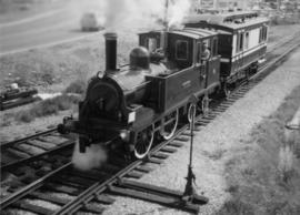
Grand Trunk Pacific Railway

Hart Highway Existing Land Use

Location & Watershed Map
M PSYU Aleza Lake Research Forest Old File #051597

Major Residential Development Proposals from June 1975 to August 1977

Map 93I.001 annotated to show 1994 RFP study area

Map 93J.010 annotated to show transects

Map of area covered by Tree Farm Licences no. 1 and no. 40 for Columbia Cellulose and Skeena Kraft

Map of Permanent Growth and Yield Sample Plots Showing their Location

Map of the Central Section of British Columbia shewing the country served by the Grand Trunk Pacific Railway

Map of the Colony of New Caledonia and the British & American Territory West of the Rocky Mountains

"Map of the Pacific Great Eastern Railway"

Map showing Jasper Park, Fraser River and Prentiss Gray's 1926 adventure

Map showing Mining Properties in Vicinity of Stewart and Salmon River. Portland Canal Mining Division. British Columbia

McGregor River forest cover map
Miscellaneous forest history material
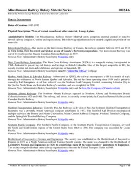
Miscellaneous railway history material

Monkman P.S.Y.U. forest cover map

Monkman P.S.Y.U., T.F.L. 30, and area

North Nechako Existing Land Use

North Nechako-Hart Proposed Land Use

Northwood Pulp & Timber Limited 1975 Operating Areas
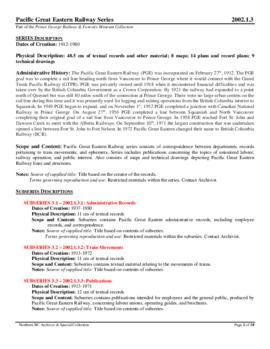
Pacific Great Eastern Railway (PGE)

Peden Hill: High Density Option

Peden Hill: Low Density Option

Peden Hill: Medium Density Option

Peden Hill: Spring & Fall Shadow

Peden Hill: Winter Shadow

Photo 41404 - Headwaters of W.A.C. Bennett Dam

Photo 41405 - W.A.C. Bennett Dam

Photo 41406 - W.A.C. Bennett Dam

Photo 41407 - W.A.C. Bennett Dam

"Pieces of Eight Treasure Map, British Columbia, Canada"