Affichage de 236 résultats
Archival description
Giscome, Cariboo District, British Columbia showing soils & landforms annotated

C.P. 825, 826, 410, 420 - F.L. A18165 - Aleza Lake Forest - P.G.T.S.A.

Aleza Lake Research Forest annotated to show proposed culverts and roadside brushing

Aleza Lake Research Forest annotated to show graded roads and parking lots

Aleza Lake Research Forest annotated to show dispersed (9%) spruce bark beetle green attack

Aleza Lake Research Forest Plot 103

Aleza Lake Research Forest Plot 112

Aleza Lake Research Forest - Management Compartments and Administrative Boundaries

Aleza Lake Research Forest - Research Trials and Permanent Plots

Aleza Lake Research Forest - Access and Access Management

Aleza Lake Research Forest - TRIM Base Map

Aleza Lake Research Forest - Ecosystem Theme Map

Aleza Lake Research Forest - Terrain Theme Map

Aleza Lake Research Forest - Terrain Resource Inventory Mapping (TRIM)

Aleza Lake Research Forest - Site Series Classification

Aleza Lake Experiment Forest - Map No. 1

Aleza Lake Experiment Forest - Map No. 2

Aleza Lake Experiment Forest - Map No. 3

Status of Sustained-Yield Forestry Programme as at December 31, 1969

Sketches of Harbours, Queen Charlotte Islands, 1878

Advanced Copy of a Map of the Queen Charlotte Islands

Map showing Mining Properties in Vicinity of Stewart and Salmon River. Portland Canal Mining Division. British Columbia

Location & Watershed Map

Map of area covered by Tree Farm Licences no. 1 and no. 40 for Columbia Cellulose and Skeena Kraft

British Columbia

Status of Sustained-Yield Forestry Programme as at 31 December 1962

Plan of Carney Addition in the Heart of Fort George

Map of the Central Section of British Columbia shewing the country served by the Grand Trunk Pacific Railway

Sketch Map Showing the Proposed Route of the Western Union Telegraph between Fort Fraser and the Stikine River

Map of the Colony of New Caledonia and the British & American Territory West of the Rocky Mountains

"Prince George B.C."
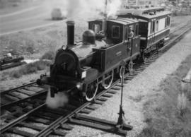
David Davies Railway Collection

"The Scenic and Industrious Route of BC Rail"

"Map of the Pacific Great Eastern Railway"

"The British Columbia Centennial Treasure: Official Map"

"Pieces of Eight Treasure Map, British Columbia, Canada"

"British Columbia Physiographic Subdivisions"

Photo 41404 - Headwaters of W.A.C. Bennett Dam

Photo 41405 - W.A.C. Bennett Dam

Photo 41406 - W.A.C. Bennett Dam

Photo 41407 - W.A.C. Bennett Dam

G. Gary Runka fonds

"British Columbia's Skeena Salmon"

North Nechako Existing Land Use

Hart Highway Existing Land Use

College Heights-Southwest Existing Land Use

North Nechako-Hart Proposed Land Use

Blackburn Development Area Proposed Sector Plan

V.L.A. Proposed Zoning

V.L.A. Record of Public Representations at Zoning Hearing, April 12, 1976