Mostrando 658 resultados

Archival description
236 resultados con objetos digitales Muestra los resultados con objetos digitales
1 Aug. 1970 Flight - Photos 47910-48433
2019.10.9 · Dossiê · 1 Aug. 1970
Parte de Lockwood Survey Corporation Ltd. collection

These remote-sensing aerial photographs were taken by Lockwood Survey Corporation Ltd. under contract for the B.C. Forest Service. Some photographs are annotated to show logging activity; clearcuts, slash piles, log booms, and tree debris on the water are also visible in some of the images. No detailed location information or index accompanies the photographs. These historically important aerial photographs depict Williston Lake soon after its creation in 1968 with the building of the W.A.C. Bennett Dam on the Peace River. Also depicted are the rivers and tributaries that empty into the Williston Reservoir, such as the Finlay River, the Ospika River, and the Omineca River.

The identification coding on these photographs can be interpreted as follows:

  • The largest number on the leftmost side is the frame number for the individual photograph.
  • The following code to the right in the format "B) 70-38" is currently unknown, but may refer to an internal project number for the Lockwood Survey Corporation.
  • The 6" may refer to the camera's focal length in inches.
  • Next is "17,150 ASL" which is 17,150 feet Above Sea Level.
  • Following is "152.63" which refers to the camera's focal length in millimeters, which equals 6 inches.
  • The "W1339" may refer to the reel, but that is unconfirmed.
  • "1 AUG 70" is the date the photos were taken.
"Map of Lower Mainland Railways"
2013.6.35.16 · Item · Mar. 1971
Parte de David Davies Railway Collection

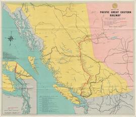
Map depicts rail lines in the BC lower mainland, including BC Hydro Railway, Burlington Northern Railway, the Canadian Pacific Railway, the Canadian National Railway, and the Pacific Great Eastern Railway.

2006.18.5.18 · Dossiê · 1974
Parte de Aleza Lake Research Forest Society fonds

File is a Resource Folio of maps and accompanying information created by Northwood Pulp & Timber regarding Timber Sale Harvesting Licence A01847, Willow River Block, Willow River P.S.Y.U. Includes maps that depict ungulates, waterfowl, recreation areas, special influence areas, and timber types. Most of the sheets have a duplicate, some with very slight variations. The following maps are supposed to be included in the but were missing upon arrival at the Archives: fish & topography, cutting permits & roads, and soils.

Oilweek: Pipeline Wall Map
2009.6.13.45.14 · Item · Nov. 1976
Parte de The Honourable Iona Campagnolo fonds

Map depicts existing oil lines, oil lines proposed or under construction, product lines, existing gas lines, gas lines proposed or under construction, LPG lines, and LPG lines proposed in Canada and Northern USA.

2009.6.13.45.09 · Item · 1976
Parte de The Honourable Iona Campagnolo fonds

Map depicts the whole of Canada and notes: gas pipelines, gas gathering lines, proposed gas pipelines, oil pipelines, oil gathering lines, proposed oil pipelines, gas fields, oil fields, refining centres, extraction plants, and oil sands. There is a smaller subsequent map of Alberta highlighting these features in greater detail.

"Prince George" 1976 map
2012.13.6.63 · Dossiê · 1976
Parte de J. Kent Sedgwick fonds

Item is an original 1976 map depicting Prince George, published by the Province of British Columbia Ministry of the Environment.

Regional District of Kitimat-Stikine
2009.6.13.45.18 · Item · 1976
Parte de The Honourable Iona Campagnolo fonds

Map depicts the regional district of Kitmat, but is extensively annotated showing the proposed route of the Kitmat Truck Ferry, running through Terrace and up into the "Yukon Markets," and the Kispiox Connector, running from Prince Rupert to Hazelton and further East along Highway 16 and north along the Kispiox River.