Mylar map is a plot map of a research plot at the Aleza Lake Research Forest. Provides date the plot was established, the harvest history, the silviculture history, remeasurement history, and information about individual trees.
Item is a hand-drawn map of a plot in the Aleza Lake Research Forest. Individual trees are marked and numbered.
Map indicates locations of research trials and permanent plots in the Aleza Lake Research Forest. Map produced by Madrone Consultants.
Item is a forest cover map for Aleza Lake Research Forest (Special Use Permit 19070). Shows experimental plots and timber sale areas.
Reproduced map on mylar depicts the Aleza Lake timber reserve near Aleza Lake, BC.
This map depicts the location of the Archie Creek site, annotated on a photocopied 93I.011 BC government map (undated).
Item is a British Columbia Forest Cover Map, serial number 093I001. Includes full format forest cover labels.
Item is a British Columbia Forest Cover Map, serial number 093J010. Includes full format forest cover labels.
Item is a British Columbia Forest Cover Map, serial number 093J010. Includes full format forest cover labels.
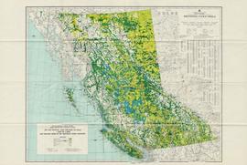
Item is a map of British Columbia and is a key map showing: maps published on scale 1 inch to 2 miles and summary zones of the provincial forest inventory. Map includes index of post offices correct to October 22, 1956.
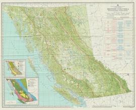
Item is a map compiled and produced by Geographic Division, Surveys and Mapping Branch, Department of Lands, Forests, and Water Resources ; geological and physiographical data supplied by Dept. of Mines and Petroleum Resources, Victoria, B.C. (1964).
Map issued as part of the Canadian Pulp and Paper Industry magazine. Depicts locations of all pulp and paper mills in Canada in 1975 and provides a listing of company names.
Zimmerman, AdamOriginal linen map depicts mining claims in the Cassiar District of British Columbia that were located in 1900-1901: L. 115 Princess Louise, L. 310 North Star, L. 311 Bonanza, L. 309 Emerald, and L. 312 Emma.
Map reflects highways, main, branch and property roads, trails, public sustained yield unit boundaries, cutting permit boundary, contours, height of land, edge of lake, merchantable and immature timber, non-commercial cover, and swamps.
Item is a map of Prince George Wood Preserving Ltd. Development Plan Forest Licence A27771 for the period of January 1, 1986 to January 1, 1991: Fraser Operating Area. Geographic features include the Fraser River.
Map of Timber Sale X72108 shows area to be scarified. Location is outside Prince George in the Upper Fraser area near Kenneth Creek.
Map of Timber Sale X72108 shows area to be scarified. Location is outside Prince George in the Upper Fraser area near Kenneth Creek.
Map of Timber Sale X72108 shows area to be scarified, as well as previously logged areas. Location is outside Prince George in the Upper Fraser area near Kenneth Creek.
Item is a Forest Cover Map, 93J-10-d, annotation on the back reads Carpet Lake. Geographic features include Merton Lake and Peculiar Lake.
Item is a Forest Cover Map, 93J-7, annotation on the back reads Summit Lake. Geographical features include Summit Lake and Crooked River.
Original forest cover map shows timber history in the area of Giscome, BC.
Colour-coded topographic map depicts forest stands of different heights.
Map reflects soil and landforms of Giscome area.


