Mylar map is a plot map of a research plot at the Aleza Lake Research Forest. Provides date the plot was established, the harvest history, the silviculture history, remeasurement history, and information about individual trees.
Item is a hand-drawn map of a plot in the Aleza Lake Research Forest. Individual trees are marked and numbered.
Map indicates locations of research trials and permanent plots in the Aleza Lake Research Forest. Map produced by Madrone Consultants.
Item is a forest cover map for Aleza Lake Research Forest (Special Use Permit 19070). Shows experimental plots and timber sale areas.
Reproduced map on mylar depicts the Aleza Lake timber reserve near Aleza Lake, BC.
This map depicts the location of the Archie Creek site, annotated on a photocopied 93I.011 BC government map (undated).
Map depicts proven on & offshore oil & gas areas, and probable oil & gas areas in less then 1000' water. The map conveys the North Pole in the centre and spans out to include Canada, Europe and the "Union of Soviet Socialist Republics."
Item is a British Columbia Forest Cover Map, serial number 093I001. Includes full format forest cover labels.
Item is a British Columbia Forest Cover Map, serial number 093J010. Includes full format forest cover labels.
Item is a British Columbia Forest Cover Map, serial number 093J010. Includes full format forest cover labels.
This map depicts where to find ghost towns, forts, First Nation villages, and sites with supposed hidden treasures in British Columbia.
The item is a reproduction of an aerial photograph of Prince George. Annotation states, "City of Pr. Geo. 1958 Aereal Photo CBD."
The item is a reproduction of an aerial photograph of Prince George between 1972 to 1975.
Map depicts sea floor of the Beaufort Sea, fault lines, and diapirs.
Map depicts British Columbia in its entirety as-well as smaller subsequent maps of Vancouver, Victoria and Vicinity, Prince George, Kamloops, Nelson, and Vancouver Island.
Item is a hand drawn and coloured map by the City of Prince George Planning Department depicting the Blackburn neighbourhood development area's proposed sector plan in 1976.
The item is a map depicting Bowron Lake Park in British Columbia, the park boundary, the patrol cabin, roads, campsites, glaciers, and trails. Various handwritten annotations are written on the map and Public Shelters are circled in red pen.
Item is a map of British Columbia and is a key map showing: maps published on scale 1 inch to 2 miles and summary zones of the provincial forest inventory. Map includes index of post offices correct to October 22, 1956.
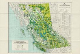
The map depicts the biotic regions and forests in British Columbia.
Map depicts the climactic regions of British Columbia which includes the coast, interior, and the northwest.
Map depicts annotations of the freight-way routes throughout British Columbia. These routes include: the Garnet Enterprise Truck Haul from Vancouver to Terrace, the Canadian Freightways from Vancouver to Edmonton to Alaska; the Lindsay Transfer from Terrace to Dease Lake and Telegraph Creek; and the Northland Navigation roll-on and roll-off service.
The map depicts the highest mountains in British Columbia; includes the Rocky Mountains, the Northern and Southern Plateaus, and the Mackenzie Mountain area.
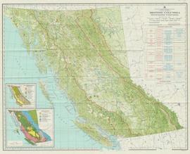
Item is a map compiled and produced by Geographic Division, Surveys and Mapping Branch, Department of Lands, Forests, and Water Resources ; geological and physiographical data supplied by Dept. of Mines and Petroleum Resources, Victoria, B.C. (1964).


