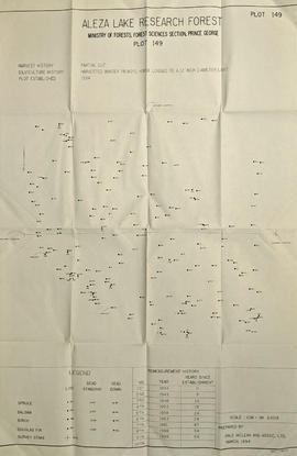
Item is a Forest Cover Map, 93J-7, annotation on the back reads Summit Lake. Geographical features include Summit Lake and Crooked River.
Large scale map shows Aleza Lake Research Forest permanent sample plot 103. Includes information about live and dead trees and their species (spruce, balsam, birch, douglas fir). Also includes remeasurement history. Plot 103 was established in 1926 and is an unlogged, old growth, uneven aged, spruce-balsam stand.
Large scale map shows Aleza Lake Research Forest permanent sample plot 112. Includes information about live and dead trees and their species (spruce, balsam, birch, douglas fir). Also includes remeasurement history. Plot 112 was established in 1926 and is an unlogged, old growth, uneven aged, spruce-balsam stand.
Mylar map is a plot map of a research plot at the Aleza Lake Research Forest. Provides date the plot was established, the harvest history, the silviculture history, remeasurement history, and information about individual trees.
Map reflects forest type boundary line, bogs and swampy non-forested areas, creeks, lakes, rivers, tree species labels of spruce, balsam, and birch, stand descriptions, historical timber sale boundaries, stand history symbol, gravelled secondary roads, unimproved old roads, management compartment boundary, research forest boundary, ecological reserve boundary, and old growth emphasis areas.
Item is a reproduced map of Aleza Lake annotated to show a 1994 RFP study area.
Mylar map is a plot map of a research plot at the Aleza Lake Research Forest. Provides date the plot was established, the harvest history, the silviculture history, remeasurement history, and information about individual trees.
Map depicts historical timber sales areas and permanent sample plots (PSPs) at the Aleza Lake Research Forest. This map may be a guide (or otherwise related) to maps 2006.18.5.43-59.
Item is a photocopied Aleza Lake Forest map with forest cover labels, annotated to show 1995 sample transects.
Item is a photocopied map of the Aleza Lake area annotated to show transects.
Map depicts structural stages in the Aleza Lake Research Forest. Shows areas of: pioneer growth, shrub/herb, pole saplings, young forests, mature forests, and old forests. Ecosystem classification and mapping by Oikos Ecological Services Ltd.
Map depicts ecosystems in the Aleza Lake Research Forest. Shows areas of: upland sites without wetland components, upland sites with wetland components, lowland wet forest sites, wetlands, and Bowron floodplain benches. Ecosystem classification and mapping by Oikos Ecological Services Ltd.
Map depicts terrain themes in the Aleza Lake Research Forest. Ecosystem classification and mapping by Oikos Ecological Services Ltd.
Map depicts terrain in the Aleza Lake Research Forest. Ecosystem classification and mapping by Oikos Ecological Services Ltd.
Map accompanies “Aleza Lake Research Forest Management and Working Plan #2 Draft #3”.
Item is a British Columbia Forest Cover Map, serial number 093J010. Includes full format forest cover labels.
Item is a map of Aleza Lake Research Forest land management units and boundaries. By Madrone Consultants Ltd. May, 9, 1997.