Drawing depicts visual notes taken at the 2020 Public Health Summer Institute with the theme "Think Globally, Act Locally: Public Health and the Anthropocene". Themes related to the COVID-19 pandemic are depicted.
This map is the May 2008 amendment (Bylaw 8061) of the Schedule C of the 2001 Official Community Plan, Bylaw No. 7281 for the City of Prince George. This Schedule C map shows the long range land use for the City of Prince George.
This map is the October 2006 amendment (Bylaw 7807) of the Schedule C of the 2001 Official Community Plan, Bylaw No. 7281 for the City of Prince George. This Schedule C map shows the long range land use for the City of Prince George.
This map is the May 2006 amendment (Bylaw 7807) of the Schedule C of the 2001 Official Community Plan, Bylaw No. 7281 for the City of Prince George. This Schedule C map shows the long range land use for the City of Prince George.
This street map of the VLA area in Prince George includes property outlines and street numbers.
This map is Schedule C of the 2001 Official Community Plan, Bylaw No. 7281 for the City of Prince George. This Schedule C map shows the long range land use for the City of Prince George.
This map is part of Schedule B of the 1993 Official Community Plan, Bylaw No. 5909 for the City of Prince George. This particular map reflects the 1998 amendment to the Official Community Plan.
This map is the Schedule A accompanying map for the City of Prince George's Soil Removal and Deposit Bylaw No. 7022 of 1999. It depicts designated soil removal areas and M.O.T.H. gravel reserves.
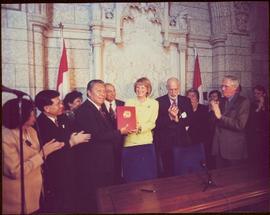
The group stands in front of an ornate stone wall and two Canadian flags.
Handwritten annotation on photograph enclosure reads: “8/6/99. Dear Lady, When I saw this photograph I knew there was a certain person who would truly appreciate and ‘feel’ its significance. Not many steps left to take now . . . . your unwavering support is never more appreciated. best personal regards, Peter”; handwritten annotation on verso reads: “Nisga’a”.
This map depicts the City of Prince George's plan for soil removal and deposit.
This map is part of Schedule B of the 1993 Official Community Plan, Bylaw No. 5909 for the City of Prince George. This particular map reflects the 1998 amendment to the Official Community Plan.
This map is part of Schedule B of the 1993 Official Community Plan, Bylaw No. 5909 for the City of Prince George. This particular map depicts the east area of the City of Prince George, including the Prince George Airport (YXS) and the Blackburn area.
This map is part of Schedule B of the 1993 Official Community Plan, Bylaw No. 5909 for the City of Prince George. This particular map depicts the northeast area of the City of Prince George, including the industrial areas on Prince George Pulpmill Road and Northwood Pulpmill Road along the Fraser River.
This map is part of Schedule B of the 1993 Official Community Plan, Bylaw No. 5909 for the City of Prince George. This particular map depicts the central area of the City of Prince George, including the Bowl area, the VLA, the Crescents, South Fort George, Heritage, and Peden Hill.
This map is part of Schedule B of the 1993 Official Community Plan, Bylaw No. 5909 for the City of Prince George. This particular map depicts the northwest area of the City of Prince George, including the North Nechako neighbourhood and the Hart.
This map is part of Schedule B of the 1993 Official Community Plan, Bylaw No. 5909 for the City of Prince George. This particular map depicts the southwest area of the City of Prince George, including College Heights, UNBC, University Heights, and Vanway.
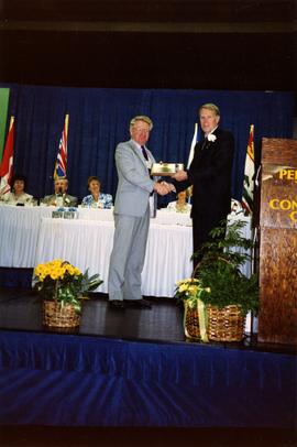
Photograph depicts Gary Runka receiving a Agricultural Institute of Canada Fellow award at the 1990 AIC Convention at the Penticton Conference Centre.
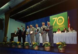
Photograph depicts recipients of the 1990 Agricultural Institute of Canada Fellow award at the 1990 AIC Convention at the Penticton Conference Centre. Gary Runka is third from right.
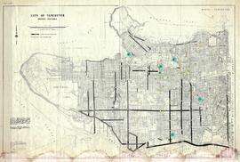
This municipal map of the City of Vancouver from 1987 shows street names and street widening information.
Item is the Proposed Land Use Map, 1978-2012, referred to in By-law No. 3138, the City of Prince George Official Community Plan. The original draft of this map was completed on October 24, 1977. This version of the map was amended in July 1982.
Item is a map depicting the Vancouver Carney study neighbourhood area in Prince George.
Item is a map depicting land use in the Vancouver Carney study neighbourhood area in Prince George. Also includes two mylar overlays that show the outlines of "unit 2" and "unit 3" development areas.
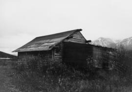
This file contains images of a land dispute around Cassiar. The photographs depict a cabin on a lot, a destroyed cabin, and outhouses. The accompanied documents in the original file refer to the subjects of "Claims, Leases, and Land lots," and it is implied that there were issues of squatters, illegal occupation, and mineral claims.
Item is a map depicting proposed land use between 1978 and 2012 in the City of Prince George. This map was drawn for the City of Prince George Community Plan; this particular version of the map was displayed in City of Prince George council chambers through 1979.
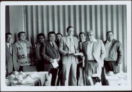
The group stands against wall, banquet tables in foreground.
Handwritten annotation on verso reads: “Minister DINA Hugh Faulkner + Kitamaat Band Council for Land Claim presentation”.
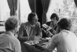
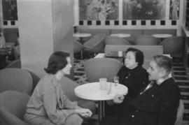
Hugh Faulkner and Kitamaat Band Council members sitting at a table talking during the Kitamaat Band North Coast District Council meeting and land claim presentation.
Hugh Faulkner is sitting at a table and speaking into a recording device that is held by two men. A third man is sitting with his back to the camera.
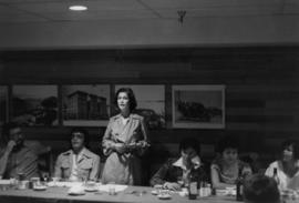
Minister Iona Campagnolo speaking at the North Coast District Council, three unidentified men and two unidentified women seated around her. Handwritten annotation on verso reads: “North Coast District Council”.
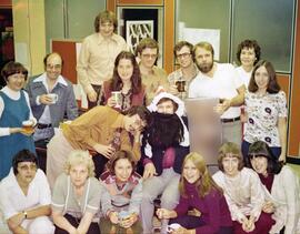
Photograph is a group portrait of BC Agricultural Land Commission staff members at a Christmas party. Back row, left to right: Patti, Terry Lewis, unknown, Julie Glover, Gordon Gram, Gary Holisko, Kirk Miller, unknown, Shirley Brightman. Middle row, left to right: Eve Lew, Jim Plotnikoff (Santa). Front row, left to right: Verona Hoosen, unknown, Jane Perch, Denise Jankovich, unknown, unknown.
Item is a hand drawn and coloured map by the City of Prince George Planning Department depicting existing land use for the Van Bow neighbourhood area.
Item is a hand drawn and coloured map by the City of Prince George Planning Department depicting existing zoning for the Van Bow neighbourhood area. Also includes two hand-drawn mylar overlays for the map; one showing "Opportunities & Constraints" such as housing age and condition and the other showing "Subdivision Activity" over decades of development in the Van Bow area.
Item is a map annotated in colour by the City of Prince George Planning Department depicting major residential development proposals from June 1975 to August 1977 in the City of Prince George. This map was drawn for the City of Prince George interim Community Plan.
Hugh Faulkner and Kitamaat Band Council members sitting at a table talking during the Kitamaat Band North Coast District Council meeting and land claim presentation.
Two Kitamaat Band Council members sitting at a table during the Kitamaat Band North Coast District Council meeting and land claim presentation. A third man is sitting in the background with crossed arms.
The group stands against wall, banquet tables in foreground.
Handwritten annotation on verso reads: "Minister DINA Hugh Faulkner + Kitamaat Band Council for Land Claim presentation".
Group shot of Hugh Faulkner and the Kitimaat Band Council at a land claims presentation during the North Coast District Council meeting. Eight council members are pictured.
Iona Campagnolo sitting and speaking with Mr. and Mrs. Solomon Doolan in Kincolith during the North Coast Council meeting and land claim presentation with the Kitimaat Band Council.
Hugh Faulkner, Kitamaat Band Council members, and an unknown man sitting at a table talking during the Kitamaat Band North Coast District Council meeting and land claim presentation.
Many people are seated around a meeting table. Hugh Faulkner is at the head of the table, seated beside a flip chart with the word "Agenda" written at the top.
Item is a hand drawn and coloured map by the City of Prince George Planning Department depicting zoning proposed by the Prince George City Planner for the VLA neighbourhood.
Item is a hand drawn and coloured map by the City of Prince George Planning Department depicting Hart Highway neighbourhood area existing land use in 1976.
Zonder titelItem is a hand drawn and coloured map by the City of Prince George Planning Department depicting the Blackburn neighbourhood development area's proposed sector plan in 1976.
Item is a hand drawn and coloured map by the City of Prince George Planning Department depicting the VLA neighbourhood proposed zoning in 1976.
Item is a hand drawn and coloured map by the City of Prince George Planning Department depicting public representations at the VLA neighbourhood zoning hearing that occurred on April 12, 1976.
Item is a hand drawn and coloured map by the City of Prince George Planning Department depicting zoning proposed by Prince George Alderman A. Stauble for the VLA neighbourhood.
Item is a map depicting the areas of spring and fall shadow in the Peden Hill neighbourhood in Prince George.
Item is Map 3 of a group of five maps relating to a City of Prince George Study of Construction Aggregates by the firm Willis, Cunliffe, Tair & Company Limited. Map 3 shows geology of the Prince George area and known sources of construction aggregates.
Item is a hand drawn and coloured map by the City of Prince George Planning Department depicting the North Nechako and Hart neighbourhood area proposed land use in 1976.
Item is a hand drawn and coloured map by the City of Prince George Planning Department depicting existing land use for the Van Bow neighbourhood area.
Item is a map depicting a future medium density development plan for the Peden Hill neighbourhood in Prince George.

![City of Prince George - Schedule C of the Official Community Plan - Long Range Land Use Map [May 2008 Amendment]](/uploads/r/northern-bc-archives-special-collections-1/4/3/a/43a9e75941f1542735d999de340307d163e79dffdadbf4546bb9346b63f7e734/2023.5.1.41_-_2008_May_-_City_of_Prince_George_Long_Range_Land_Use_Map_JPG85_tb_142.jpg)
![City of Prince George - Schedule C of the Official Community Plan - Long Range Land Use Map [October 2006 Amendment]](/uploads/r/northern-bc-archives-special-collections-1/6/d/6/6d643c10801eba2ac493689972e57429dba42ec7592f54cb55151b96362d7048/2023.5.1.40_-_2006_Oct_-_City_of_Prince_George_Long_Range_Land_Use_Map_JGP85_tb_142.jpg)
![City of Prince George - Schedule C of the Official Community Plan - Long Range Land Use Map [May 2006 Amendment]](/uploads/r/northern-bc-archives-special-collections-1/6/5/5/65536bc04aa97580c140131651dc357dfe5c3a1315822394f388d96940bc39cb/2023.5.1.39_-_2006_May_-_City_of_Prince_George_Long_Range_Land_Use_Map_JPG85_tb_142.jpg)


![City of Prince George - Schedule B of the Official Community Plan, Bylaw No. 5909 [2001 Amendment]](/uploads/r/northern-bc-archives-special-collections-1/c/3/6/c36392b90696286cc6281e8cc2efbf7691c2617726495fa28db2cbdcc20e4e4c/2023.5.1.36_-_Official_Community_Plan_City_of_PG_Schedule_B_2001_JPG85_tb_142.jpg)


![City of Prince George - Schedule B of the Official Community Plan, Bylaw No. 5909 [1998 Amendment]](/uploads/r/northern-bc-archives-special-collections-1/d/6/d/d6d1c4e7e37fc948b97b3caa36447b52f7d2b76b13d45e3710aefee7b13840f0/2023.5.1.33_-_1998_Official_Community_Plan_City_of_PG_JPG85_tb_142.jpg)


![Proposed Land Use 1978-2012, Official Community Plan, City of Prince George [1982 Amendment]](/uploads/r/northern-bc-archives-special-collections-1/6/6/9/669fc9dc3b840a6896f6a2a968a948283a3c5d972b6b48d718b427a57ebbe67f/2023.5.1.22_-_1982_-_Proposed_Land_Use_1982-2012_JPG85_tb_142.jpg)

![Vancouver Carney Study [Existing Land Use]](/uploads/r/northern-bc-archives-special-collections-1/d/8/4/d841cd29016ddb96663d51e137bd7a3b7c4dfe3ec645baca199615e3e4464da3/2023.5.1.21a_-_Vancouver_and_Carney_Study_Area_Existing_Land_Use_JPG85_tb_142.jpg)
![Proposed Land Use 1978-2012, Official Community Plan, City of Prince George [1979 Amendment]](/uploads/r/northern-bc-archives-special-collections-1/c/e/d/ced2c18ae074ee79ace57d0454f038b5e09774ff682567e053093476af37c166/2023.5.1.14_-_1979_-_1978-2012_Official_Community_Plan_City_of_Prince_George_JPG85_tb_142.jpg)
