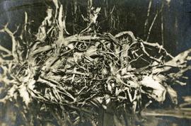
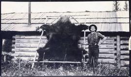
Photograph depicts a man standing near a very large driftwood root.
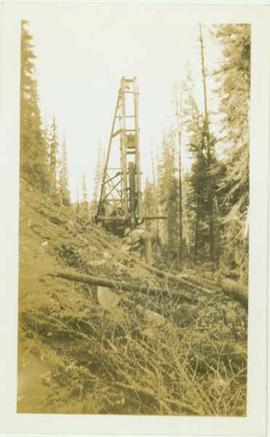
Photograph depicts an unidentified man standing on a hillside in front of a pile driver located in a forested landscape.
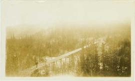
Photograph depicts an unidentified man standing on a newly constructed wooden roadway that winds through a forested landscape.
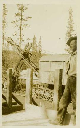
Photograph depicts an unidentified man standing on a wooden road beside a steamshovel in front of a forested landscape.
Photograph depicts an unidentified man standing on a wooden road beside a steamshovel in front of a forested landscape.
Photograph depicts a man standing in the foreground of the photo on a wooden trestle that leads through a forested landscape. Handwritten annotation on verso reads: "Tressle for carrying flume across Valley of South from Germansen Creek. This is continuous tressle for nearly 2000 feet. Maximum height 54feet."
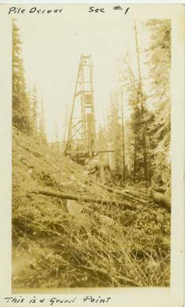
Photograph depicts a man leaning over in front of a tall wooden pile driver in a forest environment. Annotation on recto of photograph reads: "Pile driver sec.#1. This is a gravel point"
Series contains working and management plans, a policy handbook, drafts, correspondence, proposals, recommendations, revenue records, photographs, handwritten notes, maps, and planning projects.
Item is an original BC Forest Service "Management Manual" that was published circa 1955 and amended many times up to 1973.
Handwritten annotation below photo on page taped to photograph: "PHOTO #1: Outcrop of Serpentine showing veinlets of asbestos fibre. Wider veinlets 1/2" - 1"."
Handwritten annotation below photo on page taped to photograph: "PHOTO #3 Showing approx. area covered by Asbestos - serpentine float". The approximate area has been outlined in blue ink on verso of photograph. Photo taken from lower level in valley, trees in foreground, outcrop visible in distance.
Handwritten annotation below photo on page taped to photograph: "PHOTO #4 Face of cut 4' wide 3' deep. Showing serpentine fragments in loose asbestos fibre. Assumed to overly serpentine high in fibre veinlets. Frost action."
Photograph depicts snowy mountaintop, wooden shelter and truck in foreground. Corresponding note on accompanying photo description page: "Pictures taken July 2nd, 1952. 1. Picture taken from campsite showing snow on talus."
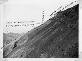
Handwritten annotation below photo on page taped to photograph: "PHOTO #2: Looking N across talus slide of asbestos fibre and serpentine fragments." Handwritten annotation on verso of photograph in blue ink describing sections of photograph which have been pointed to or outlined: "Talus of asbestos fibre & serpentine fragments -->" "Photo #1 -->" "Approx upper contact of serpentine -->".
File consists of a paper titled "Managing Canada's North: The Case of the Provincial North" presented by Weller at the seminar "Managing Canada's North: Challenges and Opportunities" held by the Institute of Public Administration of Canada as well as copies of the paper printed for the seminar in English and French. This file was originally numbered to correspond with conference paper number 26 listed in Weller's CV.
File consists of "Managing Your Woodland: A Non-Forester's Guide to Small-Scale Forestry in British Columbia" (1988).
Photograph depicts the first of three manufacturing floors in the Leigh Instruments Ltd. factory.
Noranda Inc.Item is a reproduced map of Aleza Lake annotated to show a 1994 RFP study area.
Item is a photocopied map of the Aleza Lake area annotated to show transects.
Item is a map that distinguishes the regions covered by Tree Farm Licence No. 1 granted to Columbia Cellulose and Three Farm Licence No. 40 granted to Skeena Kraft. Major locations indicated in this map include: Prince Rupert, Terrace, Hazelton, Smithers, Kitimat, Skeena River, and Nass River. Railway routes are also shown.
Map reflects reserve boundary, roads, trails, 20 feet contour intervals, air photo centre, declination, swamps, and mile post at the Aleza Lake Forest Reserve.
Series consists of cartographic materials including maps and blueprints of the Aleza Lake Research Forest. The maps reflect permanent sample plots and other study areas. The blueprints outline details for the development of a Ranger Station.
Series consists of maps, technical drawings, and other oversize material collected by Gary Runka that are not associated with specific Land Sense Ltd. client jobs.
Series consists of maps, and road maps, and trail guides from various communities and regions in Northern and Central BC. Series includes Forest Cover Maps and maps related to BC forest and natural resource management.
Annotation on slide: "Marked-to-cut tree with old scar, Summit selection trial".
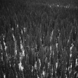
No annotation on slide.
No annotation on slide.
Sub-subseries consists of market research and competitor analysis records concerning Northwood Mills that were created or accumulated by Adam Zimmerman during his tenures as the company's President, Director, and Chairman. Includes assessments of other companies for possible acquisition and to keep aware of competition. Also includes appraisals of pulp and timber lands.
Northwood Mills Ltd.Sub-subseries consists of market research and competitor analysis for Northwood Pulp and it's renamed successors Northwood Pulp and Timber Ltd. (1972-1998) and Northwood Forest Industries Ltd. (1979-1998). These records were created or accumulated by Adam Zimmerman during his tenures as the company's President and Director, as well as his Presidency of Northwood Pulp's parent company, Northwood Mills. Includes market surveys, research on other pulp companies, and files on individual competitors.
Northwood Pulp and Timber Ltd.Item is a marking manual compiled by D.R. Glew, Assistant Forester.
File contains an original BC Forest Service report for E.P. 443 by S. Benteli entitled "Marking of Douglas Fir: A Preliminary Investigation of the Problems, Restricted to Interior Dry Types and the Cariboo".
Item is an original issue of British Columbia Forest Service Research Notes on "Marking of Spruce in the Fort George Forest District" by L.A. deGrace, E.W. Robinson, and J.H.G. Smith.
File consists of an original BC Parks "Master Plan for Valhalla Provincial Park". Includes accompanying correspondence from Grant Hazelwood to Dr. Terry Huberts, Minister of Parks, as well as to Phil Whitfield of BC Parks.
Item is a copyprint reproduced from the British Columbia Forest Service photographic records held at BC Archives.
Item is a copyprint reproduced from the British Columbia Forest Service photographic records held at BC Archives.
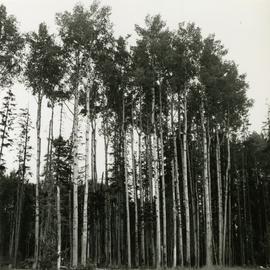
Caption describing photograph: "Frames 8, 9, and 10. Mature stand of Aspen growing on moderately drained Bednesti silt (Sandy silt). Ht 95', 22" DBH. Age 110 years. Excellent form. Mile 11 Hart Highway. Adjacent field has excellent crop of potatoes and timothy."
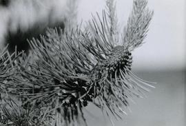
Caption describing photograph: "Maturing 2nd year cones on right, mature non-serrotinous cone with seed dispersed on left."
Item is McBride, B.C. Sheet 93H and Part of 83E Second Status Edition (1971) from "Classification and Interpretation of some Ecosystems of the Rocky Mountain Trench, Prince George Forest Region, British Columbia: First Approximation" (1984).
This file includes two major photographic collections concerning the construction and development of the underground mine at Cassiar, title the McDame Project.
The first collection includes fifteen monthly progress reports documenting the development from July 1988 to December 1989. The progress reports are authored by G. Verret, and were distributed to the executives of Cassiar Asbestos in Vancouver as well officials of the B.C. Government and other creditors of the Corporation. Most images are annotated and dated. Many of the loose photographs are accompanied by an inventory sheet.
Subjects depicted include: the staging area prior to mine development, the initial development of the “Vent Portal”, a jumbo drill working on the mine face, the working face marked for drilling and wired with fuses, a Caterpillar dozer clearing snow after an avalanche, scene of a fire in winter time, complete conveyor sump decline, mining vehicle parked on the “Lay-Down Area” presumably near the portal, the working face of the mine at various stages of development, 1563 portal being slashed, the removal of the overburden for the tramline loading station site, the construction of the transfer tower(s), construction of the stockpile area, the construction of a sedimentation pond, a presumed cave in, construction of footings for the conveyor, construction of the tramline loading terminal station, construction of the crusher building, a slash titled “Breakthrough in Access Ramp”, storage of powder and fuses, a washout in conveyor decline, fog at the portal in -30 degrees Celsius, the 1290 junction flooded, a slab of shotcrete which fell on and injured a miner while shotcreting, shotcrete blasted off walls for repairs, images of the “Hilti-test”, shots showing grade of drift, and structural failures in the 1350 adit.
Locations and structure within the underground mine depicted include: yellow ventilation ducting, ground support including steel screen and shotcrete, steel cables bolted unto ground support, puddles in the adits, the access road to the lay-down area, the exhaust drift, “Fans and Heaters in the 1415 adit”, the 1350 sump, the access ramp to the 1320, the exhaust ramp safety bay, the conveyor decline, the ventilation adit, the 1563 portal, the temporary repair shop at the 1415 portal, junctions of various drifts, the ”Fresh Water Pump & Pumphouse on lower Creek”, the “Ventilation Raise/1563 Platform”, a “Diamond Drill Station” at 6066 North in the underground mine, the “Bridge to the Gravel Pit”, the “Crushing and Screening Plant” in the gravel pit, the ventilation bulkhead in the conveyor decline, and the “Powder Magazine”.
People depicted include Rose Gay and R. Tyne on a tour of the underground mine, a geologist with a rockhammer, a miner identified as A. Jacobs working, contract miners Bruno and Marbel from Canadian Mine Development, and unidentified miners rockbolting, shotcreting, and drilling using jackleg drills.
Vehicle and mining equipment depicted include jeeps, pickup trucks, a front end loader, an unidentified a small unmanned tracked machine with a long arm, scoop trams, a land cruiser, an ore truck with a flat tire, the cone crusher, a “scissor lift”, a mobile shotcrete machine, a new grout pump, a new Boart Jumbo Drill, and a detached bucket half of a 413 ore truck.
The second collection depicts the McDame Project construction in 1986 and 1987.
Content of these photographs includes: various machinery used for excavating and drilling, underground progress of tunneling, supports, wire meshing, rock formations in mine, and exposed asbestos. There are no annotations regarding this photographs.
File consists of the "McGregor Model Forest: Annual Report 1999-2000."
File consists of the "McGregor Model Forest: Annual Report 95/96."
File consists of the "McGregor Model Forest: Annual Report 96/97."
File consists of the "McGregor Model Forest: Annual Report 97/98."
Series consists of administrative records of the McGregor Model Forest Association (MMFA) including: Board of Directors Meeting Minutes from 1993 to 1997; work plans from 1994 to 1997 and 2002 to 2003; annual reports from 1995 to 2006; Technical Steering Committee Meeting Minutes from 1993 to 1997. Series also includes MMFA Master Direction document and Defining Document as well as a reference guide for the MMFA.
File consists of the "McGregor Model Forest Association: Annual Report 2000-2001."
File consists of the "McGregor Model Forest Association: Annual Report 2001-2002."
File consists of the "McGregor Model Forest Association: Annual Report 2003-2004."
File consists of the "McGregor Model Forest Association: Annual Report 2004-2005."
