File consists of notes, clippings, and reproductions relating to Quesnel, Barkerville, and Wells. Includes: "An Historic Walk of Carson Avenue, Quesnel, B.C". pamphlet prepared by the Quesnel Branch Cariboo Historical Society (1990); "Wells, B.C". pamphlet by the Wells Historical Society (1980); "Cottonwood House Provincial Historic Park" pamphlet by the Province of British Columbia (1980); and vol. 1 of the Cariboo Gazette newspaper (2002). Also includes a map depicting Bowron Lake Park in British Columbia (1968).
Item is an original 1966 map depicting Quesnel British Columbia, published by the Department of Lands, Forests and Water Resources in Victoria.
Item is an original 1969 map depicting Quesnel in British Columbia, published by the Department of Energy, Mines and Resources in Ottawa.
Map depicts rail trackage in the Greater Vancouver area, showing dates of completion and abandonment of railway lines. Also shows proposed rail lines.
Map depicts railway lines in the state of Washington, including those crossing over the border into British Columbia.
Map depicts all current rail lines in Western Canada and Alaska and major railway stations. Includes insets for Alaska & Yukon, Edmonton area, Winnipeg area, and the Vancouver area.
Hand drawn draft map depicts historical railway routes in British Columbia. Includes dates and annotated information about rail lines.
Map depicts range reference area exclosure locations for livestock and wildlife in the Fort St. John Forest District.
File consists of assorted real estate listings and appraisals for investment properties in Prince George, Mackenzie, and Vanderhoof. A survey of Tabor Lake, documents from a continuing education seminar for engineers, and recreational area assessments are also included. Also includes 19 street traffic and parking maps of Prince George from the 1970s.
Map is a "Recreation and Logging Road Guide to the Forest Lands of Vancouver Island Alberni Valley and the Surrounding Area" created for the public.
Map is a "Recreation and Logging Road Guide to the Forest Lands of Vancouver Island Alberni Valley and the Surrounding Area" created for the public. Backside states "Welcome to TFL 44", along with promotional imagery and information for backcountry travelers.
Item is an original 1985 map depicting Red Rock area of British Columbia, published by the Department of Energy, Mines and Resources. The map includes pen markings.
Map depicts the city of Regina, Saskatchewan, noting main arterial, visitor centre, special interest points, parks and recreational areas, elementary and secondary schools, and shopping centres. A smaller subsequent map of the business district is provided as well.
Series consists of planning material created or collected by Chander Suri during his employment as a planner for the Regional District of Fraser-Fort George (RDFFG) between 1968 and 1977. These records include land development research, population data, economic studies, promotional material for the City of Prince George and Regional District, and long-term plans for the municipality of Prince George. This series also contains photographs, maps, and plans related to projects of relevance to RDFFG.
Map depicts the regional district of Kitmat, but is extensively annotated showing the proposed route of the Kitmat Truck Ferry, running through Terrace and up into the "Yukon Markets," and the Kispiox Connector, running from Prince Rupert to Hazelton and further East along Highway 16 and north along the Kispiox River.
Item is an original draft copy of "Regional Landscapes for the British Columbia Parks System".
Series contains aerial photographs, stump data sheets, permanent sample plot summaries, correspondence, minutes from meetings, research proposals, budget reports, measurement charts, various historical documents, permits, field notes, overview diagrams, and an inventory of the 1994 Northwood Pulp and Timber donation to the Fraser Fort George Museum.
Series consists of records created and collected in relation to research projects Dr. Paul Sanborn was engaged in, often with other colleagues, during his employment with the BC Ministry of Forests and/or the University of Northern British Columbia. These archival research records are predominantly unpublished documents, reports, data, and photographs. Some of Sanborn's research projects did not result in a formal scientific publication. In other instances, some of Sanborn's research projects resulted in only a portion of the collected data utilized for a formal publication.
Sanborn compiled details about each research project and its associated records in a summary note. Each of these notes is provided in PDF format along with its research project series. These notes serve as an essential guide for researchers who wish to interpret, utilize, and repurpose Sanborn's data for other future research projects.
Kent Sedgwick’s research subject files contain original research notes, interviews and oral histories, news clippings, and collected primary and secondary sources. The series also includes both original and reproduction photographs, audio recordings, and maps. The subject files primarily relate to the history, urban planning, and historical geography of the Central Interior of British Columbia, especially Prince George area and the East Line communities over the course of the 20th century. They also include extensive notes on geographic features, landscapes, interpretative trails, architectural history, industrial history, history of Western exploration and land survey, and the First Nations history of the region.
File is a Resource Folio of maps and accompanying information created by Northwood Pulp & Timber regarding Timber Sale Harvesting Licence A01847, Willow River Block, Willow River P.S.Y.U. Includes maps that depict ungulates, waterfowl, recreation areas, special influence areas, and timber types. Most of the sheets have a duplicate, some with very slight variations. The following maps are supposed to be included in the but were missing upon arrival at the Archives: fish & topography, cutting permits & roads, and soils.
Item is a map depicting the revised site plan for the Salmon Valley Ranch created by Trelle Morrow, architect.
Pennock, W.B. RIVER CROSSING EXERCISE. Prince George, B.C. 2 SEP 43. Presented to Major-General H.N. Ganong G.O.C. 8 CDN. DIV. by Lt-Col. W.B. Pennock C.R.C.E. 8 CDN. DIV. 1943. Oblong 4to. 24pp of text, color maps, one showing the proposed crossing of Nechako River. 20 b/w snapshot photos, mounted with corners, each with captions + Appendix A, B and C of facts and figures. A large folding contemporary map of Vernon is laid in, with one of the training zones (?) highlighted on the map in a red square box. Fabricoid spine and corners.
The original typescript for a (presumably confidential and secret) document listing the preparations for defensive manoeuvres in the event of war with Japan taking place in Northern British Columbia. This document describes a simulation of what events and defences could take place, including how to conduct river crossings; when in the war game, the author imagines what would happen should the Japanese invade Prince Rupert as a starting point for the invasion of Canada.
An important document providing insight into the thinking of the Canadian military while preparing for the possibility of Japan extending its war into the North Pacific Theatre during World War II.
The item is a map depicting the Salmon Portage area along the Salmon River. Various annotations are written in pen and sections of the map are coloured with pencil crayon. The Forest Cover Map identification number is 93J.026.
The item is a map depicting the Salmon Portage area along the Salmon River. Various annotations are written in pen and sections of the map are coloured with pencil crayon. The Forest Cover Map identification number is 93J.026.
The item is a map depicting the Salmon Portage area along the Salmon River. Various annotations are written in pen and sections of the map are coloured with pencil crayon. The Forest Cover Map identification number is 93J.027.
The item is a map depicting the Salmon Portage area along the Salmon River. Various annotations are written in pen and sections of the map are coloured with pencil crayon. The Forest Cover Map identification number is 93J.027.
File consists of maps depicting the Salmon River Portage area.
Item is an original 1983 map depicting Salmon River in British Columbia, published by the Province of British Columbia Ministry of Environment. The map includes pen and pencil annotations.
Item is an original 1986 map depicting Salmon Valley in British Columbia and was published by the Department of Energy, Mines and Resources Ottawa Canada.
Item is an original 1954 map depicting Salmon Valley British Columbia, published by British Columbia Department of Lands and Forests. Map includes pen markings.
Item is an original 1987 map depicting Saxton Lake in British Columbia, published by the Department of Energy, Mines and Resources Ottawa, Canada. The map includes pen markings.
Item is a photocopied 1961 National Topographic System map of Sinclair Mills in British Columbia, published by the Canadian Department of Geography. The map includes pen markings.
Map reproduction of the Sinclair Spruce Lumber Co. Ltd. T.S.H.L. A01848 C.P. 310 cutting area, likely in the Aleza Lake Research Forest.
Logging plan of Sinclair Spruce Lumber Company's T.S.X. 73378 at Hubble Creek shows areas to be cut.
Logging plan of Sinclair Spruce Lumber Company's T.S.X. 73378 at Hubble Creek shows areas to be cut. Annotations show areas logged.
File consists of a folder containing documents describing Skeena Kraft Limited. Folder consists of:
- Svenska Cellulosa Aktiebolaget--A Forest Products Giant
- Columbia Cellulose Company, Limited--A Corporate History
- Two World-Wide Sales Organizations to Market Skeena Kraft Pulp
- Skeena Kraft Limited Adopts Distinctive Housemark Symbol Adapted from Sun Totem, Kee-War-Kow, Family Crest of Sky People
- The Nass and Skeena Valleys--A New Economic Region Terrace and Prince Rupert are Hubs in Finance and Services
- MISSING: Twinriver Timber Limited: New Company Created to Administer Two Tree Farm Licence Areas
- The Forests Behind the Coast Range Produce Superior Pulp
- Efficient New Woodroom Highlights Skeena Mill
- Integrating Two Power Systems--A Marriage with Convenience One Power Group Serves Two Mills
- Pulping Group Features Flexible Bleaching Sequence and World's Largest Flakt Drier
- New Dams Create Huge Storage Area for Skeena Water Supply
- Advanced Process Control Techniques Employ Computers Extensively
- Skeena Kraft Mill Quality Control and Process Control Tune Mill to Produce Prime Quality Pulps
- Co-ordination and Administration of Construction and Design of Skeena Kraft Shared by H.A. Simons and Central Engineering of Columbia Cellulose
- Purchasing and Traffic Departments Buy and Move More than 25,000 Tons of Materials During Skeena Kraft Construction Co-ordinated Sea and Land Transport System Introduced
- Skeena Kraft--Hundreds of New Jobs Canada-Wide Recruiting Programme Attracts New Workers to Growing Nass-Skeena Region;
- Also includes 19 photographs; 12 technical drawings and diagrams; 2 maps;
- Promotional pamphlet "The Skeena Kraft Story."
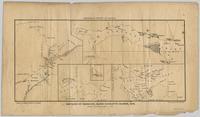
Pope, Frank L. “Sketch Map Showing the Proposed Route of the Western Union Telegraph Between Fort Frazer and the Stekine River, British Columbia. From exploration by the party under the command of Maj. Frank L. Pope Ass’t Engineer, 1866.
Reproduced map on mylar depicts locations of elevations and benchmarks at the Aleza Lake forest.
Item is an original copy of "Soil Resources of the Smithers-Hazelton Area" by G.G. Runka at the Soil Survey Division, BC Department of Agriculture. Includes two accompanying maps.
Map depicts south eastern British Columbia, with highlighted annotations by Davies to emphasize location of rail lines.
The item is a map that depicts subdivision lots along the Fraser River in Prince George. The subdivision is DL 745 and 747 of the Cariboo District. Map is certified by G. F. Templeton, a BC land surveyor.
Item is an original 1976 map depicting Spakwaniko Creek in British Columbia, published by the Department of Energy, Mines & Resources in Ottawa, Canada. The map includes pen markings.
File consists of an original reproduction of a map entitled "Spatsizi Provincial Park Key Map" by BC Parks.
Map depicts the City of Squamish, Howe Sound, and the Britannia Mine.
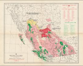
Item is a map of British Columbia's Status of Sustained-Yield Forestry Programme as at 31 December 1962. The map has been annotated to show forest area surveyed by Celgar Ltd. as base for new kraft mill.
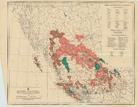
Item consists of a map of British Columbia showing Status of Sustained-Yield Forestry Programme as at December 31, 1969 with colour coded areas indicating Public Sustained Yield Units, Special Scale Areas, Tree Farm Licences, and Major Parks.


