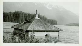
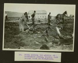
Showing 39008 results

Archival description
21297 results with digital objects Show results with digital objects
Summer day
Item · 7/1/1979
Part of Mary Fallis fonds
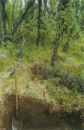
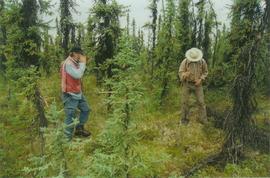
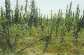
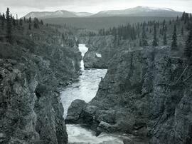
View of grassy shore speckled with lupins, water in the midground and rocky shore in background, Bathurst Inlet, Nunavut

Summer at sea
2009.10.2.020 · Item · [between 1923 and 1925]
Part of Fred Jeffery Photograph Collection

Photograph depicts a view of the sun on the ocean with the ship's bow in the foreground. Handwritten annotation below photograph reads, "Summer at sea".

2023.2.2.1.3.3 · Item · Apr. 2005
Part of Dr. Paul Sanborn fonds

Unpublished results for the Sulphur stable isotope tracer study (E.P. 886.15) were presented in annual reports to the funding agencies, including this "Sulphur Fertilization of Lodgepole Pine: A Stable Isotope Tracer Study (Ministry of Forests E.P. 886.15) - Project Y051210 - Technical Report" from April 2005.

2002.7.2.58.4 · Item
Part of H.G.T. (Harry) Perry fonds

Completed Map Suggested Highway Routes to Alaska with Legend.
? Map Showing Suggested Highway Routes to Alaska “to accompany report of the Inter-departmental Committee on the British Columbia, Yukon, Alaska Highway.”
? Legend includes: 1) Proposed Main Routes, 2) Possible Alternative Routes, 3) Possible Connections or Branch Roads, 4) Roads Fully or Partially Constructed in Province and Yukon, 5) Roads Elsewhere.

2002.7.2.58.2 · Item
Part of H.G.T. (Harry) Perry fonds

? Colorful map of mostly Yukon, BC, AB, and parts of Alaska, Northwest Territories and southern part of the United States.
? Legend, Mileage Tables and notes are printed on a white sheet that is then glued onto the map
? Legend includes: 1) Main Routes shown, 2) Roads Fully or Partially Constructed in B.C. and Yukon, 3) Roads Elsewhere, 4) Airports.

Sue Sedgwick
2012.13.1.65.60 · Item · [1976?]
Part of J. Kent Sedgwick fonds

Image depicts Sue Sedgwick holding what appears to be cooked pork and onions.

1996.8.1.142 · Item · 4 May 1978
Part of Chander Suri fonds

A b&w plan re Tentative Plan of Subdivision of West 1/2 of D.L. 2413 C.D. drafted on tracing paper, produced by Central Planning and Management Consulting.

1996.8.1.214 · Item
Part of Chander Suri fonds

Tentative Plan of Proposed Subdivision On South 1/2 District Lot4028 and Part of S.E. 1/4 District Lot 4047 Lying East of the John Hart Highway Cariboo District-British Columbia.

1996.8.1.218 · Item · 14 April 1978
Part of Chander Suri fonds

A b&w plan re Tentative Plan for Subdivision of N1/2 of D.L. 2172 C.D. drafted on a tracing paper, produced by Central Planning and Management Consulting LTD. Tabor Lake is identified on this plan.

1996.8.1.216 · Item · 1 June 1978
Part of Chander Suri fonds

A b&w plan re Tentative Plan for Subdivision of N1/2 of D.L. 2172 C.D. drafted on a tracing paper, produced by Central Planning and Management Consulting LTD. Tabor Lake is identified on this plan.

1996.8.1.217 · Item · 16 May 1978
Part of Chander Suri fonds

A b&w plan re Tentative Plan for Subdivision of N1/2 of D.L. 2172 C.D. drafted on a tracing paper, produced by Central Planning and Management Consulting LTD. Tabor Lake is identified on this plan.

1996.8.1.266 · Item
Part of Chander Suri fonds

Original colour plan re "Proposed plan of subdivision of DL8379 except the most northerly 20 metres in parallel width thereof and DL 8380 except Block A land, the easterly 80 feet Cariboo District."

1996.8.1.062 · Item
Part of Chander Suri fonds

A b&w plan produced by W.D. Usher and Associates Land Surveyors Prince George B.C. Plan of Subdivision of N.E. 1/4 and S.E. 1/4 of District Lot 4633, S.E. 1/4 District Lot 9095 and Block A. District Lot 9095 and Part of S.W. 1/4 District Lot 4633, Block B, District Lot 9095 and District Lot 9095 Cariboo District-British Columbia.

1996.8.1.326 · Item · May 1987
Part of Chander Suri fonds

A b&w plan drafted on tracing paper. Proposed Subdivision of Lots-8,9 PL.24949, and Lot-1, PL.30204, NE1/4Sec.34, TP.19, RG.18, Kamloops, B.C. Copper Head Dr., Trans Canada Highway, Iron Mask Road and etc are identified on the plan. Produced by Central Planning and management Consulting LTD PG BC

2012.13.2.02.33.01 · Item · [1990?]
Part of J. Kent Sedgwick fonds

The item is a reproduction of a section of survey map drafted on 18 March 1915 and revised on 23 May 1916. The reproduction was likely created in 1990. The Plan Number is 1268 and highlights the area along the Nechako and Fraser Rivers. The map details subdivisions East of Carney Street, North of Twentieth Avenue and South of Ninth Avenue. Annotations in pencil state different map scale variations and "cemetery setback."

2012.13.2.02.33.06 · Item · [1990?]
Part of J. Kent Sedgwick fonds

The item is a reproduction of a survey map drafted in approximately 1911 and revised in May 1914. The reproduction was likely created in 1990. The annotation states, "Plan 1391" and is circled in red ink. The area covered is along the Nechako and Fraser Rivers and Northeast of First Avenue.

2012.13.2.02.33.10 · Item · [1990?]
Part of J. Kent Sedgwick fonds

The item is a reproduction of a survey map drafted June 1912. The reproduction was likely created in 1990. The area covered is Central Fort George, South of 5th Street, East of Alden Avenue, North of 12th Street and West of Fraser Street. Annotations state, "Plan 1085 Carney Addition."